2 DaysSolo Traveler6 Stops

Gila Valley (Safford, Thatcher), Arizona

2-Day Itinerary for Solo Traveler

“Adobe Light & Alpine Quiet: Two Days Solo in the Gila Valley”

Adobe Light & Alpine Quiet: Two Days Solo in the Gila Valley

Here, the desert doesn't shout—it hums. Adobe walls hold centuries of quiet history while a mountain rises improbably out of the valley floor, climbing from cactus to pine in a single afternoon's drive. This is Arizona without the performance: a place to walk slow streets alone, strike up conversation over green chile, and watch the Milky Way ignite over a ridge nobody else is standing on.

At a Glance

Climate & Weather
Spring brings mild days (65–75°F) and cool nights, with wildflowers emerging along the valley floor and occasional afternoon showers. Pack a rain jacket, a warm layer for Mount Graham's elevation (temperatures there run 15–20°F cooler than Safford), sunscreen, and a hat for exposed trail sections.
Getting Around
A car is essential—there's no transit network, and distances between clusters (Safford to Mount Graham, Safford to Roper Lake) run 20–40 minutes. Downtown Safford itself is compact and walkable.
Budget
Budget roughly $60–90/day for a solo traveler covering meals, state park day-use fees, and incidentals—this is an affordable corner of Arizona with no premium tourist pricing.
Safety
The Gila Valley is low-crime and welcoming to solo travelers, but it's rural—let someone know your hiking plans, especially on Mount Graham, where cell coverage disappears. Watch for rattlesnakes and Gila monsters on warm-season trails; stay on marked paths and avoid tall grass at dawn/dusk. Flash flooding is a monsoon-season risk, not a spring one, but check conditions before entering any wash.
Connectivity
Cell service is reliable in Safford and Thatcher but drops out intermittently on Mount Graham's upper elevations. Download offline maps before heading up the mountain. Most cafes and lodging offer WiFi.
Local Tips
Most businesses close by 6pm and Sundays run quiet (church and family time)—plan dinner and shopping accordingly. Arrive at trailheads and the observatory early; mid-morning cloud buildup is common in spring. Solo travelers will find the communal-table setup at local cafes an easy entry point for conversation with ranchers, hikers, and longtime residents.

Highlights

  • Golden-hour wandering through Safford's unspoiled adobe storefronts
  • Hands-on history at the restored San Jose de Los Campos Mission
  • A switchbacking drive into the cool pines of Mount Graham's Pinaleño high country
  • Sunrise solitude at Roper Lake's turquoise shoreline
  • Communal-table meals where solo diners are the norm, not the exception
  • Stargazing-grade darkness minutes from a small-town main street

Day-by-Day Plan

Arrival & orientation

Day 1: Settling Into Adobe Time

A gentle, low-mileage day (under 2 miles walking) spent acclimating in downtown Safford's historic streets and mission grounds, with an easy pace suited to travel fatigue.

Wear
Light layers—a breathable shirt with a packable rain jacket, comfortable walking shoes for uneven sidewalks, and a sunhat for midday glare.
Budget
$45–65 (breakfast, lunch, dinner, incidental shopping)
9:30 AM - 11:00 AM
Safford Downtown Historic District · morning · 90 min · Safford Downtown & Valley Base

Start slow. Weathered adobe and brick storefronts catch the morning sun at a flattering angle, and the streets are near-empty on a weekday—arrive by 9:30am and you'll have the sidewalks almost entirely to yourself before the midday errand-runners appear. Let a taquería's mesquite smoke and simmering chiles pull you down a side street; this is a place built for unhurried wandering, not checklist sightseeing.

Safford Downtown Historic District
Photo by Tama66 on Pixabay
The corner of 5th and Main offers the best architectural lineup—shoot it in soft morning light before 10am shadows get harsh.
Flat, wheelchair-accessible sidewalks throughout, though benches are sparse—plan rest stops if needed.
8 min drive — A short crosstown hop past irrigated fields, the valley opening up green on either side of the road.
11:20 AM - 12:35 PM
San Jose de Los Campos Mission · midday · 75 min · Safford Downtown & Valley Base

A short hop from downtown, this restored mission trades retail bustle for the hush of hand-plastered adobe walls and old cottonwoods stirring in the wind. Run your fingers along the rough-textured walls, breathe in sun-warmed sage, and take the time to read the layered story of Spanish colonial roots tangled with the valley's modern farming heritage—a quiet, contemplative counterpoint to the morning's main street energy.

San Jose de Los Campos Mission
Photo by DJ Williams on Pexels
Shoot the acequia and garden irrigation channels at golden hour, or the adobe walls in raking side light for maximum texture.
Flat paths and wheelchair accessible, though shaded rest areas are limited—budget extra time if you need breaks.
Lunch
Main Street Cafe $
Cafe/Coffee · Near Safford Downtown Historic District
A relaxed counter-and-communal-table spot where solo diners blend right in—good for a slow coffee and easy conversation with regulars.
El Charro $
Mexican · Near Safford Downtown Historic District
Hearty, unpretentious Mexican plates with the kind of generous portions that define the valley's food culture.
Dinner
Fancy Pizzeria $
Pizza · Near Safford Downtown Historic District
A casual, low-key dinner option with bar-style seating—easy for a solo traveler winding down after a travel day.
If it rains: Duck into covered storefronts along Main Street or browse local shops; the mission's covered sections also hold up well in light rain, though heavy rain can turn unpaved garden paths muddy.

Ease into the valley's rhythm with a slow walk through downtown Safford, where adobe facades glow in soft morning light and the only real decision is which side street to wander down first. The quiet, low-key energy here is ideal for a first day—no rush, no crowds, just warm brick, cracked sidewalks, and the smell of a taquería waking up for the day.

The pace barely shifts as you move from main street to mission grounds, trading shopfronts for adobe walls and cottonwood shade. This is a contemplative hour best spent slowly—read the plaques, touch the walls, and let the valley's layered history (Spanish colonial, then agricultural) settle in before the day winds down.

Dinner stays simple and close to downtown—pizza and casual conversation at a spot where solo diners are the norm. Early to bed is wise; tomorrow's mountain drive rewards an early start, and Safford's streets go quiet by 9pm anyway.

Alpine adventure & lakeside calm

Day 2: From Pine Ridges to Lakeshore Light

A moderate-energy day covering roughly 3-4 miles on foot, ascending into Mount Graham's cool pine forest before descending to the calmer shoreline of Roper Lake.

Wear
Layered clothing is essential—short sleeves for the valley floor, a warm fleece and windbreaker for Mount Graham's elevation, sturdy hiking shoes, and swimwear or quick-dry clothes if you plan to wade at Roper Lake.
Budget
$55–75 (state park day-use fee, lunch, dinner, snacks)
45 min drive — A steadily climbing mountain road with switchbacks—windows down for the first half, heater on for the last, as desert gives way to pine.
7:30 AM - 9:30 AM
Mount Graham (Discovery Park) · morning · 120 min · Mount Graham & High Country

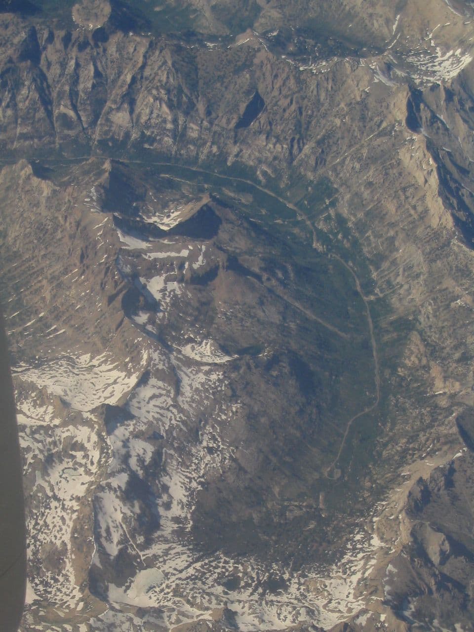
Arrive by 7:30am and the overlook is yours alone—by mid-morning, weekend traffic can change that, but on a weekday the silence is complete except for wind through the pines. The drive up is itself a destination: switchbacks climbing through desert scrub into cool, pine-thick air, with the Gila Valley unspooling below in impossibly clear light. At the top, the Large Binocular Telescope's dome complex feels almost otherworldly against the mountain backdrop—a solitary traveler's dream of scale and silence.

Mount Graham (Discovery Park)
Unknown / wikimedia (Public domain)
Shoot the mountain road switchbacks with the desert panorama behind you on the way up, and the observatory dome complex once you reach the top—both work best in the crisp, clear morning light before any cloud buildup.
Unpaved and uneven terrain in places—not wheelchair accessible, and benches are sparse, so pace yourself on the walk to the overlook.
15 min drive — A short forest-road transfer between trailheads, pine shadows flickering across the windshield.
9:45 AM - 11:45 AM
Pratts Trail/Helms Crag Trail System · midday · 120 min · Mount Graham & High Country

A moderate hike along ridgelines that feel impossibly far from anywhere, with juniper and creosote scent rising off sun-warmed rock and hawks circling overhead. This is prime solo-traveler terrain—trails quiet enough for real solitude, open enough that you're never far from the trailhead if needed. Take the shorter 2-hour loop rather than the full ridge traverse to keep the day balanced before the drive back down.

Pratts Trail/Helms Crag Trail System
Photo by Alex Moliski on Pexels
The Helms Crag ridgeline overlooking the Gila Valley is best shot in the mid-morning light you'll have here—later in the day haze softens the view.
Uneven, rocky trail surfaces—not suitable for mobility devices; sturdy footwear is a must.
35 min drive — A descending drive back toward the valley floor, pines thinning back into desert scrub and the lake appearing suddenly, bright blue against red rock.
1:00 PM - 4:00 PM
Roper Lake SP · afternoon · 180 min · Roper Lake & Recreation Area

The landscape shifts entirely—turquoise water rimmed by copper-red ridges, a gentle lap against the shore replacing the ridge-top wind. After a morning of elevation and exertion, this is the deliberate pace-shift: a shaded lakeside walk, maybe a wade in the cool water, and the kind of unhurried stillness that rewards solo travel. Weekday afternoons stay fairly quiet here, making it easy to find a private cove along the upper loop trail.

Roper Lake SP
Orcutt, Charles Russell, 1864-1929 San Diego Society of Natural History / wikimedia (Public domain)
The pine-shaded cove along the upper loop trail is a quieter, more intimate shot than the main shoreline—try it in the soft afternoon light.
Flat, wheelchair-accessible paths with benches roughly every 200 meters—one of the most accessible stops of the trip.
Lunch
Subway $
Sandwich · Near Safford Downtown Historic District, en route to Mount Graham
A practical, pack-it-up option for fueling a trailhead day—grab it in Safford before heading up the mountain.
Dinner
El Charro $
Mexican · Near Safford Downtown Historic District
A fitting last-night meal—hearty, communal, and the kind of unpretentious regional cooking that defines the valley's food identity.
Optional detour: Aravaipa Canyon Wilderness — Could replace Pratts Trail/Helms Crag as a full-day alternative before Roper Lake
Arizona's most pristine riparian canyon offers a full-immersion wilderness experience with waterfalls and red-rock narrows found nowhere else in the valley. Skip if: Requires a permit, 6+ hours commitment, and demands an early dawn start—it doesn't fit a balanced two-day solo itinerary without cutting Roper Lake entirely.
If it rains: If weather turns on Mount Graham, observatory access may be restricted—retreat to lower elevation and spend the time in Safford's downtown shops and cafes instead, saving the mountain for a clearer day. Roper Lake's picnic shelters offer covered space if afternoon showers roll through.

The day opens with a climb—literally. The drive up Mount Graham trades desert heat for pine-scented mountain air in under an hour, and arriving early means the overlook and observatory grounds are yours alone before any weekend traffic arrives. A ridge hike follows, quiet and open, the kind of trail that rewards solo hikers with real solitude and sweeping views back down into the valley.

The descent back toward Roper Lake marks a deliberate shift in mood—from ridge-top exertion to shoreline stillness. Turquoise water, red rock, and a gentler pace make this the day's counterbalance: shaded trails, quiet coves, and the kind of unhurried afternoon that closes out a solo trip well.

Head back into Safford for a final, hearty dinner—communal tables and generous plates of regional Mexican cooking make for an easy, low-pressure close to the trip. With most businesses shuttering by 6pm, plan an early dinner and an easy evening; the valley's quiet rhythm is, by now, a welcome one.

Want to tweak this trip?

Our AI planner can customize this itinerary to your exact dates, interests, and travel style.

Customize This Itinerary
Good to Know

Restaurant details (hours, menus, availability) change frequently. Check current hours before visiting, especially in seasonal destinations.

Dietary compatibility tags are general guidance. If you have severe allergies, confirm directly with the restaurant.

Travel tips are general guidance, not professional safety advice. Check government advisories for latest information.

All prices are approximate and may vary seasonally.

We use cookies to improve your experience and analyze site usage. Essential cookies are always active. You can customize your preferences or accept all cookies. Cookie Policy