3 DaysSolo Traveler6 Stops

Pinnacles NP (Soledad), California

3-Day Itinerary for Solo Traveler

β€œSpires, Shadows & Sky: 3 Days Alone in Pinnacles”
Spires, Shadows & Sky: 3 Days Alone in Pinnacles

The spires rise rust-red from the valley floor like something volcanic still remembers being violent. Out here, alone before 7am, the only sound is wind combing through chaparral and the far-off cry of a condor riding a thermal you can't yet see.

At a Glance

Climate & Weather
Summer temperatures regularly exceed 90–100Β°F by midday, with little shade on exposed trails; mornings start cool (60sΒ°F) and heat climbs fast after 9am. Pack a wide-brim hat, sun sleeves or long sleeves, electrolyte packets, at least 3 liters of water per person per day, and sturdy trail shoes with good grip on loose volcanic rock.
Getting Around
A car is essential β€” there's no public transit inside or around the park. The east and west entrances are NOT connected by road inside the park, so pick one side and stay there; the west entrance near Soledad is closer to all clusters in this itinerary. Arrive at trailhead parking before 8am in summer, as lots fill and close once full.
Budget
Expect roughly $40–65/day for a solo traveler covering park entrance fees, trail snacks, one sit-down meal, and incidental gear (extra water, sunscreen) β€” lodging is separate and budgeted by base town.
Safety
Solo hikers should tell someone their trail plan and expected return time β€” cell service is unreliable inside the park. Heat exhaustion is the primary summer risk; start before 7am, avoid midday exertion on High Peaks, and turn back if you feel dizzy or nauseated. Condors and eagles are non-threatening; rattlesnakes are present on sun-warmed trails, so watch your footing and stay on marked paths.
Connectivity
Cell service is spotty to nonexistent throughout the park, including at trailheads and the visitor center's exterior areas β€” download offline maps and let someone know your plan before you lose signal. Soledad and Salinas have reliable coverage and basic WiFi at hotels.
Local Tips
Fill up on gas and buy all your water and food in Soledad or Salinas before entering the park β€” there are no reliable food services inside. Weekday mornings, especially Tuesday through Thursday before 8am, offer the closest thing to solitude Pinnacles has to give in summer. Bring paper trail maps as backup since GPS and cell data both fail regularly inside the park boundary.

Highlights

  • Sunrise summit views from the High Peaks Trail with almost no one else on the ridge
  • Crawling through the cool dark of Balconies Cave with a headlamp and total quiet
  • Scanning volcanic cliffs for California condors, North America's rarest bird
  • Reservoir waters mirroring red rock walls on the Bear Gulch loop
  • Golden-hour light hitting the spires like a struck match
  • Solo-friendly pacing with built-in rest, shade, and heat safety margins
  • A raw, uncrowded alternative to California's more famous coastal parks

Day-by-Day Plan

Orientation, gentle acclimation

Day 1: Arrival & First Light Among the Spires

A lighter first day easing into the park's scale and heat with an early cave walk and visitor center orientation, covering roughly 2.5 miles of easy-to-moderate terrain.

Wear
Breathable long sleeves, sun hat, closed-toe trail shoes, and a daypack with at least 2 liters of water β€” the cave interior runs cool, so a light layer helps.
Budget
$45 (park entry, snacks, one sit-down dinner in Soledad)
7:30 AM - 8:15 AM
Pinnacles Visitor Center Β· morning Β· 45 min Β· High Peaks & Cave Loop

Start here to orient yourself before the heat builds β€” the exhibits on condor recovery and volcanic geology give context you'll feel underfoot later. Arrive right at opening and you'll have the vista windows to yourself, spires backlit in soft gold through the glass. Rangers here are a good first conversation of the trip if you're traveling solo and want trail condition updates or company recommendations for the day.
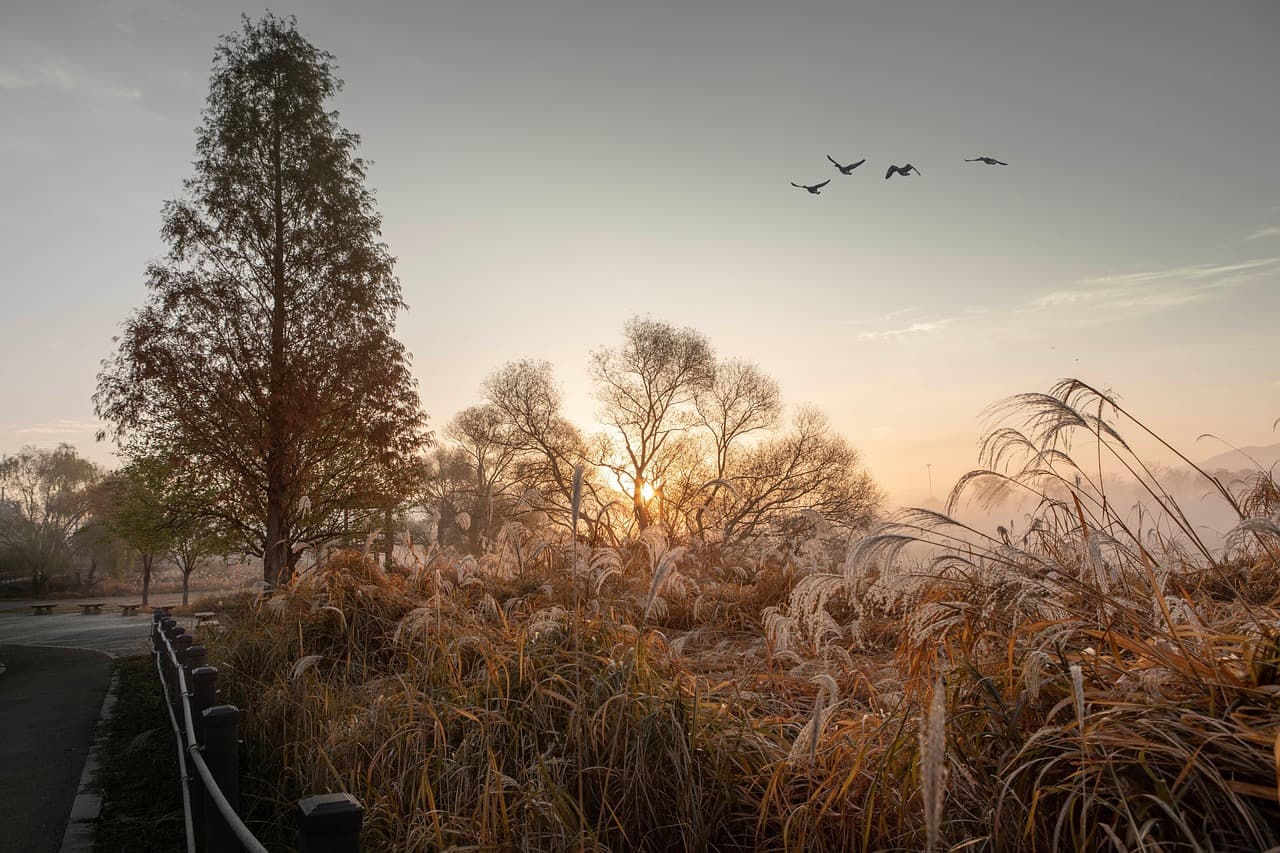
Pinnacles Visitor Center
Photo by KimJaesub on Pixabay
Shoot the vista windows facing the High Peaks formation right at opening β€” the low morning light rakes across the rock without the midday glare.
Fully wheelchair accessible with flat paths and frequent benches β€” the easiest stop of the trip.
15 min drive β€” A short valley-floor drive with spires growing larger in the windshield the whole way.
8:45 AM - 10:15 AM
Balconies Cave Β· midday Β· 90 min Β· High Peaks & Cave Loop

Duck into cool, mineral-scented dark just as the outside temperature starts climbing β€” this is the smartest midday move in summer. Bring a headlamp; your hand will find lichen-slicked stone as you thread narrow passages, and sudden openings above reveal jewel-blue sky in flashes. It's a solitary, meditative scramble, and quiet enough mid-morning on a weekday that you might have entire chambers to yourself.

Balconies Cave
Howes Cave association, Howes Cave, N.Y. [from old catalog] / wikimedia (Public domain)
Photograph the interior light shafts around 9:30–10am when the sun angles directly into the rock openings.
Not accessible for wheelchairs or those needing flat terrain β€” expect scrambling, low clearances, and uneven footing.
Optional detour: Condor viewing β€” After Balconies Cave and before evening rest
Late afternoon thermals sometimes bring condors soaring close to accessible overlooks, a rare wildlife thrill with minimal walking. Skip if: Skip if you're heat-fatigued from the cave hike β€” better attempted fresh on Day 2's cooler morning.
If it rains: If it rains, Balconies Cave itself stays passable, but muddy approach trails make it slower going β€” instead, spend extended time at Pinnacles Visitor Center's indoor exhibits on condor recovery and volcanic history.

The day opens gently β€” you'll want to be through the gate and into the visitor center before the parking lot fills, letting the cool morning air and quiet exhibits ease you into the park's scale without overwhelming a first day still shaking off travel.

By mid-morning you're underground in Balconies Cave, trading heat and glare for cool stone and hand-held light, a deliberate pace-shift that keeps the day's exertion low while still delivering the park's strangest, most memorable texture.

Head back toward Soledad as the heat peaks, resting through the hottest hours before a simple dinner in town β€” plan meals around Soledad's limited but functional options rather than expecting anything inside the park, and get to bed early ahead of tomorrow's pre-dawn start.

Summit hiking, geology

Day 2: Ridge Lines and Reservoir Light

The most physically demanding day, combining the High Peaks summit push with the Bear Gulch Reservoir loop, totaling roughly 5.5 miles across steep, exposed terrain.

Wear
Moisture-wicking layers, a wide-brim hat, sun sleeves, trail shoes with strong grip, and a hydration pack carrying at least 3 liters β€” this is the day heat management matters most.
Budget
$55 (trail snacks, electrolyte supplies, dinner in Salinas or Soledad)
6:00 AM - 8:00 AM
High Peaks Trail Β· morning Β· 120 min Β· High Peaks & Cave Loop

Start in the dark-to-dawn light with headlamp in pocket, because by 9am this exposed ridge turns brutal in summer heat. Dusty switchbacks give way to sudden 360-degree views over the Salinas Valley, and the thin air and effort make the summit plateau feel genuinely earned. Arrive at the trailhead by 6am and you'll likely summit in near-total solitude β€” a rare, private moment with one of California's strangest skylines.

High Peaks Trail
Anne LaBastille / wikimedia (Public domain)
Reach the summit plateau by 7am for soft directional light across the ridgelines, long before the midday flatness sets in.
Not recommended for those needing stable or flat terrain β€” steep, rocky, and exposed with real fall consequences if rushed.
10 min walk β€” A short connector trail downhill, legs still loose from the summit push, dust settling on your boots.
9:00 AM - 11:30 AM
Bear Gulch Reservoir Trail Β· midday Β· 150 min Β· High Peaks & Cave Loop

Descend into cooler canyon air where reservoir water mirrors red volcanic walls and canyon wrens call from the cliffs. This is a deliberate pace-shift from the morning's intensity β€” moderate rather than grueling, with condor and golden eagle shadows sometimes crossing overhead. Starting before 10am keeps you ahead of the crowd window and the day's rising heat.

Bear Gulch Reservoir Trail
Photo by 12019 on Pixabay
Catch the reservoir outlet where water cascades from the canyon walls β€” best light is late morning before the sun goes directly overhead and flattens the color.
Not recommended for wheelchairs or those needing flat terrain β€” steep descent and uneven, exposed sections throughout.
Optional detour: Pinnacles Visitor Center β€” After Bear Gulch Reservoir Trail and before heading back to town
A cool, shaded, wheelchair-accessible stop to rehydrate, use restrooms, and decompress in air conditioning after two demanding trails. Skip if: Skip if you already visited Day 1 and are eager to beat the heat back to your accommodation instead.
If it rains: If it rains, both High Peaks Trail and Bear Gulch become genuinely hazardous with slick rock and surging seasonal water β€” wait 24 hours and pivot instead to Balconies Cave, which holds stable temperature regardless of weather.

You'll want to be moving before sunrise, headlamp on, boots crunching gravel in the dark β€” the effort of the High Peaks climb pays off in a summit plateau that catches first light before the valley below even wakes up.

The descent into Bear Gulch shifts the whole mood of the day: canyon shade, mirrored water, and the occasional eagle shadow replace the ridge's exposed drama, giving tired legs a gentler but still scenic second act.

Get out of the park before peak afternoon heat, then rest through the worst of it β€” dinner back in Salinas or Soledad should be simple and unhurried, since today's exertion (nearly 6 miles combined) is the trip's physical high point and recovery matters.

Wildlife, wind-down

Day 3: Condor Watch and Slow Descent

A lighter final day centered on condor viewing and reflection, covering roughly 2 miles at an easy pace before departure.

Wear
Comfortable layers for temperature swings between shaded overlook and open cliff exposure, plus binoculars if you have them and sun protection as always.
Budget
$35 (snacks, coffee, light lunch before departure)
7:00 AM - 8:30 AM
Condor viewing Β· morning Β· 90 min Β· Condor Country

Mornings are quieter here, and thermal activity often brings condors gliding over the volcanic cliffs before the day heats up. Wind rushes past exposed rock, and the sight of a condor's massive wingspan cutting across rust-red stone is worth the early wake-up on its own. This is an easy, low-exertion morning after two demanding days β€” bring patience and let the sky do the work.

Condor viewing
Wilbur, Sanford R / wikimedia (Public domain)
The reservoir overlook works best early morning when thermals are just forming and condors ride low, closer cliff lines.
Uneven, unpaved terrain with sparse benches β€” manageable for most fitness levels but not wheelchair accessible.
Optional detour: Machete Ridge Trail β€” After Condor viewing, for travelers extending their stay
For serious hikers wanting a full-day wilderness challenge with strong condor and golden eagle sighting odds along exposed ridgelines. Skip if: Skip entirely on a departure day β€” this trail demands 5+ hours and isn't compatible with a standard travel-out schedule.
If it rains: If it rains, condor viewing becomes unreliable since low cloud cover reduces visibility β€” pivot to Balconies Cave or Bear Gulch Cave as dry, weather-stable alternatives if you have time before departure.

The final morning stays gentle and quiet, cliffside wind and distant condor cries replacing yesterday's exertion β€” this is a good stop for a slow, reflective close to the trip, camera ready but no rush required.

With the main activity finished by mid-morning, the rest of the day opens up for the drive out β€” grab final supplies in Soledad or Salinas before hitting the highway, since options thin out fast once you're back on 101.

Plan for an early departure rather than a lingering evening β€” Pinnacles' surrounding towns wind down early, and the drive back to SFO or Monterey Regional is easier tackled in daylight while the spires are still visible in the rearview mirror.

Want to tweak this trip?

Our AI planner can customize this itinerary to your exact dates, interests, and travel style.

Customize This Itinerary
Good to Know

Restaurant and food service details change frequently, especially in small towns near the park β€” check current hours before visiting, and plan meals around Soledad or Salinas rather than expecting services inside the park itself.

Dietary compatibility tags are general guidance. If you have severe allergies, confirm directly with any restaurant before ordering.

Travel tips are general guidance, not professional safety advice β€” check current park conditions, heat advisories, and government travel advisories before your trip.

All prices are approximate and may vary seasonally, especially around park entrance fees and fuel costs in nearby towns.
We use cookies to improve your experience and analyze site usage. Essential cookies are always active. You can customize your preferences or accept all cookies. Cookie Policy