4 DaysTeen Families8 Stops

Las Vegas area (non-gaming), Nevada

4-Day Itinerary for Teen Families

โ€œRed Rock, River Stone & Mountain Snow: A Winter Family Week Beyond the Stripโ€

Red Rock, River Stone & Mountain Snow: A Winter Family Week Beyond the Strip

Forget the neon โ€” this is the Vegas where canyon wrens call across rust-colored cliffs and snow dusts the pines just an hour from the desert floor. Winter strips away the crowds and the heat, leaving crisp mornings, low golden light, and wide-open trails for families craving something raw and real.

At a Glance

Climate & Weather
Winter in the Las Vegas valley is mild by day (50โ€“60ยฐF) but chilly at night; Mount Charleston sits at 7,000+ feet and often holds genuine snow with temps in the 30s. Pack layers: a warm jacket, gloves, and waterproof boots for the mountain, plus a light layer for valley days.
Getting Around
A rental car is essential โ€” the three main clusters (Hoover Dam/Boulder City, Red Rock Canyon, Mount Charleston) are each 30โ€“45 minutes from the Las Vegas valley in different directions, and there's no meaningful public transit between them.
Budget
Budget roughly $80โ€“130/day per family of four for meals and activities (park entry fees, casual dining, and a few souvenirs); Hoover Dam and Mount Charleston have modest fees, Red Rock Canyon requires a timed entry/parking fee.
Safety
Roads to Mount Charleston can ice over in winter โ€” check NDOT road conditions before driving up, and carry chains or a 4WD vehicle if snow is forecast. Days are short, so plan mountain activities to wrap by mid-afternoon before temperatures drop and light fades.
Connectivity
Cell coverage is reliable in Las Vegas, Boulder City, and along the Red Rock scenic loop, but expect spotty or no signal on Mount Charleston's higher trails โ€” download offline maps before heading up.
Local Tips
Winter is peak season for solitude at these non-ski sites โ€” arrive early anyway, since golden light and empty overlooks are worth the alarm clock. Check Mount Charleston Lodge for current snow conditions, and note that some trailheads may require traction devices after storms.

Highlights

  • Standing mid-span on Hoover Dam's pedestrian walkway, wind roaring up from Black Canyon
  • Golden hour at Fire Canyon overlook, red rock glowing like embers
  • Snow crunching underfoot on Mount Charleston's pine-shaded trails
  • Vintage soda fountain stops and gallery-hopping in Boulder City
  • Bristlecone pines twisted by a thousand winters
  • Teen-approved photo ops at every turnout โ€” no casino required
  • Low winter crowds mean viewpoints you'll practically have to yourselves

Day-by-Day Plan

Settling in, gentle engineering wonder

Day 1: Arrival & the River That Built a Region

A light first day easing into the trip with Hoover Dam and a wander through Boulder City's small-town charm, roughly 1.5 miles of walking total.

Wear
Layers โ€” a light jacket for morning chill, comfortable walking shoes, sunglasses for the dam's open-sky glare.
Budget
$60โ€“90 for the family (dam tour tickets optional, casual lunch and dinner)
9:00 AM - 10:30 AM
Hoover Dam ยท morning ยท 90 min ยท Hoover Dam & Boulder City

Arrive by 9am and the parking lot is still half-empty โ€” by 11am, tour buses have filled the overlooks. Walk the pedestrian span and feel the wind funnel up through Black Canyon, engine-hum vibrating faintly through the concrete underfoot. Teens tend to light up at the sheer scale of it โ€” a 726-foot wall holding back an entire lake โ€” while younger siblings love spotting the intake towers rising like sci-fi sentinels from the water.

Hoover Dam
Unknown authorUnknown author or not provided / wikimedia (Public domain)
Shoot from the Nevada-side overlook in mid-morning light, when the dam face is fully lit and shadows haven't yet flattened the details.
Fully wheelchair accessible with flat paths and frequent benches โ€” a good low-strain start to the trip.
5 min walk โ€” A short stroll back across the span, sun now higher and the lake glinting turquoise below
10:30 AM - 11:15 AM
Hoover Dam ยท midday ยท 45 min ยท Hoover Dam & Boulder City

Linger a little longer at the intake towers and visitor overlook before the midday crowd peaks โ€” this is a good stretch for the family to split up briefly, teens wandering ahead with phones out for photos while parents take the slower route back.

Hoover Dam
Unknown authorUnknown author or not provided / wikimedia (Public domain)
Turn back toward the visitor center for a shot framing the dam against the desert mountains behind it.
Same flat, accessible path as the morning visit.
Optional detour: Boulder City stroll (galleries and cafes) โ€” After Hoover Dam and before evening rest
Boulder City's small-town streets offer vintage shops, local art, and a slower pace that's a nice palate-cleanser after the dam's scale and crowds. Skip if: If everyone's travel-weary from arrival, skip it and head straight to rest โ€” the dam alone is a full morning experience.
If it rains: Hoover Dam remains fully operational in light rain, with covered viewing areas near the visitor center; the walkway is exposed, so bring a rain jacket if storms are forecast.

Ease into the trip at Hoover Dam, where the scale of the thing โ€” a wall of concrete taming an entire river โ€” tends to silence even distracted teenagers for a moment. Arrive early, before the tour buses, and the pedestrian walkway is yours to explore at a relaxed pace, wind carrying the mineral smell of the lake up from below.

After the dam, the pace softens further with time in Boulder City's low-key streets โ€” small galleries, local shops, and a lived-in charm that contrasts sharply with the Strip's glitz. It's an easy, low-walking afternoon meant to let first-day travel fatigue settle before the more active days ahead.

Keep the evening unhurried โ€” settle into your accommodations, let the teens have some downtime with their phones, and turn in early. Tomorrow's canyon light waits for no one, and an early alarm pays off in ways a late night won't.

Desert drama, golden hour chasing

Day 2: Fire in the Rock: Red Rock Canyon at First Light

A moderately active day exploring Red Rock Canyon's scenic loop and trails, with roughly 3 miles of walking across uneven desert terrain.

Wear
Sturdy hiking shoes, layers for cool morning temps warming by midday, sun hat, and plenty of water even in winter.
Budget
$70โ€“100 (park entry/parking fee, casual lunch, dinner)
35 min drive โ€” A quiet highway drive west as the sun climbs, valley lights fading behind you and red cliffs rising ahead
7:30 AM - 9:30 AM
Red Rock Canyon (see above) ยท morning ยท 120 min ยท Red Rock Canyon

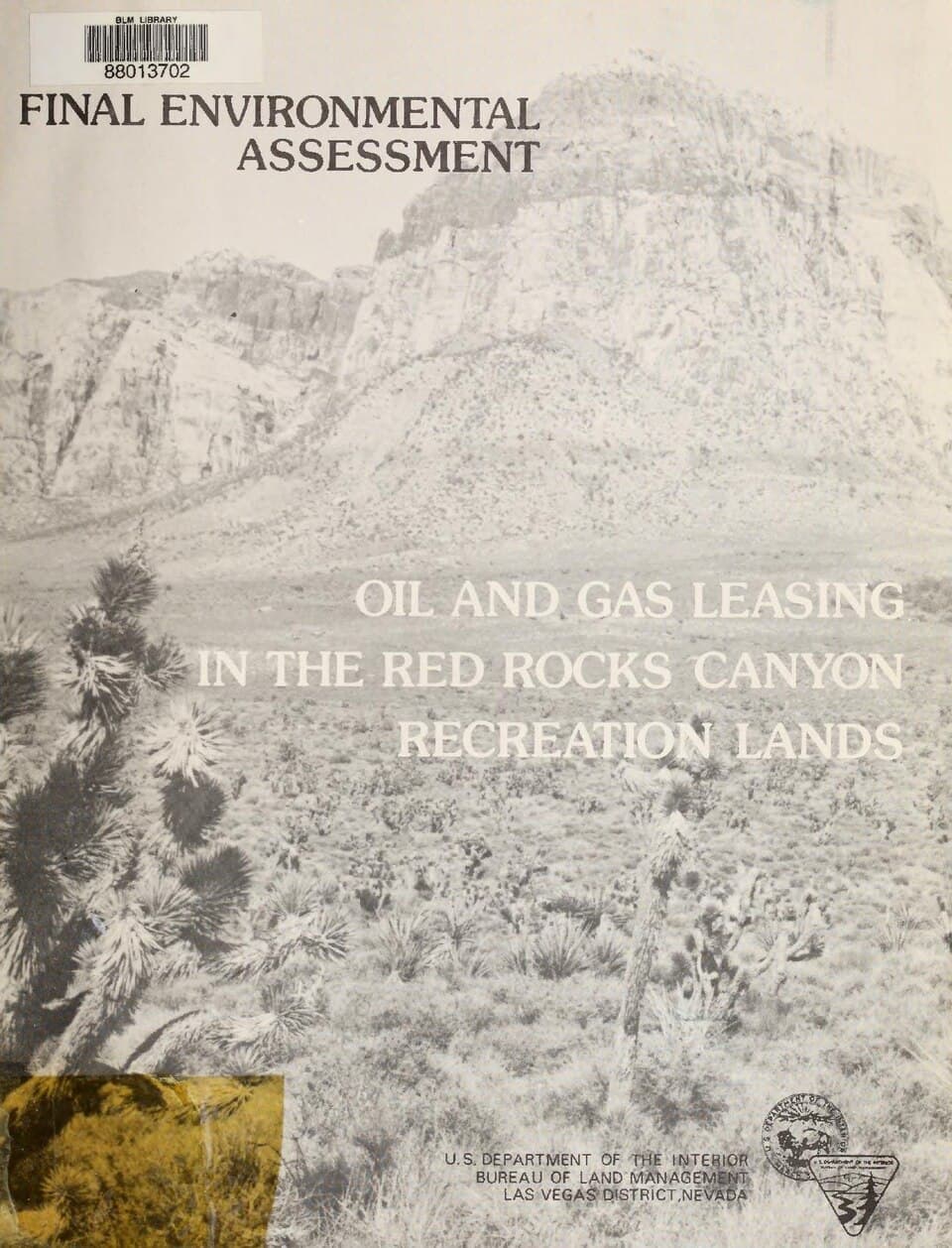
Arrive by 7:30am and the scenic loop is nearly silent โ€” just wind through creosote and the occasional raven call. The sandstone glows deep red-orange in the low winter sun, striations telling a million-year story in bands of color. This early window is gold for families: cooler temps make the moderate trails comfortable, and teens get a sense of scale and drama without the crowds that build by mid-morning.

Red Rock Canyon (see above)
United States. Bureau of Land Management. Las Vegas District Civish, William T / wikimedia (Public domain)
Head to the Calico Tanks ridgeline or a Moenkopi Loop turnout in the first hour of light โ€” shadows are long and the rock nearly burns with color.
Terrain is uneven and not wheelchair accessible; benches are sparse, so plan rest stops along the loop road pullouts.
10 min drive โ€” A short hop along the 13-mile scenic loop road, red walls rising closer on either side
9:30 AM - 11:30 AM
Red Rock Canyon (see above) ยท midday ยท 120 min ยท Red Rock Canyon

Push a bit further into the canyon for a family-paced hike โ€” Calico Tanks or a shorter loop segment works well, with plenty of stopping points for water breaks and photos. By late morning the crowds pick up noticeably, so this is the window to be already deep into the landscape rather than just arriving.

Red Rock Canyon (see above)
United States. Bureau of Land Management. Las Vegas District Civish, William T / wikimedia (Public domain)
Fire Canyon overlook offers a wide, dramatic panorama best shot before 11am when the light is still soft.
Not suitable for mobility challenges โ€” trail surfaces are rocky and uneven with some elevation change.
Optional detour: Additional Moenkopi Loop turnout stop โ€” Between the two Red Rock Canyon stops
A quick, easy pullover for photos without committing to a full trail โ€” good for a mid-morning stretch break. Skip if: Skip if the family is eager to get onto a real trail rather than more scenic driving stops.
If it rains: Red Rock Canyon stays open in light rain and the moody skies can make for striking photos, but avoid narrow washes if flash-flood warnings are issued; bring rain jackets as storms can roll in quickly.

Beat the desert to its own punchline โ€” arrive at Red Rock Canyon while the light is still low and gold, and the loop road nearly empty. The cliffs seem to hold their own inner fire in this early light, deep red against a cool blue winter sky, and the quiet makes it feel like the family has the whole canyon to itself.

As the sun climbs, shift into a moderate hike โ€” Calico Tanks or a comparable trail segment gives teens a taste of real scrambling and reward views without over-taxing younger family members. By early afternoon, crowds have built considerably, so plan to be winding down your hike as the parking lots fill.

Head back toward the valley for an easy dinner and rest โ€” legs will be pleasantly tired from the uneven desert terrain, and tomorrow's mountain day calls for a full charge.

Alpine adventure, elevation shift

Day 3: Snow Above the Desert: Mount Charleston

The most physically active day of the trip, hiking pine-forested trails at high elevation with possible snow underfoot โ€” roughly 4 miles of walking.

Wear
Warm layers, waterproof boots or traction devices if snow is present, gloves, hat โ€” temperatures can be 20-30 degrees cooler than the valley.
Budget
$50โ€“80 (casual lodge lunch, gear rental if needed, dinner)
45 min drive โ€” A steady climb in elevation, ears popping, temperature gauge dropping as pines replace cactus outside the window
8:00 AM - 11:00 AM
Mount Charleston (summer hiking) ยท morning ยท 180 min ยท Mount Charleston Alpine

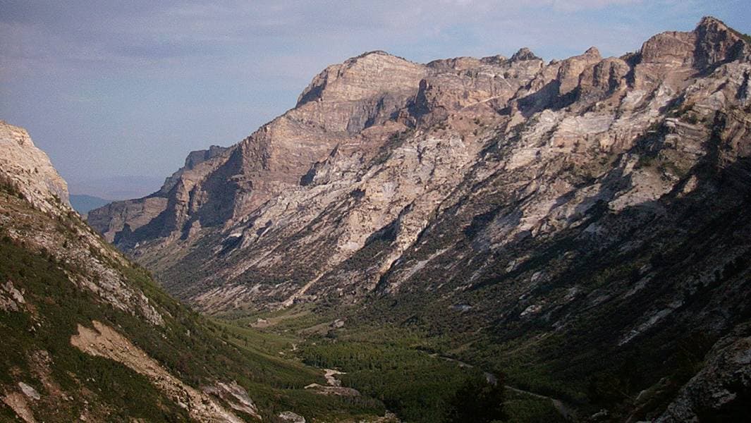
The drive up feels like leaving the desert behind entirely โ€” Joshua trees give way to pinyon pine, then ponderosa, then possibly a dusting of snow. Arrive by 8am for the quietest trails; the air smells sharp with pine resin, and the crunch of frost or snow underfoot is a genuine novelty after days of desert dust. Bristlecone pines along the way look ancient and wind-twisted, a striking contrast to the sandstone drama of the past two days โ€” a good reminder to families that this landscape holds real variety.
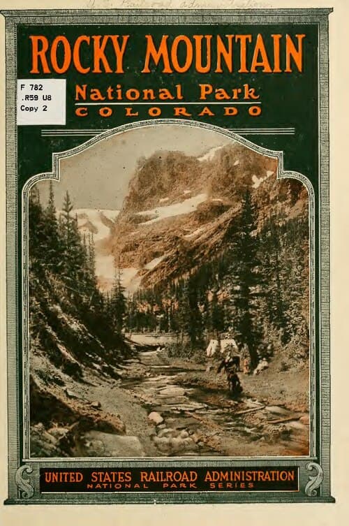
Mount Charleston (summer hiking)
United States Railroad Administration / wikimedia (Public domain)
Cathedral Rock overlook at sunrise offers a rare shot: snow-dusted pines in the foreground with the hazy Vegas Valley stretching below.
Not suitable for mobility challenges โ€” trail surfaces are uneven, sometimes icy, with real elevation gain; sturdy footwear is essential.
15 min walk โ€” A gentle trail transition deeper into the grove, snow (if present) muffling footsteps to near silence
11:00 AM - 12:30 PM
Mount Charleston (summer hiking) ยท midday ยท 90 min ยท Mount Charleston Alpine

Slow the pace for a family-friendly stretch of trail near the Bristlecone Pine Grove โ€” the gnarled, thousand-year-old trees against pale winter stone feel almost otherworldly, and it's an easy win for teens hunting a unique photo that doesn't look like everyone else's Vegas trip.

Mount Charleston (summer hiking)
United States Railroad Administration / wikimedia (Public domain)
Midday light filters softly through the bristlecones โ€” a good window for detail shots of bark texture and twisted branches.
Trail remains uneven and not wheelchair accessible; benches are sparse, so build in rest stops.
Optional detour: Mummy's Head ridgeline viewpoint โ€” After Bristlecone Pine Grove and before heading back down the mountain
A 360-degree panorama stretching from mountain forest to distant desert valley โ€” a dramatic capstone to the day's hiking. Skip if: Skip if energy is flagging or weather is turning; it requires additional elevation gain and isn't essential to the day's core experience.
If it rains: If storms roll in, trails become muddy and potentially dangerous โ€” descend immediately and redirect to lower-elevation Red Rock Canyon, which remains a safer option in bad weather.

Trade desert heat for alpine cold as you climb toward Mount Charleston โ€” the transformation from cactus to snow-dusted pine happens astonishingly fast, and by the time you're on the trail, the valley feels like a different planet entirely. Early arrival means quiet trails and the particular hush that snow brings to a forest.

Ease into a gentler grove walk among ancient bristlecone pines, giving tired legs a break from the morning's elevation gain while still delivering one of the trip's most striking, least-expected photo opportunities. This is a good stretch for teens to range a little ahead on their own, phones out, within easy calling distance.

Descend back toward the valley as the light fades early โ€” winter days are short up here โ€” and settle into a relaxed dinner, the kind of tired that comes from real mountain air and real elevation change, a satisfying contrast to the trip's desert days.

Farewell views, easy pace

Day 4: Last Light on Red Rock

A lighter final day revisiting Red Rock Canyon's scenic loop for photography and a relaxed farewell to the landscape, with about 2 miles of easy walking.

Wear
Comfortable layers, walking shoes, sunglasses โ€” expect mild winter valley temperatures.
Budget
$50โ€“70 (park fee if not already covered, casual lunch, departure snacks)
8:00 AM - 10:00 AM
Red Rock Canyon (see above) ยท morning ยท 120 min ยท Red Rock Canyon

Return for a final, unhurried pass through the scenic loop โ€” this time with no pressure to hike hard, just soaking in the landscape one more time. Morning light is soft and low, and having already explored the trails, the family can pick favorite turnouts to revisit or discover a corner missed on day two.

Red Rock Canyon (see above)
United States. Bureau of Land Management. Las Vegas District Civish, William T / wikimedia (Public domain)
Revisit the Fire Canyon overlook in early light for a farewell family photo with the full sweep of red rock behind you.
Terrain remains uneven off the paved pullouts; stick to overlook areas for an easier, more accessible final visit.
Optional detour: Extra scenic loop drive-through โ€” After the final Red Rock Canyon stop and before departure
A slow, no-hiking drive through the loop one more time offers a low-effort way to soak in the scenery before flying out. Skip if: Skip if you're pressed for time before a flight โ€” the earlier stop already captures the essential experience.
If it rains: Red Rock Canyon remains open and atmospheric in light rain; if conditions worsen significantly, consider spending remaining time in Boulder City's indoor shops and cafes instead.

Close out the trip the way it started at Red Rock Canyon โ€” but slower this time, no trail agenda, just family members wandering favorite turnouts and taking in the desert's quiet immensity one last time before heading toward the airport.

Keep the final hours unhurried โ€” a relaxed lunch, maybe a last drive through the scenic loop, and time to let the trip's contrasts settle: dam and desert, canyon fire and mountain snow, all within a few hours of each other.

Head to the airport with sand still in your shoes and pine scent lingering in a jacket pocket โ€” proof that Vegas holds far more than its famous lights suggest.

Want to tweak this trip?

Our AI planner can customize this itinerary to your exact dates, interests, and travel style.

Customize This Itinerary
Good to Know

Restaurant details (hours, menus, availability) change frequently. Check current hours before visiting, especially in seasonal destinations.

Dietary compatibility tags are general guidance. If you have severe allergies, confirm directly with the restaurant.

Travel tips are general guidance, not professional safety advice. Check government advisories and road conditions for the latest information, especially for Mount Charleston in winter.

All prices are approximate and may vary seasonally.

We use cookies to improve your experience and analyze site usage. Essential cookies are always active. You can customize your preferences or accept all cookies. Cookie Policy