Ruby Mountains (Lamoille Canyon), Nevada
3-Day Itinerary for Solo Traveler
“Granite, Wind, and Solitude: 3 Days Alone in the Ruby Mountains”
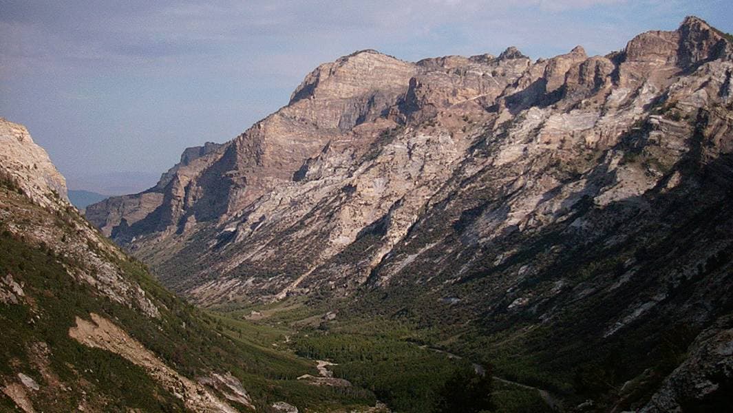
The Rubies don't announce themselves the way the Tetons or Sierras do — they wait at the edge of the Nevada high desert, a jagged blue line that turns out, up close, to be a glacial cathedral. This is a trip for a solo traveler who wants thin air, granite underfoot, and enough silence to hear their own thoughts sharpen.
At a Glance
Highlights
- Sunrise light pouring down Lamoille Canyon's glacial walls
- A high-alpine lake so clear you can count the stones on its floor
- Switchback climbs with expanding views of Liberty Peak
- Marmot whistles and wind funneling through 10,000-foot passes
- Communal-style evenings in Elko after solitary mountain days
- Photography golden hours with almost no one else in frame
- Genuine backcountry solitude only a few hours from an airport
Day-by-Day Plan
Day 1: Arrival and First Light in the Canyon
A gentle, low-mileage day (roughly 3-4 miles total) acclimating to elevation and getting oriented in Lamoille Canyon before tackling anything strenuous.
Arrive while the light is still low and gold, and you'll likely have the lower canyon pullouts to yourself — by mid-morning the parking areas fill with day-hikers. The scenic drive alone earns the trip: granite walls climb hundreds of feet on either side, snowmelt roars somewhere just out of sight, and the air smells of crushed pine needles and cold stone. Ease into the day with a walk along the lower canyon trail rather than pushing for elevation — this is about acclimating, not summiting.
Continue slowly toward Road's End Trailhead, pausing at pullouts rather than committing to a full hike today. This stretch offers the money view — Liberty Peak framed by the amphitheater walls — without the elevation gain that taxes a body still adjusting to nearly 9,000 feet. Good spot to eat a packed lunch on a rock slab in the sun.
The day begins with restraint by design: an early drive up Route 227 as the sun clears the ridgeline, the canyon walls catching gold before the crowds arrive. Rather than chasing a summit, the morning is spent easing into elevation — walking the lower canyon trail, letting lungs and legs adjust to thin air, and simply absorbing scale that photographs never quite capture.
Midday shifts to a slower rhythm, rolling up toward Road's End Trailhead in short hops between pullouts. Lunch happens on sun-warmed granite rather than at a table, and the pace stays deliberately unhurried — today is about acclimatization, not achievement.
By late afternoon, the descent back toward Elko brings a shift from alpine solitude to small-town buzz. Options for dinner are best sourced once in town — plan meals around Elko's kitchens rather than the canyon, since services thin out fast past the byway. An early night matters more than nightlife tonight; tomorrow's climb rewards rested legs.
Day 2: Into Thomas Canyon's Granite Heart
A moderately strenuous day (approximately 5-6 miles) exploring Thomas Canyon's dramatic granite terrain with meaningful elevation gain and expansive views.
Get an early start — by mid-morning the trailhead fills with day-hikers, and the switchbacks are far more pleasant in cool morning air than under midday sun. The climb toward the overlook rewards steadily: granite walls sharpen against cobalt sky, whitebark pines thin out, and the mineral scent of snowmelt sharpens the higher you go. Solo hikers will find plenty of trail companions on the ascent — a good place to strike up conversation with fellow early risers before the trail empties out again.

Push on toward the Dollar Lakes granite shelf if legs are willing — this intimate alpine basin offers a quieter, more contemplative counterpoint to the wide overlook views from earlier. Watch the sky closely; July and August afternoons bring thunderstorms with little warning, and there's no shelter above treeline. Descend without hesitation if clouds start building over the peaks.
The morning belongs to the climb: switchbacks rising steadily through whitebark pine, the granite amphitheater unfolding wider with every hundred feet gained. This is Thomas Canyon at its best — cool air, sharp light, and a trail busy enough with fellow early hikers to feel social without ever feeling crowded.
Past the main overlook, the trail opens into quieter terrain toward the Dollar Lakes shelf, where granite and still water replace the sweeping vistas of the morning. The pace slows here deliberately — this is contemplative ground, best absorbed rather than rushed — but eyes stay on the sky, since afternoon storms build quickly and there's no cover above treeline.
The drive back to Elko marks a welcome transition from granite silence to warm light and human noise. Sore legs and windburned cheeks make a strong case for a hearty dinner and an early bed — tomorrow's push into the high country demands full reserves.
Day 3: The Crest and the Mirror Lake
The most demanding day of the trip (up to 6 miles round-trip) venturing onto the Ruby Crest Trail toward a remote glacial lake, best suited to a well-acclimatized solo hiker.
This is the day to be honest about fitness and weather before committing — the crest is remote, exposed, and unforgiving of bad timing. Starting at first light means cool air for the steepest climbing and a real shot at having the ridgeline entirely to yourself; by midday, wind funnels hard through the passes and afternoon thunderstorm risk climbs sharply. The views compensate for every labored breath: folded granite ridgelines stretching toward distant Nevada basins, marmots whistling warnings from rock piles, and a scale of landscape that puts the previous two days in perspective. Tell someone in Elko your exact planned route and return time before setting out — there is no cell service here.
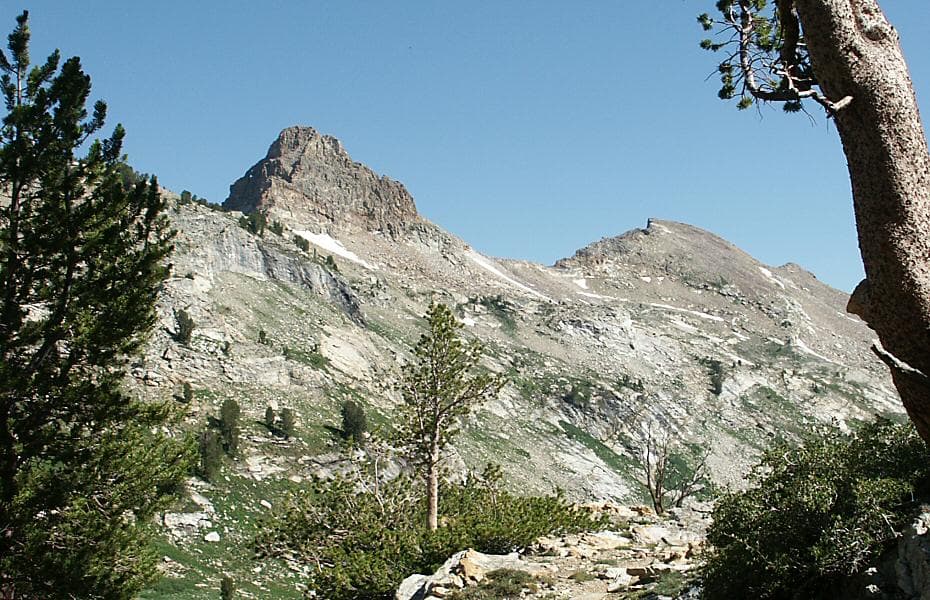
The reward for the morning's effort: a lake so clear the rocky bottom seems close enough to touch, ringed by granite walls still streaked with snowmelt. This is solitude in its purest form — most other visitors, if any, will have arrived earlier or will arrive later, leaving long stretches of complete silence broken only by wind through pine. Eat lunch lakeside, take in the reflections, and begin the return with plenty of daylight margin — this is not a place to linger past early afternoon given storm risk.
Departure happens in near-darkness, headlamp-lit switchbacks giving way to the first blue light over the ridge. The climb onto the crest is serious, sustained work — thin air, loose scree, and a silence broken only by wind and the occasional marmot call — but the payoff is a view of Nevada's folded, high-desert vastness that few visitors ever see firsthand.
Descending into the lake basin feels like stepping into a different world entirely — glassy water, sheer granite, and a stillness that swallows sound. Lunch here is less a meal than a ritual pause before the long walk back, eyes checking the sky as often as the scenery for any sign of building storms.
The final descent back to the trailhead, then the drive into Elko, closes the trip on tired legs and a full heart. A final dinner in town — ideally somewhere with counter seating for easy conversation with fellow travelers comparing trail stories — makes a fitting last note before departure, the mountains already receding into memory as headlights carry you back toward the airport road.
Want to tweak this trip?
Our AI planner can customize this itinerary to your exact dates, interests, and travel style.
Customize This ItineraryRestaurant details (hours, menus, availability) change frequently, and this remote region has especially limited, seasonal options — always check current status in Elko before relying on any single venue.
Dietary compatibility tags are general guidance. If you have severe allergies, confirm directly with the restaurant or plan self-catered meals for maximum control.
Travel tips are general guidance, not professional safety advice, especially for solo backcountry travel — check current weather, trail, and government advisories before setting out, and always share your route and return time with someone.
All prices are approximate and may vary seasonally; remote-area costs can shift with fuel prices and limited competition.