2 DaysSolo Traveler4 Stops

El Malpais NM (near Grants), New Mexico

2-Day Itinerary for Solo Traveler

“Black Rock, White Light: Two Days Across El Malpais and El Morro”
Black Rock, White Light: Two Days Across El Malpais and El Morro

Out here the black lava holds the morning cold long after the sun clears the mesa, and the silence has a texture you can almost touch. This is a landscape built for solo travelers who like their own pace, their own thoughts, and a sky that doesn't apologize for being enormous.

At a Glance

Climate & Weather
Summer days run warm to hot (70s–90s°F) with intense high-desert sun; afternoon monsoon storms can roll in fast, especially by August. Pack a brimmed hat, high-SPF sunscreen, a light long-sleeve layer for sun and wind, sturdy closed-toe hiking boots (lava rock is unforgiving), and at least 2-3 liters of water per day.
Getting Around
A car is essential — there's no public transit, and distances between the visitor center, lava fields, and El Morro are substantial (El Morro is a 45-minute scenic drive from Grants). Roads are paved but narrow and winding in places; fill up on gas in Grants before heading out.
Budget
Budget roughly $40-60/day for a solo traveler covering diner meals, snacks, and modest park fees — this is cash-friendly, unpretentious small-town New Mexico, not a destination that will strain a budget.
Safety
This is remote, self-sufficient country — let someone know your route before heading out, especially onto lava tube trails where cell signal disappears. Watch for rattlesnakes sunning on rocks, carry a headlamp for any cave sections, and avoid exposed trails if thunderstorms are forecast. As a solo traveler, stick to marked routes and avoid caving alone without telling someone your expected return time.
Connectivity
Cell service is spotty to nonexistent within both monuments — download offline maps and let your accommodation or a friend know your plans before setting out each day. Wi-Fi is available at lodging in Grants but don't expect it on the trails.
Local Tips
Arrive at trailheads by 7:30-8am in summer — not just for crowds, but to beat the heat on exposed black rock that radiates like a stovetop by midday. Many Grants restaurants close early evening, so plan dinner before 8pm. Solo travelers will find the small visitor centers and ranger desks good spots to strike up conversation and pick up trail conditions.

Highlights

  • Crawl through a lava tube cave still cool from last winter's frost
  • Watch La Ventana Arch catch the late light alone, with no one else around
  • Stand at Sandstone Bluffs and see 7,000 years of frozen fire spread to the horizon
  • Run your fingers over 400-year-old inscriptions carved by conquistadors and settlers
  • Drive the quiet backroads between Grants and El Morro with the windows down
  • Chase golden hour across two of New Mexico's least-crowded national park sites

Day-by-Day Plan

Arrival & Orientation

Day 1: First Light on the Lava Fields

A gentle introduction to El Malpais's volcanic terrain with roughly 3 miles of walking across moderate, uneven lava rock terrain.

Wear
Sturdy hiking boots with ankle support, a brimmed hat, sun shirt or layers, and gloves if you plan to touch rock inside the tubes (sharp edges).
Budget
$35-45 (park entry is free; covers lunch, snacks, water, and gas)
7:30 AM - 9:30 AM
El Malpais (lava tubes, La Ventana Arch) · morning · 120 min · El Malpais Lava Fields

Arrive while the air still carries night's chill — by 7:30am the parking area is nearly empty and the black rock hasn't yet begun radiating heat. Walk out across lava frozen mid-motion 7,000 years ago, the silence broken only by your boots crunching basalt and the occasional raven overhead. This is the kind of place that rewards solitude; give yourself time to simply stand still and feel the scale of it.

El Malpais (lava tubes, La Ventana Arch)
United States. Bureau of Land Management. Rio Puerco Resource Area / wikimedia (Public domain)
Shoot the mesa rim panoramas in the first hour of light, when shadows carve deep relief into the lava flows.
Terrain is uneven and unpaved throughout — not wheelchair accessible; sturdy footwear is essential.
10 min walk — A short walk along the rim trail, the lava field unfurling below like a frozen black sea.
9:45 AM - 11:15 AM
Crater Rim Trail to Lava Tubes · midday · 90 min · El Malpais Lava Fields

Descend into cool, cave-dark passages where the temperature drops noticeably the moment you duck below the surface — a welcome relief as the desert sun climbs. Bring a headlamp; the tubes are mostly unlit and the quiet inside has a cathedral-like weight to it. This is a good spot to chat briefly with a ranger or fellow hiker at the entrance before heading in solo, since cell signal vanishes underground.

Crater Rim Trail to Lava Tubes
Photo by Edu Raw on Pexels
Point your camera toward the tube entrance from inside — the light streaming down through the opening makes for a dramatic natural spotlight shot.
Cave sections involve uneven footing and stooping; not suitable for mobility aids.
15 min drive — A short scenic drive on the overlook road, climbing gradually with the whole lava field opening up in the rearview mirror.
12:00 PM - 1:00 PM
Sandstone Bluffs Overlook · afternoon · 60 min · El Malpais Lava Fields

A flat, easy overlook after the morning's rougher terrain — a welcome change of pace. The view opens wide across the entire lava field toward the Zuni Mountains, and at midday the light is harsh but the scale is undeniable. Pack a lunch and eat it here; there's nowhere formal to dine within the monument, so plan meals around town rather than the trailhead.
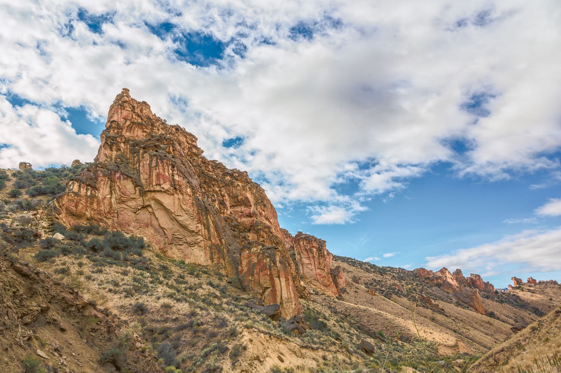
Sandstone Bluffs Overlook
Photo by Brett Sayles on Pexels
The main overlook platform captures the full lava field — best shot with wide-angle lens around midday or early evening for long shadows.
Flat paved path to the overlook — the most accessible stop of the day, though no benches are present.
Optional detour: La Ventana Arch — After Sandstone Bluffs Overlook and before heading back to Grants
The arch is at its most striking in late-afternoon light, and solo travelers often find this the quietest, most contemplative stop of the whole trip. Skip if: If you're running low on energy after a full morning on lava rock, this can easily be saved as the opening stop of Day 2 instead.
If it rains: If storms roll in, lava tubes remain accessible in light rain (avoid during flash flood warnings), but postpone exposed trail sections like the Crater Rim Trail and Sandstone Bluffs until skies clear — footing on wet basalt turns treacherous fast.

The day opens cool and still, with the lava field holding onto night's chill just long enough for an unhurried first walk across ancient black rock. Arriving early means having the mesa rim essentially to yourself, the only sounds wind and distant ravens.

After the tube caves' cool dark, the pace shifts to something gentler — a flat overlook, a packed lunch, and wide views that let the morning's exertion settle. This is the moment to slow down, drink water, and let the scale of the landscape sink in.

With no formal dining inside the monument, plan to head back into Grants for the evening — options in town run toward simple, unpretentious New Mexican diners, so settle in early since most kitchens close by 8pm. A quiet night in is well-earned after a day on lava rock.

History & Inscription

Day 2: Stone Memory at El Morro

A lighter day centered on one cultural landmark with an easy loop trail, covering roughly 2 miles of gentle walking.

Wear
Comfortable walking shoes (the trail is less rugged than Day 1's lava terrain), sun hat, and a light layer for the exposed sandstone bluff.
Budget
$25-35 (modest park fee, lunch, and gas for the scenic drive)
45 min drive — A quiet two-lane highway drive through open rangeland — a good stretch to clear your head before a day of close historical reading.
8:30 AM - 10:00 AM
El Morro NM (Inscription Rock) · morning · 90 min · Inscription Rock

The 45-minute drive south from Grants is scenic and unhurried — rolling high desert giving way to the sandstone bluff rising suddenly from the plain. Arrive by 8:30am and the inscriptions are yours alone to study: Spanish conquistadors, American pioneers, and petroglyphs from Indigenous peoples who passed this same watering hole centuries apart. Run a hand (gently, without touching the carvings directly) along the warm stone and imagine the queue of travelers who stood in this exact spot.

El Morro NM (Inscription Rock)
Tainter, Joseph A Gillo, David A Cibola National Forest (N.M.) United States. Bureau of Land Management. Albuquerque District United States. Bureau of Land Management. Socorro District / wikimedia (Public domain)
The south face of the monolith glows warmest at golden hour, but mid-morning light is best for photographing individual inscriptions without harsh shadow.
The inscription trail has some uneven, rocky sections; the lower loop near the visitor center is more accessible than the summit trail.
Optional detour: El Malpais (lava tubes, La Ventana Arch) — Before El Morro NM (Inscription Rock), if La Ventana Arch was skipped on Day 1
A quick return stop for La Ventana Arch at golden hour makes a striking bookend to the trip if missed the day before. Skip if: If Day 1 already covered the arch, skip this return trip and head straight to El Morro to maximize time at the inscriptions.
If it rains: If rain moves in, the inscriptions become harder to read and trails slicken quickly — the small visitor center exhibits at El Morro offer a dry, informative alternative covering the site's history and geology.

The drive south from Grants settles into a meditative rhythm, open country rolling past until the sandstone bluff appears almost without warning. Early arrival means quiet, unhurried time with four centuries of carved names and stories.

With the main stop complete by midday, the afternoon opens up for a slow drive back toward Grants, a chance to decompress and reflect on two days spent in landscapes defined by fire and stone, time stretched thin in both directions.

Head back into Grants for a final, easy dinner at a local diner — the kind of place where solo travelers can sit at the counter, strike up conversation with whoever's nearby, and close out the trip with a plate of red or green chile and the quiet satisfaction of having seen something genuinely old.

Want to tweak this trip?

Our AI planner can customize this itinerary to your exact dates, interests, and travel style.

Customize This Itinerary
Good to Know

Restaurant details (hours, menus, availability) change frequently, and this destination currently has limited mapped dining data near the monuments themselves — plan meals around Grants rather than the trailheads, and check current hours before visiting.

Dietary compatibility tags are general guidance. If you have severe allergies, confirm directly with the restaurant.

Travel tips are general guidance, not professional safety advice. Check government advisories and current trail/weather conditions before heading out, especially for solo travelers on remote trails.

All prices are approximate and may vary seasonally.
We use cookies to improve your experience and analyze site usage. Essential cookies are always active. You can customize your preferences or accept all cookies. Cookie Policy