3 DaysSolo Traveler6 Stops

Mount Rainier NP (Paradise, Sunrise), Washington

3-Day Itinerary for Solo Traveler

โ€œAlone with the Mountain: Three Days at Rainier's Edgeโ€

Alone with the Mountain: Three Days at Rainier's Edge

Spring at Rainier is a negotiation with the mountain โ€” clouds part just long enough to reveal the ice-crowned summit before closing again, and the meadows are just beginning to green beneath receding snowpack. Solo travel here means moving at your own rhythm: lingering at a waterfall until the light shifts, or turning back the moment the ridge feels wrong. This itinerary threads Paradise, the ancient groves of Ohanapecosh, and the quiet volcanic shoulder of Sunrise into three unhurried days built for a single set of footprints.

At a Glance

Climate & Weather
Spring at Rainier means mild but unpredictable weather โ€” expect temperatures in the 40sโ€“50sยฐF at elevation, frequent rain showers, and the chance of snow lingering on higher trails like Burroughs Mountain into June. Wildflowers are just starting low down but may not have reached peak bloom at Sunrise yet. Pack waterproof shells, insulating mid-layers, waterproof boots, and gloves; conditions can shift from sun to sideways rain within an hour.
Getting Around
A personal vehicle is essential โ€” there is no public transit within the park, and distances between Paradise, Ohanapecosh, and Sunrise are substantial (allow 1.5โ€“2 hours driving between areas). Roads to Sunrise typically open later in spring (often not until late June), so check current opening status before planning Day 3; if still closed, substitute additional time at Paradise or Ohanapecosh.
Budget
Budget roughly $60โ€“90/day for a solo traveler, covering cafeteria-style meals at Paradise Inn or Sunrise Lodge, coffee, park entrance fees (or annual pass), and incidentals. Dining options inside the park are limited and simple โ€” bring your own trail snacks and a refillable water bottle to cut costs.
Safety
Solo hikers should tell someone their planned route and expected return time, carry a paper map (cell service is unreliable), and turn back at the first sign of deteriorating weather on exposed ridges like Skyline or Burroughs Mountain. Snow patches may still cover sections of higher trails in spring โ€” microspikes are worth packing. Mountain goats and black bears are present; keep food sealed and maintain distance from wildlife.
Connectivity
Cell service is minimal to nonexistent throughout the park, including at Paradise and Sunrise. Wifi is available in limited form at Paradise Inn's lobby. Download offline maps and let someone outside the park know your itinerary before you lose signal at the entrance stations.
Local Tips
Arrive at trailheads before 8am โ€” Paradise's small parking lots fill quickly even in shoulder season on clear-weather weekends. Check the NPS road status page daily each spring, since Sunrise Road opening dates shift year to year with snowpack. If solo and craving conversation, the communal dining tables and stone fireplace lobby at Paradise Inn are the park's best low-key social hub for swapping trail notes with other travelers.

Highlights

  • Sunrise mist rising off Myrtle Falls before the first tour bus arrives
  • Standing beneath 1,000-year-old Douglas firs in the Grove of Patriarchs
  • Wildflower-lined switchbacks on the Skyline Trail with Rainier looming overhead
  • The raw, empty ridgelines of Sunrise โ€” fewer people, rawer views
  • Cafeteria coffee at Paradise Inn's stone fireplace on a fog-bound morning
  • Fremont Lookout's 360-degree theater of glaciers and volcanic peaks
  • Solo-friendly communal tables at Paradise Inn where trail stories get swapped

Day-by-Day Plan

Arrival & Alpine Orientation

Day 1: Settling Into the Mountain's Shadow

A gentler day of acclimatization at Paradise, covering roughly 3โ€“4 miles on established trails with moderate elevation gain.

Wear
Waterproof hiking boots, a insulated layer under a rain shell, gloves, and a warm hat โ€” spring mornings at 5,400 feet can hover near freezing even when Seattle is mild.
Budget
$45-65 (park entry if not annual pass, cafeteria breakfast and dinner, coffee)
7:30 AM - 9:00 AM
Myrtle Falls ยท morning ยท 90 min ยท Paradise

Arrive before 8am and the falls are yours alone โ€” just the roar of snowmelt crashing through the gorge and mist settling on your face in the cool air. The short paved-then-dirt trail from the visitor center climbs gently through still-dormant meadow grass, with Rainier's summit occasionally breaking through morning cloud directly above the cascade. This is the easiest introduction to Paradise's scale, and a good gauge for how your legs feel at elevation before committing to anything longer.

Myrtle Falls
Photo by leoleobobeo on Pixabay
Shoot the main overlook just after sunrise when mist from the falls catches low-angle light โ€” by 10am the crowds and flatter midday light diminish the effect.
Trail has real elevation gain and uneven volcanic rock steps; not wheelchair accessible, and spring runoff can make footing slick near the falls.
5 min walk โ€” A short backtrack down from the falls overlook onto the main Skyline junction, gravel crunching underfoot.
9:15 AM - 12:15 PM
Paradise (Myrtle Falls, Skyline Trail) ยท midday ยท 180 min ยท Paradise

From the falls, continue onto the lower Skyline Trail loop rather than the full summit circuit โ€” spring snowpack often still covers the upper switchbacks, so this scaled-back version keeps you on solid ground while still delivering meadow views and glacier glimpses. The air thins noticeably as you climb; expect your own breathing to become part of the soundtrack alongside distant marmot calls. Solo hikers find this an ideal pace-setting stretch โ€” no one to wait for, no one to rush for.

Paradise (Myrtle Falls, Skyline Trail)
Unknown / wikimedia (Public domain)
The meadow clearing near the Skyline Loop saddle offers the clearest full-mountain shot โ€” aim for midday when cloud cover tends to lift briefly before afternoon buildup.
Not wheelchair accessible; trail is uneven with patchy snow possible into late spring โ€” trekking poles recommended.
Breakfast
Tatoosh Cafe $
Bakery, Breakfast ยท Near Myrtle Falls trailhead
Quick pastries and strong coffee before the trail โ€” grab-and-go is the move for an early start.
Lunch
Jackson Visitor Center Cafe $
Cafe ยท Near Paradise cluster
Casual soup-and-sandwich fare with big windows facing the mountain โ€” a solid warm-up after a cold morning hike.
Dinner
Paradise Inn $$
American ยท Near Paradise cluster
Communal-style dining room with a stone fireplace lobby โ€” the park's best spot for a solo traveler to strike up conversation with fellow hikers over a hearty plate.
If it rains: If rain moves in, shorten to the Myrtle Falls spur only and skip the Skyline loop โ€” footing turns treacherous on wet volcanic rock, and low cloud erases the summit views that make the climb worthwhile.

The day begins gently, with an early walk to Myrtle Falls while Paradise is still hushed and mostly empty. Cold mist off the cascade and the low grumble of glacier melt set the tone โ€” this is a soft landing into the mountain's scale, no crowds yet to jostle past.

By midday, the lower Skyline Trail offers a longer but still measured push into subalpine terrain, meadows just beginning to thaw underfoot. Cloud cover tends to shift quickly here โ€” patience rewards you with brief, dramatic openings onto the summit before it disappears again.

Dinner at Paradise Inn closes the day around its stone fireplace, where the communal dining tables make it easy for a solo traveler to trade trail notes with strangers before an early, well-earned night's sleep.

Old Growth & River Valley

Day 2: Among the Ancient Trees

A quieter, flatter day exploring ancient forest, covering roughly 2-3 miles with minimal elevation gain โ€” a deliberate contrast to Day 1's alpine exertion.

Wear
Layered rain jacket over a fleece, waterproof shoes rather than heavy boots โ€” the forest floor stays damp and shaded even on drier days.
Budget
$35-55 (light lunch, coffee, minor incidentals โ€” no major activity fees beyond park entry)
75 min drive โ€” A scenic descent from Paradise through Stevens Canyon Road, switchbacking down through changing forest zones โ€” worth a pullover at any of the canyon viewpoints along the way if fog allows.
8:30 AM - 10:00 AM
Grove of Patriarchs ยท morning ยท 90 min ยท Ohanapecosh & Stevens Canyon

Arrive by 8:30am and the grove is silent except for the distant thunder of the river and the occasional drip of overnight rain off ancient cedar boughs. These trees are up to a thousand years old, their bark deeply furrowed, moss climbing every surface โ€” a total sensory shift from Paradise's exposed alpine drama into something hushed and cathedral-like. The suspension bridge crossing partway through is a highlight; pause there and feel the structure sway gently over the river below.

Grove of Patriarchs
B.Bailey / pexels (Pexels License)
Midday light filters best through the canopy in dappled shafts โ€” arrive by mid-morning for the softest, most even light before harsher midday contrast sets in.
Trail is flat and well-maintained with frequent benches, among the more accessible options in the park, though still unpaved and can be muddy in spring.
Breakfast
Tatoosh Cafe $
Bakery, Breakfast ยท Near Paradise cluster, en route to Ohanapecosh
A last coffee and pastry stop before departing Paradise for the drive south to Ohanapecosh.
Optional detour: Stevens Canyon scenic pullovers โ€” Between Paradise and Grove of Patriarchs
Since the drive exceeds an hour, brief roadside pullovers along Stevens Canyon Road offer canyon and forest views worth a five-minute stretch break. Skip if: Skip if fog or rain limits visibility โ€” better to press on directly to the grove and stay on schedule.
If it rains: Grove of Patriarchs remains hikeable even in steady rain โ€” the canopy offers some shelter and the trail drains well โ€” making this an ideal rain-day activity if Paradise or Sunrise plans get scrapped.

The morning trades alpine exposure for old-growth hush, the drive itself a slow descent through shifting forest zones before arriving at the Grove of Patriarchs. Walking among trees a thousand years old resets the day's pace entirely โ€” this is contemplative, unhurried ground.

With the grove's loop complete by late morning, the rest of the day stays loose and low-key โ€” a deliberate rest day for legs that worked hard at Paradise, with time to explore Ohanapecosh's quieter corners or simply sit by the river.

Options for dinner near Ohanapecosh are limited within park boundaries, so plan to eat either back at Paradise or pack a substantial picnic supply for the evening โ€” a lower-key night ahead of Sunrise's early start tomorrow.

Solitude & Volcanic Ridgelines

Day 3: The Mountain's Quiet Shoulder

The most physically demanding day, covering 5-6 miles of exposed ridge trail at Sunrise with significant elevation gain โ€” contingent on Sunrise Road being open for the season.

Wear
Full layering system: base layer, insulated mid-layer, waterproof shell, gloves, warm hat, and sturdy waterproof boots with good ankle support โ€” conditions on Burroughs Mountain shift fast and temperatures drop sharply with wind.
Budget
$40-60 (cafeteria lunch at Sunrise, coffee, snacks โ€” minimal activity costs beyond park entry)
110 min drive โ€” A long but scenic drive north and around the mountain's flank via Cayuse Pass and the White River entrance โ€” consider a brief pullover at any viewpoint along Chinook Pass Road if fog allows a break.
7:00 AM - 9:00 AM
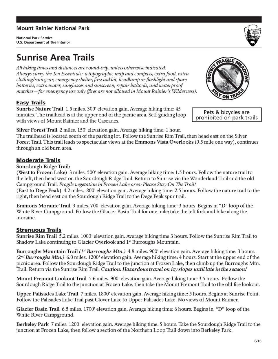
Sunrise (Burroughs Mountain, Fremont Lookout) ยท morning ยท 120 min ยท Sunrise

If the road is open this early in spring, arriving by 7am rewards you with an almost private view โ€” Rainier's northeast face catching first light while the parking lot still sits nearly empty. The air up here is thinner and colder than Paradise, and the landscape feels rawer: fewer wildflowers this early in the season, more exposed volcanic rock and lingering snow patches. This is Rainier stripped to its essentials, and solo travelers often find it the emotional high point of the trip.

Sunrise (Burroughs Mountain, Fremont Lookout)
National Park Service, U.S. Department of the Interior / wikimedia (Public domain)
Shoot from the main overlook platform in the first hour after arrival โ€” the low sun angle lights the northeast face directly, a look that flattens out by mid-morning.
Not wheelchair accessible; high elevation and exposed terrain mean no accessible facilities nearby.
10 min walk โ€” A short walk from the Sunrise parking area to the Burroughs Mountain trailhead, gaining elevation immediately.
9:15 AM - 12:15 PM
Burroughs Mountain Trail ยท midday ยท 180 min ยท Sunrise

The trail climbs across exposed ridge and volcanic scree toward the Emmons Glacier's raw northeast face โ€” in spring, expect possible snow patches on the upper sections, so check current trail reports and turn back if conditions feel unstable underfoot. Wind whistles constantly across these ridges, and the silence between gusts is profound; this is solitude in its purest form, often with no one else in sight for stretches at a time. Solo hikers should carry a paper map here, since the terrain has few obvious landmarks in low visibility.
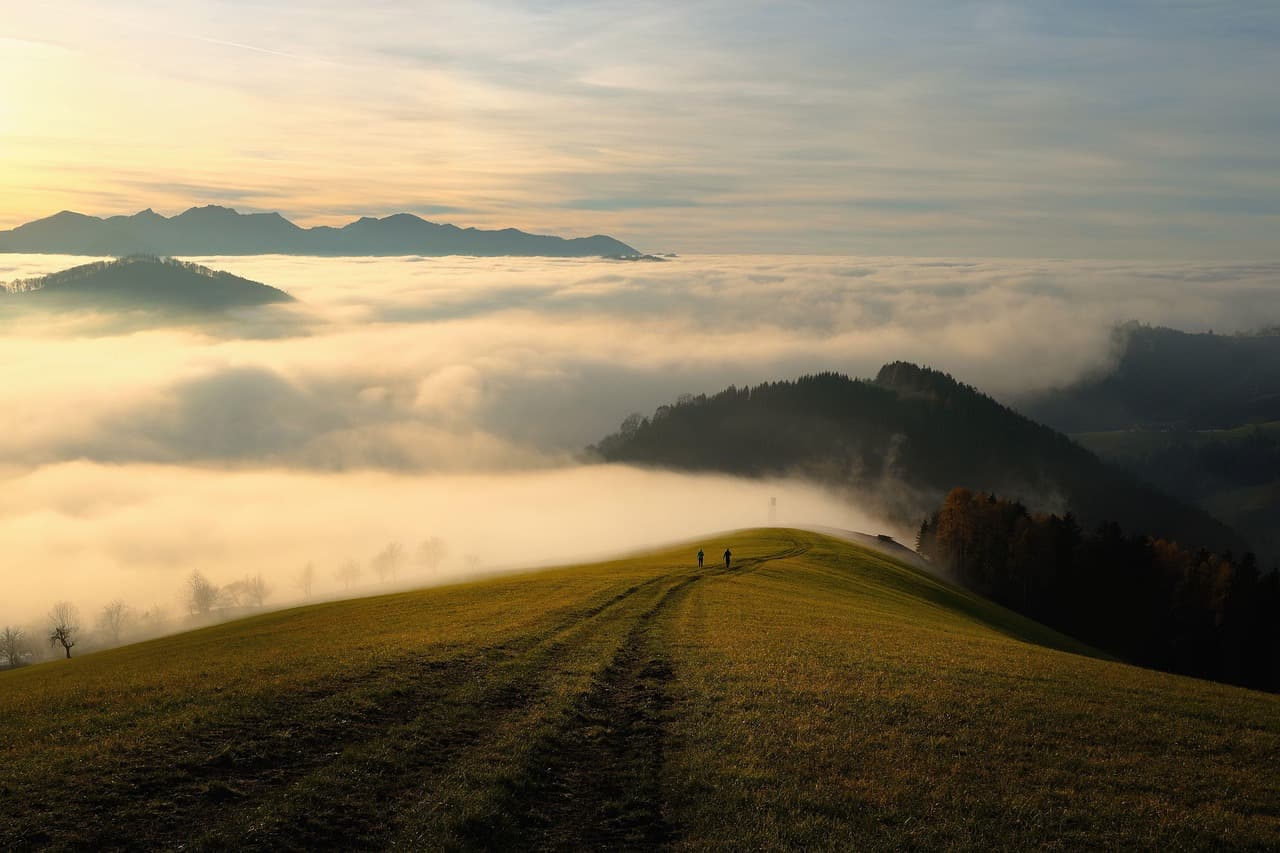
Burroughs Mountain Trail
Photo by shogun on Pixabay
The summit ridge overlooking Emmons Glacier is best photographed late morning once the sun has cleared the eastern ridgeline, lighting the glacier's crevasses in sharp relief.
High elevation gain and exposed, uneven terrain โ€” not recommended for those with mobility concerns; no facilities along the route.
40 min walk โ€” A ridge walk connecting Burroughs Mountain to the lookout, wildflowers just starting to emerge along the path in sheltered pockets.
12:45 PM - 2:15 PM
Fremont Lookout ยท afternoon ยท 90 min ยท Sunrise

The historic fire lookout tower crowns a ridge with a genuinely 360-degree view โ€” glaciers to the south, jagged Cascade peaks stretching east, and total silence apart from wind against the old tower's metal frame. By early afternoon, cloud can build quickly, so treat any clear window here as a bonus rather than a guarantee. It's a fitting final stop for the trip: expansive, quiet, and entirely earned by three days of climbing toward it.
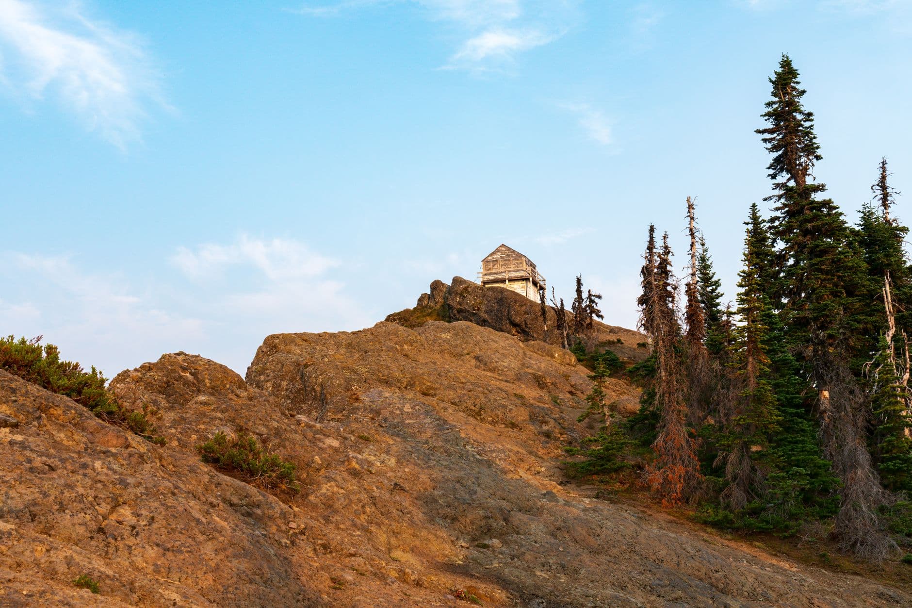
Fremont Lookout
Photo by JOHN CALLERY on Pexels
Late morning to early afternoon offers the clearest long-range visibility before typical afternoon cloud buildup rolls in from the southwest.
Not recommended for those with mobility limitations; no benches or facilities at the lookout itself.
Optional detour: Chinook Pass Road viewpoints โ€” Between Ohanapecosh area and Sunrise
Since the drive to Sunrise exceeds 90 minutes, a brief pullover along Chinook Pass Road offers dramatic canyon and forest views worth five minutes if weather allows. Skip if: Skip in low visibility or when racing to beat morning crowds to Sunrise โ€” the pullovers add minimal value in fog.
If it rains: If Sunrise is fogged in or the road is closed, retreat to the Sunrise Visitor Center exhibits if accessible, or fall back on Paradise's Myrtle Falls spur trail as a lower-elevation alternative that stays hikeable in poor weather.

The day opens with the long drive north to Sunrise, arriving early enough to catch the mountain's northeast face still catching first light โ€” a payoff for the effort of getting here before the crowds.

The pace shifts into the trip's most demanding stretch, climbing Burroughs Mountain's exposed ridge toward Fremont Lookout, wind and thin air a constant reminder of the elevation. Lunch options are minimal at Sunrise itself, so packing food from the previous day or morning stop is worth planning ahead for.

With the lookout as the trip's final major stop, the drive back out of the park offers time to decompress โ€” a fitting quiet close to three days spent almost entirely on the mountain's own terms.

Want to tweak this trip?

Our AI planner can customize this itinerary to your exact dates, interests, and travel style.

Customize This Itinerary
Good to Know

Restaurant details (hours, menus, availability) change frequently, especially in a seasonal park setting. Check current hours before visiting.

Dietary compatibility tags are general guidance. If you have severe allergies, confirm directly with the restaurant or cafeteria staff.

Travel tips are general guidance, not professional safety advice. Check current NPS conditions, road status, and weather forecasts before each day's activities.

All prices are approximate and may vary seasonally; park entrance fees and cafeteria pricing are subject to change.

We use cookies to improve your experience and analyze site usage. Essential cookies are always active. You can customize your preferences or accept all cookies. Cookie Policy