3 DaysSolo Traveler6 Stops

Mount Rainier NP (Paradise, Sunrise), Washington

3-Day Itinerary for Solo Traveler

Meadows, Ancient Firs & Fire Lookouts: 3 Days Solo on Mount Rainier

Meadows, Ancient Firs & Fire Lookouts: 3 Days Solo on Mount Rainier

The mountain announces itself before you ever reach the trailhead — a white shoulder rising over the treeline, impossibly close, impossibly large. This is a trip built for solitude: early starts before the crowds arrive, long views that reward patience, and quiet forest floors where the loudest thing is the river.

At a Glance

Climate & Weather
Summer (July–August) is the park's only reliably dry stretch, but temperatures at elevation stay cool — expect 50–70°F days with sharp afternoon cloud build-up and possible thunderstorms. Pack waterproof layers, a warm hat, sun protection, and sturdy broken-in hiking boots regardless of the forecast.
Getting Around
A personal vehicle is essential; there's no public transit within the park. Roads between Paradise and Sunrise take roughly 2–2.5 hours via the SR-123/SR-410 loop, so plan those as separate driving days rather than a single loop. Fill up on gas outside the park — services inside are limited.
Budget
Budget roughly $60–90/day for a solo traveler — cafeteria-style lodge meals run $12–25, picnic supplies save money at midday, and the park entrance fee is a one-time $30 (or use an annual pass).
Safety
Solo hikers should stick to marked trails, tell someone their route and expected return time, and turn back at the first sign of thunder on exposed ridges like Burroughs or Skyline. Store food properly against bears, keep distance from mountain goats, and check the NPS conditions page each morning — weather here changes fast.
Connectivity
Cell service is unreliable to nonexistent at Paradise, Sunrise, and most trailheads. Download offline maps before you go, and treat any lodge WiFi as a bonus, not a plan.
Local Tips
Arrive at trailheads before 8am in summer — by 10am, Paradise's lots are full and Skyline Trail feels like a commuter line. Solo travelers should eat at the communal tables in Paradise Inn's dining room, where sharing a table with strangers is the norm, not the exception. Bring cash or a card for the wilderness permit self-pay stations if adding any overnight routes.

Highlights

  • Sunrise light hitting Myrtle Falls before the crowds arrive
  • Wildflower meadows on the Skyline Trail with Rainier looming overhead
  • Ancient 1,000-year-old firs in the Grove of Patriarchs
  • Golden-hour ridge walking on Burroughs Mountain
  • Panoramic solitude at Fremont Lookout's fire tower
  • Solo-friendly lodge dining with communal tables at Paradise Inn

Day-by-Day Plan

Arrival & Alpine Orientation

Day 1: Settling Into the Mountain's Shadow

A gentler first day acclimating to elevation with an easy waterfall walk and a longer meadow hike once your legs adjust, covering roughly 4–5 miles total.

Wear
Layered clothing — a base layer, a warm mid-layer, and a waterproof shell; broken-in hiking boots; sun hat and sunscreen for exposed meadow sections.
Budget
$55–70 (lodge breakfast, picnic lunch supplies, dinner at Paradise Inn)
7:30 AM - 9:00 AM
Myrtle Falls · morning · 90 min · Paradise

Arrive before 8am and the overlook is yours alone — just the roar of glacier-melt crashing through mossy rock and the sweet, sharp smell of lupine waking up in the morning cool. The trail climbs gently through alpine turf before the falls appear suddenly, framed by Rainier's summit in the background on clear mornings. This is the easiest of the Paradise trails, a perfect first taste of altitude before tackling anything steeper.

Myrtle Falls
Photo by leoleobobeo on Pixabay
Shoot the main overlook around 8am when soft light hits the cascade without harsh midday glare, and Rainier is often still cloud-free.
Trail has moderate elevation gain and uneven volcanic soil; not wheelchair accessible.
10 min walkA short uphill walk from the falls overlook back to the main Skyline junction, meadow grass brushing your ankles.
9:30 AM - 1:30 PM
Skyline Trail · midday · 240 min · Paradise

By mid-morning the meadows are in full bloom — lupine and paintbrush painting the slopes purple and orange beneath a mountain that seems to grow larger with every switchback. This loop circles some of the best wildflower terrain in the park, and solo hikers move at their own rhythm here, pausing as long as they like at the ridge viewpoint east of Panorama Point for a full 360-degree payoff. Expect your legs to feel the thin air on the steeper pitches — this is the day's main physical effort.

Skyline Trail
Photo by S_Donald on Pixabay
The meadow clearing north of the Skyline Loop saddle offers the clearest full-mountain shot — best between 10am and noon before afternoon haze builds.
Steep, uneven terrain with significant elevation gain; not recommended for those with mobility limitations.
Breakfast
Tatoosh Cafe $
Bakery, Breakfast · Near Myrtle Falls trailhead
Grab a pastry and hot coffee before the trailhead — quick, warm, and unfussy.
Lunch
Jackson Visitor Center Cafe $
Cafe · Near Skyline Trail trailhead
Casual counter-service spot for a hot soup or sandwich after the Skyline loop — solo-friendly bar seating by the windows.
Dinner
Paradise Inn $$
American · Near Myrtle Falls / Skyline Trail
Historic stone-and-timber dining room with long communal tables — easy to strike up conversation with fellow hikers over a hearty plate.
Optional detour: Paradise (Myrtle Falls, Skyline Trail)Between breakfast and the Skyline Trail loop
If you want a slower start, the broader Paradise meadow area offers extra short spur trails for photography before committing to the full loop. Skip if: Skip if you're prioritizing time on the main Skyline loop before crowds thicken after 10am.
If it rains: If rain moves in, stick to the lower Myrtle Falls spur only — the waterfall is even more dramatic with extra runoff, but skip the exposed Skyline switchbacks where footing and visibility deteriorate fast.

The first light at Myrtle Falls belongs to early risers — cool air, the low thunder of snowmelt, and a mountain that seems to hover directly overhead. It's a gentle warm-up for legs and lungs still adjusting to elevation, with just enough climb to remind you where you are.

As the day warms, the Skyline Trail becomes the main event — meadows blazing with wildflowers, switchbacks climbing toward sweeping ridge views, and Rainier's glaciers glinting in full sun. This is the physical heart of day one, best tackled while morning coolness still lingers in the shaded sections.

Dinner at Paradise Inn closes the day with stone fireplaces, historic timber beams, and the low hum of shared tables — an easy place for a solo traveler to land after a long hike and trade trail notes with strangers before an early, well-earned sleep.

Old-Growth Forest & Valley Calm

Day 2: Ancient Giants and River Song

A lower-intensity day exploring old-growth forest along the Ohanapecosh valley, with a shorter walking distance of around 2 miles and a lighter physical load after yesterday's climb.

Wear
Layered clothing suited to shaded forest cool; waterproof shoes are useful given frequent misting near the river; light rain jacket packed just in case.
Budget
$40–55 (picnic lunch, light dinner, no major activity fees)
75 min driveA scenic drive southeast from Paradise along Stevens Canyon Road, forest closing in around the car as elevation drops.
8:00 AM - 9:30 AM
Grove of Patriarchs · morning · 90 min · Ohanapecosh & Stevens Canyon

Arrive by 8am and the grove feels like a cathedral before the congregation shows up — shafts of amber light slicing through 1,000-year-old Douglas firs, the forest floor soft with centuries of fallen needles. The suspension bridge crossing over the river is a highlight in itself, swaying gently as the water rushes below. This flat, well-shaded loop offers a welcome contrast to yesterday's alpine exertion.

Grove of Patriarchs
B.Bailey / pexels (Pexels License)
The suspension bridge framed by ancient firs is best photographed early, when mist and low light add depth to the canyon below.
Mostly flat with good drainage and benches every 200m — one of the more accessible trails in the park, though not fully wheelchair-friendly.
Breakfast
Tatoosh Cafe $
Bakery, Breakfast · Near Paradise cluster, pre-departure
A quick coffee and pastry before the long drive southeast — better to fuel up before leaving Paradise.
Optional detour: Grove of PatriarchsExtended loop option after the main grove walk
Photography-focused travelers may want a second slower pass through the grove at midday for different light and detail shots. Skip if: Skip the repeat pass if you'd rather use the extra time driving toward Sunrise before afternoon crowds build on the access road.
If it rains: The Grove of Patriarchs trail is well-drained and genuinely enjoyable in light rain — mist adds atmosphere to the ancient canopy. Heavy downpour is the only reason to reconsider; in that case, treat today as a slow driving and rest day, exploring visitor center exhibits instead.

Morning in Ohanapecosh moves at forest pace — cool, still air; the low thunder of the river beyond the trees; centuries-old firs standing in patient silence. It's a deliberate change of rhythm from yesterday's exposed alpine terrain, and solo travelers often find this grove naturally meditative.

With the grove behind you, the afternoon is intentionally light — a long, scenic drive northeast toward Sunrise, with plenty of pullouts along the way to stretch, photograph distant ridgelines, and let the day's pace stay unhurried before tomorrow's bigger push.

Settle into the Sunrise area as the light softens, keeping dinner simple and self-sufficient given limited services this far into the park — a good night to review tomorrow's early trailhead plan and get to bed before the pre-dawn start.

Alpine Ridges & Solitude

Day 3: Fire Towers and Glacier Light

The most physically demanding day, covering roughly 5–6 miles across exposed alpine ridgeline with the biggest payoff in views and solitude.

Wear
Warm layers for pre-dawn cold, wind-resistant shell for exposed ridges, sturdy boots for volcanic scree, and sun protection for the exposed midday sections.
Budget
$45–60 (trail snacks, packed lunch, simple dinner before departure)
6:30 AM - 8:30 AM
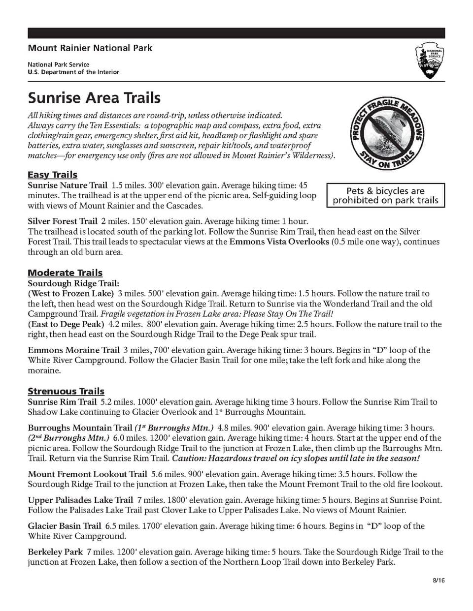
Sunrise (Burroughs Mountain, Fremont Lookout) · morning · 120 min · Sunrise

Arrive at dawn and the Sunrise overlook is nearly empty — thin, cold air, the first light catching Rainier's northeast face, wildflowers still dew-heavy underfoot. This is the payoff for an early alarm: by 10am the lot fills and the quiet vanishes. Solo travelers especially benefit from this window, since the platform and trail feel personal rather than crowded.

Sunrise (Burroughs Mountain, Fremont Lookout)
National Park Service, U.S. Department of the Interior / wikimedia (Public domain)
The main overlook platform at true sunrise frames Rainier with wildflower foreground — arrive by 6:30am for the clearest light before haze builds.
Limited accessible terrain; overlook platform itself is reachable but surrounding trails have uneven footing.
15 min walkA steady uphill walk from the Sunrise overlook onto the First Fork meadow crossing, wildflowers thickening as elevation increases.
9:00 AM - 12:00 PM
Burroughs Mountain Trail · midday · 180 min · Sunrise

The ridge opens dramatically here — Rainier's raw northeast face fills the horizon, marmots whistle from the scree, and the trail crosses genuine high-alpine terrain that feels earned with every step. This is the day's centerpiece climb, best tackled while morning cool still holds and before afternoon cloud buildup threatens the exposed ridge.
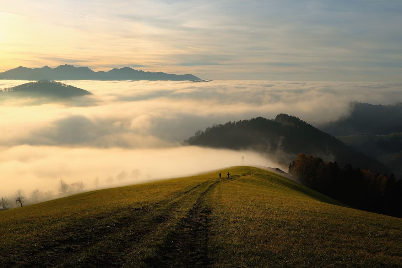
Burroughs Mountain Trail
Photo by shogun on Pixabay
The summit ridge overlooking Emmons Glacier is best photographed late morning, once the sun clears the eastern ridgeline but before midday flattening.
High elevation gain and exposed terrain; not recommended for those with mobility limitations or fear of exposed heights.
20 min walkA ridge walk continuing from Burroughs, volcanic scree crunching underfoot with the lookout tower visible ahead on the skyline.
12:30 PM - 2:00 PM
Fremont Lookout · afternoon · 90 min · Sunrise

The historic fire tower marks a fitting final stop — 360-degree views stretching over jagged Cascade ridgelines, wildflower meadows blazing at your feet, and a quiet that rewards the effort of getting here. Watch the sky closely; afternoon cloud buildup is common, and this exposed point is no place to linger if thunder rolls in.
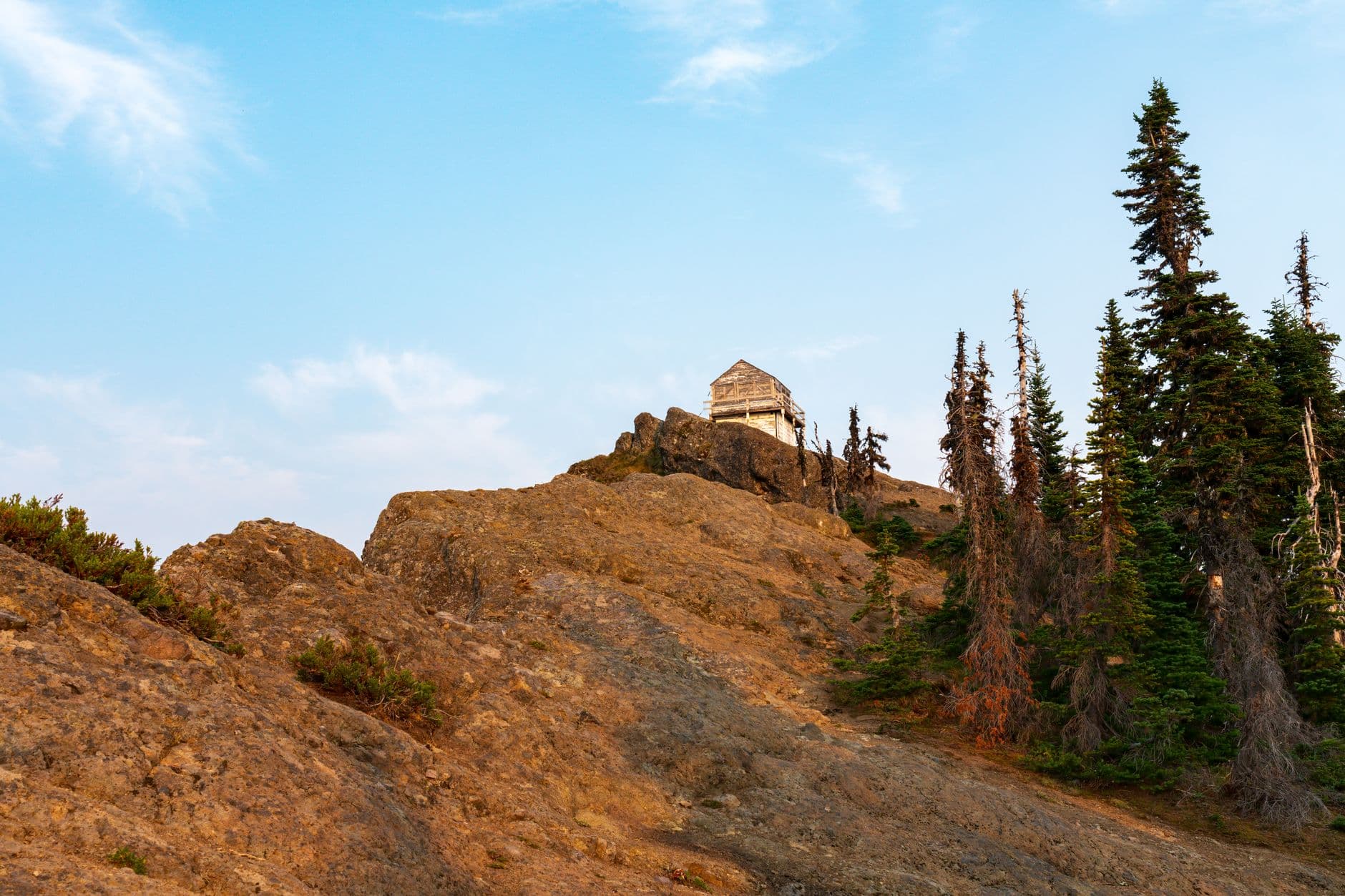
Fremont Lookout
Photo by JOHN CALLERY on Pexels
The lookout tower base framed against Rainier and Emmons Glacier works best in early afternoon light before clouds typically build.
Not recommended for those with mobility limitations; steep, exposed final approach with no accessible facilities.
Optional detour: Burroughs Mountain TrailBetween the Sunrise overlook and Fremont Lookout
Photographers may want extra time along Graybeard Ridge for distant Cascade peak shots in clearer late-morning light. Skip if: Skip lingering here if afternoon clouds are already forming — better to reach Fremont Lookout and descend before weather turns.
If it rains: If Sunrise becomes inaccessible due to heavy rain or cloud, retreat to the Sunrise Visitor Center exhibits, or drive back toward Paradise for the lower-elevation Myrtle Falls spur, which remains hikeable in wetter conditions.

Pre-dawn cold gives way to a spectacular sunrise over the Cascades — the mountain's northeast face catching first light while the trail and overlook remain nearly silent, a rare solo-friendly stillness before the day's crowds arrive.

The ridge walk toward Burroughs and on to Fremont Lookout is the trip's most demanding stretch — exposed, high, and increasingly cloud-watched as midday approaches, but rewarded with views that make the earlier alarm and the aching legs feel entirely worth it.

With no dining data mapped directly to Sunrise, plan to eat from packed trail supplies or drive toward Ashford or Enumclaw for a proper hot meal before departure — a quiet, reflective close to a trip built around solitude and scale.

Want to tweak this trip?

Our AI planner can customize this itinerary to your exact dates, interests, and travel style.

Customize This Itinerary
Good to Know

Restaurant details (hours, menus, availability) change frequently. Check current hours before visiting, especially in seasonal destinations.

Dietary compatibility tags are general guidance. If you have severe allergies, confirm directly with the restaurant.

Travel tips are general guidance, not professional safety advice. Check government advisories and NPS conditions pages for the latest information before hiking.

All prices are approximate and may vary seasonally.

We use cookies to improve your experience and analyze site usage. Essential cookies are always active. You can customize your preferences or accept all cookies. Cookie Policy