3 DaysSolo Traveler8 Stops

Seattle area (day trips), Washington

3-Day Itinerary for Solo Traveler

โ€œFalls, Ridgelines & Island Wind: A Solo Seattle Day-Trip Circuitโ€

Falls, Ridgelines & Island Wind: A Solo Seattle Day-Trip Circuit

Mist off a 268-foot falls, the burn of switchbacks climbing toward alpine light, and salt wind on a bluff at the edge of the Strait โ€” this is Seattle without the Seattle, three days of driving distance and dramatic Pacific Northwest terrain. Spring means wildflowers are just starting, the crowds haven't arrived yet, and you'll want a rain jacket in your daypack no matter what the morning sky promises.

At a Glance

Climate & Weather
Spring in the Seattle area means mild days (50โ€“60ยฐF), unpredictable rain showers, and blooming wildflowers on lower trails. Pack waterproof layers, a packable rain shell, sturdy hiking shoes, and a warm mid-layer for higher elevations like Mount Si's summit, which can be 15+ degrees colder and windy.
Getting Around
A rental car is essential โ€” this itinerary is built entirely around driving day trips from a Seattle base. Roads are well-maintained; I-90 East gets congested with hikers on weekend mornings, so early starts pay off. Whidbey Island requires either the Mukilteo ferry or the longer Deception Pass Bridge drive.
Budget
Plan roughly $60โ€“90/day for a solo traveler, covering trail snacks, a sit-down lunch or dinner, coffee, and minor park/parking fees (Discover Pass required at some trailheads, around $30 annually or $10/day).
Safety
Solo hiking here is common and well-supported โ€” trails are heavily trafficked and well-marked, but always tell someone your route, carry a charged phone, and check trail conditions the morning of (spring snowmelt can make upper Mount Si sections slick). Puget Sound water is cold year-round, so keep distance from unstable shoreline edges at Whidbey. Wildlife (deer, elk) is common and non-aggressive; give it space.
Connectivity
Cell coverage is reliable in town and on most highways, but expect dead zones on Mount Si's upper switchbacks and parts of Whidbey's rural roads โ€” download offline maps before you leave civilization.
Local Tips
Arrive at trailheads by 8am on weekends โ€” Mount Si and Rattlesnake Ledge parking lots fill by 9:30am in good weather. Bring a $10 Discover Pass or buy a day pass at self-service kiosks. Solo travelers should consider chatting up fellow hikers at trailhead lots or brewery bars โ€” Pacific Northwesterns are friendly but not pushy, a good balance for solo social opportunities.

Highlights

  • Standing in the mist-cloud of Snoqualmie Falls before the tour buses arrive
  • Earning the summit meadow view on Mount Si, Rainier hanging on the horizon
  • A quiet alpine lake reflection at Rattlesnake Ledge with almost no one around
  • Salt air and gallery-hopping in Langley's walkable, artist-filled village
  • Windswept bluff walking at Ebey's Landing with the Olympics across the water
  • Fresh Puget Sound seafood at a brewery counter where solo diners are the norm
  • Golden-hour light on Fort Casey's old gun batteries overlooking Admiralty Inlet

Day-by-Day Plan

Arrival & Gentle Immersion

Day 1: Mist, Thunder, and Easing Into the Valley

A lighter first day pairing an easy, awe-inducing waterfall visit with a moderate lakeside trail โ€” about 3 miles of walking total, low-to-moderate energy.

Wear
Layered clothing, waterproof shell, comfortable walking shoes with grip (trails can be damp), and a hat for mist protection at the falls.
Budget
$45โ€“65 (parking, lunch, coffee, optional gift shop browsing)
8:00 AM - 9:00 AM
Snoqualmie Falls ยท morning ยท 60 min ยท Snoqualmie Valley

Arrive by 8am and the observation deck is nearly yours alone โ€” just the roar of 268 feet of falling water and cool mist settling on your jacket. This is Twin Peaks country, and even without the show's mythology, the raw scale of water crashing into an emerald gorge is a genuinely humbling way to start a solo trip. Take your time on the deck; there's no rush and no crowd yet to push through.

Snoqualmie Falls
Robert Ashworth from Bellingham, WA., USA / wikimedia (CC BY 2.0)
Shoot from the main observation deck in soft morning light before 9am โ€” post-rain mist adds ethereal texture to the falls.
Fully paved path with frequent benches and wheelchair access to the main deck.
15 min drive โ€” A short scenic drive deeper into the valley, evergreens crowding closer to the road as elevation climbs slightly.
9:30 AM - 11:30 AM
Rattlesnake Lake & Ledge Trail ยท midday ยท 120 min ยท Snoqualmie Valley

A gentle-to-moderate ascent through evergreen forest rewards you with a genuinely postcard-worthy alpine lake view โ€” without Mount Si's brutal grade. Solo hikers find this trail social without being crowded; it's common to fall into easy trailside conversation with fellow hikers pausing at the same overlook. Spring wildflowers are just beginning to dot the meadow sections.
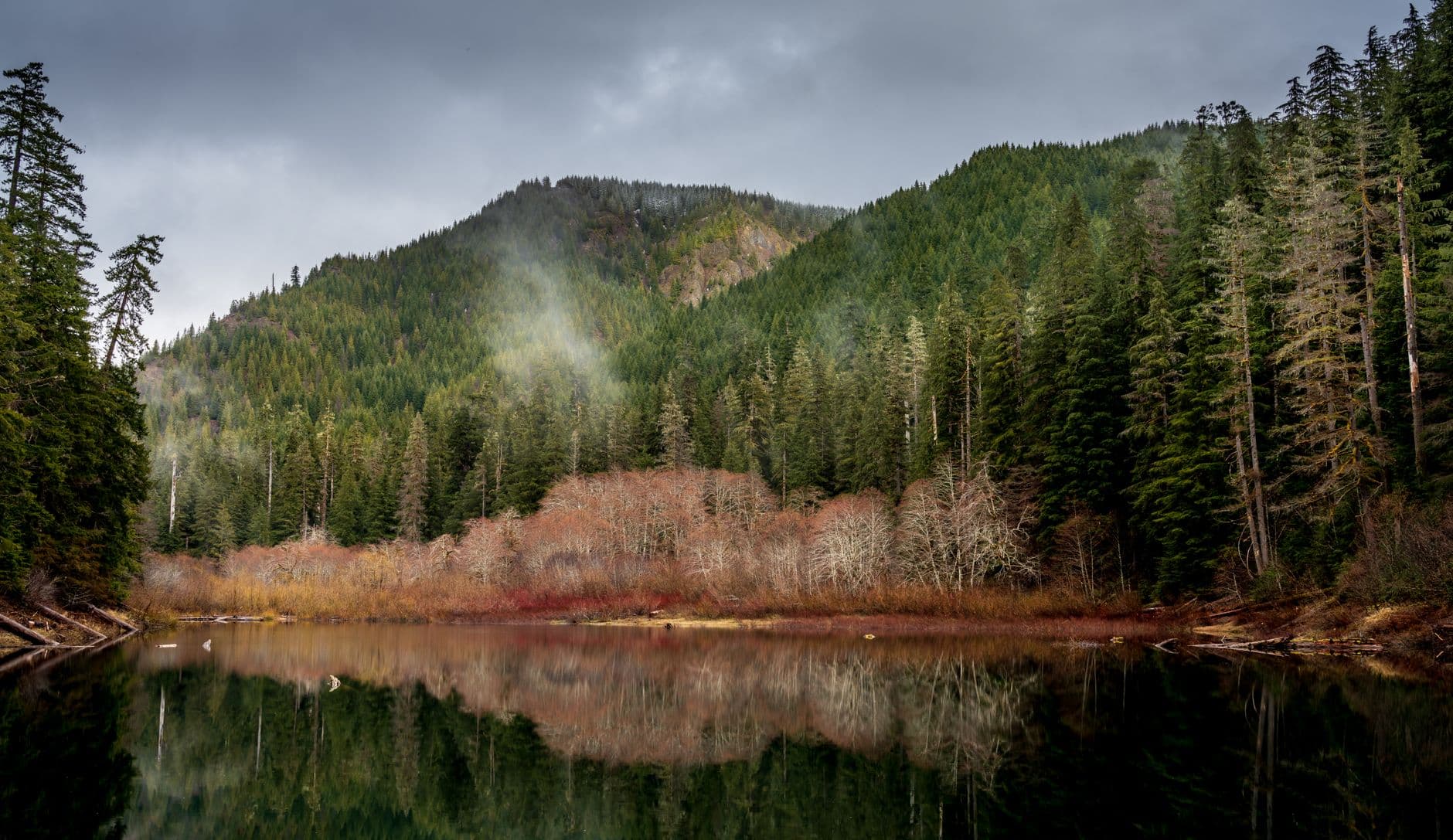
Rattlesnake Lake & Ledge Trail
Photo by JOHN CALLERY on Pexels
The rocky ledge overlook mid-morning gives clean light on the lake without harsh midday glare โ€” aim for before 11am.
Not wheelchair accessible; uneven terrain and moderate elevation gain.
Lunch
Salish Lodge & Spa $$$
Upscale Pacific Northwest ยท Near Snoqualmie Falls
Sit at the bar for a relaxed solo lunch with a falls-adjacent view โ€” worth the splurge for the setting alone.
Subway $
Sandwich ยท Near Snoqualmie Falls
A practical, quick option if you'd rather eat trailside before or after Rattlesnake Ledge.
Optional detour: Twin Falls Trail โ€” After Rattlesnake Ledge and before returning to Seattle
A gentler, shorter waterfall hike through old-growth forest if you want a second, calmer nature fix. Skip if: Skip if you're already at 3+ miles walked and want to conserve energy for tomorrow's Mount Si climb.
If it rains: Heavy rain actually intensifies Snoqualmie Falls' power โ€” the observation deck stays open and dramatic even in a downpour. If Rattlesnake Ledge feels too slick or exposed, retreat to the falls' gift shop and Salish Lodge grounds for a drier, moodier alternative.

Beat the crowds to Snoqualmie Falls while the observation deck is still quiet โ€” just you, the mist, and the thunder of 268 feet of falling water. It's a gentle, awe-filled way to shake off travel fatigue without demanding much of your legs yet.

After a relaxed lunch, shift into light hiking mode at Rattlesnake Lake, climbing gradually through fir forest to a ledge overlook that reveals a glassy alpine lake framed by jagged peaks โ€” rewarding without being punishing, a good gauge for how your legs feel ahead of Mount Si.

Head back toward Seattle as the valley light softens, giving your body an early rest โ€” tomorrow's Mount Si summit push demands a good night's sleep and an early alarm.

Alpine Challenge

Day 2: The Ridge and the Sky

The physically demanding centerpiece of the trip โ€” a 4-mile round-trip summit hike up Mount Si, roughly 4-5 miles walked total, high energy output.

Wear
Sturdy hiking boots, moisture-wicking layers, a warm insulating layer for the summit, gloves if it's cold, and plenty of water โ€” this is a serious climb.
Budget
$40โ€“55 (trail snacks, post-hike meal, parking)
10 min drive โ€” A quick backroad drive deeper into North Bend, morning light just breaking over the ridgeline ahead.
7:00 AM - 12:00 PM
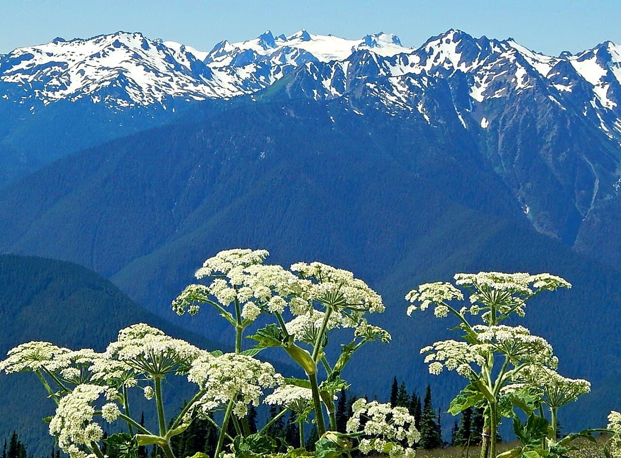
Mount Si ยท morning ยท 300 min ยท Snoqualmie Valley

Arrive by 7am and you'll have the lower switchbacks nearly to yourself โ€” by 9am the trailhead lot is full and the path shoulder-to-shoulder with weekend hikers. The climb through old-growth forest is steep and relentless, but the payoff at Haystack Ridge (1.5 miles in) and again at the summit meadow โ€” with Rainier looming on a clear day โ€” makes every burning step worth it. This is a proud, solo-friendly challenge; expect to trade encouraging nods with fellow hikers on the way up.

Mount Si
US Forest Service / wikimedia (Public domain)
Shoot the summit meadow with Rainier backdrop in late morning once cloud cover typically lifts โ€” bring a wide lens for scale.
Not wheelchair accessible; steep, uneven terrain unsuitable for those with mobility limitations.
Lunch
Domino's $
Pizza ยท Near Snoqualmie Falls / North Bend area
An unglamorous but satisfying post-summit refuel โ€” sometimes simple carbs are exactly right after 4 punishing miles.
Optional detour: Snoqualmie Falls โ€” After Mount Si and before heading back to Seattle
A low-effort victory lap โ€” sit near the falls and let your legs recover while soaking in the view a second time from a different angle. Skip if: Skip if your legs are done and you'd rather head straight back for rest โ€” you already saw it on Day 1.
If it rains: Mount Si has no real rain backup โ€” wet, slick rock on the switchbacks makes this hike genuinely hazardous, so if rain is forecast, swap this day with Day 1's easier itinerary and hike Mount Si on a clear-weather day instead.

This is the day you climb โ€” an early, quiet start up Mount Si's forested switchbacks, the trail steep enough to demand full attention, old-growth canopy filtering cool gray-green light until you break out above the treeline into wide alpine sky.

The summit meadow delivers the payoff: a 360-degree sweep from the Olympics to Mount Rainier, cool wind, and the quiet satisfaction of having earned every inch of it solo. The descent is easier on the lungs but harder on the knees โ€” take it slow on the loose rock.

Head back toward Seattle exhausted in the best way โ€” a simple, low-key dinner and an early night are exactly right after a five-hour mountain effort.

Coastal History & Solitude

Day 3: Salt Wind and Island Time

A full day on Whidbey Island blending historic fortifications, a walkable art village, and a windswept bluff trail โ€” roughly 3-4 miles walked, moderate energy.

Wear
Windproof layers, a warm hat for bluff winds, comfortable walking shoes, and a rain shell โ€” coastal weather shifts fast.
Budget
$55โ€“75 (ferry fare, lunch, coffee, gallery browsing, dinner)
30 min ferry โ€” The Mukilteo ferry crossing itself is part of the experience โ€” salt air, gulls trailing the wake, and your first glimpse of the island rising ahead.
9:00 AM - 12:00 PM
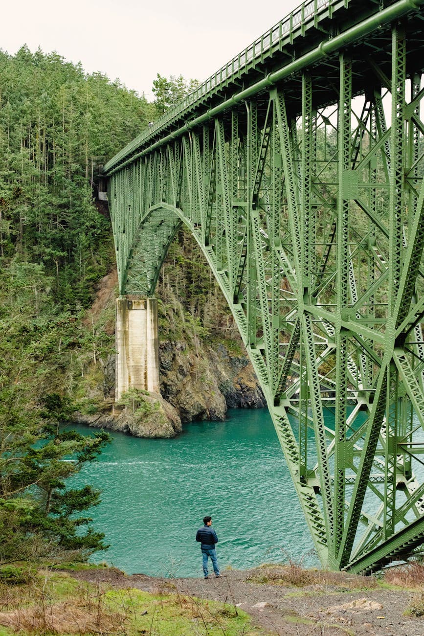
Whidbey Island (Deception Pass, Fort Casey) ยท morning ยท 180 min ยท Whidbey Island

Arrive by 9am to wander the parade grounds and gun batteries while the morning light is still soft and low, gilding the weathered brick and restored cannons. There's a quiet, contemplative energy here well-suited to solo exploring โ€” read the interpretive signs at your own pace, climb into the old bunkers, and take in sweeping views of Admiralty Inlet without competing for space.

Whidbey Island (Deception Pass, Fort Casey)
Makayla Asuncion / pexels (Pexels License)
The lighthouse gallery overlooking Admiralty Inlet is best in morning light, before haze builds over the water later in the day.
Wheelchair accessible with flat paths and frequent benches throughout the historic grounds.
25 min drive โ€” A quiet island road drive south, farmland and glimpses of Puget Sound sliding past the window.
12:30 PM - 2:30 PM
Langley Whidbey Island ยท midday ยท 120 min ยท Whidbey Island

Langley is the kind of small, walkable village built for solo wandering โ€” gallery-hopping, coffee in hand, weathered storefronts with hanging flower baskets leading down toward the waterfront. It's an easy place to strike up conversation with gallery owners or fellow travelers over coffee, and the pace here is unhurried by design.

Langley Whidbey Island
Photo by Ken1843 on Pixabay
First Street's gallery facades photograph beautifully in early afternoon light, flower boxes catching the sun.
Wheelchair accessible; walkable main street with variable waterfront access.
15 min drive โ€” A short drive north along the island's spine, farmland giving way to open bluff views as you approach.
3:00 PM - 5:00 PM
Ebey's Landing National Historical Reserve ยท afternoon ยท 120 min ยท Whidbey Island

The bluff trail here delivers exactly what the name of this trip promises โ€” windswept solitude, sweeping views across the Strait of Juan de Fuca to the Olympics, and the quiet company of native grasses bending in salt wind. Spring means the prairie meadows are just starting to green, and weekday afternoons keep the trail refreshingly uncrowded.

Ebey's Landing National Historical Reserve
Photo by Josh Hild on Pexels
Golden hour (roughly 5:30-6:30pm in spring) at the cliff-edge overlook gives dramatic side light across the water โ€” worth timing your visit to linger toward sunset if energy allows.
Not wheelchair accessible; uneven bluff-top terrain.
Lunch
Salty Sea Coffee $
Cafe/Coffee ยท Near Langley Whidbey Island
A relaxed counter-service spot good for a solo coffee-and-pastry break while people-watching Langley's main street.
Tonic Juice & Remedy $
Juice/Smoothies ยท Near Langley Whidbey Island
A light, healthy option if you want something quick between gallery stops.
Dinner
Double Bluff Brewing Company $$
Pub fare ยท Near Langley Whidbey Island
Bar seating and a communal, easygoing vibe make this an ideal solo dinner spot โ€” strike up conversation over a local pour before the ferry back.
Ultra House $$
Japanese/Ramen ยท Near Langley Whidbey Island
A cozy ramen counter perfect for solo diners craving something warm after a windy bluff walk.
If it rains: Langley's galleries and cafรฉs become the day's anchor if rain sets in โ€” Fort Casey's museum structures also offer shelter, and the outdoor batteries remain accessible with waterproof gear, while Ebey's Landing turns moody and atmospheric in mist if you don't mind getting damp.

The ferry crossing to Whidbey sets a slower, salt-scented tone for the day โ€” arrive at Fort Casey while the light is still soft, wandering old gun batteries and parade grounds with sweeping views of Admiralty Inlet largely to yourself.

Langley's walkable village offers an easy midday reset โ€” coffee, gallery browsing, and the kind of unhurried solo wandering that rewards curiosity, before heading north to Ebey's Landing for a windswept bluff walk overlooking the Strait.

Wind down with dinner at a brewery bar in Langley, where solo diners are welcome at the counter and conversation flows easily, before catching the ferry back under a sky fading from gold to dusk โ€” a fitting, unhurried close to three days of Pacific Northwest wildness.

Want to tweak this trip?

Our AI planner can customize this itinerary to your exact dates, interests, and travel style.

Customize This Itinerary
Good to Know

Restaurant details (hours, menus, availability) change frequently. Check current hours before visiting, especially in seasonal destinations.

Dietary compatibility tags are general guidance. If you have severe allergies, confirm directly with the restaurant.

Travel tips are general guidance, not professional safety advice. Check government advisories for latest information.

All prices are approximate and may vary seasonally.

We use cookies to improve your experience and analyze site usage. Essential cookies are always active. You can customize your preferences or accept all cookies. Cookie Policy