2 DaysTeen Families4 Stops

Bighorn Canyon NRA (WY side), Wyoming

2-Day Itinerary for Teen Families

โ€œDam Walls & Desert Bends: Two Days in Bighorn Canyonโ€

Dam Walls & Desert Bends: Two Days in Bighorn Canyon

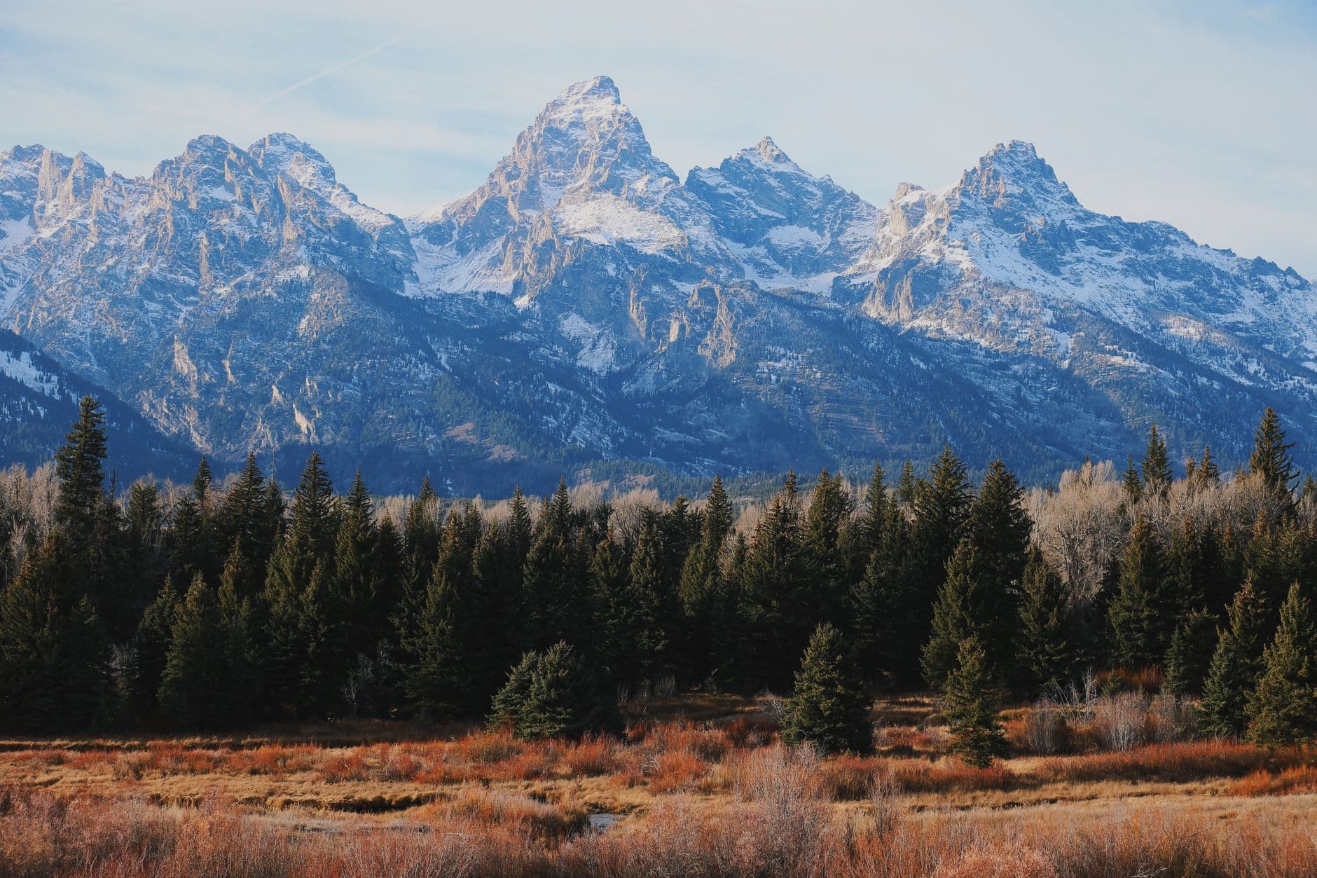
The canyon doesn't announce itself gradually here โ€” it opens all at once, a thousand feet of red and purple stone dropping to water so turquoise it looks lit from within. This is a trip built around beating the sun: early overlooks, midday shade, and evenings watching the rock walls go amber.

At a Glance

Climate & Weather
Summer days run warm to hot with intense sun and little shade at the overlooks; afternoons can bring sudden thunderstorms, so pack layers, a rain shell, sun hats, and reef-safe sunscreen. Mornings near the water are cool enough for a light jacket.
Getting Around
A personal vehicle is essential โ€” there's no public transit inside the park, and the two main clusters (Yellowtail Dam/Afterbay and Horseshoe Bend/Central Canyon) are connected by a scenic but winding road best driven in daylight.
Budget
Budget roughly $40โ€“$60 per person per day for a teen family, covering picnic groceries, a sit-down dinner in Lovell, fuel, and minor park fees โ€” most activities here (overlooks, hiking) are free once you're in.
Safety
Cell service is spotty to nonexistent once you're inside the recreation area, so download offline maps and tell someone your plan; watch footing near unguarded overlook edges, check boots for rattlesnakes on warm trails, and store all food securely against black bears.
Connectivity
Expect little to no cell signal inside the NRA; Lovell and Cody have normal coverage and WiFi, so sync maps and messages before heading in each morning.
Local Tips
Start both days before 8am to claim empty overlooks and avoid the worst heat; stock a cooler in Lovell the night before since there's no food service inside the park; and let teens lead a photo stop or two โ€” the overlooks are genuinely Instagram-worthy and a little autonomy goes a long way on a two-day trip.

Highlights

  • Standing above Yellowtail Dam as spillway roar fills the canyon
  • Scanning Bighorn Lake's 71-mile reservoir for golden eagles
  • The vertigo-inducing first look down at Horseshoe Bend's turquoise curve
  • Early-morning light turning canyon walls from gray to burnt orange
  • Teen-friendly photo ops at every major overlook
  • Picnic lunches with unobstructed canyon views instead of a crowded cafe
  • Quiet, uncrowded trails if you arrive before 8am

Day-by-Day Plan

Orientation, water, easy wonder

Day 1: Arrival & First Light on the Reservoir

A gentle first day covering about 2 miles of walking total, centered on the dam and reservoir views with plenty of rest breaks to adjust to the altitude and heat.

Wear
Lightweight layers, closed-toe walking shoes, sun hats, and swimsuits under clothes in case lake access invites a wade; bring a light rain shell for afternoon storm chances.
Budget
$45โ€“55 per person (picnic lunch groceries, gas, dinner in Lovell)
7:30 AM - 8:30 AM
Yellowtail Dam ยท morning ยท 60 min ยท Yellowtail Dam & Afterbay

Arrive while the parking lot is still half-empty and the air still carries the night's coolness โ€” by 9am this overlook fills with midday crowds. The roar of water through the spillways echoes off canyon walls striped in red and purple, and the warm stone underfoot makes a good spot for teens to lean over the rail (safely) and feel the scale of the thing. It's an easy, low-effort first stop that rewards early risers with near-solitude.
Yellowtail Dam
United States. Bureau of Reclamation United States. Bureau of Land management / wikimedia (Public domain)
Shoot the full dam face from the Afterbay overlook around 8am, when the light is soft and the water hasn't yet kicked up haze.
Uneven, unpaved sections near the overlook; sturdy shoes recommended, no wheelchair access.
10 min drive โ€” A short, winding drive along the canyon rim road โ€” windows down, first real glimpse of the full reservoir opening up around a bend.
9:00 AM - 10:30 AM
Bighorn Lake ยท midday ยท 90 min ยท Yellowtail Dam & Afterbay

The reservoir stretches out ahead like a ribbon of turquoise glass, framed by canyon walls that shift color as the sun climbs โ€” sage and juniper scent the breeze, and if you're lucky, a golden eagle will cut a slow circle overhead. This is the stop to let teens wander a bit on their own along the rim turnouts for their own photos while parents set up a shaded rest break; the scale of the 71-mile lake tends to quiet even the most device-distracted teenager.

Bighorn Lake
Photo by Deb Hayes on Pexels
The main overlook is best for wide-angle reservoir shots mid-morning before haze builds; the boat launch area is better at golden hour if you're staying nearby.
Unpaved, uneven ground with sparse benches; limited mobility visitors should plan for short stops near the elevated parking area.
Optional detour: Afterbay Dam overlook pulloff โ€” After Yellowtail Dam and before Bighorn Lake
A quick secondary vantage for a full-face dam photo without the crowd at the main overlook. Skip if: Skip if you're already running behind schedule or if teens are eager to get to the open water views at Bighorn Lake.
If it rains: If storms roll in, the overlooks near Yellowtail Dam's visitor contact area offer some shelter and the dam viewing remains dramatic (if slippery) in rain โ€” plan a shorter visit and keep to paved pullouts rather than trail edges.

The day starts cool and quiet, with the dam's spillway roar as the first big sensory hit of the trip โ€” a good low-stakes way to ease everyone into the canyon's scale before the sun gets serious. Arriving before 8am means the overlook is practically private, a rare treat in peak summer season.

After the dam, the pace shifts to something slower and more exploratory at Bighorn Lake, where the reservoir's size becomes the whole point โ€” less about moving through stops quickly and more about standing still and looking. Pack a picnic lunch to eat trailside with the canyon as the view since there's no dining data for this stretch; groceries from Lovell the night before make this painless.

Head back toward Lovell for dinner at one of its family-run diners (names vary seasonally, so check current listings locally), then let the evening wind down early โ€” an 8pm cutoff matters less today since tomorrow starts early again, but everyone will be glad for the rest after a day of sun and canyon air.

Drama, heat, golden light

Day 2: Red Rock and the Horseshoe's Curve

A slightly more adventurous day with roughly 2.5 miles of walking, focused on the dramatic red-rock Horseshoe Bend viewpoint and central canyon trails before the afternoon heat peaks.

Wear
Breathable hiking clothes, sturdy trail shoes, wide-brim hats, sunglasses, and plenty of sunscreen โ€” little shade exists at this cluster's overlooks.
Budget
$50โ€“60 per person (picnic supplies, gas, dinner in Lovell or Cody depending on route out)
45 min drive โ€” The drive south from the Afterbay area winds through high desert scrubland โ€” watch for mule deer crossing at dawn, and keep an eye on the fuel gauge since services thin out fast.
7:00 AM - 7:45 AM
Horseshoe Bend ยท morning ยท 45 min ยท Horseshoe Bend & Central Canyon

Get here by 7am and the overlook belongs to you โ€” just vast silence, the faint rush of the Bighorn River far below, and canyon walls glowing burnt orange in the early light. The drop is real and the vertigo is part of the thrill, which tends to land well with teens looking for a little adrenaline before breakfast. By mid-morning this spot gets busy with photographers and families, so the early arrival is non-negotiable for the best experience.

Horseshoe Bend
Oren F. Morton / wikimedia (Public domain)
The main overlook platform gives the classic horseshoe composition; shoot it just after sunrise when the canyon walls are at their most saturated red.
Unpaved, uneven terrain with sheer unguarded drops in places โ€” supervise teens closely near the edge, not suitable for wheelchairs.
10 min walk โ€” A short walk along the rim path to the northern ledge โ€” the kind of quiet shuffle that lets conversation pick up again after the early rise.
10:00 AM - 11:30 AM
Horseshoe Bend ยท midday ยท 90 min ยท Horseshoe Bend & Central Canyon

Rather than rushing off, linger through the ledge viewpoint to the north for a different angle on the canyon walls โ€” the midday sun brings out texture and layering in the rock that the early light misses. This is a good stretch for teens to take the lead on composing their own shots or just sitting quietly with a water bottle, since the heat by now demands a slower pace and shade breaks.

Horseshoe Bend
Oren F. Morton / wikimedia (Public domain)
Midday light flattens color somewhat, so focus shots on canyon-wall texture and depth rather than the classic wide shot best saved for sunrise.
Same uneven, unguarded terrain as the main overlook; benches are sparse, so bring a portable seat or blanket if extended rest stops are needed.
Optional detour: Scenic pullover along the connector road โ€” Between Bighorn Lake (Day 1) and Horseshoe Bend (Day 2) if driving the full route same-day
Breaks up the 45-minute drive between clusters with a quick stretch and a fresh high-desert vista โ€” useful since the drive exceeds the usual comfort window. Skip if: Skip if you're already running early and want to maximize uncrowded time at Horseshoe Bend before 8am.
If it rains: The Horseshoe Bend overlook is partially sheltered by canyon walls, so light rain is manageable, but heavy rain can make the final approach road muddy โ€” check conditions before driving in, and if storms are heavy, delay this cluster for later in the day or the following morning.

The day opens with the most dramatic stop of the trip โ€” that first look over the edge at Horseshoe Bend, where the river curls impossibly far below and the canyon walls catch fire in the sunrise light. Getting there by 7am isn't just a nice-to-have; it's the difference between silence and a crowded platform.

Rather than piling on a second major hike, the day stays within the same cluster for a slower second look at the bend from a different vantage โ€” a deliberate pace shift that respects both the heat and the need to avoid back-to-back strenuous activities. Pack a picnic from supplies gathered in Lovell beforehand, since there's no on-site dining data for this remote stretch.

As the heat breaks and the light turns gold again, start the drive back toward Lovell (or Cody, if that's the lodging base) for a relaxed dinner at a local diner โ€” check current hours and menus, since options are sparse and change seasonally. Wind down well before 8pm, giving everyone a last look back at the canyon glowing amber in the rearview mirror.

Want to tweak this trip?

Our AI planner can customize this itinerary to your exact dates, interests, and travel style.

Customize This Itinerary
Good to Know

Restaurant details (hours, menus, availability) change frequently, and dining options directly inside Bighorn Canyon NRA are extremely limited โ€” plan around nearby towns like Lovell and check current hours before visiting.

Dietary compatibility tags are general guidance. If you have severe allergies, confirm directly with the restaurant.

Travel tips are general guidance, not professional safety advice. Check government advisories and current park conditions for the latest information on trail closures, weather, and wildlife activity.

All prices are approximate and may vary seasonally.
We use cookies to improve your experience and analyze site usage. Essential cookies are always active. You can customize your preferences or accept all cookies. Cookie Policy