3 DaysTeen Families7 Stops

Devils Tower NM (non-climbing), Wyoming

3-Day Itinerary for Teen Families

โ€œStone Sentinel: 3 Days Around Devils Tower with Teensโ€

Stone Sentinel: 3 Days Around Devils Tower with Teens

The Tower announces itself from miles off, a gray column rising out of ponderosa and prairie like the land cracked open and forgot to close. Spring here means wildflowers threading through red dirt, sudden squalls that clear to gold light within the hour, and trails quiet enough that your teens might actually put the phones down to stare.

At a Glance

Climate & Weather
Spring brings mild days (50sโ€“60sยฐF) but weather flips fast โ€” a sunny morning can turn to a cold drizzle by lunch. Pack layers: a base layer, a fleece or light sweater, and a packable rain jacket. Mornings and evenings can dip near freezing, so bring a hat and gloves for early starts.
Getting Around
A car is essential โ€” there's no public transit, and distances between Devils Tower, Hulett, and Sundance run 10 to 35 miles on open two-lane highways. Roads are well-maintained but can be gravel or slick after rain; drive cautiously at dawn and dusk when wildlife crosses.
Budget
Budget roughly $60โ€“90 per day per person for food and activities โ€” entrance fees are modest, dining is diner-casual, and the biggest spend tends to be gas and the occasional gift shop stop.
Safety
This is low-risk terrain for teens and parents alike โ€” trails are well-marked and short. The real hazards are weather-related (sudden thunderstorms, muddy trail sections) and wildlife-related (give any bison, elk, or deer wide berth, especially near the Tower base). Cell service is spotty, so download offline maps before setting out.
Connectivity
Expect weak to nonexistent cell signal inside the monument and patchy coverage in Hulett and Sundance. Most lodging offers WiFi, but treat this as a low-connectivity trip โ€” a good excuse to have teens unplug.
Local Tips
Arrive at trailheads before 9am to beat tour bus crowds and catch soft morning light on the Tower. Pack a thermos and snacks, since dining options thin out fast once you leave Hulett or Sundance. Respect posted signs near the Tower base โ€” many Native tribes consider this ground sacred, and prayer cloths tied to trees should be left undisturbed.

Highlights

  • Sunrise loop beneath 867 meters of columnar rock
  • Red dirt and pine on the Red Beds Trail at golden hour
  • Standing at the rim of a 40-foot buffalo jump sinkhole
  • 32 miles of empty-horizon byway with the Tower as compass point
  • Frontier and indigenous artifacts in a one-room Hulett museum
  • Wildflower-flecked grassland and wide Wyoming sky

Day-by-Day Plan

Orientation and easy awe

Day 1: Arrival and First Sight of the Tower

A gentle arrival day centered on the flat, iconic Tower Trail loop โ€” about 1.3 miles of walking at an easy pace with time to settle in.

Wear
Layered clothing, a light rain jacket, sturdy sneakers or light hikers โ€” the Tower Trail is flat and well-packed but exposed to wind.
Budget
$50โ€“70 per person (park entrance fee, casual lunch and dinner, snacks)
9:00 AM - 10:30 AM
Tower Trail ยท morning ยท 90 min ยท Devils Tower Monument

After hours in the car, this is the easiest possible introduction to the monument: a flat, well-packed loop that circles the base of the Tower through a forest of ponderosa pine. Arrive by 9am and the trail still holds morning cool and quiet โ€” by midday, tour groups fill the parking lot. Teens tend to perk up fast here; the columns overhead look almost architectural, like something built rather than grown, and there's a built-in scavenger-hunt energy to spotting climbers on the rock face.

Tower Trail
Photo by Alex Moliski on Pexels
The north face viewpoint near the 0.3-mile marker catches sharp shadow detail on the columns in mid-morning light.
Flat packed-dirt path, suitable for most mobility levels, though benches are sparse โ€” pack a seat cushion if needed.
5 min walk โ€” A short stroll back toward the visitor center plaza, the Tower looming larger with every step.
10:45 AM - 12:15 PM
Devils Tower (Red Beds Trail, Tower Trail) ยท midday ยท 90 min ยท Devils Tower Monument

Rather than a new hike, this block is built for lingering โ€” picnic at one of the viewpoints, let teens wander slightly ahead for their own photos, and circle back toward the visitor center to read interpretive signage on the Tower's geology and cultural significance. The Belle Fourche River murmurs somewhere below, barely visible through the trees, and the whole scene has a hush to it that even restless teenagers notice.

Devils Tower (Red Beds Trail, Tower Trail)
United States. Forest Service. Pacific Northwest Region / wikimedia (Public domain)
The Tower Trail overlook near the visitor center frames the monolith classically โ€” best light is late morning before the sun moves directly overhead.
Visitor center and main overlook area are paved and accessible; Red Beds sections are not recommended for mobility-limited visitors.
Optional detour: Red Beds Trail โ€” After Devils Tower (Tower Trail) and before evening rest
For families with energy to spare, the rust-red rock bands and river views add a quieter, more dramatic perspective of the Tower than the main loop. Skip if: The uneven, rooted terrain makes it a poor fit on arrival day when everyone's tired from travel โ€” save the fuller hike for Day 2 or 3 if legs allow.
If it rains: If rain moves in, shorten the Tower Trail loop to its first half-mile for photos, then retreat to the visitor center for interpretive exhibits, which are fully indoors.

The drive in delivers the Tower in slow reveal โ€” a gray thumb on the horizon that grows absurdly large as the highway bends closer. Settle into the Tower Trail by mid-morning, an easy flat loop beneath columns that look stacked by some careful giant. Arrive before 9am if the overnight drive allows; the light is softer and the parking lot still has space.

Keep the pace unhurried โ€” this is a day for loosening travel-stiff legs, not pushing mileage. Picnic within sight of the Tower, let teens claim a rock to sit on and watch for climbers, and drift slowly back toward the visitor center to read the geological story of how this igneous rock came to stand alone on the plains.

As the light goes gold, the Tower's columns throw long shadows across the grass โ€” a good final look before heading to lodging in Hulett or the campground. Dinner options are limited this close to the monument, so plan to eat in town or rely on packed provisions for a quiet first night.

Trail and plains history

Day 2: Red Dirt and Deep History

A fuller hiking day on the Red Beds Trail followed by an afternoon exploring the Vore Buffalo Jump, covering roughly 2.5โ€“3 miles total at a moderate pace.

Wear
Hiking shoes with grip (Red Beds has uneven, sometimes muddy terrain), a rain shell, sun hat, and layers for temperature swings between shaded trail and open plains.
Budget
$55โ€“80 per person (Vore Buffalo Jump admission, lunch, snacks, gas for the drive)
5 min drive โ€” A short hop from lodging to the trailhead parking area, dew still on the grass.
8:00 AM - 9:30 AM
Red Beds Trail ยท morning ยท 90 min ยท Devils Tower Monument

Start early โ€” by 8am the trail is nearly empty, the rust-colored rock bands glowing under low sun, and the air still holds that cold, clean bite of a spring morning. This loop trades the Tower Trail's architecture for raw geology: streaked red rock, ponderosa shade, and periodic breaks in the trees where the Tower reappears suddenly, framed differently each time. It's a good test of teen patience and stamina without being genuinely difficult.

Red Beds Trail
Photo by Sam McCool on Pexels
The red outcrop overlook near mile 1.2 is best photographed in early morning light, when the rock color saturates deepest.
Not recommended for wheelchair users or those with significant mobility limitations โ€” uneven, sometimes muddy surface.
45 min drive โ€” A straight run east on I-90, radio low, grassland rolling by in every direction โ€” worth a quick stretch stop at any pullout if legs stiffen.
12:30 PM - 1:30 PM
Vore Buffalo Jump ยท afternoon ยท 60 min ยท High Plains Historic Sites

The drive out here feels like leaving the monument behind entirely โ€” just grassland, wind, and sky until a modest sign marks the sinkhole. Teens who shrug off typical museum stops tend to lean into this one: standing at the rim of a 40-foot pit where Plains tribes drove buffalo for centuries hits differently than reading about it in a textbook. The silence out here is almost physical, broken only by wind moving through grass.

Vore Buffalo Jump
R. M. Ballantyne / wikimedia (Public domain)
Shoot the pit rim from the north side looking south for the best sense of depth and scale.
Uneven rim terrain is not recommended for those with mobility challenges; sturdy shoes advised.
Optional detour: Hulett Pioneer Museum โ€” After Vore Buffalo Jump and before evening return
A compact, indoor complement to the Buffalo Jump โ€” frontier and indigenous artifacts that round out the day's history theme, with frequent benches for anyone ready to sit. Skip if: If the group is museum-fatigued or the weather's clear and inviting, skip it in favor of extra time on the Belle Fourche Scenic Byway for golden hour.
If it rains: If rain sets in, shift the morning to a shorter Red Beds segment (first half-mile only) and move the Hulett Pioneer Museum earlier in the day โ€” it's fully indoors and unaffected by weather.

Lace up for a proper trail morning: Red Beds delivers red rock, pine shade, and recurring glimpses of the Tower that reward patience. Early arrival matters here โ€” before 9am the trail holds a stillness that disappears once tour groups arrive later in the day.

The drive out to Vore Buffalo Jump trades forest for open plains, and the mood shifts from scenic to contemplative. Standing at the rim of the sinkhole, with wind constant and horizon endless, tends to land harder with teens than any brochure could โ€” it's tangible history, not abstract.

Head back toward Hulett or Sundance as the light softens, considering a slow pass along the Belle Fourche Scenic Byway if energy allows. Dinner options are limited this far out, so plan around whichever town you're based in, and expect an early close to the evening โ€” most local spots wind down by 8 or 9pm.

Scenic byway and farewell views

Day 3: Open Road and Golden Light

A lighter final day combining a scenic drive along the Belle Fourche Scenic Byway with a final Tower viewpoint stop, roughly 1โ€“2 miles of walking total.

Wear
Comfortable layers for in-and-out-of-car stops, sunglasses, a light jacket for breezy overlooks.
Budget
$40โ€“60 per person (fuel, lunch, snacks, any last souvenirs)
9:00 AM - 10:30 AM
Belle Fourche Scenic Byway ยท morning ยท 90 min ยท High Plains Historic Sites

This is a drive built for pullouts, not endurance โ€” 32 miles of grassland and horizon with the Tower appearing and vanishing depending on the curve of the road. Let teens pick which overlooks to stop at; the sense of choice tends to keep spirits higher than a fixed itinerary. Morning light is soft and uncluttered by haze, ideal for the kind of wide, dramatic shots that actually look good on a phone screen.

Belle Fourche Scenic Byway
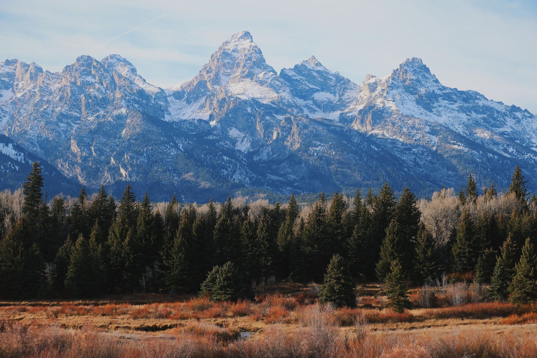
Photo by Mike Lensing on Pexels
The north pullout near mile marker 10 has the lowest crowds and the most dramatic angle on the Tower โ€” best before 10am.
Some pullouts are accessible directly from the car; others require a short walk over uneven ground.
25 min drive โ€” Back toward the monument on quiet highway, the Tower growing steadily larger through the windshield.
11:00 AM - 12:30 PM
Devils Tower (Red Beds Trail, Tower Trail) ยท midday ยท 90 min ยท Devils Tower Monument

One last pass by the Tower feels right as a send-off โ€” not a full hike, just time to sit, snack, and take in the scale of the thing before the drive home. By late morning crowds build, so treat this less as a repeat hike and more as a slow, appreciative goodbye, with time for teens to wander a short distance on their own within sight of the group.

Devils Tower (Red Beds Trail, Tower Trail)
United States. Forest Service. Pacific Northwest Region / wikimedia (Public domain)
The Joyner Ridge viewpoint captures the Tower's full profile against open sky โ€” worth the short detour if time allows.
Paved areas near the visitor center are accessible; trail sections beyond are not.
Optional detour: Hulett Pioneer Museum โ€” After Belle Fourche Scenic Byway and before the final Tower visit
A quick, indoor stop if the byway drive runs short or weather turns, rounding out the trip's cultural thread. Skip if: Skip it if the group would rather maximize outdoor time on this final day โ€” the Tower itself is the stronger closing memory.
If it rains: If weather turns wet, prioritize the Hulett Pioneer Museum as an indoor stop and treat the byway as a drive-through rather than a stop-and-walk experience โ€” the landscape still reads as moody and dramatic through the windshield in rain.

Ease into the final day with the long, unhurried drive of the Belle Fourche Scenic Byway, stopping wherever the Tower catches the light just right. This is the day to hand teens a bit of the decision-making โ€” which pullout, which angle, how long to linger.

Circle back to the Tower one last time, not for another full hike but for a quiet, appreciative close โ€” snacks, a last look at the columns, maybe a short wander along the paved section near the visitor center. It's a good moment for photos that actually capture the trip's feeling rather than just checking a box.

With the drive home or onward ahead, keep the evening simple โ€” grab food in Sundance or Hulett before hitting the highway, and let the Tower fade in the rearview the way it arrived: slowly, then all at once.

Want to tweak this trip?

Our AI planner can customize this itinerary to your exact dates, interests, and travel style.

Customize This Itinerary
Good to Know

Restaurant details (hours, menus, availability) change frequently, especially in small gateway towns. Check current hours before visiting.

Dietary compatibility information was not available for this region's dining options. Confirm directly with any restaurant regarding allergies or specific needs.

Travel tips are general guidance, not professional safety advice. Check current National Park Service alerts and weather conditions before your trip.

All prices are approximate estimates and may vary seasonally or with fuel costs.
We use cookies to improve your experience and analyze site usage. Essential cookies are always active. You can customize your preferences or accept all cookies. Cookie Policy