2 DaysActive Retirees5 Stops

Grand Teton NP (east side), Wyoming

2-Day Itinerary for Active Retirees

“Mirror Lakes & Mountain Light: Two Gentle Days on Grand Teton's East Side”
Mirror Lakes & Mountain Light: Two Gentle Days on Grand Teton's East Side

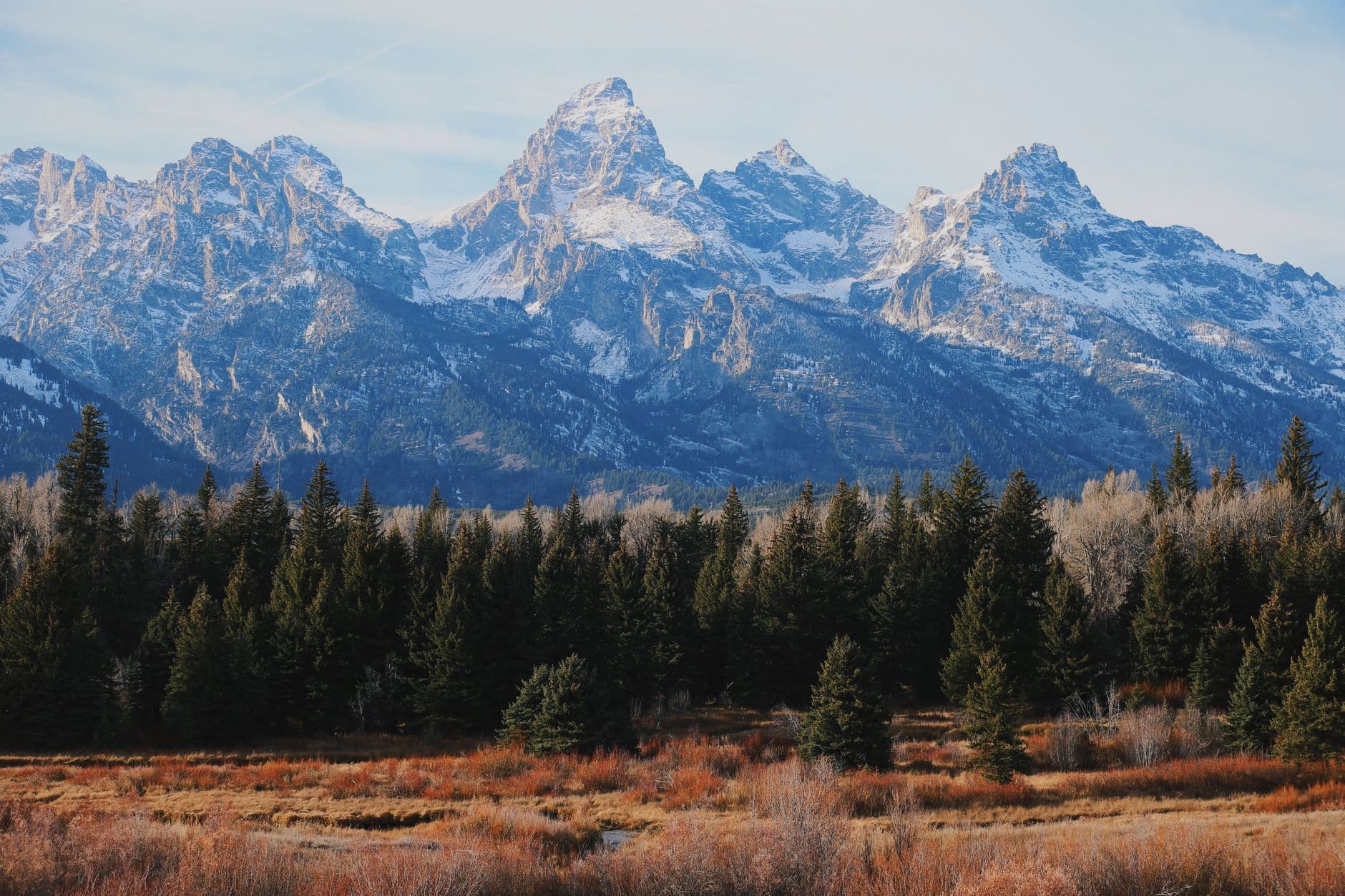
Spring arrives on the Teton Range in layers—mist lifting off glassy lakes, wildflowers nosing through thawing meadows, snow still clinging to granite summits overhead. This two-day arc moves at the pace of a mountain morning: unhurried lake walks, wide river bends thick with wildlife, and a summit view that asks nothing of your knees but rewards you with the whole valley.

At a Glance

Climate & Weather
Spring in Grand Teton is gorgeous but moody—expect daytime highs in the 50s°F, nights near freezing, and sudden rain or even snow showers. Pack waterproof layers, a warm fleece, sturdy waterproof shoes, and a brimmed hat for sun breaks between storms.
Getting Around
A personal vehicle is essential on the east side—distances between clusters range from 15 to 40 minutes, and some unpaved roads (like the approach to Schwabacher Landing) can be soft after rain. Drive slowly at dawn and dusk for wildlife on the roadway.
Budget
Budget roughly $90–140/day per person for meals and modest park activities (boat shuttle, parking, incidentals); dining leans toward hearty lodge fare rather than fine dining within the park itself.
Safety
This is bear country—carry bear spray on any trail walk and make noise in brush or near water. Mountain weather shifts fast in spring; bring layers even on a sunny morning. Trails can be muddy or snow-patched at higher elevations, so favor established, flatter paths early in the season.
Connectivity
Cell service is sparse to nonexistent throughout the park interior; download offline maps before you go. Jenny Lake Visitor Center and lodges in Jackson offer reliable WiFi.
Local Tips
Arrive at any marquee viewpoint before 8am—by mid-morning, parking lots at Jenny Lake and Oxbow Bend fill quickly even in shoulder season. Check the visitor center or park app each morning for the Schwabacher Landing road conditions and Signal Mountain Road opening status, as spring plowing schedules vary year to year.

Highlights

  • Sunrise stillness on Jenny Lake before the boat shuttle crowds arrive
  • A flat, wildflower-fringed loop at String Lake with Teton peaks doubled in the water
  • Moose-spotting at golden hour along the Snake River's oxbow bends
  • Panoramic summit views from Signal Mountain without a strenuous climb
  • Accessible, bench-lined trails at the Laurance S. Rockefeller Preserve
  • Spring's shoulder-season quiet—fewer crowds, cooler air, dramatic cloud-wrapped peaks

Day-by-Day Plan

Arrival & Lake Stillness

Day 1: Settling In at the Water's Edge

A gentle orientation day covering roughly 2 miles of flat-to-moderate walking around Jenny Lake and String Lake, with ample rest stops and unhurried pacing.

Wear
Waterproof layered jacket, warm fleece underneath, sturdy waterproof walking shoes, gloves and a hat for the cool morning air, sunglasses for midday glare off the water.
Budget
$70–100 per person (boat shuttle optional, picnic lunch, casual dinner in Jackson)
8:00 AM - 9:30 AM
Jenny Lake · morning · 90 min · Moose & Jenny Lake Area

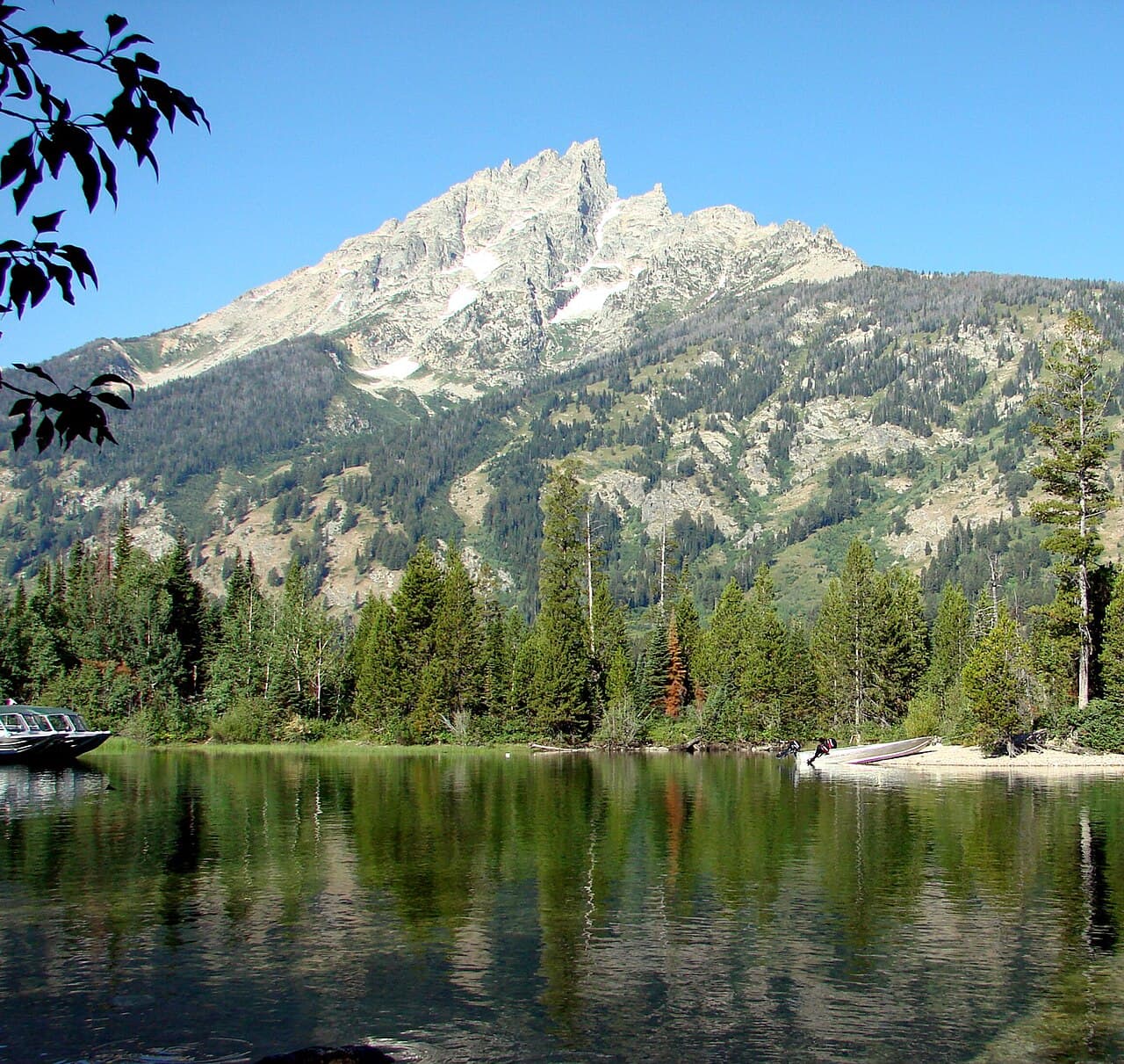
Arrive by 8am and the lake is nearly silent—just the soft lap of turquoise water against gravel and the occasional echo of rockfall off the Cathedral Group above. Take the short boardwalk to the boat dock for an unobstructed view of the peaks doubled in the water, then settle onto one of the shoreline benches rather than attempting the longer canyon trails. By 9:30am, the first tour buses begin arriving, so this window is yours.

Jenny Lake
inkknife_2000 (7.5 million views +) / wikimedia (CC BY-SA 2.0)
The north shore near the boat dock captures the full Cathedral Group reflection—best in the flat morning light before 9am, when wind hasn't yet rippled the surface.
Paths near the dock are packed gravel, not fully flat; benches are sparse, so plan rest stops and consider the boat shuttle to minimize walking if mobility is a concern.
10 min drive — A short hop along Teton Park Road, pines thickening as the road narrows toward the trailhead lot.
10:00 AM - 11:30 AM
String Lake Trail · midday · 90 min · Moose & Jenny Lake Area

A short, scenic drive brings you to String Lake, where the trail hugs a flat, obsidian-dark shoreline and the Teton peaks rise in near-perfect symmetry overhead. This is the gentlest walking of the trip—soft trail underfoot, frequent spots to pause, and good odds of spotting waterfowl or distant elk near the inlet. Spring wildflowers are just beginning to dot the forest edge, adding color to the otherwise stark granite backdrop.

String Lake Trail
Photo by Alex Moliski on Pexels
The north end of the lake offers the clearest mirror symmetry of peaks and water—visit before 10:30am for stillest conditions.
The trail is flat and well-packed but not paved; benches are sparse, so this suits moderate walkers rather than those requiring frequent seating.
Optional detour: Laurance S. Rockefeller Preserve — After String Lake Trail and before returning to lodging
Fully accessible, flat paths and frequent benches make this preserve the most comfortable stop of the day, with a visitor center offering indoor respite and rich natural history exhibits. Skip if: If energy is already spent after two lake stops, this can easily be saved for a future visit—it adds another 60–90 minutes of walking.
If it rains: If rain moves in, head to the Laurance S. Rockefeller Preserve visitor center for its comprehensive indoor exhibits on Teton geology and ecology, then wait out the worst of the weather before a short, sheltered walk on the preserve's accessible overlooks.

The day begins softly, with Jenny Lake wrapped in cool, pine-scented air and almost no one else on the shoreline. Mist often lingers over the water at this hour, slowly burning off to reveal the full scale of the peaks above—an easy, contemplative start that asks nothing more than a short walk and a willingness to sit still and look.

By midday, the pace shifts only slightly—String Lake's flat trail offers a continuation of the morning's calm, with wildflowers beginning to appear underfoot and the peaks now mirrored in even stiller water. This is unhurried walking, with plenty of excuses to pause, breathe, and simply take in the valley's scale.

With no in-park dining data to rely on for this remote cluster, plan to head toward Jackson for the evening meal—the 30–40 minute drive back into town offers a chance to unwind, and Jackson's restaurant scene (covered more fully on Day 2) provides the comfortable, excellent dining this trip calls for. Settle in early; tomorrow's river and summit views reward an unhurried start.

Wildlife & Panorama

Day 2: River Bends and Mountain Air

A relaxed day combining low-energy river viewpoints with a high-elevation summit overlook, totaling under 2 miles of walking across the Snake River Corridor and Signal Mountain.

Wear
Layered clothing with a waterproof outer shell, warm hat and gloves for the summit (temperatures drop noticeably at elevation), comfortable walking shoes with good grip for gravel overlooks.
Budget
$80–110 per person (picnic supplies, fuel, casual dinner in Jackson)
7:30 AM - 8:15 AM
Schwabacher Landing · morning · 45 min · Snake River Corridor

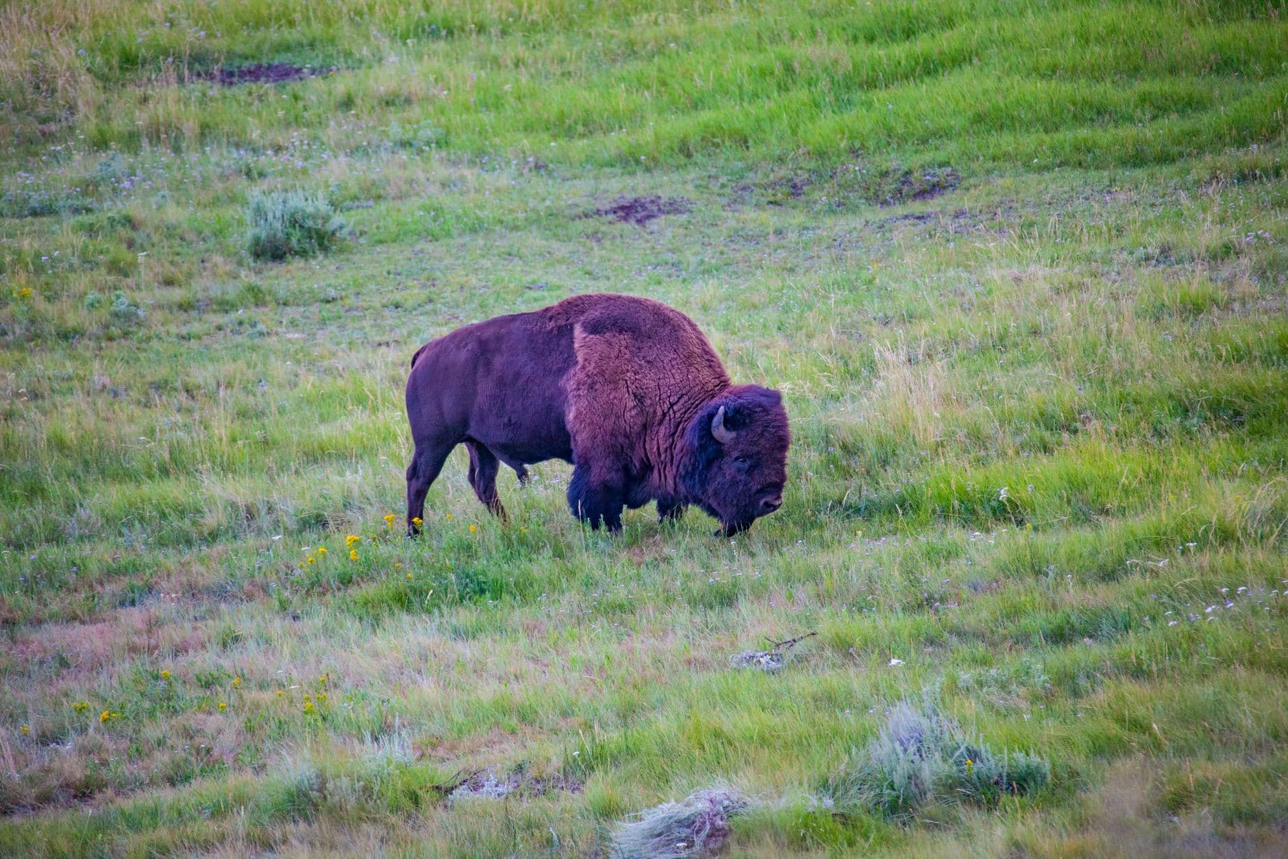
Arrive at first light, when the Snake River lies glassy and still and moose often wade quietly among the reeds. The short boardwalk requires minimal walking, making this an easy, high-reward stop—cool sagebrush-scented air, the soft burble of water, and the Tetons mirrored perfectly in the calm current. By mid-morning the light flattens and the crowds thicken, so this early window is the best version of the experience.

Schwabacher Landing
Alaska-Yukon-Pacific exposition, 1909. [from old catalog] / wikimedia (Public domain)
Shoot from the boardwalk at dawn light for the clearest peak reflections in the river's calm side-channel.
The access road is unpaved and can be rutted or soft after rain; the landing itself has uneven, natural terrain with no formal accessible path—best suited to those comfortable with gravel and dirt underfoot.
20 min drive — A quiet stretch of road along the river valley, with occasional glimpses of the water through the trees.
9:00 AM - 9:30 AM
Oxbow Bend · midday · 30 min · Snake River Corridor

A short drive brings you to this famous river bend, where Mount Moran rises sharply over the Snake's slow curve. The paved, flat pullout makes this one of the easiest stops of the trip—just a few steps from the car to a wide, uninterrupted view. Watch for moose along the eastern edge of the bend and listen for the occasional splash as wildlife moves through the shallows.

Oxbow Bend
Oregon. Fish Commission / wikimedia (Public domain)
The main pullout offers the widest reflection of the peaks in the river—visit mid-morning for balanced light, or return at golden hour for warmer tones.
Fully wheelchair accessible with a flat, paved viewpoint and minimal walking required from the parking area.
35 min drive — A winding ascent with pullouts along the way—worth a pause partway up if clouds are rolling dramatically over the peaks.
1:00 PM - 2:30 PM
Signal Mountain · afternoon · 90 min · Signal Mountain & Eastern Gateway

After a relaxed midday break, the scenic drive up Signal Mountain delivers one of the trip's biggest payoffs for the least physical effort—360-degree views over Jackson Lake and the full Teton Range from a gravel summit platform, with ravens calling overhead and only a short walk required from the parking area. This is a favorite for active retirees precisely because the reward is disproportionate to the exertion.

Signal Mountain
Eissacmedic / wikimedia (CC BY-SA 3.0)
The summit viewing platform facing west captures the full Teton Range—early afternoon light works well, but come before 5pm if clouds are building, as spring storms often roll in by late day.
The summit platform is reached via a short, somewhat uneven gravel path; not fully wheelchair accessible, but manageable for those comfortable with brief, moderate inclines and sturdy footwear.
Optional detour: Laurance S. Rockefeller Preserve — Before Schwabacher Landing or as an alternative to Signal Mountain if weather turns
Its fully accessible trails and indoor visitor center make it a reliable fallback with frequent benches and gentle pacing. Skip if: If Day 1's itinerary already included it, repeating the stop adds little new scenery for this trip's second day.
If it rains: If the weather closes in, skip the Signal Mountain summit (visibility and wet pavement make the drive less rewarding) and instead spend the afternoon at the Jackson Lake Dam visitor center or extend time at Oxbow Bend, where misty, moody conditions often produce the most dramatic photography of the trip.

The day opens quietly at Schwabacher Landing, where dawn light turns the river to glass and moose sometimes drift through the reeds unbothered by the handful of early visitors. A short drive later, Oxbow Bend offers an equally easy, paved viewpoint—no real walking required, just the slow unfolding of Mount Moran over still water.

After a relaxed midday pause, the energy shifts upward—literally—as the drive up Signal Mountain climbs through forest to a summit platform with sweeping, uninterrupted views in every direction. The walking here is brief and the reward outsized, making it an ideal afternoon anchor for a day built around comfort and scenery over exertion.

With the day's main sights behind you, the descent back toward Jackson offers one last chance to watch the light change on the peaks in the rearview mirror. Plan an unhurried dinner in town to close out the trip—arriving before 6:30pm typically means quieter seating and a more relaxed pace, a fitting end to two days spent moving gently through some of the park's most iconic, accessible corners.

Want to tweak this trip?

Our AI planner can customize this itinerary to your exact dates, interests, and travel style.

Customize This Itinerary
Good to Know

Restaurant details (hours, menus, availability) change frequently, especially in shoulder season. Check current hours before visiting.

Dietary compatibility tags are general guidance. If you have severe allergies, confirm directly with the restaurant.

Travel tips are general guidance, not professional safety advice. Check current park and government advisories, including road and bear activity updates, before your trip.

All prices are approximate and may vary seasonally.
We use cookies to improve your experience and analyze site usage. Essential cookies are always active. You can customize your preferences or accept all cookies. Cookie Policy