3 DaysSolo Traveler6 Stops

Mueller SP (near Canon City), Colorado

3-Day Itinerary for Solo Traveler

โ€œRed Rock Solitude: Three Days Alone with Mueller's High Countryโ€

Red Rock Solitude: Three Days Alone with Mueller's High Country

The air up here is thin enough to hear your own footsteps, and in spring the meadows below Mueller's ridgelines flush green while snow still clings to shaded pockets of pine. This is a trip built for solitude โ€” long red-dirt trails with nobody on them at 7am, canyon overlooks that make strangers strike up conversation, and evenings that end early because the mountain quiet asks you to.

At a Glance

Climate & Weather
Spring at elevation means mild midday sun but real cold at dawn and dusk, plus the chance of sudden rain or even snow squalls. Pack a rain shell, a warm base layer, gloves for early starts, and broken-in hiking boots โ€” red clay trails turn slick fast when wet.
Getting Around
A car is essential โ€” distances between clusters run 20-45 minutes and there's no public transit. Roads into Mueller SP and Phantom Canyon are steep, winding, and occasionally gravel, so allow extra time and drive cautiously, especially at dawn when wildlife crosses roads.
Budget
Budget roughly $60-90/day for a solo traveler โ€” trailhead parking/entrance fees, a Royal Gorge Bridge ticket, casual meals in Canon City, and coffee or trail snacks add up faster than you'd expect for a place this remote.
Safety
Solo hikers should tell someone their trail plan and expected return time, carry a paper map (cell service is unreliable in the park), and make noise on trails to avoid surprising elk or the rare mountain lion. Flash flooding is a real risk in canyon sections after storms โ€” check weather before committing to Phantom Canyon Road or narrow canyon trails.
Connectivity
Cell coverage is spotty to nonexistent inside Mueller SP and on Phantom Canyon Road; Canon City proper has reliable service and most lodging offers WiFi. Download offline maps before heading up the mountain.
Local Tips
Weekday mornings are dramatically quieter than weekend afternoons โ€” arrive at trailheads by 7:30-8am for near-total solitude. Canon City restaurants close by 8-9pm, so plan dinner earlier than you might elsewhere, and don't skip the bar seating at local taverns โ€” it's the easiest way to strike up conversation with rafters and hikers passing through.

Highlights

  • Sunrise solitude on Pinnacles Trail's sandstone spires
  • White-knuckle hairpins on Skyline Drive with no guardrails
  • A mile-high walk across Royal Gorge Bridge
  • Fossil-hunting ground where dinosaur bones once surfaced
  • Wildflower-flecked meadows on Mueller SP's forest trails
  • Golden-hour views from Phantom Canyon's mining-era gravel road
  • Solo-friendly evenings in Canon City's easygoing tavern scene

Day-by-Day Plan

Orientation, gentle immersion

Day 1: Arrival & First Light on Red Dirt

A lighter first day easing into elevation with a moderate canyon hike and a scenic-drive warmup, covering roughly 3-4 miles on foot.

Wear
Layers โ€” a warm base layer for the cool morning, a packable rain shell, sturdy hiking boots, and a sunhat for exposed midday sections.
Budget
$45-60 (park entry, casual lunch and dinner in Canon City, trail snacks)
8:00 AM - 10:00 AM
Mueller SP ยท morning ยท 120 min ยท Mueller State Park โ€” Alpine meadows and forest solitude

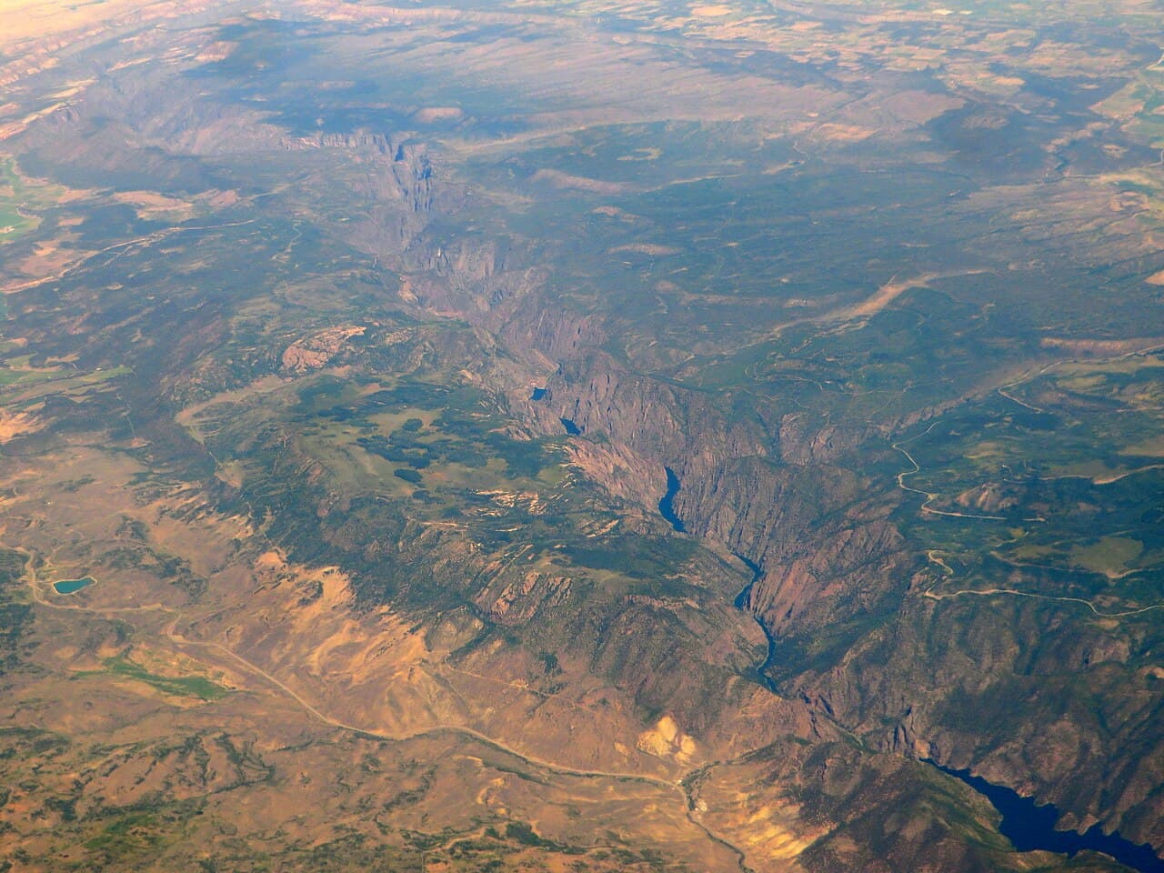
Ease into the altitude on the park's main trails, where ponderosa pine scents the air and the Arkansas River whispers somewhere below the canyon walls. Arrive by 8am and the Outlook Trail overlook is yours alone โ€” by mid-morning, weekend hikers start trickling in even in shoulder season. This is orientation day: no rush, just red dirt underfoot and the first real breath of Colorado high country.

Mueller SP
Ferdinand von Mueller / wikimedia (Public domain)
The Red Rock Canyon viewpoint near the entrance catches soft morning light best before 9:30am.
Trails are uneven with no paved sections; sturdy footwear is essential.
20 min drive โ€” A short backroad hop past scattered ranch fencing, radio fading to static as the canyon walls close in.
10:30 AM - 12:00 PM
Garden Park Fossil Area ยท midday ยท 90 min ยท Mueller State Park โ€” Alpine meadows and forest solitude

A gentler, cognitively easy stop for day one โ€” walk sun-warmed sandstone faces streaked with fossil seams and imagine the ground giving up dinosaur bones a century ago. It's quiet almost year-round, so there's rarely competition for the interpretive signage or the wide desert views back toward Mueller's plateau.
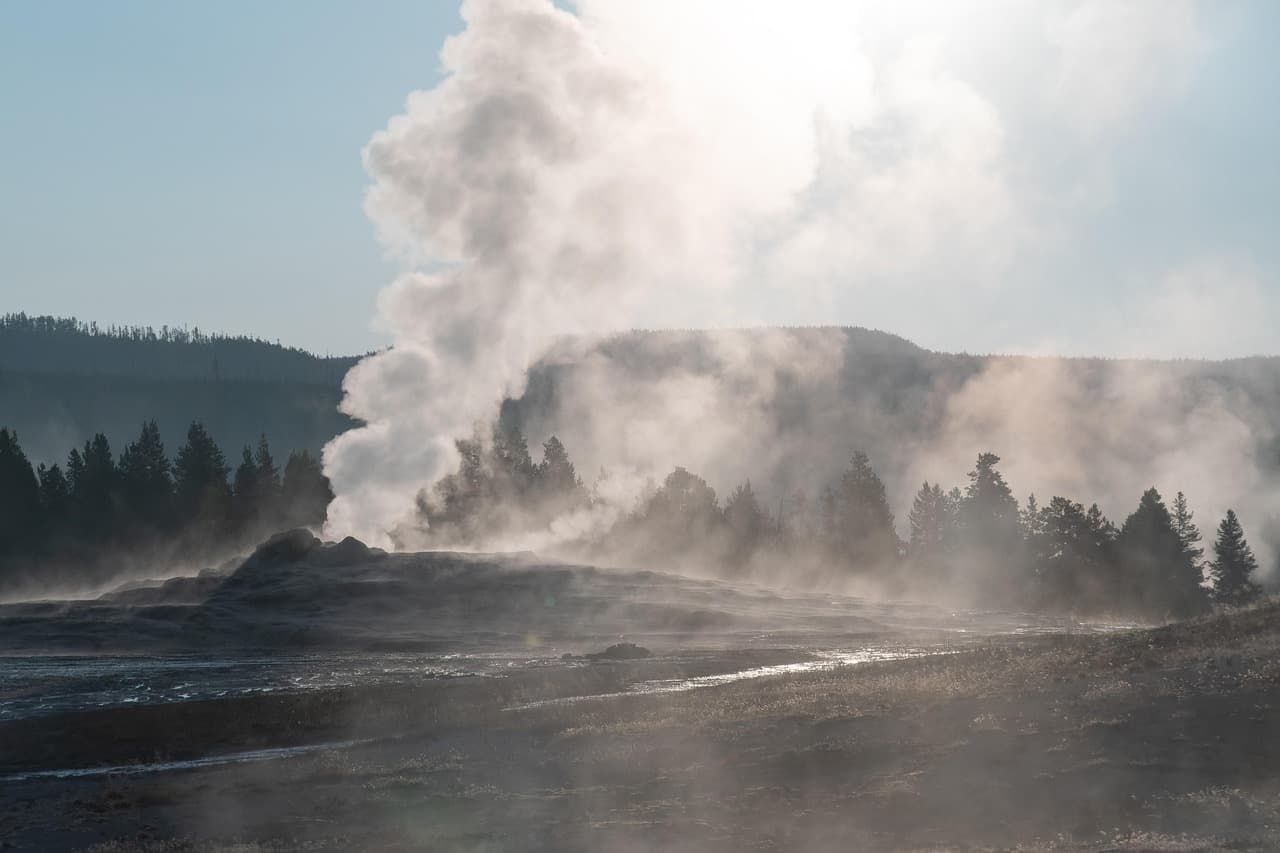
Garden Park Fossil Area
Photo by Gruendercoach on Pixabay
Midday sun flattens the fossil-bearing rock faces โ€” better to shoot wide-angle views of the plateau instead.
Uneven gravel trail; not wheelchair accessible.
Optional detour: Pinnacles Trail โ€” After Garden Park Fossil Area and before settling into lodging
If energy allows, the sandstone spires offer a dramatic capstone to day one with panoramic valley views. Skip if: Better saved for day two's early light โ€” day one should stay light to let your body adjust to elevation.
If it rains: If rain moves in, skip Garden Park's exposed trail and instead drive Mueller SP's scenic overlooks from the car, saving the fossil walk for a drier window later in the trip.

The first morning is about easing in โ€” Mueller SP's main trails offer just enough elevation gain to feel the altitude without overdoing it, and arriving early means the canyon overlook is silent except for wind and the distant murmur of the Arkansas River.

After a short drive deeper into the park's backroads, Garden Park Fossil Area slows the pace further: a low-key wander through sandstone where paleontologists once pulled dinosaur bones from the earth, ideal for a day when your legs and lungs are still adjusting.

Head down to Canon City as the light softens over the foothills โ€” dinner options in town are casual and hearty, reflecting the area's ranching roots, and an early night helps the body settle into mountain elevation before tomorrow's longer hike.

Peak hike, high vistas

Day 2: Spires at Sunrise, Bridge at Noon

The most physically demanding day, combining an early moderate hike with a dramatic bridge walk, totaling roughly 5-6 miles.

Wear
Warm layers for a pre-dawn start, moisture-wicking layers for midday sun on the bridge, and a rain shell in case afternoon clouds build.
Budget
$70-90 (Royal Gorge Bridge admission, lunch, dinner, coffee)
7:00 AM - 8:30 AM
Pinnacles Trail ยท morning ยท 90 min ยท Mueller State Park โ€” Alpine meadows and forest solitude

Start before the sun fully clears the ridgeline โ€” decomposed granite crunches underfoot, sage and dry pine hang in the cool air, and the summit at mile 1.5 delivers a silence broken only by wind. Solo hikers get the trail almost entirely to themselves at this hour; by 10am the switchbacks see a steady trickle of weekend traffic even in spring.

Pinnacles Trail
Photo by Pexels on Pixabay
The Pinnacles Peak summit at mile 1.5 catches dramatic low-angle light just after sunrise.
Uneven decomposed granite terrain; not recommended for those needing accessible paths.
35 min drive โ€” Winding descent out of the park, elevation dropping fast enough to feel it in your ears.
10:00 AM - 10:45 AM
Skyline Drive (Canon City) ยท midday ยท 45 min ยท Canon City Heights & Skyline Ridge โ€” High vistas and town views

A short, adrenaline-spiked detour down a 1905 ridge road with no guardrails โ€” tires squeal softly on tight curves, and the valley below spreads out in gold and green. It's a quick, jolting contrast to the morning's quiet hike, best driven slowly with windows down.

Skyline Drive (Canon City)
United States. Railroad Administration / wikimedia (Public domain)
The ridge crest overlook facing southwest is the standout shot โ€” best in flat midday light when haze is minimal.
Narrow, unguarded road; not suitable for those uncomfortable with heights or those needing accessible paths.
15 min drive โ€” A quick hop along the ridge road, gorge walls rising ahead like a slow reveal.
11:30 AM - 1:30 PM
Royal Gorge Bridge & Park ยท afternoon ยท 120 min ยท Canon City Heights & Skyline Ridge โ€” High vistas and town views

Walk out onto a bridge suspended nearly a mile above the Arkansas River, the structure swaying faintly underfoot while rapids roar somewhere far below in the rust-red gorge. It's the busiest stop on the trip โ€” arriving right at opening or after 2pm avoids the thickest mid-morning crowds, and solo travelers often find easy conversation waiting in line for the zipline or railway.
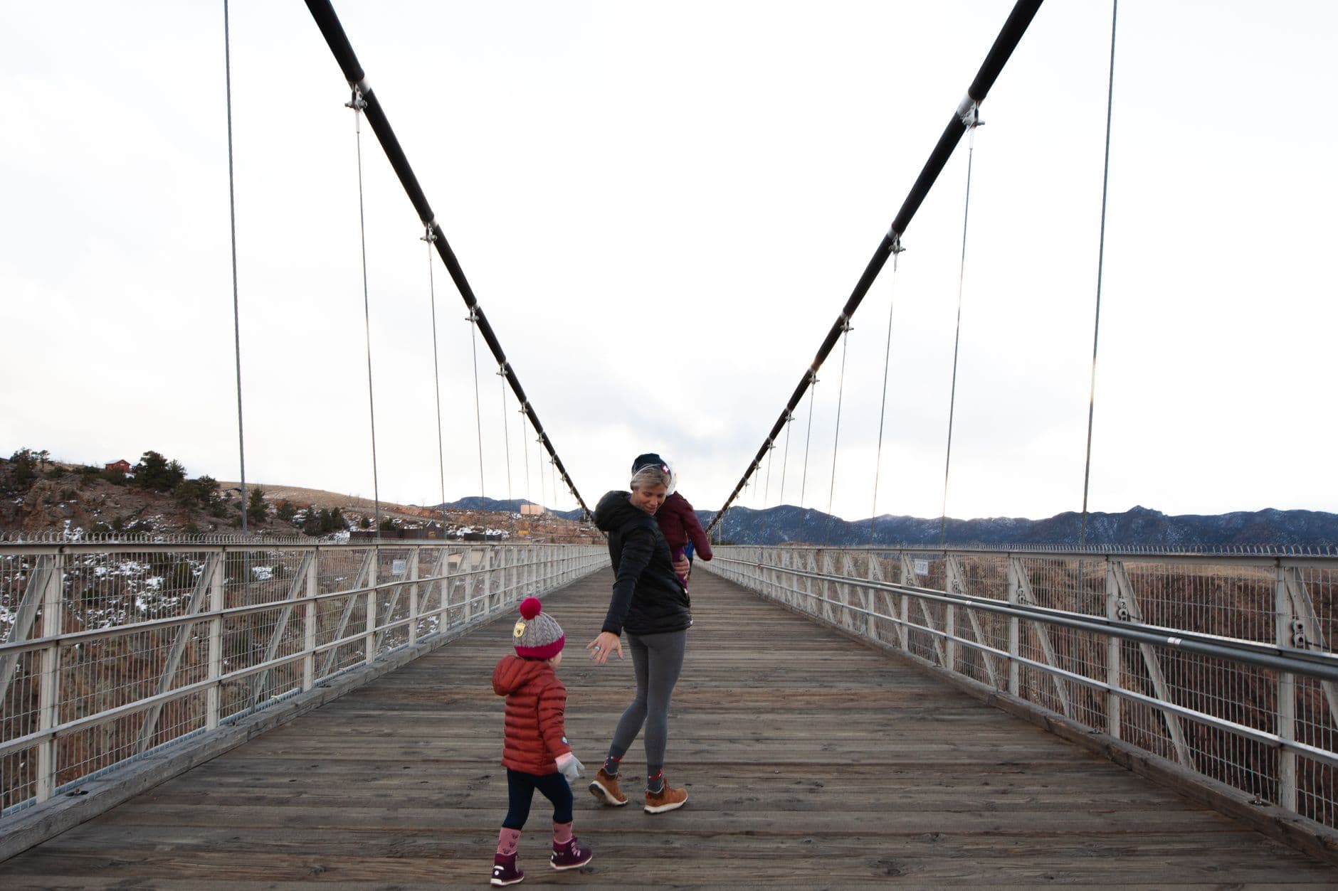
Royal Gorge Bridge & Park
Photo by Josh Willink on Pexels
Mid-span of the bridge looking west toward the canyon mouth is the classic shot โ€” best with midday sun lighting the canyon walls.
Bridge walking is accessible, but some park attractions have uneven terrain.
Optional detour: Phantom Canyon Road โ€” After Royal Gorge Bridge & Park and before evening in Canon City
If time and energy allow, the golden-hour final switchbacks offer sweeping views back toward the gorge rim. Skip if: At nearly 3 hours round-trip, it can overload an already full day โ€” better suited to day three's slower pace.
If it rains: If storms roll in, skip Skyline Drive entirely (it's genuinely unsafe wet) and spend extra time at Royal Gorge Bridge & Park's covered visitor center exhibits, or postpone the bridge walk itself since some attractions there operate in light rain.

Sunrise on Pinnacles Trail rewards the early solo hiker with total quiet โ€” sandstone spires catching first light, the valley still shadowed below, nothing but wind and birdsong for company on the trail up.

The pace shifts hard after the hike: Skyline Drive's white-knuckle curves give way to the sheer scale of Royal Gorge Bridge, where the quiet solitude of the morning trades for a buzzier, more social atmosphere and a genuinely vertigo-inducing walk above the river.

Back in Canon City, tired legs and a full afternoon call for an early, hearty dinner โ€” the town's casual taverns close by 8-9pm, so don't wait too long, and bar seating makes for easy conversation with other hikers and rafters winding down their day.

Scenic drive, slow farewell

Day 3: Gravel, Ghosts, and Gorge Light

A more relaxed final day centered on a long scenic drive with mining history, covering minimal walking distance (under 2 miles).

Wear
Comfortable layers for a day mostly spent driving with short walks, plus a warm layer for exposed overlooks and dust-appropriate clothing for gravel roads.
Budget
$40-55 (fuel, lunch, coffee, dinner)
8:00 AM - 11:00 AM
Phantom Canyon Road ยท morning ยท 180 min ยท Canon City Heights & Skyline Ridge โ€” High vistas and town views

Dust rises softly behind the tires as the road threads through canyon walls glowing ochre and rust, tracing routes miners once chased for fortune. Starting early means empty pullouts at the mile-8 overlook and the mining cabin cluster at mile 14 โ€” by afternoon, weekend traffic picks up, though spring weekdays stay pleasantly sparse.

Phantom Canyon Road
Photo by Alexandre Henry Alves on Pexels
The overlook near mile 8 offers the best southwesterly canyon vista โ€” shoot mid-morning for clean light on the geological layers.
Gravel road surface is challenging; limited safe turnaround points for those needing accessible stops.
Optional detour: Mueller SP โ€” After Phantom Canyon Road and before departure
A final quiet walk on familiar trails offers a gentle bookend to the trip, especially if wildflowers are blooming. Skip if: If legs are tired from three days of hiking and driving, a slower town wander or early departure may serve better.
If it rains: Phantom Canyon Road's gravel surface becomes slippery and washout-prone after heavy rain โ€” check conditions with Fremont County first, and if wet, spend the morning instead revisiting Royal Gorge Bridge & Park's indoor exhibits or driving Skyline Drive only if conditions there are dry.

The last full outing is unhurried by design โ€” Phantom Canyon Road unspools slowly through canyon walls that tell 300-million-year-old stories, with mining relics and layered rock formations rewarding anyone willing to stop often and look closely.

With the drive complete by midday, the afternoon opens up for a final loop back through familiar territory โ€” perhaps a last easy walk in Mueller SP's meadows, now dotted with early spring wildflowers, or simply a slower descent back toward Canon City.

A final dinner in Canon City closes the trip on the same relaxed, early note as the rest of the visit โ€” settle into bar seating at a local spot, let the day's dust and quiet mountain hours settle, and turn in early before tomorrow's drive out.

Want to tweak this trip?

Our AI planner can customize this itinerary to your exact dates, interests, and travel style.

Customize This Itinerary
Good to Know

Restaurant details (hours, menus, availability) change frequently. Check current hours before visiting, especially in seasonal destinations.

Dietary compatibility tags are general guidance. If you have severe allergies, confirm directly with the restaurant.

Travel tips are general guidance, not professional safety advice. Check government advisories for latest information.

All prices are approximate and may vary seasonally.
We use cookies to improve your experience and analyze site usage. Essential cookies are always active. You can customize your preferences or accept all cookies. Cookie Policy