2 DaysSolo Traveler5 Stops

Daniel Boone NF (Stearns, London), Kentucky

2-Day Itinerary for Solo Traveler

Falls, Fog, and Frontier Ridgelines: Two Days Solo in Daniel Boone National Forest

Falls, Fog, and Frontier Ridgelines: Two Days Solo in Daniel Boone National Forest

Mist rises off the Cumberland River before sunrise, wildflowers crowd the trailheads, and the roar of falling water is the only sound for miles. This is Daniel Boone National Forest in spring — wild, quiet, and made for slow, solitary discovery.

At a Glance

Climate & Weather
Spring days run mild (56–63°F) with cool mornings and a real chance of rain — pack a waterproof layer, a warm mid-layer for evenings, and broken-in hiking shoes for slick, muddy trail sections.
Getting Around
A car is essential — this is rural mountain terrain connected by winding two-lane roads (I-75 and US-27 are the main arteries). Distances between clusters can take 45–60 minutes, so fuel up and download maps before you set out.
Budget
Budget roughly $60–90/day for a solo traveler, covering casual meals, trail snacks, park/railway fees, and incidental costs — lodging not included.
Safety
Solo travelers should stay on marked trails, tell someone your hiking plan and expected return time, and carry a paper map or downloaded offline map since cell service is unreliable in the gorges. Black bears are present — store food properly and keep a respectful distance. River currents near Big South Fork and Cumberland Falls are stronger than they look, especially after spring rain.
Connectivity
Cell coverage is spotty to nonexistent inside the forest and gorges; expect reliable signal mainly in Stearns and London town centers. Download offline maps and let someone know your plans before heading into remote trail sections.
Local Tips
Arrive at Cumberland Falls before 8am to have the overlook nearly to yourself; check the lunar calendar in advance if you're hoping to catch the moonbow, since it only appears on clear nights around the full moon. Many local restaurants close early, so plan dinner before 8pm.

Highlights

  • Standing before Cumberland Falls at dawn before the crowds arrive
  • Chasing the rare moonbow on a clear spring night
  • Six miles of solitude along the Laurel River Trail
  • Gorge-rim views where the Big South Fork carves through sandstone
  • A vintage train ride through Appalachia's most dramatic canyon
  • Trout and homemade pie at family-run mountain kitchens

Day-by-Day Plan

Arrival & Cascades

Day 1: First Light at the Falls

A gentle orientation day centered on Cumberland Falls and the Laurel River Trail, with roughly 4–5 miles of walking at a relaxed pace.

Wear
Layered clothing, a waterproof jacket, sturdy hiking shoes with good tread for wet rock and creek crossings, and a hat for sun or drizzle.
Budget
$45–65 (park access, trail snacks, lunch and dinner)
7:30 AM - 9:00 AM
Cumberland Falls (moonbow) · morning · 90 min · Cumberland Falls Area

Arrive while the mist still hangs low and the overlook platform is nearly empty — by 9am it fills with weekend crowds and tour groups. The falls announce themselves before you see them: a deep, constant roar as 3,600 gallons per second plunge 68 feet into the gorge below, throwing cool spray onto your face and the scent of wet stone into the air. Solo travelers often strike up conversation here with fellow early risers and photographers setting up tripods along the rim.

Cumberland Falls (moonbow)
Bernice Chmarouski / pexels (Pexels License)
Shoot from the upper rim trail at sunrise for a full-cascade view with soft morning light; return after dark on a clear night near the full moon for the rare moonbow.
Trail to the main overlook is not wheelchair accessible and involves uneven terrain; benches are sparse, so pace yourself.
10 min walkA short walk along the park road connects the falls overlook to the Laurel River trailhead — a good stretch to shake off the morning chill.
9:30 AM - 12:30 PM
Laurel River Trail Loop · midday · 180 min · Cumberland Falls Area

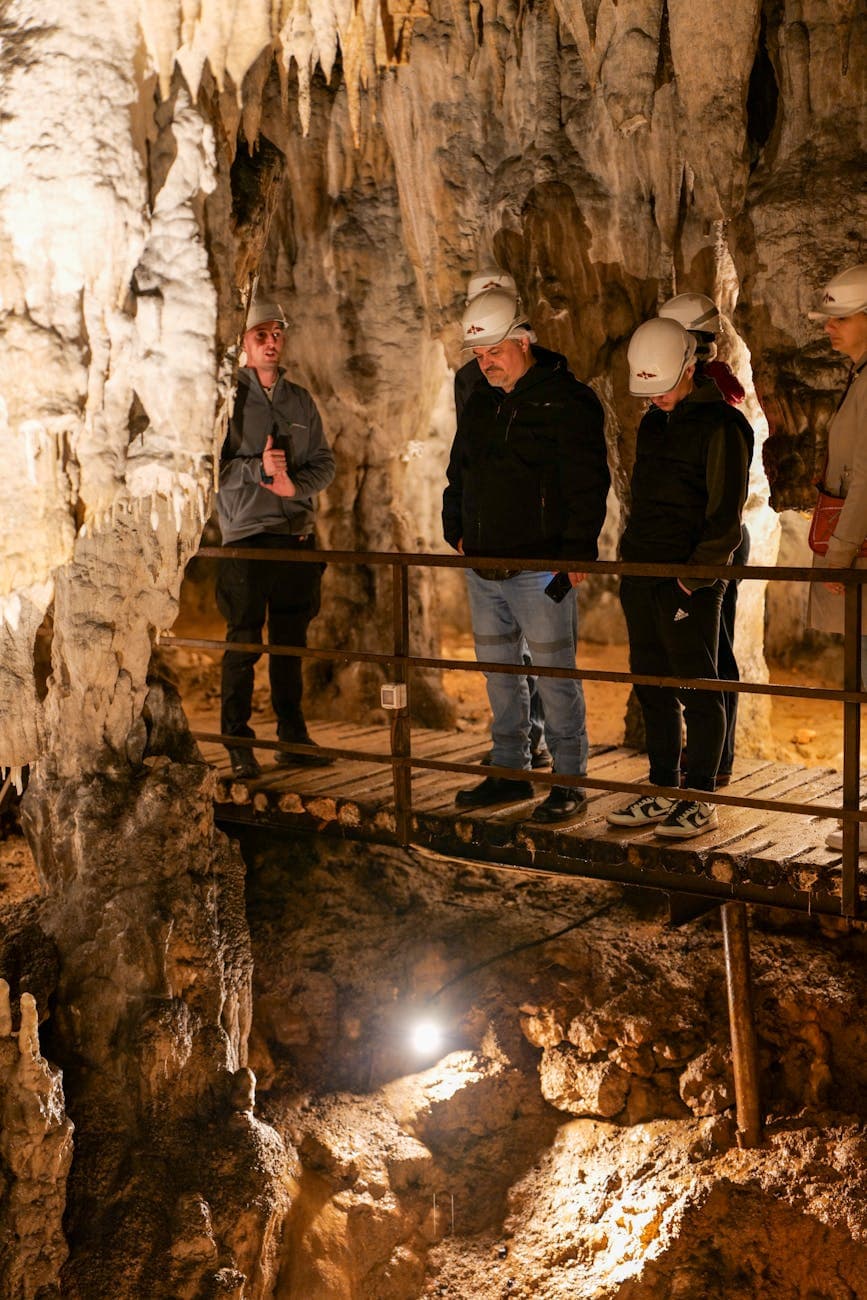
This six-mile loop trades the falls' crowds for near-total solitude — creek crossings, cascades, and birdsong replace the roar of the main overlook. The trail rewards a steady, unhurried pace: soft forest floor underfoot, cool mineral-scented air rising off the Laurel River, and quiet pools perfect for a trailside break. It's an ideal stretch for solo hikers who want space to think, though it's worth telling someone your expected return time before setting out.

Laurel River Trail Loop
Photo by Deb Hayes on Pexels
The main river crossing at mile 2.5 offers wide, reflective pools — best photographed in mid-morning light when the water is calm.
Not wheelchair accessible; trail surface is uneven with creek crossings that can be slippery, especially after rain.
5 min driveA brief evening drive back to the falls parking area, headlights catching moths and mist along the road.
8:30 PM - 10:30 PM
Cumberland Falls (moonbow) · evening · 120 min · Cumberland Falls Area

If the sky is clear and the moon is near full, return after dark for the moonbow — a pale, silvery arc bending through the falling mist, visible almost nowhere else in North America. The overlook draws a small, hushed crowd of photographers and stargazers, making it an easy place for a solo traveler to swap stories under the stars. Bring a flashlight for the walk back and dress warmer than you think you'll need.

Cumberland Falls (moonbow)
Bernice Chmarouski / pexels (Pexels License)
Use a tripod and long exposure to capture the moonbow's faint colors; arrive right after moonrise for the clearest visibility.
Uneven terrain and low lighting at night — solo travelers should use a headlamp and stay within marked areas.
If it rains: If heavy rain or fog rolls in, skip the moonbow attempt entirely — visibility drops to zero — and instead spend the extra evening hours resting up in town; daytime falls viewing is still worthwhile in light rain, though photo quality and clarity will suffer.

The day begins in the hush before the crowds — Cumberland Falls at first light, mist curling off the gorge and the roar of falling water filling the cool morning air. Arriving before 8am means the overlook is nearly yours alone, a rare kind of stillness before the weekend hikers and photographers arrive.

The pace shifts from spectacle to solitude on the Laurel River Trail, where six miles of forest, creek crossings, and quiet cascades replace the crowds at the falls. It's a long, steady walk best taken slowly, with plenty of stops to listen to the river and let the forest do the talking.

As night falls, the return to Cumberland Falls carries a different energy entirely — if the sky cooperates, the elusive moonbow appears, a pale arc of light bending through the mist. It's a quiet, almost reverent way to close the first day, best shared in low conversation with fellow night-sky watchers before heading back to rest.

Ridgelines & Rails

Day 2: Into the Gorge Country

A moderately active day exploring Big South Fork's northern gorge and a scenic railway journey, covering roughly 3–4 miles of walking.

Wear
Layered clothing for shifting mountain temperatures, a rain jacket, closed-toe shoes with grip for uneven overlooks, and a light scarf or hat for the open-air train ride.
Budget
$55–80 (railway ticket, lunch, dinner, incidentals)
8:00 AM - 10:00 AM
Big South Fork (north end) · morning · 120 min · Big South Fork North End

Arrive early to catch the gorge in cool, quiet light — the whitewater below echoes off sandstone cliffs and the air smells of damp earth and hemlock. The overlook trail delivers a sudden, dramatic reveal of the canyon that feels earned after the winding drive in. Solo hikers will find this a manageable, moderate walk with several natural pause points for photography and quiet reflection.

Big South Fork (north end)
United States. Soil Conservation Service / wikimedia (Public domain)
The north rim overlook at the trail terminus is best photographed mid-morning, when light rakes across the gorge walls without harsh shadows.
Trails here are not wheelchair accessible and have limited benches; sturdy footwear is recommended for uneven, root-crossed paths.
20 min driveA short drive along a winding mountain road toward Stearns station, with glimpses of the gorge appearing and disappearing through the trees.
11:00 AM - 2:00 PM
Big South Fork Scenic Railway · midday · 180 min · Big South Fork North End

Trade hiking boots for a train seat as vintage rail cars clatter through one of Appalachia's most dramatic gorges. The ride is a welcome change of pace after the morning's hike — cool mountain air rushes through open windows while sheer sandstone bluffs rise above the emerald river below. It's also a natural social setting for solo travelers, with shared bench seating and staff happy to chat about the region's mining and rail history.
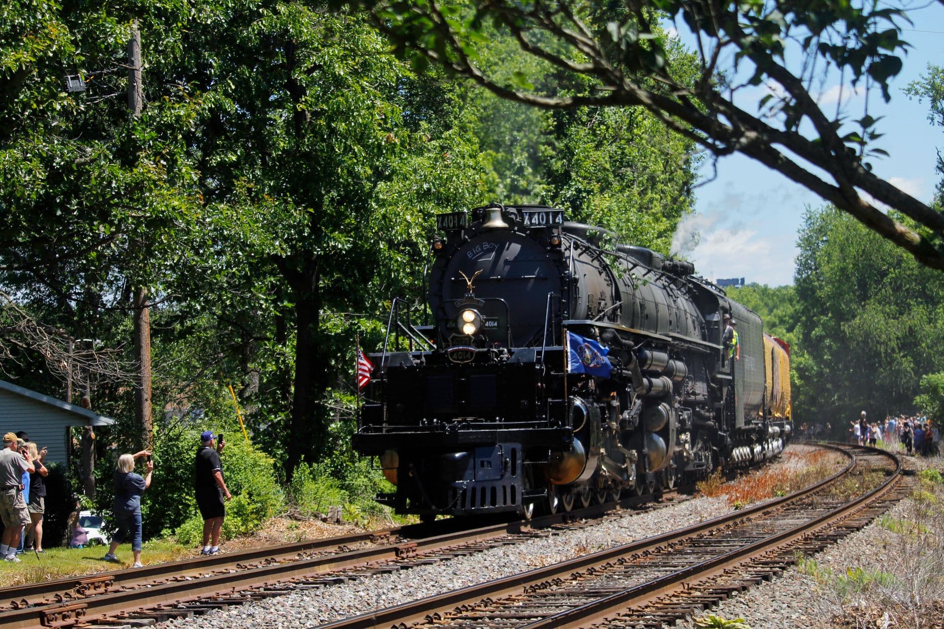
Big South Fork Scenic Railway
Photo by Sephina Cornwall on Pexels
Sit on the gorge-facing side for the mile 3–4 vista, and aim for a morning departure for the softest light on the sandstone bluffs.
Boarding accommodations are available for those with mobility needs — contact the railway office in advance to arrange assistance.
Optional detour: Laurel River Trail LoopAfter Big South Fork Scenic Railway and before evening rest
A shorter out-and-back on the first mile offers one more dose of quiet forest solitude if energy allows. Skip if: After a full morning hike and a three-hour train excursion, most solo travelers will prefer to rest rather than add another trail.
If it rains: If rain sets in, trails around Big South Fork become slippery and visibility drops — the Scenic Railway typically still operates in light rain, so shift the day's focus toward the train excursion and confirm departure status with the railway office 48 hours ahead.

The second day trades waterfall mist for gorge country — an early start at Big South Fork rewards you with cool air, echoing whitewater, and a canyon view that opens up almost without warning. It's a quieter, more rugged landscape than the falls, with fewer visitors this early in the day.

By midday, the pace eases into something more social and scenic: a vintage train ride along the rim of the gorge, open windows and clacking rails replacing the hiking boots of the morning. It's a fitting shift in energy — less exertion, more immersion in the landscape and easy conversation with fellow riders.

As the light softens, the day winds down slowly — an evening free of scheduled stops, ideal for reflecting on two days spent among waterfalls, gorges, and quiet Appalachian trails before heading back to town for a relaxed dinner.

Want to tweak this trip?

Our AI planner can customize this itinerary to your exact dates, interests, and travel style.

Customize This Itinerary
Good to Know

Restaurant details (hours, menus, availability) change frequently. Check current hours before visiting, especially in seasonal destinations.

Dietary compatibility tags are general guidance. If you have severe allergies, confirm directly with the restaurant.

Travel tips are general guidance, not professional safety advice. Check government advisories for latest information.

All prices are approximate and may vary seasonally.

We use cookies to improve your experience and analyze site usage. Essential cookies are always active. You can customize your preferences or accept all cookies. Cookie Policy