Red River Gorge (Slade area), Kentucky
2-Day Itinerary for Couples
“Stone Arches & Quiet Fire: A Winter Escape to Red River Gorge”

In winter the gorge empties out and the sandstone goes quiet — bare branches let the light through, frost silvers the moss, and the arches that draw summer crowds by the busload stand nearly yours alone. This is Red River Gorge stripped to its bones: cold air, long shadows, and two days built for slow mornings and dramatic, empty overlooks.
At a Glance
Highlights
- Frost-rimmed views through Natural Bridge's stone arch with no one else on the trail
- Standing beneath the 78-foot span of Sky Bridge in hushed winter silence
- A windswept ridge walk along Auxier Ridge with panoramic, leaf-bare views
- Golden hour light raking across Chimney Top Rock's weathered sandstone
- Intimate, low-key dinners in Slade after short, cold days outdoors
- The rare gift of having a 100-arch wilderness almost entirely to yourselves
Day-by-Day Plan
Day 1: Arches in Cold Light
A lighter first day centered on the accessible, well-marked trails of the Natural Bridge & Sky Bridge Loop — roughly 2.5 miles of walking at a relaxed pace to ease into the terrain and the cold.
The trail climbs through bare winter forest where the usual crowd noise is gone, replaced by the crunch of frozen leaf litter and your own breath in the cold air. Arrive by 9am and the arch is yours — the sandstone glows pale amber even in winter's flatter light, and the gorge view through the opening stretches out in sharp, clear air with none of summer's haze. Take the extra time on the steeper sections; ice can linger in shaded patches even when the trail looks dry.

Beneath the 78-foot span, the canyon holds an almost church-like hush in winter — no rustling leaves, just the faint rush of the Middle Fork somewhere below and the occasional call of a winter bird echoing off stone. Stand under the arch looking up for the most dramatic perspective, then walk out to the visitor platform for the full span in context against a stark, leafless canyon. This is the kind of quiet couples usually have to earn in summer, and in winter it's simply given.
The day opens slow and cold, with frost still clinging to the underbrush as you climb toward Natural Bridge. Arriving early means the arch and its gorge view belong to just the two of you — a rare, unhurried kind of awe that winter makes possible. Move carefully on the descent where shaded patches of trail can hold ice even when the rest of the path looks clear.
A short drive brings you to Sky Bridge, where the canyon's hush deepens further. Standing beneath the 78-foot arch, cold air pooling in the gorge below, there's a sense of scale that's easy to miss when the trail is crowded — today it isn't. Take the full 90 minutes here; there's no reason to rush a view this good.
With options at the trailheads themselves limited this time of year, plan to head back toward Slade for the evening meal — pack a thermos of something warm for the drive, and let the first day close gently with an early night after the cold air and elevation.
Day 2: Ridge Line & Golden Hour Stone
A more ambitious second day on the Auxier Ridge & Chimney Top cluster, covering roughly 3.5–4 miles of ridge-line hiking with real elevation exposure and the trip's most dramatic views.
Arrive by 8:30 and the weathered sandstone cap is silent, no one else's voice carrying on the wind. Winter's clear cold air sharpens the view into the canyon below — rust-red cliffs against a stark, leaf-bare forest canopy, the Red River a distant murmur. This short, moderate stop is the perfect warm-up before the longer ridge walk, and the 360-degree vista is arguably better in winter, when nothing blocks the sightlines.

This is the trip's centerpiece — a windswept ridgeline where the forest drops away on both sides to reveal layered ridges fading into blue-gray haze. In winter, bare trees open up views that summer's canopy would hide entirely, and the trail's usual weekend crowds are nowhere to be found. Take it slow on the sandstone outcrops, which hold ice in shaded spots even on a sunny day, and budget the full three hours to actually stand at the overlooks rather than rush past them — this is the kind of quiet, expansive terrain that couples remember long after the trip ends.
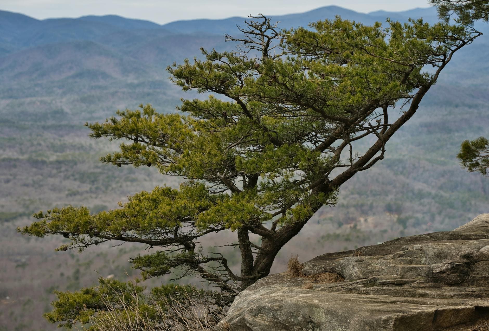
The morning starts with a short, punchy climb to Chimney Top Rock, where cold, still air and total solitude make the payoff feel outsized for the effort. It's the ideal warm-up before the real climb — legs loosen, eyes adjust to the scale of the gorge, and the day's mood settles into something slow and awe-struck.
From there, the connector trail leads onto Auxier Ridge itself, where the terrain opens dramatically and the views stretch for miles in every direction. This is the physically demanding heart of the trip, but the reward — standing at a ridge overlook with the whole gorge laid out below in winter's clear light — is worth every careful step over icy sandstone.
With trailhead dining thin on the ground, plan your evening meal for Slade rather than expecting anything on-site — pack out with snacks and something hot for the ride, and let the evening wind down early after a long, cold, rewarding day on the ridge.
Want to tweak this trip?
Our AI planner can customize this itinerary to your exact dates, interests, and travel style.
Customize This ItineraryRestaurant details (hours, menus, availability) change frequently, and no specific dining venues were available in our sourced data for these trailhead areas — check current options in Slade and Stanton before you go.
Dietary compatibility tags are general guidance. If you have severe allergies, confirm directly with any restaurant before dining.
Travel tips are general guidance, not professional safety advice. Check current trail and road condition reports and government advisories before setting out, especially in icy winter conditions.
All prices are approximate and may vary seasonally.