Red River Gorge (Slade area), Kentucky
2-Day Itinerary for Solo Traveler
“Stone Arches & Solitude: Two Days in the Red River Gorge”

Winter strips the gorge down to its bones — bare sandstone, cold silver light, and a hush that summer never allows. This is the season when you can stand on a 78-foot stone arch and hear nothing but wind and your own breath, when the trailheads that swarm in October belong almost entirely to whoever's willing to bundle up and show up early.
At a Glance
Highlights
- Standing alone atop Sky Bridge in the gray hush of a winter morning
- Watching amber light climb the sandstone walls of Natural Bridge
- Ridge-walking Auxier's spine with panoramic views stripped bare of leaf cover
- Scrambling Chimney Top Rock for 360-degree views of rust-red cliffs
- Off-season solitude at the region's most photographed formations
- Hearty Appalachian comfort food after a cold day on the trail
- Slow mornings and short winter days that force an easier, more contemplative pace
Day-by-Day Plan
Day 1: Arches, Amber Light, and an Easy First Day
A gentler day centered on the accessible, well-marked trails of the Natural Bridge & Sky Bridge Loop, totaling roughly 3-4 miles of walking at a relaxed pace.
Arrive by 8am and the gorge is yours — no chatter, no jostling for the overlook, just cold air and the hollow sound of wind moving through the arch. The sandstone glows pale gold even under winter's flatter light, and the trail up feels almost private this early. Take it slow on the approach; wet leaves and shaded patches can hide ice even when the rest of the trail looks dry.

A short drive delivers you to a different kind of drama — a 78-foot arch suspended over the Middle Fork, its underside catching filtered light in a way that feels almost cathedral-like. In winter, with the canopy bare, you get sightlines into the gorge that summer's leaves completely obscure. Walk to the far viewing platform for the classic full-span shot, then take the short spur down toward the underside for a completely different, more intimate perspective.
The day starts slow and cold, with frost still clinging to the trailhead sign at Natural Bridge. Climbing toward the arch, the forest is stripped down to gray trunks and amber leaf litter, and the quiet is almost startling after the drive in. By the time you reach the viewpoint, the sun has just cleared the ridge, throwing long light across the gorge and lighting the underside of the arch like a furnace.
After a short drive deeper into the loop, Sky Bridge offers a different texture of solitude — narrower, more enclosed, the canyon walls pressing closer. With winter's bare branches, you can see straight down into the Middle Fork drainage in a way that's impossible come spring. Take your time here; there's no rush, and the light shifts noticeably even over an hour.
With no formal dining options mapped directly to either stop, plan your evening meal around Slade or Stanton rather than the trailhead — pack a thermos and snacks for the day itself. Head back to your lodging as the short winter daylight fades fast; by 5:30pm it's essentially dark, so give yourself buffer time to be off any trail well before dusk.
Day 2: Ridge Line and Rock Summit
A more demanding day on the Auxier Ridge & Chimney Top cluster, covering an estimated 4-5 miles of ridge and summit hiking at a moderate-to-high energy level.
Get here at first light and the whole cliff-top belongs to you — no crowds, just a cold wind whipping across bare rock and a 360-degree view of rust-colored cliffs disappearing into blue-gray winter haze. It's a short approach, which makes it perfect as a warm-up before the longer ridge walk ahead. Footing on the rock cap can be slick with frost this early, so move deliberately near the edges.

This is the day's main event — a windswept, narrow ridgeline hike where the forest suddenly drops away on both sides to reveal layered ridges fading into haze. Winter's bare trees mean the views open up dramatically compared to leafier seasons, though the wind exposure is real, so keep those layers zipped. It's a fantastic solo hike: technical enough to feel earned, but well-marked enough that you won't second-guess the route. Pace yourself and budget extra time for photos at the main overlook.
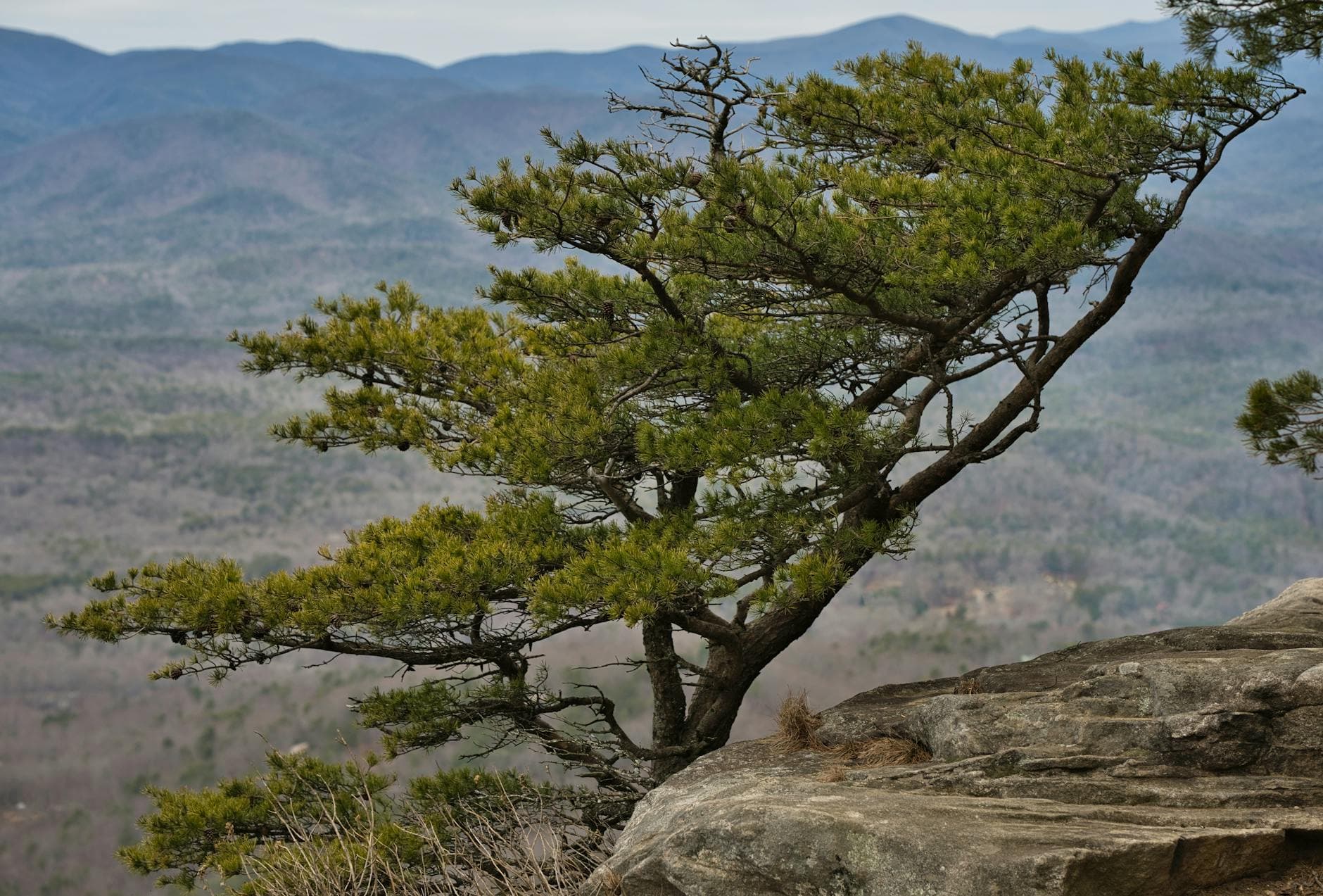
Frost still coats the rock at Chimney Top when you arrive, the wind carrying a mineral chill straight off the exposed cap. The views stretch impossibly far in the winter clarity — no haze from summer humidity, just crisp lines of ridge after ridge. It's a short stop, but a good one to shake off the morning cold before the real climb begins.
Auxier Ridge unfolds slowly, the trail narrowing until forest gives way to open rock and sudden, vertiginous views. Midday light in winter sits lower in the sky, casting long shadows across the canyon that make the whole landscape feel sculptural. There's a stillness up here that's rare any other season — just wind, distant birdsong, and the occasional creak of cold branches.
No dining data is mapped directly to either stop, so plan to eat in Slade or Stanton on the way back rather than expecting anything at the trailhead — pack extra snacks and water for the day itself. With winter darkness arriving by late afternoon, aim to be back at the car well before dusk, and consider an early, hearty dinner in town to close out two days of solitude among the gorge's stone.
Want to tweak this trip?
Our AI planner can customize this itinerary to your exact dates, interests, and travel style.
Customize This ItineraryRestaurant details (hours, menus, availability) change frequently. Check current hours before visiting, especially in seasonal destinations.
Dietary compatibility tags are general guidance. If you have severe allergies, confirm directly with the restaurant.
Travel tips are general guidance, not professional safety advice. Check government advisories for latest information.
All prices are approximate and may vary seasonally.