Red River Gorge (Slade area), Kentucky
4-Day Itinerary for Couples
“Stone Arches & Slow Fires: 4 Winter Days in Red River Gorge”

In winter, the gorge empties out and goes quiet — bare branches let the sandstone show through, frost silvers the moss, and you can stand on a thousand-foot overlook without another soul in sight. This is Red River Gorge stripped to its bones, best shared with someone who doesn't mind cold hands and long silences.
At a Glance
Highlights
- Standing alone beneath Natural Bridge's 65-foot sandstone arch in the hush of a winter morning
- Watching your breath fog over Sky Bridge's 78-foot span with nobody else on the platform
- A wind-scoured summit at Chimney Top Rock with 360-degree views of rust-colored cliffs
- The high, exposed drama of Auxier Ridge under a low winter sun
- Fireside dinners after short, cold days and long, dark nights
- Near-total solitude on trails that heave with crowds every other season
Day-by-Day Plan
Day 1: Arrival & First Light on Stone
A short, low-effort day easing into the gorge with one iconic, accessible stop and an early dinner — under 2 miles of walking.
After the drive in, let this be the soft landing — a well-graded trail leads up through bare winter trees to the 65-foot sandstone arch, where the gorge opens below in a wash of gray-green ridgelines. The cold keeps crowds away almost entirely this time of year, so you'll likely have the arch's overlook to yourselves, wind threading through the opening with a low, hollow sound. Take it slow; this is about arriving, not conquering.

Travel day — settle into lodging near Slade or the Natural Bridge State Park area, unpack warm layers, and let the drive's tension drain away before heading out.
A gentle first outing to Natural Bridge SP eases you into the gorge's scale without overexertion. The trail is short enough to feel restorative rather than demanding, and the cold and near-empty paths set a contemplative tone for the trip ahead.
Head back to your lodging and settle in early — winter dining hours in the area tend to be limited, so plan a simple, cozy meal at your accommodation or check ahead for what's open nearby. Let the first night be about warmth, quiet, and the sound of wind outside.
Day 2: The Arch and the Wind
A moderate day centered on Sky Bridge's dramatic arch with a relaxed afternoon, totaling around 2.5 miles of walking.
Arrive by 8 AM and the loop trail to this 78-foot arch is yours alone — frost still clinging to the rhododendron, your footsteps the only sound besides the faint rush of the Middle Fork far below. Walk beneath the arch first to feel its scale from underneath, then climb to the platform for the full span in context against pale winter sky. By 9:30 the light has flattened and it's time to move on before any midday visitors arrive.
An early start rewards you at Sky Bridge — the cold keeps the trail empty, and the arch feels like a discovery rather than a tourist stop. Take your time beneath the span before the light shifts.
With the morning's climb behind you, ease into a slower rhythm — a simple lunch, a walk around Slade or your lodging grounds, or quiet time by a fire. This is a day to conserve energy for the more demanding ridge hike ahead.
An early, unhurried dinner suits the short winter daylight — check with your lodging or nearby Slade establishments for current winter hours, as many local spots keep reduced schedules this season.
Day 3: Ridge Line & Wide Sky
The most demanding day of the trip — a high-energy ridge hike combined with a shorter summit stop, roughly 4 miles total.
A short, sharp climb delivers you to a weathered sandstone cap with 360-degree views over rust-red cliffs and deep green-gray forest — in winter's low light, the canyon looks almost sculptural. Wind whips hard up here, so this is a quick, breathtaking stop rather than a lingering one; arrive at opening light for the clearest air and softest color before haze builds later in the day.

This is the trip's centerpiece — a windswept ridgeline where the forest suddenly falls away to reveal layered ridges fading into blue-gray haze. In winter, bare trees open up views that are hidden in leafier seasons, and the crowds that clog this trail in October are nowhere to be found. Walk slowly across the exposed sandstone spine, pausing at the main overlook to take in the scale of the gorge — this is the kind of quiet that makes couples stop talking and just stand together.
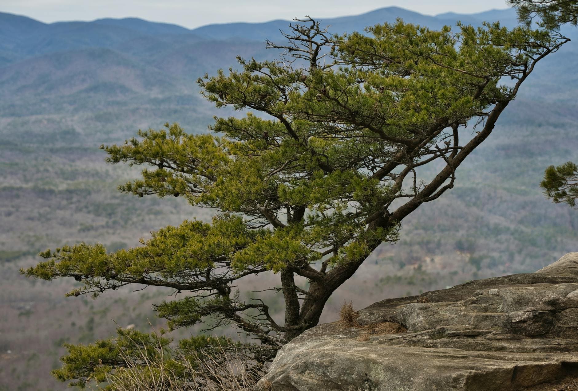
An early, cold start rewards you with Chimney Top Rock's summit views almost entirely to yourselves, wind sharp but the light extraordinary. This short climb serves as a warm-up before the longer ridge walk ahead.
Auxier Ridge stretches the morning into midday, its exposed sandstone spine delivering the trip's most expansive views. The hike demands focus on footing but rewards with long, quiet overlooks — budget real time here rather than rushing through.
After a physically full day, keep the evening simple — warm food, dry clothes, and rest. Check with local Slade-area spots for current winter hours, as many close early or midweek this season.
Day 4: Slow Morning, Soft Goodbye
A light final day revisiting favorite light and views before departure, under 2 miles of easy walking.
Return once more, this time simply to sit with the place — morning mist often rises from the gorge floor and drifts visibly through the arch opening in the cold air, a scene worth the early wake-up alone. With no agenda but presence, this final visit closes the loop on the trip's central image: stone holding light.
A final unhurried visit to Natural Bridge SP lets the trip close on a quiet note — mist, stone, and cold air, with no itinerary pressure left.
Use the remaining hours for the drive out, allowing extra time for winding roads and any lingering ice on shaded curves.
Departure — plan for a straightforward drive to CVG or LEX, giving yourselves a buffer for winter road conditions.
Want to tweak this trip?
Our AI planner can customize this itinerary to your exact dates, interests, and travel style.
Customize This ItineraryRestaurant details (hours, menus, availability) change frequently, especially in winter when many small local spots reduce hours or close midweek — check current hours before visiting.
Dietary compatibility tags are general guidance. If you have severe allergies, confirm directly with the restaurant.
Travel tips are general guidance, not professional safety advice. Trail and road conditions change quickly in winter — check current forest service and weather advisories before hiking.
All prices are approximate and may vary seasonally.