Pennsylvania Wilds, Pennsylvania
2-Day Itinerary for Solo Traveler
“Ridgelines and Starlight: Two Days Alone in the Pennsylvania Wilds”
Out here, the forest doesn't perform for you — it just exists, ancient and indifferent, which is exactly the point. Two days moving from a broken 19th-century viaduct to a ridge-top vista to a night sky uncorrupted by a single streetlight will strip away the noise you didn't know you were carrying.
At a Glance
Highlights
- Stand on the fractured span of Kinzua Bridge where steel met an F1 tornado
- Watch ridgelines roll toward the horizon from Denton Hill's mountaintop vista
- Lie back under one of the darkest skies in the eastern United States at Cherry Springs
- Solo-friendly pacing with generous photography windows at every stop
- Golden-hour light on rust-red steel and old-growth hemlock corridors
- Quiet, uncrowded weekday access to two of PA's most photographed landmarks
Day-by-Day Plan
Day 1: Into the Highlands: Bridge, Trail Edge, and Ridgeline Light
A gentle first day easing into the region's scale — roughly 2.5 miles of walking total, moving from the dramatic ruin of Kinzua Bridge to a mellow mountaintop vista by late afternoon.
Arrive before 9am and the walkway is nearly yours alone — just wind whistling through the skeletal steel arches where the 2003 tornado tore the span apart mid-air. Walk to the end of the safe section and look down through rust-red fragments into the gorge below; the scale of the wreckage says more about nature's power than any placard could. For a solo traveler, this quiet hour is ideal for slow, uninterrupted photography and a little reflection on impermanence.

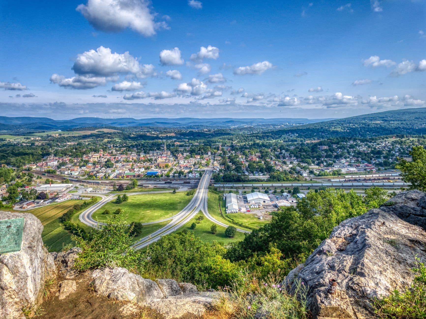
After a midday break, the ridge-top vista at Denton Hill delivers a completely different mood than the bridge's steel-and-gorge drama — open air, balsam-scented wind, and ridge after ridge dissolving into afternoon haze. It's a low-energy stop, perfect for decompressing solo with a thermos of coffee and no agenda beyond watching light shift across the valleys.
The day opens slow and deliberate at Kinzua Bridge, where early light catches the rusted steel of the collapsed span and the gorge below sits wrapped in cool, rising creek air. Walking the remaining safe section alone, with only the wind for company, sets the tone for the whole trip: this is a place that rewards patience and quiet attention rather than a checklist mentality.
After lunch and the winding drive south, the mood shifts from the bridge's raw, broken grandeur to something gentler at Denton Hill — a mountaintop clearing where ridgelines stack toward the horizon and the only sound is wind through sparse conifers. It's an easy, restorative stop, ideal for a solo traveler to simply sit with a view and let the scale of the landscape settle in.
With no formal dinner plans mapped to a specific POI tonight, plan to eat in one of the small towns near your lodging — Galeton or Wellsboro both keep to early hours, so aim to be seated by 7 or 7:30pm at a local diner or tavern where solo diners are welcome at the bar. Turn in early; tomorrow's stargazing night at Cherry Springs means a later finish and an early-morning contrast the next day.
Day 2: Chasing Dark: A Night Under Cherry Springs' Uncorrupted Sky
A lighter-footed day overall (under 1 mile of walking) that builds toward the trip's emotional peak after dark, with a slow, unhurried daytime pace to conserve energy for the night ahead.
This is the night the whole trip has been building toward. As your eyes adjust in the eastern meadow, the sky reveals itself in layers — first a handful of bright stars, then hundreds, then an overwhelming tapestry stretching horizon to horizon with the Milky Way arcing directly overhead. Solo travelers often find this the most communal stop of the trip too: fellow stargazers cluster quietly near telescopes and are usually happy to share a view or a conversation in hushed tones. Arrive before full dark to claim a good spot in the meadow and let your night vision develop slowly — avoid checking your phone once you're set up.

Keep the day intentionally unstructured — this is a chance to rest, do laundry, wander a nearby small town, or simply nap in preparation for a late night. Given the previous day's stops are covered, use the daylight hours to check the weather forecast for Cherry Springs and plan your route with a full tank of gas, since services thin out fast near the park.
As afternoon fades, make the drive toward Cherry Springs with time to spare, stopping in Coudersport for an early meal — kitchens here close by 8 or 9pm, so eat before the sky commitment, not after. Arrive at the park while there's still light left to get oriented and find a comfortable spot in the meadow.
Darkness falls in stages, and so does the sky's reveal — a slow unveiling of stars, then the Milky Way, then a silence so complete it feels like its own kind of sound. Solo travelers frequently find community here, trading quiet conversation with strangers under shared awe. Plan to wrap by 11:30pm at the latest, driving out carefully on unlit roads, carrying the kind of stillness that's hard to find anywhere else.
Want to tweak this trip?
Our AI planner can customize this itinerary to your exact dates, interests, and travel style.
Customize This ItineraryRestaurant details (hours, menus, availability) change frequently. Check current hours before visiting, especially in seasonal destinations.
Dietary compatibility tags are general guidance. If you have severe allergies, confirm directly with the restaurant.
Travel tips are general guidance, not professional safety advice. Check government advisories for latest information.
All prices are approximate and may vary seasonally.