Blue Ridge Highlands (Bristol, Abingdon), Virginia
2-Day Itinerary for Solo Traveler
“Ridgeline & Rail-Trail: Two Days Alone in the Blue Ridge Highlands”
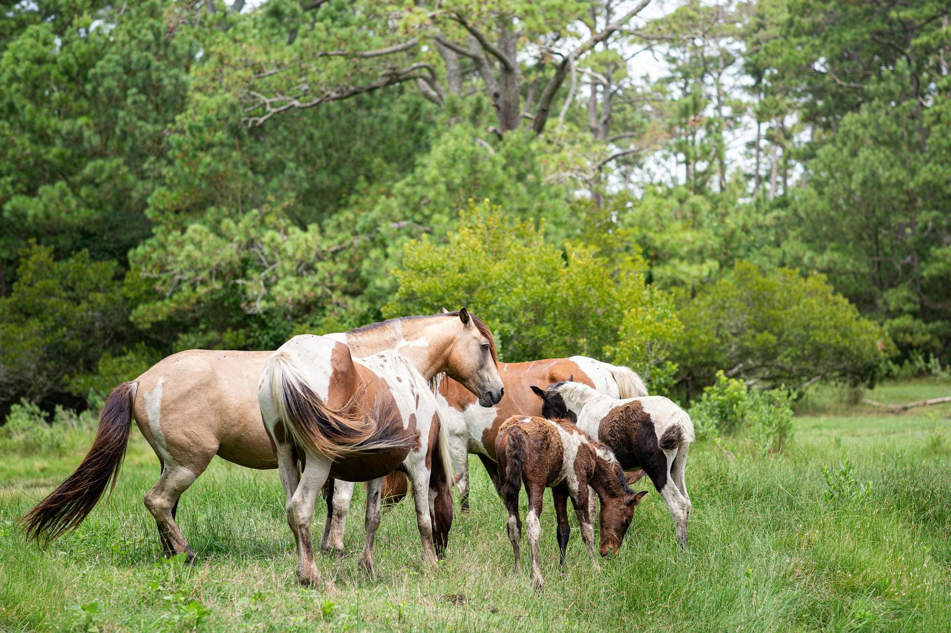
The wind up here doesn't just move — it arrives with a story, sweeping across highland meadows where wild ponies graze like they own the ridge. Two days, one set of legs, and a corner of Appalachia that rewards solitude with 360-degree horizons and gravel trails that hum under your own steady pace.
At a Glance
Highlights
- Wild ponies grazing free across Grayson Highlands' windswept meadows
- Sunrise solitude at Wilburn Ridge before the crowds arrive
- Legs-only ascent toward Mount Rogers, Virginia's highest point
- A gravity-assisted roll down 17 miles of the Virginia Creeper Trail
- Trailside creek crossings and restored rail trestles near Damascus
- Early dinners and porch-light conversation in small mountain towns
Day-by-Day Plan
Day 1: Highlands and Hoofprints
A moderate-to-intense day covering roughly 5–6 miles on foot across highland meadows and forested ridge trail, with energy building from gentle wildlife-watching into a demanding partial ascent toward Mount Rogers.
Arrive by 7am and the meadows are yours — mist still clinging to the ridgeline, wild ponies grazing unbothered just yards from the trail, their soft whinnies the only sound besides wind moving through wildflowers. By 9am the lower meadows fill with weekend hikers and the ponies drift toward quieter high ground, so this early window is the one to savor slowly. Solo travelers will find the Stamped Ground Trail loop especially rewarding — wide sightlines, easy trail-finding, and frequent pony sightings that make for natural conversation-starters with fellow early risers.

From Grayson Highlands, the approach toward Mount Rogers climbs through dense spruce-fir forest before the trees thin and the wind sharpens — a shorter 4-hour round-trip route from this trailhead makes the summit achievable without an all-day commitment. The quiet up here is different from the meadows below: heavier, thinner air, your own footsteps and heartbeat the loudest things around. Solo hikers should treat this as the day's serious effort — tell someone your turnaround time, carry extra water, and watch the sky; storms build fast at this elevation in summer.

The highlands wake up slow and cool, mist pooling in the low meadows while the first ponies of the day move unhurried across open grass. Arriving before 7am means near-total solitude — just you, the wind, and the occasional distant whinny carrying across the ridge. This is the kind of morning that resets a traveler's whole pace, gentle enough for a first full day but wild enough to feel like you've truly arrived in the mountains.
The trail shifts character entirely as it climbs toward Mount Rogers — meadows give way to dense forest, then to wind-scoured rock near the summit. The physical demand ramps up noticeably here, thin air and steep grades replacing the easy wandering of the morning. It's a deliberate pace shift: heavier breathing, quieter mind, and eventually those wide-open 360-degree views that make the climb worth every switchback.
With no dining data mapped directly to these remote trailheads, plan to drive toward Abingdon or Damascus for dinner rather than expecting trailside options — pack extra snacks for the descent just in case. Ease into the evening with an early meal in town (most kitchens here wind down by 8–9pm), and let tired legs signal an early night ahead of tomorrow's gentler, rolling trail day.
Day 2: Downhill Grace on the Creeper Trail
A moderate day covering roughly 8–12 miles by bike (or a shorter hiked section) with a gentle net-downhill grade, offering a welcome contrast to yesterday's climbing effort.
Start early — by 7:30am the gravel is quiet, dew still clinging to rhododendron leaves, and Laurel Creek running loud enough to hear through the trees before you see it. The classic move for a solo traveler with limited time is a shuttle-supported ride from near Whitetop down toward Damascus, letting elevation do most of the work while you coast past restored trestles and open farmland meadows. It's inherently social too — shuttle vans and trailside rest stops are easy places to strike up conversation with other riders doing the same descent, a nice counterpoint to yesterday's solitary climb.
The descent begins in cool shade, gravel crunching steadily underfoot or tire while Laurel Creek keeps pace somewhere just out of sight through the hemlocks. This is the day's centerpiece — miles unspooling with far less effort than yesterday's climb, trestles arriving like small architectural surprises against the green, and the overall mood loosening into something closer to play than exertion.
As the trail nears Damascus, the landscape opens into farmland and softer light, a natural cue to slow down, refill water, and consider whether a second shorter ride or a walk through town suits your remaining energy better. This is the flexible stretch of the day — no rigid schedule, just a chance to follow whatever pace feels right after a full morning on wheels.
With no specific dining venues mapped to the trail corridor itself, plan your evening meal around Damascus or Abingdon proper rather than expecting trailside restaurants — small-town kitchens here tend to close early, so aim to sit down well before 8pm. It's a fitting quiet close to two days spent largely in your own company, legs pleasantly worn out, ridge and rail both behind you.
Want to tweak this trip?
Our AI planner can customize this itinerary to your exact dates, interests, and travel style.
Customize This ItineraryRestaurant details (hours, menus, availability) change frequently. Check current hours before visiting, especially in seasonal destinations.
Dietary compatibility tags are general guidance. If you have severe allergies, confirm directly with the restaurant.
Travel tips are general guidance, not professional safety advice. Check government advisories for latest information.
All prices are approximate and may vary seasonally.