Blue Ridge Highlands (Bristol, Abingdon), Virginia
3-Day Itinerary for Solo Traveler
“Ridgeline Solitude: Three Days Among Wild Ponies and Rail-Trail Hollows”
The Blue Ridge Highlands don't announce themselves — they arrive slowly, in switchbacks and creek sounds and the sudden hush of a highland meadow where ponies graze like they own the place. This is a trip for the traveler who wants big sky and quiet trails without a crowd to negotiate, and small-town evenings where a bar seat and a local's conversation come easily.
At a Glance
Highlights
- Wild ponies grazing windswept meadows at Grayson Highlands
- Summit solitude atop Mount Rogers, Virginia's highest point
- A rail-trail descent through 34 miles of restored Appalachian rail corridor
- Trestle crossings and creekside light along the Virginia Creeper Trail
- Early-morning trailheads with no one else in sight
- Small-town Appalachian dinners built for solo diners who like to talk
Day-by-Day Plan
Day 1: Into the High Meadows
A moderate first day easing into elevation with a highland pony walk and light town exploration, roughly 3-4 miles of walking total.
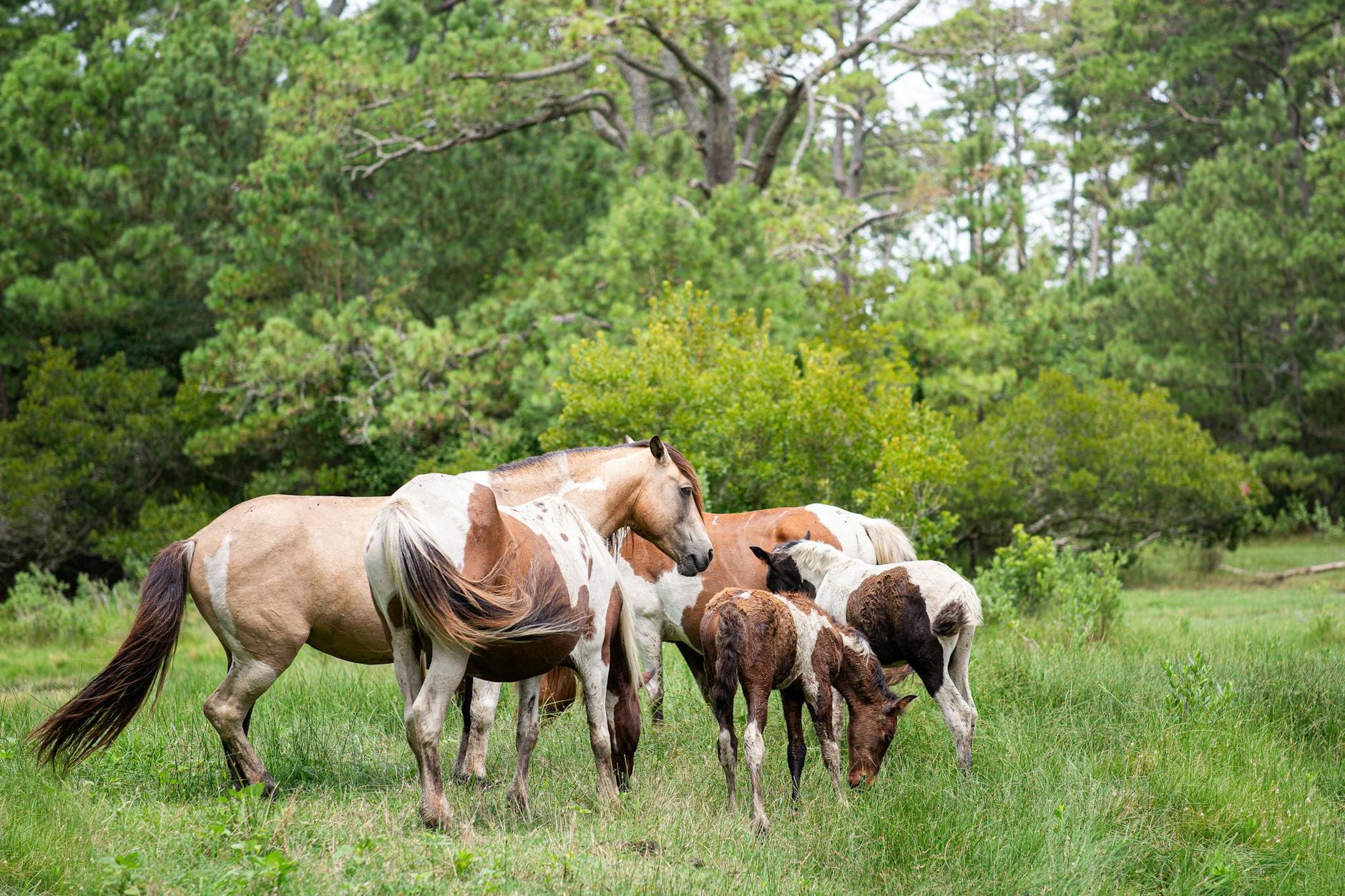
Arrive by 7:30am and the meadows are yours — cool air still holding the night's chill, mist ghosting off the ridgelines, and if you're lucky, a small band of ponies grazing unbothered thirty feet off the trail. By 9am, weekend crowds start filling the lower meadows, so this early window is worth the alarm clock. Solo travelers find this an easy, social trail — expect friendly nods from other early hikers and photographers.

From Grayson Highlands, the trail toward Mount Rogers climbs through spruce-fir forest that mutes sound to almost nothing — just your own footsteps and the occasional creak of wind-bent trees. For a first day, aim for a shorter approach rather than a full summit push; the goal today is orientation, not exhaustion, so 3 hours out-and-back through the lower forest and rhododendron thickets is plenty. Late June brings pink blooms that contrast beautifully against far ridgelines.

The day begins in hushed highland meadows, where wild ponies move unhurried through the grass and the only real decision is how close to get before pulling out the camera. Early arrival means the trail is nearly silent — just wind, birdsong, and the occasional distant whinny.
By midday, the terrain shifts into denser forest as the trail toward Mount Rogers climbs gently through spruce-fir stands. This is a shorter, gentler introduction to the mountain rather than a full summit attempt — enough to feel the scale of the place without overextending on day one.
With no dining data mapped directly to this cluster, plan your evening meal in town rather than at the trailhead — pack extra trail snacks for the day and settle into wherever you're staying with an easy, unhurried night.
Day 2: Summit Push and Wind-Scoured Rock
The most physically demanding day, with a full summit approach to Mount Rogers covering 5-6 miles round trip at high exertion.
This is the day's centerpiece — a full summit approach starting before sunrise to beat both the heat and the afternoon thunderstorm risk that builds through summer afternoons. The forest thins as elevation climbs, cold air sharpening against your face, until wind-scoured rock and 360-degree ridge views emerge from the mist. Solo hikers should log their route with someone before setting out; the trail sees other hikers on weekends, offering natural checkpoints and occasional trail conversation, but weekday mornings can be solitary in the best way.
After the summit's intensity, the highland meadows feel almost gentle — a lighter, restorative walk back through pony territory as afternoon light softens and crowds thin from their midday peak. This is a good stretch to slow down, sit on a rock, and simply watch the ponies graze rather than chase another vigorous mile.
Before sunrise, the trail up Mount Rogers is nearly silent except for your own breathing and boots on packed earth. The forest changes character as you climb — hardwoods give way to spruce-fir, then to open rock — until the summit delivers a horizon that seems to fold in from every direction at once.
The descent back into Grayson Highlands feels like exhaling. Ponies still graze in the meadows, afternoon light now softer and more golden than the morning's cool tones, and the pace naturally slows to match tired legs and a satisfied, quieter mind.
With no specific dining options mapped to this remote cluster, treat tonight as a low-key one — plan your meal around wherever you're staying rather than expecting trailside options, and let an early night set in after the day's exertion.
Day 3: Rolling Down the Rail-Trail
A gentler final day covering the Virginia Creeper Trail's scenic descent by bike, roughly 15-20 miles of easy trail riding, followed by evening in town.
Arrive at the Wheatland trailhead by 8am, before the shuttle vans and weekend cyclists arrive in force, and the trail feels like it belongs entirely to you — gravel crunching underfoot or tire, Laurel Creek rushing somewhere just out of sight through hemlock and rhododendron. The descent toward Damascus loses elevation steadily, so the ride feels easier than it looks on a map, and solo cyclists often find themselves chatting with fellow riders at trestle overlooks — a naturally social trail.
The Creeper Trail unspools ahead in long green curves, creek sound tracking alongside for miles, trestles arriving one after another like punctuation marks in the descent. Riding solo here doesn't feel lonely — other early cyclists nod and chat at overlooks, and the trail's gentle grade makes conversation easy even while moving.
As the trail nears Damascus, the corridor opens into farmland and open meadow, ridge lines framing the approach. This is a natural point to slow the pace, return the bike, and let the morning's momentum settle into a more relaxed afternoon exploring the small trail town on foot.
With no specific restaurant data mapped to this corridor, plan your final dinner in town rather than expecting trailside dining — small-town kitchens here tend to close early, so aim to be seated by 7 or so, and consider bar seating if you're hoping for one more easy conversation before heading home.
Want to tweak this trip?
Our AI planner can customize this itinerary to your exact dates, interests, and travel style.
Customize This ItineraryRestaurant details (hours, menus, availability) change frequently. Check current hours before visiting, especially in seasonal destinations.
Dietary compatibility tags are general guidance. If you have severe allergies, confirm directly with the restaurant.
Travel tips are general guidance, not professional safety advice. Check government advisories for latest information.
All prices are approximate and may vary seasonally.