Blue Ridge Highlands (Bristol, Abingdon), Virginia
3-Day Itinerary for Solo Traveler
“Ridgeline Solitude: Three Winter Days in the Blue Ridge Highlands”
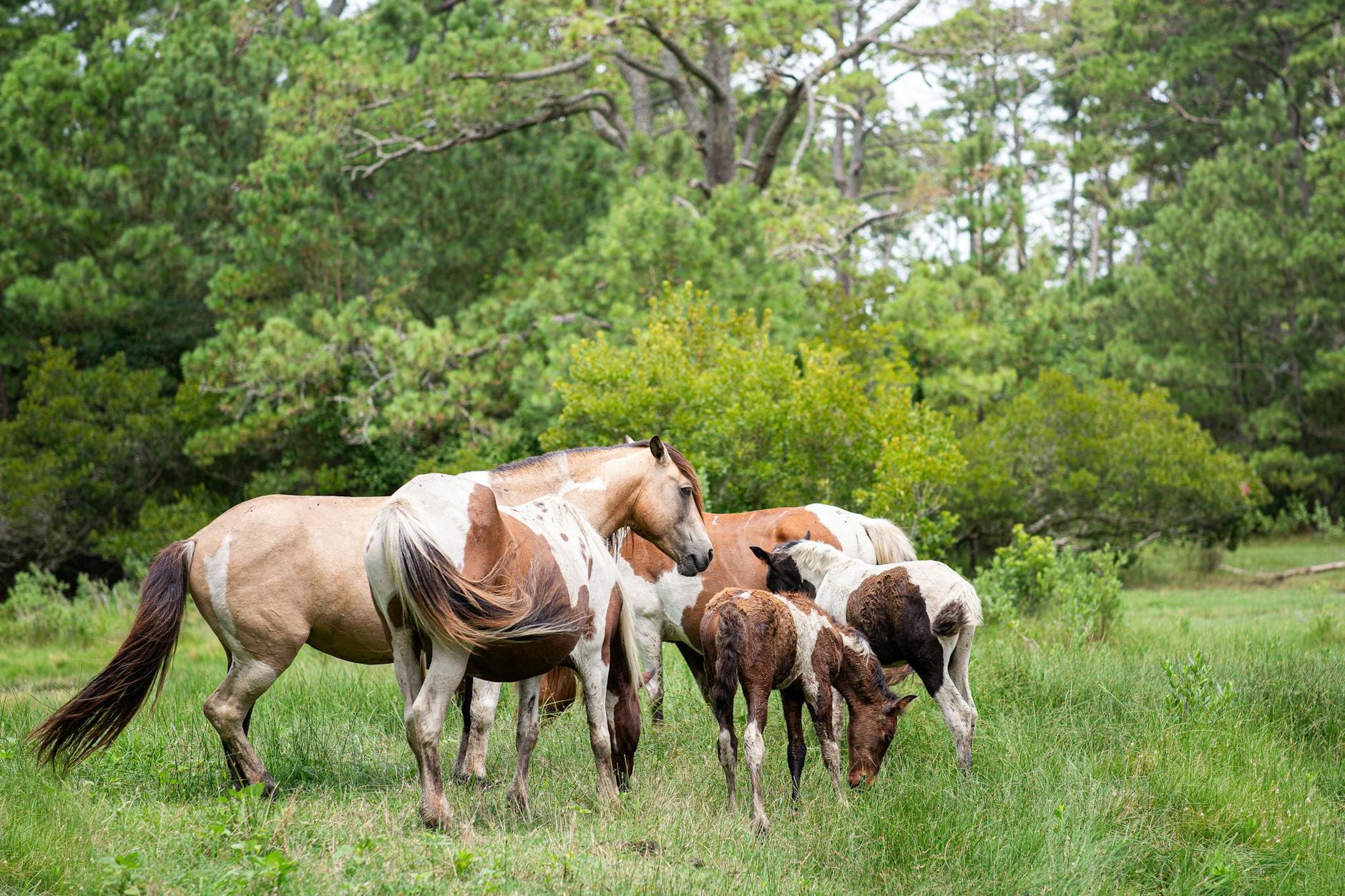
Winter strips the Blue Ridge Highlands down to bone and breath — bare ridgelines, thin cold air, and trails you'll likely have entirely to yourself. This is solo travel at its most restorative: small mountain towns that don't rush you, wild ponies cutting dark shapes against frosted meadows, and long unhurried evenings where a bar seat and a bowl of something warm feel like plenty.
At a Glance
Highlights
- Wild ponies grazing frost-tipped highland meadows with almost no one else around
- Winter-quiet views from Wilburn Ridge toward Tennessee's hazy ranges
- A gentler, flatter stretch of the Virginia Creeper Trail near Abingdon, ideal for a solo half-day walk
- Early-arrival solitude at Grayson Highlands before weekend crowds (if any) show up
- Small-town evenings in Bristol and Abingdon built for solo diners — bar seats, live music, easy conversation
- Cold, clear mountain air and 360-degree ridge views with almost zero summer haze
Day-by-Day Plan
Day 1: Arrival & the Long Climb into Highland Quiet
A lighter arrival day that eases into the region with an afternoon introduction to Grayson Highlands before settling into Abingdon or Bristol for the evening — roughly 3-4 miles of easy-to-moderate walking.
After the drive in, let the highlands do the work of resetting your nervous system: wind-scoured meadows roll out in every direction, and if you're lucky, a small band of wild ponies will be grazing in the near distance, breath visible in the cold air. Winter thins the crowds to almost nothing on a weekday, so the quiet feels complete — just wind, the occasional whinny, and your own footsteps on frozen grass. Keep a respectful distance from the ponies; they're wild, not petting-zoo tame, no matter how calm they look.

Arrival day starts slow and deliberate — settle into your accommodation, check the weather and road conditions for the highlands, and let travel fatigue burn off before heading anywhere strenuous.
Head up into Grayson Highlands for a gentle, low-stakes introduction to the region's wild character: open meadows, cold clean air, and — with some luck — a distant view of the resident ponies moving across frosted grass. This is intentionally short and unhurried, just enough to feel the scale of the place without pushing into the more demanding Mount Rogers terrain reserved for tomorrow.
Retreat down into Abingdon or Bristol as the early winter dusk settles in around 5:15 PM. Look for a bar seat at a local spot with a warm menu and a bit of live music if it's a weekend — solo diners are entirely at home in these small-town rooms, and striking up conversation with a bartender or fellow traveler is practically the local custom.
Day 2: Into Thin Air: Mount Rogers and the Ridge
The trip's most demanding day — a full push toward Mount Rogers' summit approach and surrounding ridgeline, roughly 5-6 miles of intense hiking with real elevation and winter exposure.
Arrive by 7:30 AM and the trailhead will be nearly empty — in winter, doubly so, with just your boots crunching frost and the occasional creak of spruce-fir branches overhead. The climb toward Virginia's highest point moves through dense conifer forest before opening onto wind-scoured rock and 360-degree views stretching toward Tennessee on a clear day; this is solitude in its most literal form, your own heartbeat the loudest thing on the mountain. Turn back immediately if weather closes in — the exposed summit approach carries real risk in wind, ice, or low visibility, and there's no cell signal to call for help up here.

Set out early while frost still clings to the trees — the trail climbs steadily through spruce-fir forest, cold thin air sharpening every sound, until the trees thin and the ridge opens into wide, wind-raked views. This is the physical and emotional center of the trip: demanding, quiet, and entirely worth the effort for a solo traveler seeking real solitude.
Descend at your own pace, giving yourself room to rest, refuel, and photograph the light as it shifts lower across the ridgelines. By early-to-mid afternoon, the drive back down into the valley feels like a return to warmth and civilization after hours in thin mountain air.
Reward the effort with a hearty dinner in town — legs tired, appetite sharp, and the kind of satisfied quiet that comes after a demanding day outdoors. An early night is well earned; tomorrow's pace is gentler.
Day 3: Trestles, Creek Song, and a Slow Goodbye
A lighter closing day along a gentler stretch of the Virginia Creeper Trail followed by unhurried time in Abingdon or Bristol before departure — roughly 3-4 miles of easy, flat walking.
Arrive by 8:30 AM and the trail near Abingdon will be close to silent — just gravel crunching underfoot and Laurel Creek running cold and clear through gaps in bare hemlock and rhododendron. Winter strips the foliage back, opening longer sightlines to the restored trestles and creek crossings that make this rail-trail famous, and the flatter sections near town make for an easy, contemplative walk rather than yesterday's exertion. It's an ideal solo pace-setter: no rush, no crowd, just steady footfall and cold, clean air.
Ease into the final day with a quiet walk along the flatter, creek-side stretch of the Virginia Creeper Trail — a deliberate contrast to yesterday's summit push, all soft light, running water, and unhurried footsteps.
Let the rest of the day stay loose: wander Abingdon's or Bristol's downtown streets, pick up any last local goods, and take a final unhurried look at the mountains from town level before the drive back toward the airport or home.
If departure timing allows, close with one more easy dinner in town — a last taste of Appalachian comfort food and small-town warmth before heading out, the ridges fading into the rearview mirror as the light drops early into winter dusk.
Want to tweak this trip?
Our AI planner can customize this itinerary to your exact dates, interests, and travel style.
Customize This ItineraryRestaurant details (hours, menus, availability) change frequently. Check current hours before visiting, especially in seasonal destinations.
Dietary compatibility tags are general guidance. If you have severe allergies, confirm directly with the restaurant.
Travel tips are general guidance, not professional safety advice. Check government advisories for latest information, especially regarding winter mountain road conditions.
All prices are approximate and may vary seasonally.