North Cascades NP (Diablo Lake, Ross Lake), Washington
2-Day Itinerary for Couples
“Turquoise Light: Two Days Among the North Cascades' Wild Peaks”
Glacial melt paints Diablo Lake an impossible shade of turquoise, and in spring the passes still wear traces of snow above meadows just beginning to bloom. This is a landscape that asks for patience and rewards it with silence, scale, and the kind of light that makes couples stop talking and just look.
At a Glance
Highlights
- Standing above Diablo Lake's unreal turquoise water at first light
- Watching mist lift off Ross Lake with almost no one else around
- A high-alpine ridge walk with wildflowers just starting to open
- Sunset at Washington Pass, 5,477 feet above the valley floor
- Slow mornings with no agenda but the mountains themselves
- A splurge-worthy scenic drive that feels like its own reward
Day-by-Day Plan
Day 1: First Light on Turquoise Water
A gentle, low-effort day of scenic overlooks and easy walking (under 1 mile total) to settle into the park's rhythm and let the landscape do the work.
Arrive before 8am and the overlook is nearly yours alone — the water sits impossibly turquoise against dark conifer slopes, and the only sounds are wind, the occasional raven, and the distant hum of the dam. This is the park's signature view, and for couples it's a genuinely still, unhurried moment before the day's first tour buses arrive.
A short drive east brings a second, quieter dose of turquoise water framed by conifers — less visited than Diablo, so the mood here is more private, almost secretive. Lean on the cold guardrail together and let the scale of the peaks settle in; this is a good spot for slow conversation rather than checklist sightseeing.

The day begins deliberately slow and early — arriving at Diablo Lake Overlook while the light is still soft and the parking area empty. The turquoise water seems almost artificial against the granite and pine, and for a few quiet minutes it's just the two of you, the wind, and the occasional raven overhead. This is the kind of stop that rewards patience rather than movement — no rush to the next thing.
After Ross Lake's quieter, more intimate overlook, the rest of the day opens up with no fixed plan — a chance to picnic with supplies picked up in Concrete or Marblemount, wander along the highway pullouts, or simply sit with the scenery. Given the light walking load so far, this is an ideal afternoon to rest before tomorrow's more demanding pace.
As dusk settles over the peaks, head back toward Concrete or Marblemount for dinner — options are limited this deep into the gateway region, so plan meals around town rather than expecting anything trailside. A simple, unhurried dinner and an early night set up well for tomorrow's early start.
Day 2: Ridge Light and Mountain Air
A more ambitious day combining a moderate-to-strenuous ridge hike with a dramatic mountain pass finale — expect 3-4 miles of walking and a full day of shifting terrain and light.
Starting this loop before 8am means near-solitude on the switchbacks and the best chance of catching wildflower meadows and turquoise tarns in soft morning light — by mid-morning, this trail fills fast on any clear spring day. The climb is real work, but the payoff is a 360-degree alpine panorama that feels earned rather than handed to you, and for couples, the shared effort tends to sharpen the moment at the top.

This is the day's splurge moment — not in cost, but in experience: standing at 5,477 feet as the light turns gold and then rose across the jagged ridgelines, with Diablo Lake glinting far below. Arrive by early evening to claim a spot at the stone-railed overlook before sunset crowds gather, and let the thin air and long views close the trip on the highest possible note.
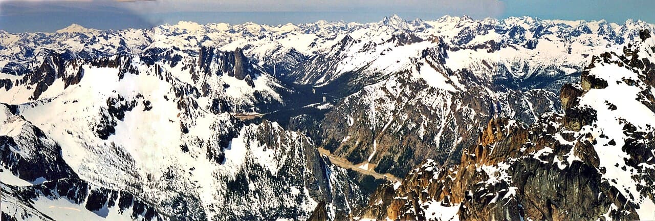
The day begins early and deliberately, with boots on the trail before the crowds arrive at Maple Pass Loop. Wildflowers are just starting to open at lower elevations, granite switchbacks give way to open ridgeline, and the turquoise tarns below catch the light in a way that makes every rest stop worth lingering over. It's a full-body, full-attention morning — the kind that leaves couples quietly proud of each other by the summit.
With the loop complete, the afternoon shifts into recovery mode — a slow lunch with packed supplies, tired legs, and the long, scenic drive east toward Washington Pass. The valley scenery does a lot of the entertaining here, so there's no rush; treat the drive itself as part of the day's pacing rather than a gap between activities.
The day closes at Washington Pass, where the light turns the granite walls gold and then rose, and the valley falls into shadow far below. This is the trip's high point, literally and emotionally — a quiet, cold, awe-filled place to end things before heading back toward a gateway town for a well-earned dinner and rest.
Want to tweak this trip?
Our AI planner can customize this itinerary to your exact dates, interests, and travel style.
Customize This ItineraryRestaurant and dining availability in this remote region change frequently and are limited overall — always confirm current hours and options before relying on them, and pack backup meals for trail days.
Dietary compatibility tags are general guidance. If you have severe allergies, confirm directly with any restaurant or service provider.
Travel tips are general guidance, not professional safety advice. Always check current trail conditions, weather forecasts, and government advisories before heading into the backcountry.
All prices are approximate and may vary seasonally.
Attractions in This Itinerary
More Itineraries for North Cascades NP (Diablo Lake, Ross Lake)
Explore Washington