Driftless Area (Southwest), Wisconsin
3-Day Itinerary for Active Retirees
“Bluffs, Caves & River Light: 3 Days in the Driftless”
Winter strips the Driftless Area down to its bones — bare limestone bluffs against pale sky, frozen coulees holding their breath, and the deep quiet of a landscape the glaciers never touched. This is slow travel by design: short days, warm cave air, hearty tavern food, and long views that don't need summer crowds to feel enormous.
At a Glance
Highlights
- Sunrise stillness over Cox Hollow Lake at Governor Dodge
- Descending into the year-round 50°F chambers of Cave of the Mounds
- Quiet winter drive along the Kickapoo River's frozen bends
- Standing where the Wisconsin and Mississippi Rivers meet at Wyalusing's Tower Hill overlook
- Hearty Midwestern tavern dinners with unhurried, uncrowded seating
- Ancient effigy mounds under bare hardwood canopy
- Genuinely empty trails and overlooks — this region in winter belongs to locals and the patient traveler
Day-by-Day Plan
Day 1: Settling Into Bluff Country
A gentle first day easing into the region with one easy state park visit and a warm underground cave experience, totaling under 1.5 miles of walking.
In winter the lake goes still and silver, rimmed in frost, and the limestone cliffs above Cox Hollow stand starker without summer's green softening their edges. Arrive by mid-morning once the roads have had time to clear of overnight ice, and you'll likely have the overlook entirely to yourself — just the occasional call of a woodpecker echoing off bare rock. Stick to the flatter loop near the lake rather than the steeper bluff trails, which can hold ice in shaded stretches; benches along the shoreline path offer easy rest points.

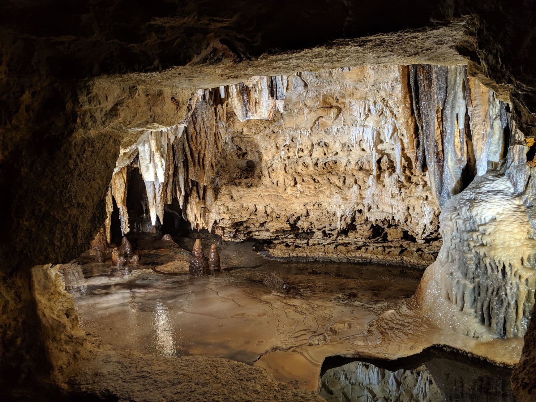
Descending into the cave feels like stepping out of winter entirely — the air turns soft and mineral-scented, a constant 50 degrees regardless of the ice above, and the path curves past calcite formations that catch the low lighting like carved glass. This is an ideal winter afternoon stop for this pace: level underground walkways, frequent pauses at formations, and no weather to contend with at all. Go early afternoon on a weekday and the chambers stay hushed enough to hear your own footsteps.
The first morning stays deliberately unhurried — settle into the rhythm of the Driftless with an easy loop near Cox Hollow Lake at Governor Dodge State Park, where winter has quieted the whole landscape to bluffs, still water, and bare trees. There's no rush to cover ground; this is about orientation, not exertion.
From the park, a short drive through frost-dusted farmland delivers you to Cave of the Mounds, where the temperature swings from biting cold to a gentle, cave-constant 50 degrees. The pace slows further underground — a level path, frequent stops at glinting formations, and no weather at all to think about.
With the short winter daylight fading by late afternoon, settle into your Dodgeville-area lodging for an early, easy evening — this small town's restaurants tend to wind down by 8pm, so plan for an early dinner and a quiet night in ahead of tomorrow's longer drive toward the Kickapoo Valley.
Day 2: Frozen Bends of the Kickapoo
A scenic, low-exertion day following the Kickapoo River valley through its bohemian river towns, with under 2 miles of easy walking across scenic pullouts and short paths.
In winter the Kickapoo slows to a dark ribbon between ice-crusted banks, its rust-red cliffs stripped bare and looking taller for it against the pale sky. Rather than a paddling day, this becomes a scenic driving-and-overlook morning — pulling off near the bridge at Ontario or the bluffs north of Readstown, stepping out briefly to take in the gorge framing, then warming back up in the car between stops. Arrive by mid-morning once any overnight frost has burned off the roads, and expect near-total solitude — this stretch empties out completely once summer paddlers are gone.
The morning unfolds slowly along the Kickapoo, trading yesterday's structured stops for a loose scenic drive through the river valley's frozen bends — pulling off wherever the light or the cliffs demand a pause, then retreating to warmth between them.
With the shortest daylight of the trip framing the afternoon, this is a good stretch to simply let the valley towns of Soldiers Grove and Gays Mills pass by the window — their bohemian, unhurried character evident even in winter's quiet, with little pressure to stop unless something catches the eye.
Head back toward lodging with plenty of daylight buffer, since river-valley roads deserve extra caution after dark; plan an early dinner given how quickly small-town Wisconsin restaurants close for the evening, and let the day's slower pace carry into a relaxed night in.
Day 3: Where Two Rivers Meet
A final day centered on Wyalusing State Park's dramatic overlooks, with light walking on scenic bluff paths totaling under 2 miles.
Winter is arguably this park's finest season for photography — bare trees open up sightlines across the confluence that summer foliage would otherwise block, and the crowds that fill the bluffs May through September vanish entirely, leaving Tower Hill's overlook silent but for wind moving through the valley. Arrive shortly after sunrise for the softest light on the water where the Wisconsin meets the Mississippi below, and take the short, well-defined path to the main viewpoint rather than the steeper mound trails, which hold ice longer in shaded sections. Effigy mounds nearby take on a stark, quiet dignity under bare hardwood canopy — worth the short additional walk if footing allows.

The trip closes at its most dramatic vantage point — Wyalusing's Tower Hill overlook, where winter's bare trees and empty trails let the confluence of the Wisconsin and Mississippi Rivers unfold with almost startling clarity. Early arrival rewards with soft light and total stillness, a fitting quiet note to end on.
With the morning's overlook as the day's centerpiece, the afternoon can stay unstructured — a slow walk toward the mound clusters if footing allows, or simply lingering near the visitor center absorbing the valley's history before beginning the drive home.
As the shortest days of the year draw the light down early, plan the return drive or final dinner in Prairie du Chien with plenty of buffer before dark, closing the trip the way it began — unhurried, and attentive to the quiet drama of a landscape the glaciers never reached.
Want to tweak this trip?
Our AI planner can customize this itinerary to your exact dates, interests, and travel style.
Customize This ItineraryRestaurant details (hours, menus, availability) change frequently, especially in winter when small-town establishments may reduce hours or close certain days — check current hours before visiting.
Dietary compatibility tags are general guidance. If you have severe allergies, confirm directly with the restaurant.
Travel tips are general guidance, not professional safety advice. Check road condition reports and government advisories for the latest winter driving information.
All prices are approximate and may vary seasonally.