3 DaysSolo Traveler6 Stops

Driftless Area (Southwest), Wisconsin

3-Day Itinerary for Solo Traveler

β€œBluffs, Ice, and Quiet Rivers: A Solo Winter Passage Through the Driftless”
Bluffs, Ice, and Quiet Rivers: A Solo Winter Passage Through the Driftless

In winter, the Driftless Area empties out and goes quiet β€” snow settles into the coulees, the rivers run dark against white banks, and the bluffs stand starker without their green cover. This is a landscape built for solitude: three days of underground crystal chambers, frozen overlooks, and small-town taverns where a solo traveler at the bar is simply part of the evening.

At a Glance

Climate & Weather
Expect cold, dry air with highs often in the 20s–30sΒ°F and lows well below freezing; 17–40cm of snow can fall monthly December–March. Pack thermal base layers, an insulated waterproof coat, wool socks, waterproof boots with good tread, gloves, and a hat that covers ears. Days are short β€” full dark by 5pm β€” so plan outdoor stops accordingly.
Getting Around
A car is essential β€” this is a rural, spread-out region with no public transit between clusters. Roads are well-maintained but winding; allow extra time after snowfall for plowing. Fill up on gas before heading into more remote stretches, as stations thin out between towns.
Budget
Plan roughly $60–90/day for a solo traveler covering meals, park admission, and the cave tour β€” Wisconsin's small-town dining is affordable, and winter admission to state parks is a modest daily vehicle fee.
Safety
This is quiet, low-crime rural terrain, but winter driving on narrow, hilly back roads is the real hazard β€” reduce speed, watch for black ice on shaded curves, and keep a charged phone and blanket in the car. Deer are highly active at dawn and dusk, so be alert on rural roads during those hours. Trails can be icy underfoot even when they look packed and safe; microspikes are worth packing.
Connectivity
Cell coverage is generally reliable in and around towns like Dodgeville and Prairie du Chien but can drop to one bar or nothing in the deeper river valleys and inside Cave of the Mounds. Download offline maps before setting out each day, and don't count on streaming anything in the coulees.
Local Tips
Winter is the region's quietest season outside the ski/snow crowds β€” you'll often have overlooks and trails to yourself, so arrive early for the best light and total silence. Many small restaurants close by 8pm and some shut entirely on Mondays, so plan dinner earlier than you might elsewhere. Ask at the bar β€” locals in these small taverns are used to solo travelers and often the best source of current road and trail conditions.

Highlights

  • Underground warmth at Cave of the Mounds while snow falls outside
  • Snow-hushed bluff trails at Governor Dodge with almost no other footprints
  • A frozen-edge look at the Kickapoo River cutting through red cliffs
  • Sunset from Wyalusing's Tower Hill over the frozen confluence of two rivers
  • Small-town Dodgeville dining where solo travelers pull up a stool and talk to strangers
  • Ancient effigy mounds dusted in snow, utterly silent in winter light

Day-by-Day Plan

Arrival & orientation

Day 1: Settling In: Caves, Cliffs, and a Quiet First Night

A gentle first day mixing an indoor cave tour with light outdoor exploration in Governor Dodge State Park, totaling under 3 miles of walking.

Wear
Layered thermal base with a warm mid-layer for the cave (55Β°F year-round, but damp), plus your full winter shell, waterproof boots, and gloves for the outdoor portion at Governor Dodge.
Budget
$55-75 (cave admission, park vehicle fee, dinner, incidentals)
9:30 AM - 11:00 AM
Cave of the Mounds Β· morning Β· 90 min Β· Governor Dodge & Dodgeville

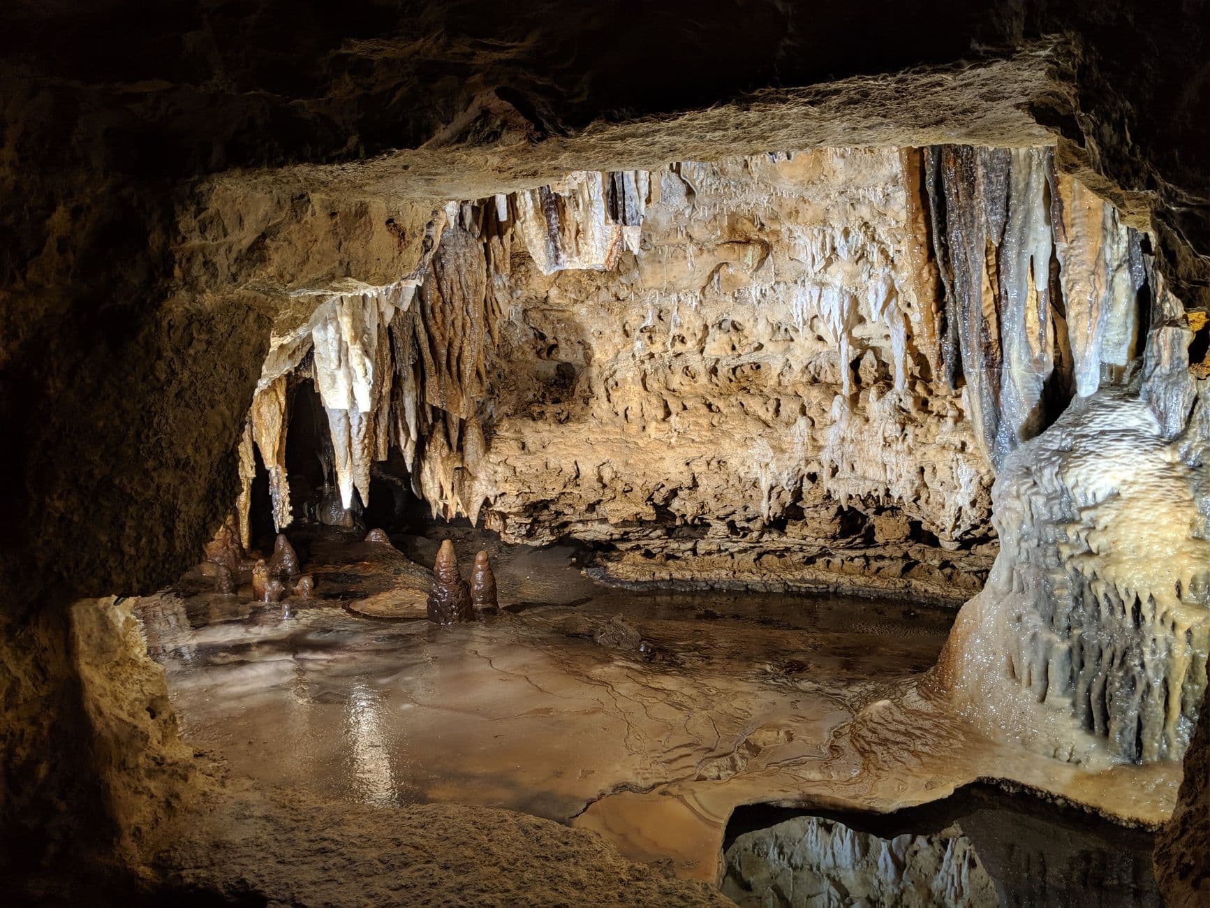
Arrive right at opening and you'll likely have the narrow stone passages nearly to yourself β€” no jostling for the underground lake reflection or the stalactite canopy that photographs so well when nobody's shoulder is in the frame. The air stays a constant cool 50-some degrees no matter what's happening in the snow above, and the hollow echo of your own footsteps becomes oddly meditative. It's an easy, low-effort way to ease into the trip before your legs get any colder outdoor mileage.

Cave of the Mounds
Photo by Manju Raj on Pexels
The main chamber's illuminated crystal formations photograph best early, before condensation from larger tour groups fogs the lighting β€” bring a tripod-friendly hand for slower shutter speeds in low light.
Paths inside are uneven stone with some low clearances; not fully wheelchair accessible, but manageable at a slow pace with sturdy footwear.
25 min drive β€” A short country-road drive past snow-dusted farmsteads and grazing cattle, radio off, windows fogging slightly from the cave's lingering dampness on your coat.
12:30 PM - 3:00 PM
Governor Dodge SP Β· afternoon Β· 150 min Β· Governor Dodge & Dodgeville

By afternoon the light in the Driftless goes low and gold even in winter, and the bluffs above Cox Hollow Lake take on a stark, sculptural quality against the snow. Stick to the shorter, well-tracked trails near the lake overlook rather than attempting the full Lost Valley loop in icy conditions β€” this is about quiet immersion, not endurance. Expect near-total solitude on a winter weekday; you may hear nothing but your own boots on packed snow and the occasional call of a pileated woodpecker.

Governor Dodge SP
United States. Agricultural Marketing Service / wikimedia (Public domain)
Head to the Cox Hollow Lake overlook in early-to-mid afternoon when the low winter sun rakes across the frozen lake surface and limestone cliffs.
Main overlook areas are reachable via flatter paths, but most trails involve uneven, potentially icy terrain β€” microspikes recommended.
If it rains: If snow or freezing rain complicates the outdoor portion, extend time at Cave of the Mounds (fully indoors and weather-proof) or use Governor Dodge's small visitor center and covered picnic facilities for a shorter, sheltered visit before returning another day for the full trail experience.

Ease into the trip underground, where Cave of the Mounds offers a windless, temperature-stable introduction to the region's geology β€” no battling cold or ice on day one, just crystalline chambers and quiet stone corridors that feel worlds away from the snow outside.

Emerge into the crisp cold and drive the short stretch to Governor Dodge State Park, where the afternoon light turns the bluffs above Cox Hollow Lake gold and blue. Keep the walking light and the pace unhurried β€” this is about acclimating to the cold and the rhythm of the place, not covering ground.

Head into Dodgeville as the light fades before 5pm, settle into your lodging, and use the evening to rest β€” dinner options in small Wisconsin towns tend to wind down by 8pm, so eat on the earlier side and treat tonight as a low-key reset before two fuller days ahead.

River valley solitude

Day 2: Down to the River: Kickapoo Valley in Winter Hush

A moderate day centered on the frozen, bluff-lined Kickapoo River corridor, with roughly 2-3 miles of walking across scenic pullovers and short trail sections.

Wear
Full winter layering system β€” insulated waterproof boots, wool socks, hand warmers, and a windproof outer shell, since river valleys hold cold air and wind funnels between the bluffs.
Budget
$40-60 (fuel, lunch, minor incidentals β€” no major admission fees along this route)
55 min drive β€” A longer, winding country drive west through rolling coulee farmland β€” worth a pullover partway if you spot a good overlook, since the road itself offers glimpses of the valley dropping away below.
9:00 AM - 11:00 AM
Kickapoo River Β· morning Β· 120 min Β· Kickapoo River Valley

Arrive early, before 9am if possible, and the river valley belongs almost entirely to you β€” the current runs dark and slow between snow-crusted banks, rust-red cliffs rise abruptly from the forest, and if you're lucky a bald eagle will cut across the gorge overhead. This is prime solo-photography territory: multiple vantage points along the bridge at Ontario and the bluffs north of Readstown offer dramatically different framings of the same winding river.
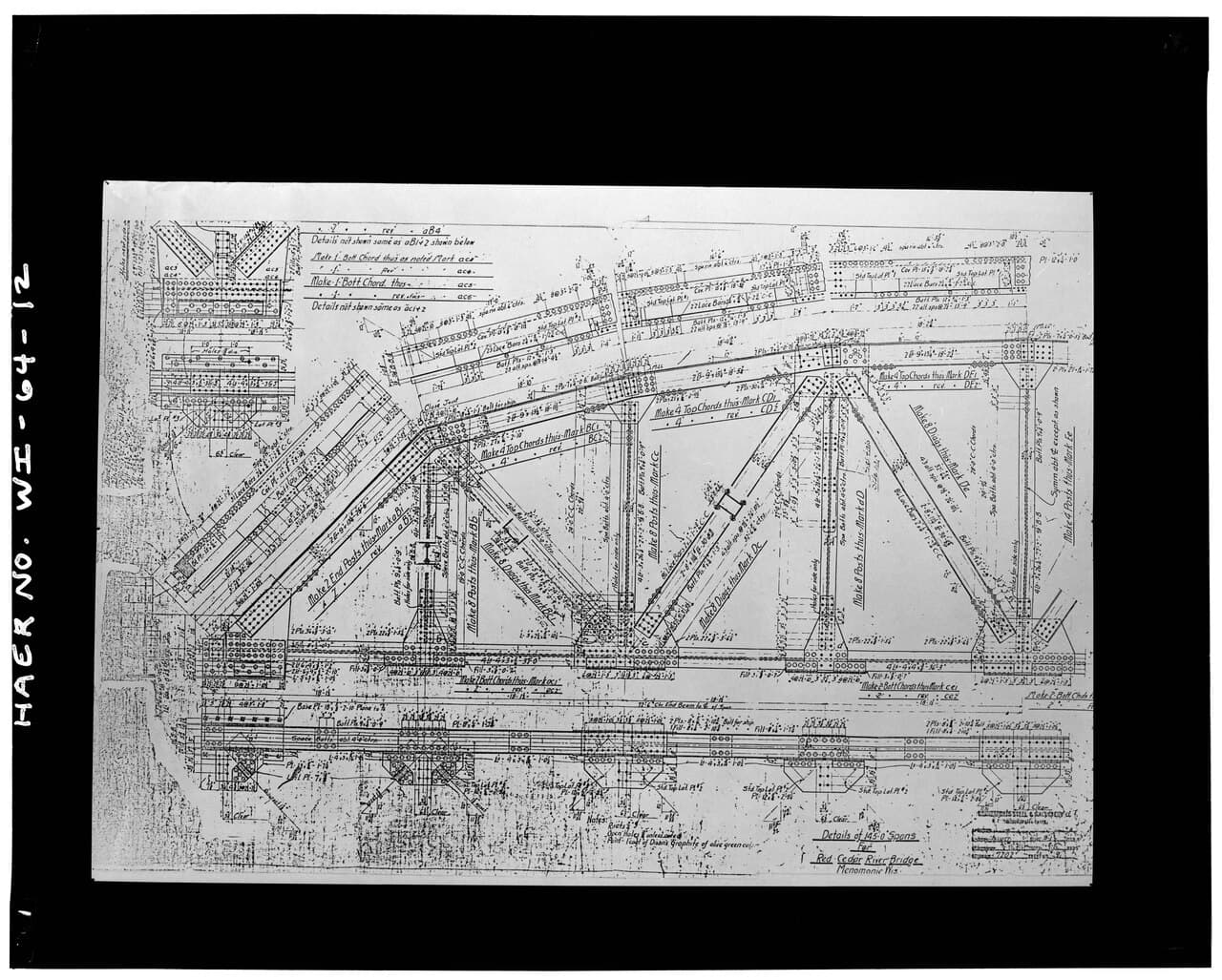
Kickapoo River
Unknown / wikimedia (Public domain)
Shoot the bridge at Ontario mid-morning when low sun cuts sideways into the gorge, throwing long shadows across the ice and rock face.
Most river access points involve uneven, potentially icy ground; accessible viewing is limited mainly to paved pullouts near parking areas.
Optional detour: Kickapoo River β€” Between the morning viewpoint near Ontario and the afternoon stretch near Readstown
A second vantage point along the same river lets you compare the gorge framing at the bridge with the wider river-bend views near the Readstown bluffs, doubling your photography options without adding a new cluster. Skip if: If the cold is cutting into your energy or ice conditions look unstable underfoot, one solid viewpoint is enough to capture the valley's character β€” skip the second stop and head into town to warm up instead.
If it rains: Heavy rain or ice storms make riverside trails genuinely hazardous β€” if conditions turn, retreat into one of the small Kickapoo Valley towns like Soldiers Grove or Gays Mills to explore the local arts and shop scene under cover rather than pushing further along exposed bluff trails.

Spend the morning tracing the Kickapoo River's frozen edges, where towering rust-colored cliffs and snow-quiet forest create a hush that's rare to find even in summer. Move slowly between viewpoints, letting the cold, mineral-clean air and the sound of moving water under ice set the pace.

With the main river stop behind you, ease into the bohemian small towns strung along the valley β€” Soldiers Grove and Gays Mills carry an artsy, unhurried character even in the dead of winter, and a slow walk through their main streets makes a gentle counterpoint to the morning's cold exposure.

Wind down early in one of the valley towns; with dinner options limited and many kitchens closing by 8pm, aim to eat on the early side, then retreat indoors as temperatures drop sharply after sunset.

Historic bluffs & departure

Day 3: Confluence and Farewell: Wyalusing's Winter Overlooks

A moderately paced final day exploring the dramatic bluff-top views at Wyalusing State Park, covering roughly 2 miles of trail before departure.

Wear
Warmest layer of the trip β€” exposed ridge-top overlooks catch full winter wind, so a heavyweight coat, insulated gloves, and a face-covering scarf or balaclava are worth having.
Budget
$30-50 (park vehicle fee, lunch, fuel for departure)
50 min drive β€” A scenic final push south along river-adjacent roads, with occasional glimpses of the Mississippi valley opening up between snow-covered bluffs.
9:00 AM - 12:00 PM
Wyalusing State Park Β· morning Β· 180 min Β· Wyalusing & Prairie du Chien

Arrive early β€” by 9am the ridge-top overlooks are silent, and in winter you may not see another soul the entire morning. From Tower Hill, the confluence of the Mississippi and Wisconsin Rivers spreads out below in a vast, pale sweep, often with mist rising where open water meets ice. The ancient effigy mounds nearby take on a stark, almost solemn quality dusted in snow, a quiet reminder of how long this landscape has drawn people to its edges.

Wyalusing State Park
Delaware Valley Milk Marketing Area. Market Administrator / wikimedia (Public domain)
Reach the Tower Hill bluff overlook as early as safely possible after sunrise for soft, low-angle light across the confluence and minimal haze in the winter air.
Wheelchair access is limited across the park; scenic overlooks near parking areas offer the most accessible views, but the main bluff trails involve uneven, often icy terrain.
Optional detour: Wyalusing State Park β€” After the Tower Hill overlook and before heading to Prairie du Chien
Extending time among the prehistoric mound clusters rewards visitors interested in the region's deeper human history, and winter's stillness makes the site feel especially contemplative. Skip if: If you're pressed for time before departure or the wind on the ridge is severe, prioritize the main confluence overlook and skip the extended mound exploration.
If it rains: If icy conditions or freezing rain make the bluff trails unsafe, shift time to the park's small visitor center for mound history and forest interpretation, or use covered picnic pavilions for a shorter, sheltered visit to the site before departure.

Spend the morning on Wyalusing's ridge trails, where the confluence of two great rivers unfolds below in near-total winter silence β€” this is the trip's most dramatic view, and having it essentially to yourself is one of the clearest rewards of visiting in the cold season.

With the morning's main hike complete, ease toward Prairie du Chien for a final look at the historic riverfront town before starting the drive home, letting the pace slow naturally as the trip winds down.

Plan your departure to avoid driving the rural roads after dark, when deer activity peaks and ice becomes harder to spot β€” aim to be well on your way home before dusk settles over the coulees.

Want to tweak this trip?

Our AI planner can customize this itinerary to your exact dates, interests, and travel style.

Customize This Itinerary
Good to Know

Restaurant details (hours, menus, availability) change frequently, especially in small seasonal towns. Check current hours before visiting.

Dietary compatibility tags are general guidance. If you have severe allergies, confirm directly with the restaurant.

Travel tips are general guidance, not professional safety advice. Check road condition reports and government advisories for the latest winter driving information.

All prices are approximate and may vary seasonally.
We use cookies to improve your experience and analyze site usage. Essential cookies are always active. You can customize your preferences or accept all cookies. Cookie Policy