2 DaysCouples3 Stops

Wind River Range (East side), Wyoming

2-Day Itinerary for Couples

β€œGranite and Glacial Water: Two Days on the Wind River's Eastern Edge”
Granite and Glacial Water: Two Days on the Wind River's Eastern Edge

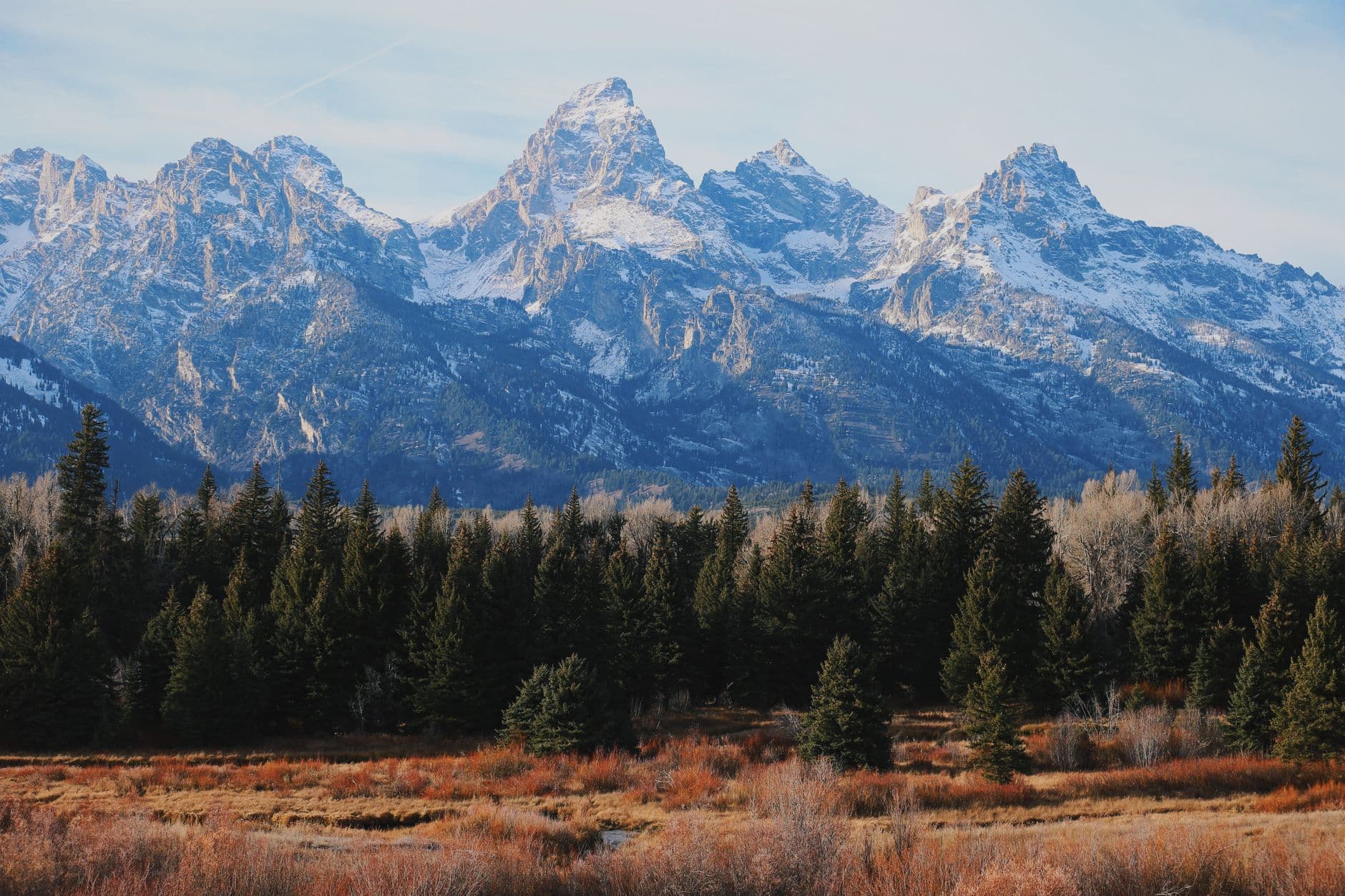
Here the Continental Divide doesn't announce itself so much as loom β€” granite walls catching first light while glacial water runs so clear it seems to erase itself. This is a landscape built for two people willing to rise early, breathe thin air, and let a waterfall's roar replace conversation for a while.

At a Glance

Climate & Weather
Summer days run mild, roughly 40-41Β°F at elevation with warmer valley temperatures, and afternoon thunderstorms are near-guaranteed by early afternoon β€” pack waterproof layers, a warm fleece, and sun protection even on clear mornings.
Getting Around
A vehicle is essential; a high-clearance vehicle is strongly recommended for the road into Green River Lakes. Distances between clusters are significant, so plan driving time generously and fuel up in Pinedale before heading out.
Budget
Budget roughly $80-130 per day for two, covering hearty diner-style meals, park/trail fees, and modest gear rental or provisions β€” this is not a resort destination, so spending stays low outside of one splurge dinner.
Safety
Both black and grizzly bears live in this range; carry bear spray on every hike and store food properly at any stop. Lightning above treeline and flash flooding in canyons are real risks β€” plan to be off exposed terrain by early afternoon and watch the sky.
Connectivity
Cell service disappears almost entirely once you leave pavement β€” download offline maps, tell someone your plan, and treat the wilderness as self-sufficient territory.
Local Tips
Start both days at first light β€” not just for the famously good morning light, but to beat both the crowds and the near-daily afternoon thunderstorms. Pack a real lunch; once you leave Pinedale, food options thin out fast, and locals expect visitors to be self-reliant.

Highlights

  • Sunrise stillness at Green River Lakes before the day-trippers arrive
  • Squaretop Mountain mirrored in turquoise alpine water
  • The Popo Agie River vanishing into limestone at Sinks Canyon
  • A short, steep hike to Popo Agie Falls' mist and thunder
  • Wildflower meadows underfoot on the approach to the lakes
  • Golden-hour light on canyon walls the color of rust and cream
  • Genuine solitude, even in peak summer season

Day-by-Day Plan

arrival & alpine stillness

Day 1: First Light on the Glacial Lakes

A gentle, scenery-forward day centered on one long, unhurried visit to Green River Lakes, with about 2-3 miles of easy-to-moderate walking along the lakeshore.

Wear
Layers are non-negotiable β€” a warm base layer and fleece for the cool morning air, a packable waterproof shell for the near-certain afternoon storms, sturdy trail shoes, and a sunhat for the exposed meadow sections.
Budget
$40-60 for two (fuel, packed provisions, park access)
7:00 AM - 11:00 AM
Green River Lakes Β· morning Β· 240 min Β· Green River Lakes β€” Pristine alpine solitude

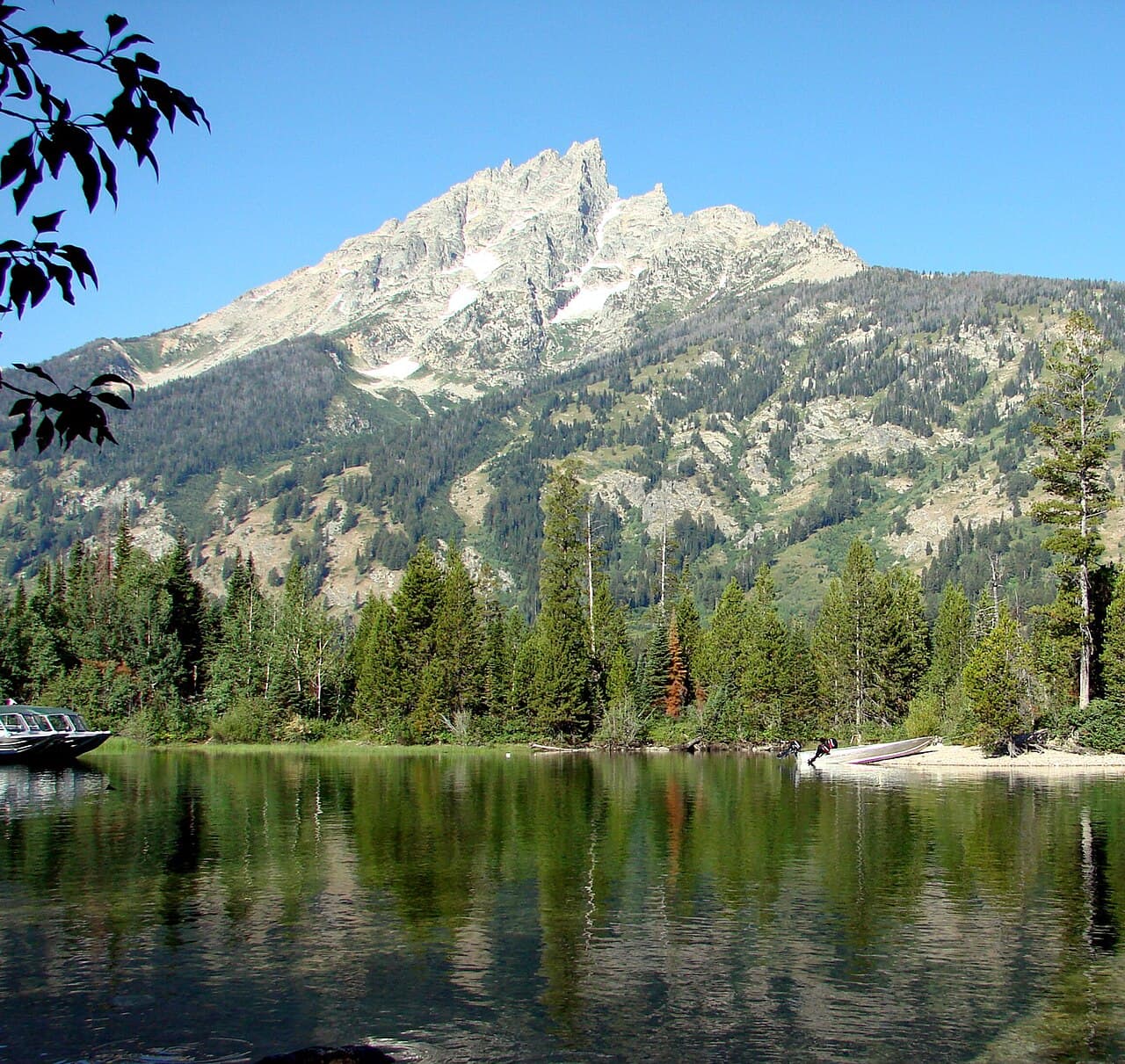
Arrive by 7am and the lake is glass β€” Squaretop Mountain doubled perfectly in turquoise water, the only sound the occasional crack of distant glacial melt. Walk the shoreline trail slowly; this is the kind of place that rewards silence more than conversation. By mid-morning the wind picks up and ripples the reflection, so the earliest hour here is genuinely the best hour, not just the quietest.

Green River Lakes
James St. John / wikimedia (CC BY 2.0)
Shoot the Lower Lake shoreline toward Squaretop between 7-8am when the water is stillest and the light is soft and directional.
Terrain is unpaved and uneven with no benches; not suitable for wheelchairs or those needing flat, stable footing.
Optional detour: Green River Lakes β€” Within the same visit, extend to Upper Green River Lake
Continuing past the lower lake toward the upper lake adds glacier views and thins the crowd almost to zero. Skip if: Skip the extension if either of you is feeling the altitude or if clouds are building early β€” this pushes total time and distance from the trailhead.
If it rains: Lightning risk rises fast above treeline in the afternoon β€” if storms build, descend to the trailhead immediately and shelter in the vehicle; this is not a day with an indoor alternative nearby, so timing the morning visit early is the real safeguard.

The day begins deliberately early, driving in while the light is still low and gold, arriving at Green River Lakes before the wider world wakes up. The lake sits utterly still at this hour, granite peaks doubled in the water, wildflowers scattered through the meadow grass underfoot. Couples who linger here find the silence itself becomes part of the experience β€” no rush, no schedule, just cold air, thin light, and each other.

By late morning the wind rises and the mirror-lake effect fades, which is the natural cue to start back toward the trailhead before afternoon thunderstorms build β€” a near-daily occurrence in this range. The drive back toward Pinedale offers a chance to decompress, windows down, granite giving way slowly to sagebrush foothills.

With no dining data mapped for this remote trailhead area, plan the evening meal back in Pinedale or Boulder rather than expecting anything at the lake itself β€” pack a substantial lunch for the day and treat dinner as the day's one town stop, settling in early given tomorrow's early start.

canyon & cascade

Day 2: Where the River Disappears

A moderate day split between the geologic wonder of Sinks Canyon and the steep, misty approach to Popo Agie Falls, totaling roughly 2 miles of walking on uneven terrain.

Wear
Sturdy hiking shoes with grip for wet rock near the falls, a light waterproof layer, and a warm layer for the cool canyon air β€” the mist near Popo Agie Falls chills quickly even on warm days.
Budget
$50-90 for two (park fees, lunch, one upscale dinner)
90 min drive β€” A long, quiet drive south from the Green River Lakes area back through Pinedale and toward Lander β€” worth a coffee stop in town before continuing on.
8:00 AM - 10:00 AM
Sinks Canyon SP Β· morning Β· 120 min Β· Sinks Canyon & Popo Agie β€” Accessible river canyon beauty

Arrive by 8am and the viewing platform is nearly empty, just the two of you and the astonishing sight of the Popo Agie River vanishing into a limestone sinkhole. The roar of the water and the cool mineral-scented air off the canyon walls make this feel almost theatrical β€” rust-and-cream rock, impossibly blue water disappearing into shadow. By late morning, weekend crowds thicken considerably, so the early slot is worth protecting.

Sinks Canyon SP
Eckhardt, William T Hatley, M. Jay Cornerstone Research (Firm) United States. Bureau of Land Management. California Desert District / wikimedia (Public domain)
Shoot from the main viewing platform mid-morning when the light angles into the canyon without harsh overhead glare.
Paths are uneven with sparse benches; not fully wheelchair accessible, though the main viewing platform is a shorter, more manageable walk than the falls trail.
20 min walk β€” A short, steady climb on a forested trail from the Sinks Canyon parking area β€” the sound of the falls builds well before the view does.
10:30 AM - 11:30 AM
Popo Agie Falls Β· midday Β· 60 min Β· Sinks Canyon & Popo Agie β€” Accessible river canyon beauty

The trail climbs through pine forest before the roar announces itself β€” white water exploding against dark granite under an open sky, cold mist drifting far enough to reach your face on the approach. This is a better mid-morning stop than early morning, once the trail's had a chance to dry slightly from overnight dew, and it pairs naturally as a contrast to the calmer sinkhole viewing just finished. Weekday timing keeps the crowd minimal even in peak season.
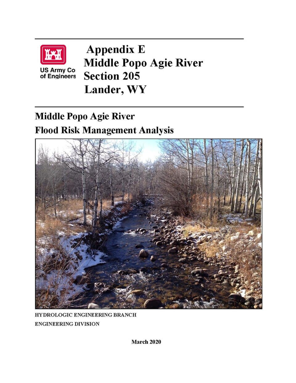
Popo Agie Falls
United States. Army. Corps of Engineers / wikimedia (Public domain)
The side angle at mist level, taken around midday when the sun crosses overhead, catches spray lit up against the dark rock.
Steep, rough terrain β€” not recommended for those needing accessible paths; younger kids and less mobile visitors may tire quickly, though this is less of a concern for most couples.
Optional detour: Sinks Canyon SP β€” After Popo Agie Falls and before heading back toward town
A second, quieter pass along the canyon rim trail downstream offers different photo angles with the Wind River Range as backdrop. Skip if: Skip this if afternoon clouds are already building β€” thunderstorms roll in reliably by early afternoon and this adds exposed time outdoors.
If it rains: If storms roll in, retreat to the Sinks Canyon State Park visitor center for shelter and interpretive exhibits, or head toward Lander (about 20 minutes away) for indoor options until weather clears.

The morning belongs to Sinks Canyon's strange, quiet drama β€” a river disappearing into stone, framed by canyon walls glowing rust and cream in the early light. Arriving early means having the platform essentially to yourselves before the mid-morning crowd builds, a rare kind of privacy for such a striking sight.

From the sinkhole, a short climbing trail leads up through pine forest to Popo Agie Falls, the roar growing louder with every switchback until the cascade itself comes into view β€” cold mist, granite, and a sky that's usually still blue at this hour, though it's worth watching for building clouds. This is the day's more physical stretch, a nice contrast in pace and mood from the stillness of the morning.

With no specific dining venues mapped for this immediate area, treat the evening as the trip's one splurge β€” head back into Pinedale or nearby Lander for a proper sit-down dinner, hearty and unpretentious in local style, and let the day's two very different landscapes settle in over a slow meal before the drive home.

Want to tweak this trip?

Our AI planner can customize this itinerary to your exact dates, interests, and travel style.

Customize This Itinerary
Good to Know

Restaurant details (hours, menus, availability) change frequently, and this remote region has especially limited, unmapped options β€” check current availability in Pinedale or Lander before finalizing dinner plans.

Dietary compatibility tags are general guidance. If you have severe allergies, confirm directly with the restaurant.

Travel tips are general guidance, not professional safety advice. Check government advisories and local ranger stations for current trail, weather, and wildlife conditions.

All prices are approximate and may vary seasonally.
We use cookies to improve your experience and analyze site usage. Essential cookies are always active. You can customize your preferences or accept all cookies. Cookie Policy