3 DaysSolo Traveler5 Stops

Wind River Range (East side), Wyoming

3-Day Itinerary for Solo Traveler

โ€œGranite, Ice, and Silence: Three Winter Days on the Wind River's Eastern Edgeโ€

Granite, Ice, and Silence: Three Winter Days on the Wind River's Eastern Edge

Snow muffles everything here except the river that refuses to freeze completely, still murmuring beneath ice where it plunges into Sinks Canyon's limestone throat. This is winter wilderness travel at its most honest โ€” short days, hard light, and the kind of quiet that makes your own footsteps sound loud.

At a Glance

Climate & Weather
Winter temperatures routinely drop to -19ยฐC (-2ยฐF) or lower at night, with heavy snow accumulation closing most high passes and backcountry roads from November through June. Pack insulated waterproof boots, down layers, a windproof shell, wool base layers, and traction devices (microspikes) for icy trails โ€” the sun is intense at altitude even in freezing air, so sunglasses and sunscreen still matter.
Getting Around
A high-clearance vehicle (4WD strongly preferred) is essential; many access roads are snow-packed or unplowed in winter and Green River Lakes Trailhead road may be impassable without a capable vehicle or extra planning. Distances are long and gas stations sparse โ€” fill up in Pinedale before heading toward either cluster.
Budget
Budget roughly $60-$100/day for a solo traveler covering hearty meals, gas, and minor gear rental or permits โ€” lodging is separate and this is not an expensive-dining destination.
Safety
Solo winter travel here demands real self-sufficiency: cell service disappears entirely once you leave Pinedale's immediate vicinity, so tell someone your route and expected return time before heading out. Carry bear spray even in winter (black bears den but grizzlies can be active in warm spells), pack emergency supplies (blanket, extra layers, food, light) in your vehicle, and treat any icy canyon trail as if it were exposed terrain โ€” a solo fall far from help is the real risk, not wildlife.
Connectivity
Expect zero to minimal cell coverage outside Pinedale town limits; download offline maps and let a trusted contact know your plan before leaving pavement. WiFi is limited to lodging and a handful of town businesses.
Local Tips
Arrive at any viewpoint by mid-morning โ€” winter daylight is short (sunrise after 7:30am, sunset before 5pm in December/January) so plan your one or two stops around the light rather than trying to cram in extras. Locals keep early schedules and most restaurants close by 9pm, so plan dinner accordingly. Solo travelers should consider chatting up locals at counter seating in Pinedale eateries โ€” it's often the best way to get current, informal road-condition intel that no app will give you.

Highlights

  • Watch the Popo Agie River disappear into a limestone sinkhole, steam rising off the one patch that never freezes
  • Stand before Popo Agie Falls sheathed in ice, sound reduced to a muffled roar beneath frozen curtains
  • Drive the scenic approach to Green River Lakes under Squaretop Mountain with not another vehicle in sight
  • Early-morning solitude at viewpoints that swarm with visitors come July
  • Hearty, unpretentious apres-adventure meals in a true cowboy gateway town
  • Self-reliant backcountry pacing built for a solo traveler who wants both solitude and sensible caution

Day-by-Day Plan

Arrival & gentle orientation

Day 1: Settling In: Sinks Canyon's Frozen Hush

A lighter first day easing into the altitude and cold with two accessible-from-town stops in the Sinks Canyon & Popo Agie cluster, totaling under 2 miles of walking.

Wear
Insulated waterproof boots with microspikes, down jacket under a windproof shell, wool base layers, gloves, and a warm hat โ€” canyon walls hold shade and cold air pools near the river.
Budget
$40-60 (lunch, dinner, minor gas)
9:30 AM - 11:30 AM
Sinks Canyon SP ยท morning ยท 120 min ยท Sinks Canyon & Popo Agie โ€” Accessible river canyon beauty

Arrive by 9:30am and the canyon is yours โ€” in winter the usual foot traffic evaporates almost entirely, leaving just the hiss of wind through frosted pines and the strange, steady roar of water vanishing into darkness. The Popo Agie River punches into a limestone sinkhole here and simply disappears, open water steaming faintly against a backdrop of snow-draped canyon walls in rust and cream. Take it slow on the viewing platform; ice can make footing tricky, and this is the kind of place worth standing still in for a while.

Sinks Canyon SP
Eckhardt, William T Hatley, M. Jay Cornerstone Research (Firm) United States. Bureau of Land Management. California Desert District / wikimedia (Public domain)
Shoot the sinkhole mid-morning when low winter sun angles into the canyon and lights the steam rising off the open water โ€” by early afternoon the canyon falls into shadow.
Paths are not wheelchair accessible and can be icy in winter; microspikes recommended, and the main viewing platform offers the easiest footing of the stops here.
20 min walk โ€” A short uphill walk along the river on a quiet, snow-packed trail โ€” your breath the loudest sound besides the water
12:00 PM - 12:45 PM
Popo Agie Falls ยท midday ยท 45 min ยท Sinks Canyon & Popo Agie โ€” Accessible river canyon beauty

A short, quiet walk upstream brings you to a waterfall transformed by cold into something almost architectural โ€” sheets of ice building out from the rock face while a core of water still crashes somewhere underneath, muffled and strange. The trail is rougher and less trodden in winter, so this is a solo-traveler moment to move deliberately rather than rush; the solitude here in December feels earned rather than lonely.
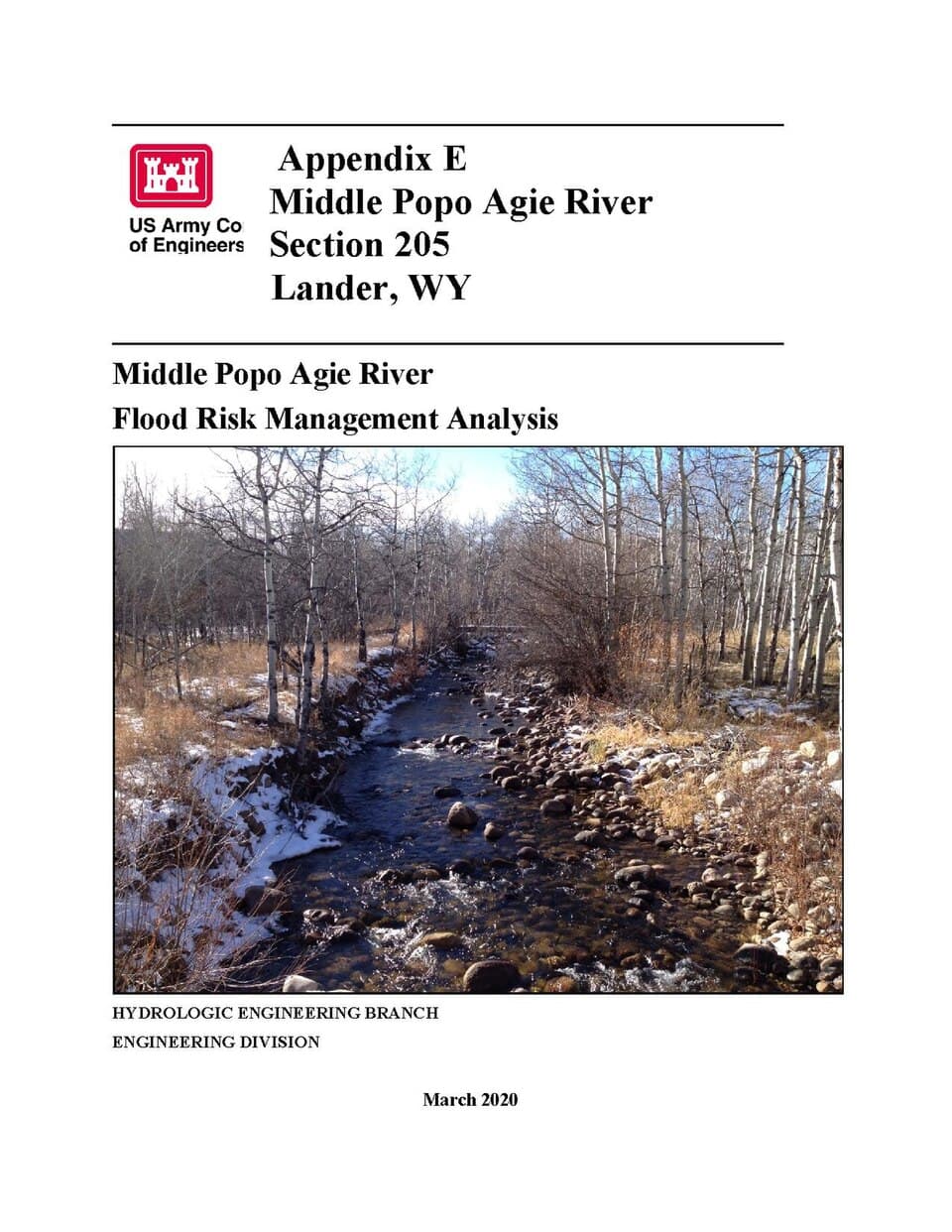
Popo Agie Falls
United States. Army. Corps of Engineers / wikimedia (Public domain)
Side-angle shots at mist level catch sunlight refracting through the ice formations โ€” best light is late morning before the sun drops behind the canyon wall.
Not wheelchair accessible; terrain is uneven and icy in winter, not recommended without solid winter footwear and caution.
If it rains: If conditions turn (heavy snow or whiteout), retreat toward Sinks Canyon State Park's sheltered areas near the main viewing platform where the canyon walls offer some wind protection, or head back into Pinedale/Lander for the afternoon rather than pushing further into exposed terrain.

Ease into the trip at Sinks Canyon, where winter has stripped the crowds away entirely and left just you, the frozen canyon walls, and a river doing something that looks almost supernatural as it vanishes underground. Go slow โ€” this is about recalibrating to altitude and cold, not racing a checklist.

After the falls, there's no need to push further; let the short winter daylight dictate an easy pace. Head back toward town for an early, warming meal and to confirm road conditions for the next two days, since options for dining details here should be confirmed locally rather than assumed.

With sunset arriving early, settle in for a calm first night โ€” rest up, check weather and road reports for the Green River Lakes drive, and let your body adjust to elevation before a bigger day ahead.

Remote alpine solitude

Day 2: The Long Drive North: Green River Lakes in Winter Light

The main event โ€” a scenic, careful drive to Green River Lakes for several hours of profound winter solitude beneath Squaretop Mountain, with total stop time near 3 hours and minimal walking given snow conditions.

Wear
Full winter layering system: insulated bibs or snow pants, heavyweight down parka, waterproof gloves, balaclava or neck gaiter, and traction devices โ€” this is the coldest, most exposed stop of the trip.
Budget
$30-50 (gas, snacks, dinner back in town)
90 min drive โ€” A long, scenic drive north on quiet winter roads โ€” check conditions before departing, as this stretch sees little traffic and no services once you leave pavement; a worthwhile midpoint pullover exists along the valley road where the first full views of the range open up
10:00 AM - 1:00 PM
Green River Lakes ยท morning ยท 180 min ยท Green River Lakes โ€” Pristine alpine solitude

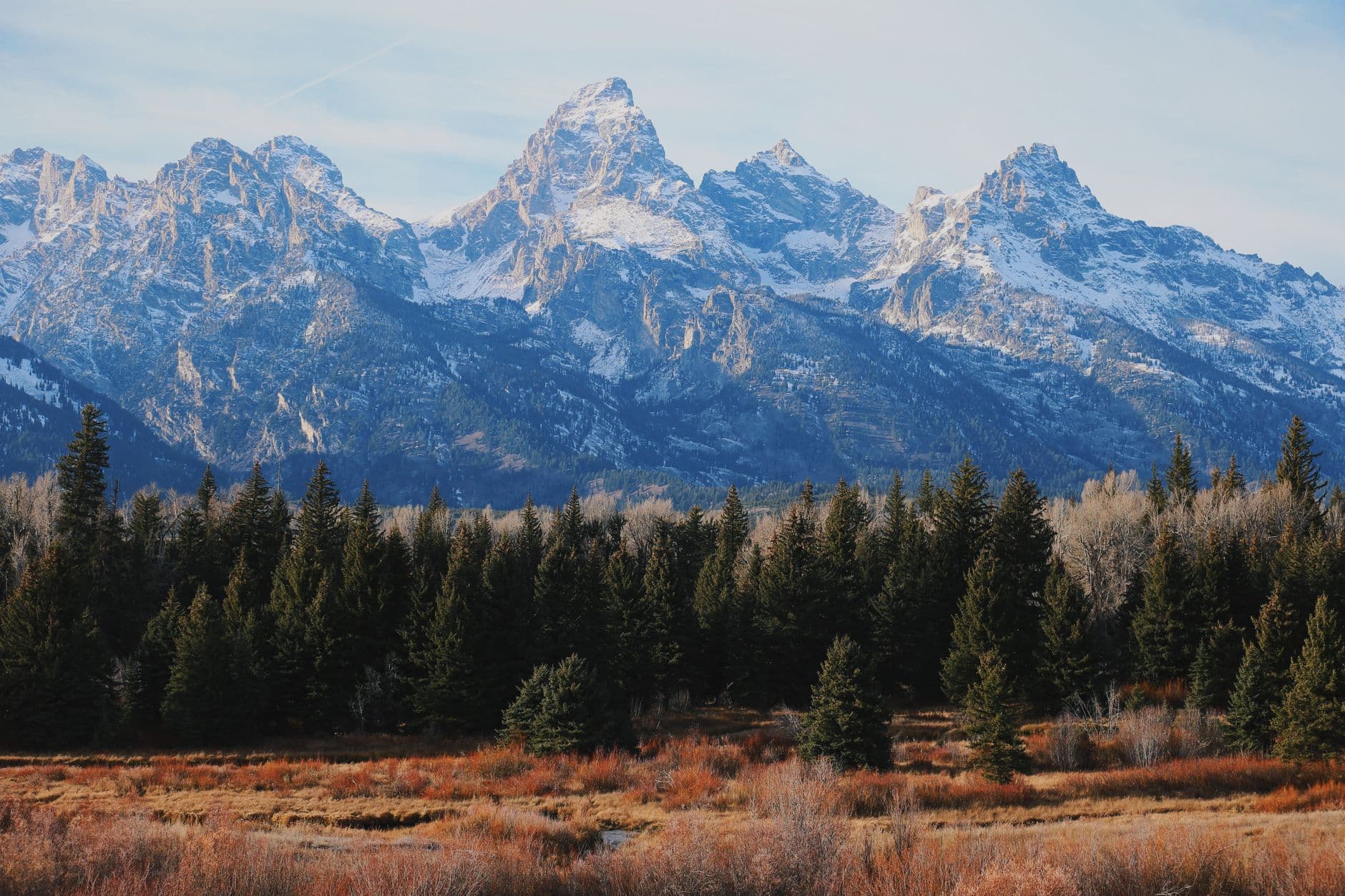
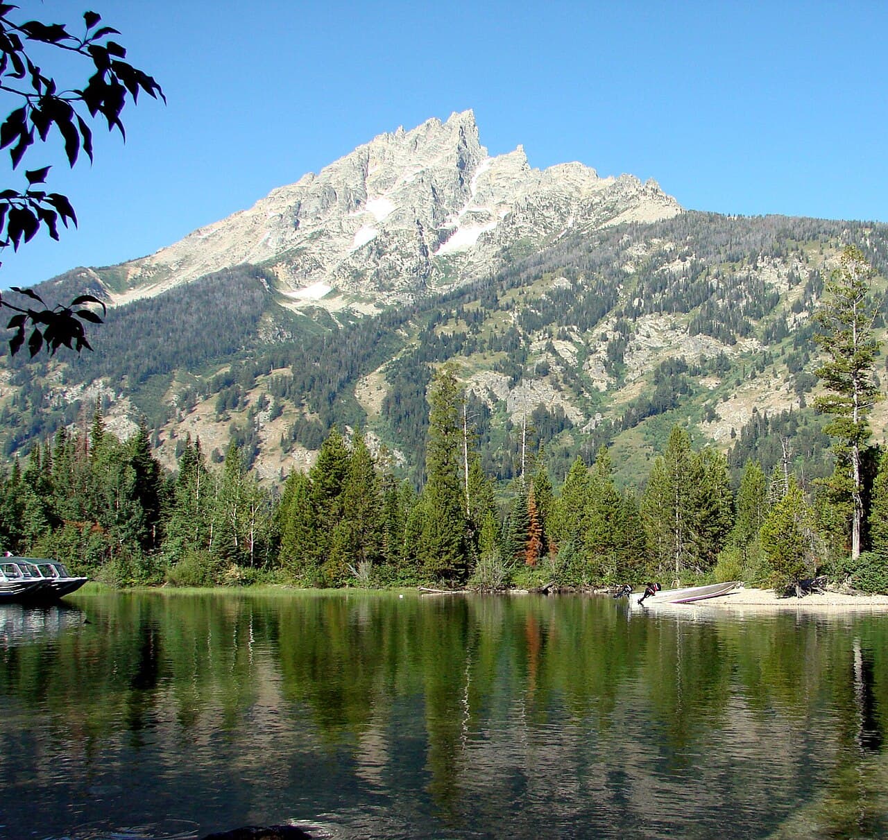
The drive in is the experience as much as the destination โ€” wide, white valley floor giving way to the sudden, improbable scale of Squaretop Mountain rising over the frozen lake basin. Arrive as early as road conditions allow; by midday the low winter sun finally clears the ridgeline and floods the lakeshore with gold, but for an hour or two beforehand you'll likely have this entire basin to yourself, the kind of silence that solo travelers come to places like this specifically to find. Stay close to cleared pullouts and known safe viewing areas; ice conditions on the lake itself can be unpredictable, so admire from shore rather than venturing onto frozen water.

Green River Lakes
James St. John / wikimedia (CC BY 2.0)
Aim for late morning to early afternoon when the sun finally crests the eastern ridgeline and lights Squaretop Mountain directly โ€” the lower lake shoreline offers the classic framing.
Not wheelchair accessible; deep snow and ice make this an uneven, demanding walk even for fit visitors, and benches or rest points are nonexistent โ€” pace yourself and turn back if conditions worsen.
Optional detour: Sinks Canyon SP โ€” Before the drive north to Green River Lakes, as an early sunrise revisit
A second, sunrise-lit visit offers completely different light and near-total solitude if you're an early riser and want to maximize photography before the long drive. Skip if: Skip if road conditions demand an early departure for Green River Lakes โ€” daylight hours are precious in winter and shouldn't be split across two locations.
If it rains: If a storm moves in or roads become unsafe, do not push toward Green River Lakes โ€” turn back toward Pinedale and treat the day as a rest/town day, using the time to confirm conditions for a later attempt or substitute a return visit to Sinks Canyon's sheltered lower trail.

This is the day's entire architecture โ€” the drive itself unspools like a held breath, open valley narrowing toward granite giants, until Green River Lakes appears, frozen and vast, with Squaretop Mountain standing sentinel over it all. Arrive early for an almost eerie solitude; this is backcountry in its rawest winter form, and moving through it carefully and reverently is the whole point.

Given the remoteness and short winter daylight, resist the urge to add another stop โ€” the return drive itself takes real concentration on snow-packed roads, and arriving back in town before dark is the priority. Use the drive back to let the scale of what you just saw settle in.

Back in town, this is the night for a proper warm meal and an early turn-in โ€” tomorrow's pace is lighter, but today's cold and driving will have taken more out of you than expected.

Reflection & gentle wind-down

Day 3: Last Light on the Canyon: Departure Day

A lighter final day revisiting Sinks Canyon & Popo Agie cluster at a different time of day for fresh light and a slower, reflective pace before departure, under 2 miles total walking.

Wear
Same winter layering system as Day 1 โ€” insulated boots, down layers, windproof shell, gloves, and microspikes for icy trail sections.
Budget
$30-50 (lunch, gas for departure)
8:30 AM - 10:00 AM
Sinks Canyon SP ยท morning ยท 90 min ยท Sinks Canyon & Popo Agie โ€” Accessible river canyon beauty

Return here one more time, but earlier โ€” by 8:30am the canyon holds a different quality of light and cold, the sinkhole's steam catching low sun at a sharper angle than your first visit. This is less about seeing something new and more about sitting with the place a little longer before heading out; solo travel rewards this kind of unhurried repetition in a way group trips rarely allow.

Sinks Canyon SP
Eckhardt, William T Hatley, M. Jay Cornerstone Research (Firm) United States. Bureau of Land Management. California Desert District / wikimedia (Public domain)
Early morning light rakes across the canyon walls at a lower angle than midday โ€” worth returning for completely different shadows and color on the rust-and-cream rock.
Same icy conditions as Day 1 apply; move carefully on the main viewing platform, which remains the most accessible vantage point.
20 min walk โ€” The same quiet uphill trail as before, now familiar underfoot, snow slightly more packed down from recent days
10:30 AM - 11:15 AM
Popo Agie Falls ยท midday ยท 45 min ยท Sinks Canyon & Popo Agie โ€” Accessible river canyon beauty

One last walk to the falls before the drive out โ€” the ice formations will have shifted slightly from two days prior, a reminder that this landscape keeps moving even in deep winter. Take your time here; there's no itinerary pressure left, just a quiet goodbye to a place that rewards exactly this kind of unhurried attention.

Popo Agie Falls
United States. Army. Corps of Engineers / wikimedia (Public domain)
Late morning brings slightly warmer light through the ice formations than your first visit โ€” look for new icicle formations that have grown since Day 1.
Not wheelchair accessible; terrain remains uneven and icy, proceed with same caution as earlier visit.
If it rains: If snow or ice makes the falls trail unsafe, stay at Sinks Canyon's main viewing platform for an extended, unhurried visit instead, or head directly into town early and use the extra time for a relaxed departure.

A quieter bookend to the trip โ€” the same canyon, but softer light and a slower pace, with nowhere else you need to be. This is solo travel at its most restorative: returning to a place you've already fallen for, simply to notice it a little more closely.

With the falls visit wrapped by midday, there's time to grab a warming lunch in town before starting the drive out โ€” pace the departure around daylight hours given winter's early sunset and variable road conditions.

Departure timing will likely have you on the road before evening sets in fully; if timing allows for one last stop in town, take it as a chance to reflect on three days of raw, quiet wilderness before re-entering cell coverage and routine.

Want to tweak this trip?

Our AI planner can customize this itinerary to your exact dates, interests, and travel style.

Customize This Itinerary
Good to Know

Restaurant details (hours, menus, availability) change frequently, and this remote region has especially limited verified dining data โ€” confirm current options directly with lodging or local visitor centers before relying on any specific venue, and plan to pack provisions as backup given the backcountry setting.

Dietary compatibility tags are general guidance. If you have severe allergies, confirm directly with the restaurant.

Travel tips are general guidance, not professional safety advice. Winter backcountry travel carries real risk โ€” check current road and avalanche conditions, carry emergency supplies, and inform someone of your route before departing pavement.

All prices are approximate and may vary seasonally.
We use cookies to improve your experience and analyze site usage. Essential cookies are always active. You can customize your preferences or accept all cookies. Cookie Policy