2 DaysSolo Traveler7 Stops

San Francisco Bay Area (day trips), California

2-Day Itinerary for Solo Traveler

“Redwoods, Ridgelines, and the Edge of the Continent: Two Days North of the Bay”
Redwoods, Ridgelines, and the Edge of the Continent: Two Days North of the Bay

North of the Golden Gate, fog drifts through redwood cathedrals and grassy ridgelines drop into a churning Pacific. This two-day solo escape trades city noise for the hush of old-growth forest, the wind-scoured drama of Mount Tamalpais, and the wild edges of Point Reyes — paced for quiet mornings, flexible afternoons, and plenty of room to simply stand still and look.

At a Glance

Climate & Weather
Spring in the Bay Area means layers are non-negotiable: mornings run cold and damp (45–55°F) with potential drizzle, afternoons can swing into mild sun (60–65°F), and coastal fog can roll in within minutes. Pack a waterproof shell, a warm mid-layer, sturdy closed-toe shoes with grip, and a hat that won't blow away.
Getting Around
A rental car is essential — these destinations are connected by winding two-lane roads (CA-1, US-101, CA-92) with no meaningful public transit between them. Fill your gas tank in San Francisco or Mill Valley before heading out, as rural gas stations are sparse.
Budget
Budget roughly $70–100/day for a solo traveler: $8–15 for Muir Woods entry/reservation fees, parking fees at some trailheads ($8–10), casual lunches ($12–20), one slightly nicer dinner ($25–35), and coffee/snacks throughout the day.
Safety
These are low-crime, outdoors-oriented destinations, but solo travelers should stay on marked trails — coastal bluffs have unstable edges and sudden drop-offs, and redwood trails can be slick with mud. Let someone know your rough route and expected return time, especially for longer hikes like Tomales Point, and carry a charged phone even though service is spotty in forested areas.
Connectivity
Cell service is unreliable to nonexistent inside Muir Woods, on Mount Tamalpais' forested slopes, and along much of Point Reyes — download offline maps before departing. Coastal towns like Half Moon Bay and Point Reyes Station have decent coverage and café Wi-Fi.
Local Tips
Book your Muir Woods parking/shuttle reservation online at least a few days ahead — it sells out fast, especially on weekends. Arrive at trailheads by 7:30–8am to beat both crowds and the midday parking crunch, and treat any clear-sky forecast with suspicion — fog can erase a view in the time it takes to tie your boots.

Highlights

  • Standing alone among 2,000-year-old redwoods before the first tour bus arrives
  • Catching 360-degree Bay views from Mount Tamalpais with the fog still peeling back
  • Walking the spine of Tomales Point with tule elk grazing against two oceans
  • Golden hour at Pigeon Point Lighthouse with waves breaking below the tower
  • A sunset stroll through Stinson Beach's tide pools and sea stacks
  • Wildflower-lined cliffs plunging into the Pacific at Chimney Rock
  • Solo-friendly counter seats and harbor-view tables made for lingering

Day-by-Day Plan

Forest and ridgeline

Day 1: Fog, Ferns, and the Shoulders of Tamalpais

A moderate-energy day combining a gentle redwood walk with a half-day on Mount Tamalpais and a sunset beach finish, totaling roughly 4-5 miles of walking.

Wear
Waterproof shell, warm layers underneath, trail shoes with grip, and a beanie or cap — mornings in the redwoods run cold and damp regardless of forecast.
Budget
$75–90 (entry/parking fees, lunch, dinner, coffee)
8:00 AM - 10:00 AM
Muir Woods (early reservation) · morning · 120 min · Muir Woods & Mill Valley

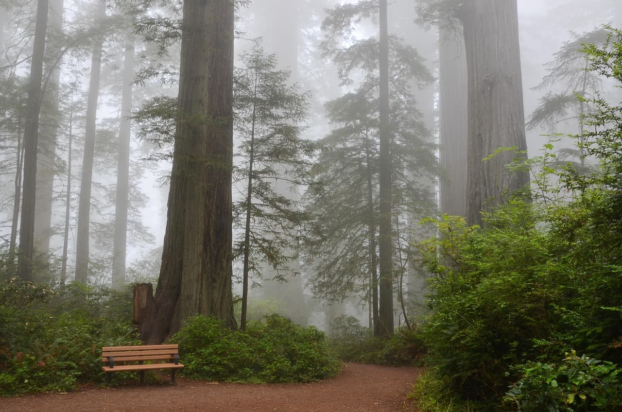
Book the earliest possible entry reservation and you'll have long stretches of the Main Trail nearly silent — just filtered light slanting through 2,000-year-old canopy and the occasional creak of a trunk settling. The air smells of damp bark and earth, and the quiet here is almost architectural, like standing inside something built rather than grown. For a solo traveler, this is a rare kind of solitude: safe, well-marked, and deeply restorative.

Muir Woods (early reservation)
Ontario. Royal Commission on Forest Reservation and National Park / wikimedia (Public domain)
The twin redwoods near the entrance photograph best in the soft, even light of early morning before direct sun breaks through the canopy.
Main boardwalk sections are paved and flat, but connecting loop trails have roots and uneven grades.
5 min walk — A short walk deeper into the preserve, the crowd noise from the entrance fading behind you.
10:00 AM - 11:00 AM
Redwood Creek Trail Loop (Muir Woods Extension) · morning · 60 min · Muir Woods & Mill Valley

Extend the morning with this gentler loop along Redwood Creek — benches appear every couple hundred meters, inviting you to just sit and listen to water over stone. Cathedral Grove, the densest cluster of ancient trees, is worth slowing all the way down for; it's the kind of place that quiets a busy mind without trying.
Redwood Creek Trail Loop (Muir Woods Extension)
Photo by USA-Reiseblogger on Pixabay
The main bridge over Redwood Creek offers a classic reflected view of the tallest trees — best before 10:30am while the water is still and shaded.
This loop is wheelchair-accessible with benches every 200 meters, the most accessible stretch in the cluster.
25 min drive — A winding mountain road with pullouts for sudden Bay views — worth a brief stop if fog is lifting.
12:00 PM - 3:00 PM
Mount Tamalpais · midday · 180 min · Marin Headlands & Mount Tamalpais

The drive up climbs out of forest into open ridgeline, and the views widen with every switchback. At the East Peak, short paved sections lead to panoramas that stretch from the Sierra Nevada to the Pacific on a clear day — though spring fog may blanket the Bay in cotton instead, which has its own quiet drama. Pack a trail snack and take the Rock Spring–Lagunita Loop if you want a longer stretch of your legs; otherwise the overlook near Pantoll Ranger Station is an easy, rewarding stop.

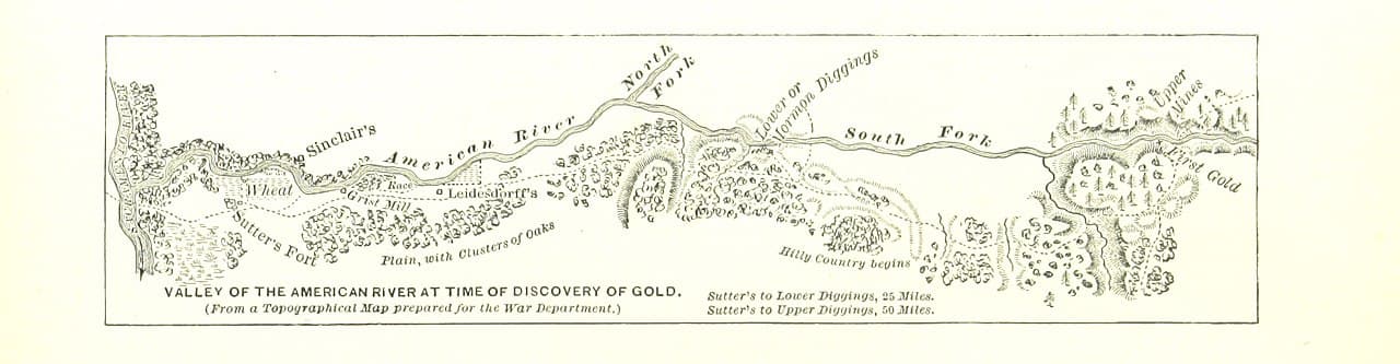
Mount Tamalpais
Banks, Charles Eugene, 1852-1932 Read, Opie Percival, 1852-1939 / wikimedia (Public domain)
Golden hour from the East Peak summit area is spectacular, but midday visits still reward with dramatic cloud layers rolling beneath the ridge.
Paved overlooks near the main parking area are accessible; most trail loops involve uneven, unpaved terrain.
20 min drive — A descending coastal road with glimpses of the ocean appearing and disappearing between ridgelines.
4:30 PM - 6:30 PM
Stinson Beach · evening · 120 min · Marin Headlands & Mount Tamalpais

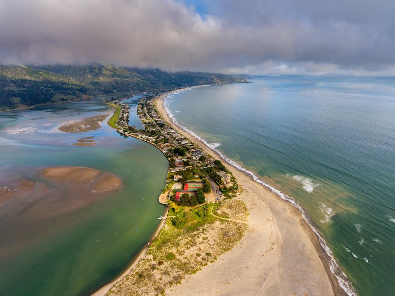
Descending from the mountain to sea level feels like a pressure release — the air turns salty, the light flattens into that particular Pacific gold, and the roar of real swells replaces the hush of the forest. Walk north past the lifeguard tower to the rocky outcrop for tide pools, or simply sit in the sand and watch the light change; this is an easy, low-effort way to close a physically full day.
Stinson Beach
Photo by derwiki on Pixabay
The southern end of the beach looking north toward the bluffs is best around an hour before sunset.
Stinson Beach has flat, wheelchair-accessible sand access near the main parking lot, rare for this coastline.
Optional detour: Pantoll Ranger Station overlook — Between Mount Tamalpais summit area and the descent toward Stinson Beach
A quick, easy vista stop with minimal walking required, good for stretching the legs before the beach. Skip if: Skip if fog has fully socked in the ridge, as the view will be minimal and time is better spent at the beach.
If it rains: If rain moves in, skip the Tamalpais overlooks and instead spend extra time in Muir Woods — the trails stay beautiful and atmospheric in light rain, with the gift shop and visitor center offering dry shelter if it turns heavy.

The day begins in near-total quiet inside Muir Woods, reserved and entered before the crowds arrive. Filtered light falls through ancient canopy onto a soft carpet of fallen needles, and the only real sound is birdsong and the occasional creak of old wood. The adjoining Redwood Creek Trail stretches the morning out gently, with frequent benches encouraging unhurried pauses along the creek.

From forest floor to open ridge, the drive up Mount Tamalpais trades intimacy for scale — Bay views unfurl in every direction, fog permitting, and the air turns sharp and cool at elevation. A longer loop trail or a simple paved overlook both deliver on the mountain's reputation, with plenty of spots to rest, snack, and take photos without feeling rushed.

The descent to Stinson Beach shifts the mood entirely: mountain hush gives way to crashing surf and salt air. Late afternoon light turns the sand golden, and a slow walk along the shoreline — maybe out to the tide pools — makes for a gentle, grounding close to a day that covered a lot of elevation and a lot of ecosystems.

Coastal wilderness

Day 2: Wind, Elk, and the Edge of Two Oceans

A higher-energy day centered on Point Reyes' dramatic peninsula trails and coastal overlooks, with roughly 5-6 miles of walking across wide-open, wind-exposed terrain.

Wear
Windproof jacket, layers, sturdy hiking boots, sunglasses, and sunscreen — Point Reyes is exposed and the wind is constant even on sunny days.
Budget
$80–100 (parking, lunch, coffee, dinner)
75 min drive — A long but scenic drive along CA-1 hugging Tomales Bay, with egrets often visible in the shallows — worth a quick pullover if time allows.
8:00 AM - 10:00 AM
Point Reyes (Chimney Rock, Tomales Point) · morning · 120 min · Point Reyes National Seashore

Arrive by 8am and the Chimney Rock overlook is nearly empty, just you, the wind, and a dizzying drop to white sand and sea stacks below. Wildflowers nod along the trailside in spring, and the scale of the place — grassland meeting cliff meeting ocean — makes for an immediate, visceral wake-up. This is a strong solo-travel stop: short, safe trails with huge visual payoff.

Point Reyes (Chimney Rock, Tomales Point)
Golden Gate Audubon Society.; Audubon Association of the Pacific.; Audubon Society of the Pacific. / wikimedia (Public domain)
The Chimney Rock overlook is best photographed in soft morning light, before midday haze flattens the contrast between cliffs and water.
Trail to the overlook is unpaved and uneven; not wheelchair accessible.
20 min drive — A short hop north along the park road, cattle fences and windswept pines lining the route.
10:30 AM - 1:30 PM
Tomales Point Trail · midday · 180 min · Point Reyes National Seashore

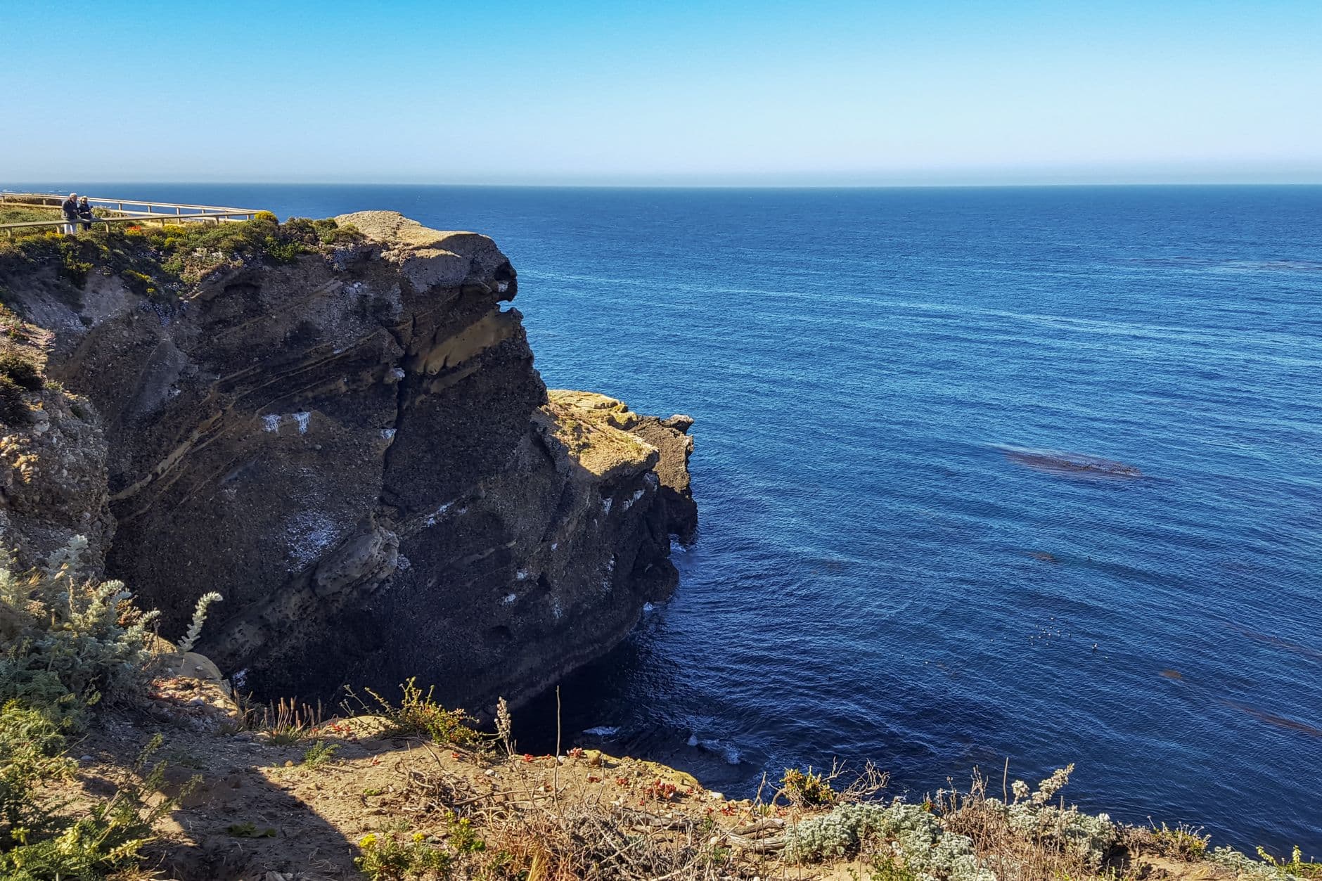
This is the day's centerpiece: a ridge walk along the spine of the peninsula with the Pacific pounding on one side and the calmer waters of Tomales Bay on the other. Tule elk often appear grazing in small herds, seemingly indifferent to hikers, and the wind never really stops — it becomes part of the rhythm of walking. Solo hikers rate this trail highly; it's popular enough to never feel isolated, but open enough to never feel crowded either.
Tomales Point Trail
Photo by dh tang on Pexels
The overlook near mile 1.5 captures both bodies of water in a single frame — best at midday when the light picks out whitecaps on both sides.
Not accessible — uneven grassland terrain throughout, not recommended for mobility-limited visitors.
90 min drive — A long coastal transfer down Highway 1 — consider a short break at a Half Moon Bay coffee spot en route to break up the drive.
4:30 PM - 6:00 PM
Pigeon Point Lighthouse · evening · 90 min · Half Moon Bay & Coastal Bluffs

The drive south trades Point Reyes' grasslands for the more rugged Highway 1 cliffs near Pescadero, ending at California's tallest lighthouse. Waves break hard against the rocks below the tower, gulls wheel overhead, and the keeper's house casts long shadows as the light turns amber. It's a quiet, contemplative stop to end an active day — good for slow photography and a moment of stillness before dinner.

Pigeon Point Lighthouse
Photo by Olzheim on Pixabay
The keeper's house and tower glow red-gold at sunset — arrive by 5pm for the best light without the midday haze.
Trails around the lighthouse are uneven and not wheelchair accessible; the parking area offers a distant but clear view of the tower.
Lunch
Main Street Grill $$
american · Near Half Moon Bay
A relaxed counter-and-table spot good for a solo lunch with hearty, unfussy plates after a long morning hike.
Dinner
The Flying Fish Grill $$
seafood · Near Half Moon Bay
Casual, counter-service seafood with harbor-fresh fish — easy for solo diners to grab a seat and strike up conversation with fellow travelers in line.
Sushi Main Street $$
japanese · Near Half Moon Bay
A good option for solo counter seating, where watching the sushi chef work makes for easy, low-pressure dining.
Optional detour: Pescadero State Beach & Marsh Natural Preserve — Between Tomales Point Trail and Pigeon Point Lighthouse
A good leg-stretch and wildlife-watching stop along the drive south, especially rewarding during spring shorebird migration. Skip if: Skip if daylight is running short, since reaching Pigeon Point before sunset should take priority.
If it rains: If heavy rain or wind moves in, skip Tomales Point entirely (it becomes dangerously slick) and instead stick to the short loop near the Point Reyes Visitor Center, saving the afternoon for Half Moon Bay's covered Main Street shops and cafés.

The day opens big, with wide-open grassland tumbling into sea cliffs at Chimney Rock. Early arrival means the overlook is yours alone, wind rushing past and wildflowers stirring at the trail edges — a dramatic, lung-filling start to a day built around scale and exposure.

The energy shifts into sustained movement on the Tomales Point Trail, a long ridge walk where ocean and bay trade places on either shoulder and tule elk occasionally punctuate the grassland. It's the physical heart of the trip, demanding but never grueling, and consistently rewarding with new vistas around every rise.

The long coastal drive south toward Pigeon Point Lighthouse offers a chance to decompress after a demanding hike, with Highway 1's cliffside curves as a scenic transition. The lighthouse itself is a quiet, golden-hour close to the trip, followed by an easy, solo-friendly dinner back in Half Moon Bay — seafood at a counter, conversation optional, the whole weekend settling into memory over a good plate of fish.

Want to tweak this trip?

Our AI planner can customize this itinerary to your exact dates, interests, and travel style.

Customize This Itinerary
Good to Know

Restaurant details (hours, menus, availability) change frequently. Check current hours before visiting, especially in seasonal destinations.

Dietary compatibility tags are general guidance. If you have severe allergies, confirm directly with the restaurant.

Travel tips are general guidance, not professional safety advice. Check government advisories for latest information.

All prices are approximate and may vary seasonally.
We use cookies to improve your experience and analyze site usage. Essential cookies are always active. You can customize your preferences or accept all cookies. Cookie Policy