4 DaysCouples12 Stops

San Francisco Bay Area (day trips), California

4-Day Itinerary for Couples

“Fog, Redwoods & Windswept Bluffs: 4 Days Around the Bay”
Fog, Redwoods & Windswept Bluffs: 4 Days Around the Bay

Fog drifts over Mount Tamalpais like a held breath while redwoods stand sentinel in cathedral silence below. This is a long weekend of slow mornings, salt-sprayed cliffs, and dinners lingering past sunset — four days tracing the Bay Area's wildest edges by rental car, built for two.

At a Glance

Climate & Weather
Spring brings mild days (55–65°F), frequent morning fog, and the real possibility of rain — pack waterproof layers, a warm jacket for summit winds, and sturdy shoes for muddy trails. Afternoons often clear into soft sun, especially inland.
Getting Around
A rental car is essential — all four days involve scenic drives of 30–90 minutes between clusters. Roads are winding coastal highways (CA-1, CA-92); allow extra time and fuel up before heading out.
Budget
Budget roughly $150–250/day per couple for meals, park fees, and incidentals — more on the splurge dinner night.
Safety
Coastal trails have sudden drop-offs and slick rocks near tide pools — stay on marked paths, especially at Point Reyes and Pescadero. Fog can roll in fast on Tamalpais and reduce visibility; carry a layer and a charged phone.
Connectivity
Cell service is spotty to nonexistent on Tomales Point, parts of Mount Tamalpais, and the Alamere Falls trail. Download offline maps before departing San Francisco.
Local Tips
Muir Woods requires advance timed-entry reservations — book weeks ahead for spring weekends. Arrive at trailheads by 7:30–8am to beat both crowds and the midday parking crunch. Bring cash for small coastal farm stands, which don't always take cards.

Highlights

  • Sunrise solitude atop Mount Tamalpais before the crowds arrive
  • Walking hand-in-hand beneath 2,000-year-old redwoods in Muir Woods
  • Wind and wildflowers on the Tomales Point elk trail
  • Sunset over Pillar Point Harbor's fishing boats in Half Moon Bay
  • A splurge dinner with ocean views to close the trip
  • Tide pools and sea stacks at Pescadero State Beach
  • Golden hour at Pigeon Point Lighthouse

Day-by-Day Plan

Arrival & alpine calm

Day 1: Settling Into the Fog — Marin's High Country

A gentle first day easing into Bay Area rhythm with a scenic summit drive and a late-afternoon beach wind-down; roughly 2 miles of easy walking.

Wear
Layers — a warm fleece or jacket for summit wind, a light rain shell just in case, and comfortable walking shoes with grip for uneven overlooks.
Budget
$120–160 for the couple, including lunch, dinner, and park parking
9:00 AM - 12:00 PM
Mount Tamalpais · morning · 180 min · Marin Headlands & Mount Tamalpais

Ease into the trip with a scenic drive up switchbacks to Marin's high country, where Douglas firs part to reveal a view stretching from the Sierra to the Pacific. Keep the pace relaxed today — a short walk near the East Peak and a lingering stop at Pantoll Ranger Station overlook is plenty for a first morning. The air up here smells of damp earth and fir resin, and on a clear spring morning you can watch fog breathe across the bay below.

Mount Tamalpais
Banks, Charles Eugene, 1852-1932 Read, Opie Percival, 1852-1939 / wikimedia (Public domain)
East Peak summit parking area at sunrise offers the clearest light before midday haze builds — but even a 9am arrival beats the afternoon crowds.
Stick to the paved overlook near the parking area if mobility is a concern; the summit trail itself is uneven and unpaved.
25 min drive — A winding descent through forest switchbacks that opens suddenly onto ocean horizon — roll the windows down for the first smell of salt air.
1:30 PM - 4:30 PM
Stinson Beach · afternoon · 180 min · Marin Headlands & Mount Tamalpais

Wind down the drive with bare feet in the sand at Stinson Beach, where Pacific swells roll in with an almost oceanic grandeur. Walk the flat shoreline hand-in-hand, let the salt spray settle on your skin, and watch seabirds wheel over the tide line — a soft, unhurried close to a travel day.
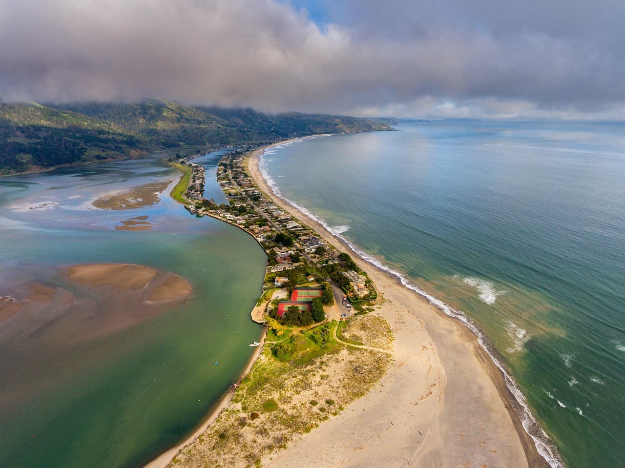
Stinson Beach
Photo by derwiki on Pixabay
The southern end of the beach looking north toward the bluffs glows best around 5–6pm, just before dinner.
The main beach is flat and wheelchair accessible; benches are sparse, so bring a blanket to sit.
Dinner
Main Street Grill $$
american · Near Half Moon Bay cluster, a short drive from Stinson if continuing south; otherwise plan a casual meal in Mill Valley en route back
Easygoing comfort food in a relaxed setting — a gentle, low-key first dinner after a travel day.
If it rains: If rain rolls in, swap the Stinson Beach walk for a visit to Muir Woods instead (trails remain beautiful in light rain) or linger in Sausalito's waterfront galleries and cafés.

The first morning unfolds slowly with a scenic drive up Mount Tamalpais, where cool mountain air and far-reaching views ease you into Bay Area time without demanding much of tired legs.

By afternoon, the pace shifts from alpine to coastal as you descend toward Stinson Beach, trading forest hush for the steady rhythm of waves and open sky.

Dinner stays simple and unhurried tonight — comfort food, an early night, and rest before three days of deeper exploration ahead.

Ancient forest, quiet awe

Day 2: Cathedral Light — Redwoods of Muir Woods

A half-day immersion in old-growth redwoods followed by a relaxed Mill Valley afternoon; under 3 miles of gentle, mostly flat walking.

Wear
Waterproof layers and closed-toe shoes with traction — the forest floor stays damp even on dry days, and spring mist is common.
Budget
$100–150 for the couple, including park reservation fees and two meals
30 min drive — A short, curving drive through eucalyptus-scented hills — have your timed-entry reservation confirmation ready at the gate.
8:00 AM - 10:00 AM
Muir Woods (early reservation) · morning · 120 min · Muir Woods & Mill Valley

Arrive right at your reserved entry time and the grove is nearly silent — just filtered light, the earthy scent of redwood duff, and the occasional distant birdcall. Walking beneath trees that predate the written word together has a quiet, grounding romance to it; by 10am, voices and footsteps multiply fast.

Muir Woods (early reservation)
Ontario. Royal Commission on Forest Reservation and National Park / wikimedia (Public domain)
The Main Trail's twin redwoods near the entrance photograph best in the soft, diffused light of early morning before direct sun breaks through the canopy.
Paths are uneven dirt with roots; sturdy shoes recommended, and benches are sparse along the main loop.
5 min walk — A short walk deeper into the preserve, the trail narrowing as crowds thin.
10:15 AM - 11:15 AM
Redwood Creek Trail Loop (Muir Woods Extension) · midday · 60 min · Muir Woods & Mill Valley

Extend the morning's hush with a gentle loop beside Redwood Creek, where the water murmurs beneath towering canopy and ferns crowd the banks in impossible green. This flatter extension pairs naturally with the main grove without repeating the same views — a good second stop before crowds peak.
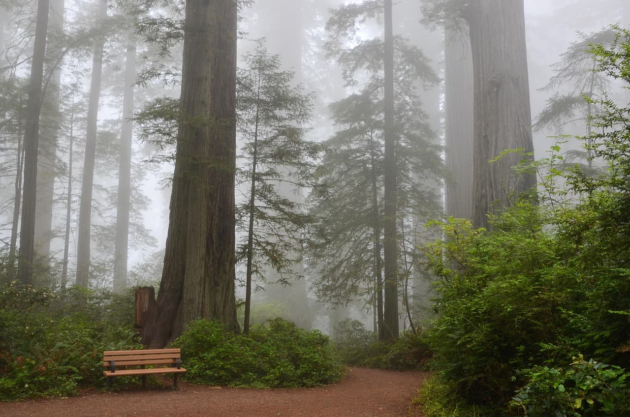
Redwood Creek Trail Loop (Muir Woods Extension)
Photo by USA-Reiseblogger on Pixabay
The main bridge spanning Redwood Creek offers a classic reflected-tree vista, best in the soft late-morning light before noon glare.
This loop is flat and wheelchair accessible with benches roughly every 200 meters — the most accessible stretch in the cluster.
Optional detour: Stinson Beach — After Redwood Creek Trail Loop and before an afternoon in Mill Valley
If energy allows, a second coastal stop extends the day's natural beauty with a completely different seaside mood. Skip if: Skip if you want a lighter afternoon — you already visited Stinson yesterday, and repeating a similar beach experience back-to-back risks feeling redundant.
If it rains: Muir Woods trails stay atmospheric and passable in light rain — the fog adds to the cathedral mystique. In heavier storms, shelter at the visitor center and gift shop, or pivot to Sausalito's indoor galleries.

Morning begins in near-total quiet beneath ancient redwoods, the kind of stillness that makes conversation drop to a whisper without anyone asking you to.

The pace eases further with a flat creekside loop, extending the forest's calm before you emerge back into daylight and decide how much more quiet you want today.

With no mapped dining data directly at this cluster, plan your evening meal in nearby Mill Valley or back toward your lodging — a relaxed, unhurried dinner suits the day's gentle rhythm.

Rugged coastal drama

Day 3: Wind, Elk, and the Edge of the Continent — Point Reyes

A full day exploring dramatic cliffs and a windswept elk trail, with roughly 4 miles of moderate walking — the most physically active day of the trip.

Wear
Windproof jacket, layers underneath, and real hiking shoes — Tomales Point is exposed and often cold even when inland is warm.
Budget
$130–180 for the couple, including park fees and two meals
75 min drive — A long but scenic drive along CA-1 hugging the coastline — stop at a pullover near Point Reyes Station if you need to stretch, since this leg exceeds an hour.
9:00 AM - 11:00 AM
Point Reyes (Chimney Rock, Tomales Point) · morning · 120 min · Point Reyes National Seashore

Arrive to golden grasslands plunging into sea cliffs, the wind immediate and bracing. Chimney Rock's overlook reveals a white-sand beach and sea stacks below — an awe-inducing, almost otherworldly start to the day, best enjoyed before the afternoon crowds arrive.

Point Reyes (Chimney Rock, Tomales Point)
Golden Gate Audubon Society.; Audubon Association of the Pacific.; Audubon Society of the Pacific. / wikimedia (Public domain)
The Chimney Rock overlook is best photographed mid-morning when the light rakes low across the white sand and sea stacks.
Overlook paths are unpaved and uneven; benches are sparse, so plan for standing viewing.
20 min drive — A short drive north along the ranch road, cattle gates and wildflower fields passing the windows.
11:30 AM - 2:30 PM
Tomales Point Trail · midday · 180 min · Point Reyes National Seashore

Walk the spine of the peninsula where tule elk graze against a backdrop of two different seas — the churning Pacific on one side, the calm of Tomales Bay on the other. It's a high-energy trek, but the sweeping, wind-scoured views make it one of the most romantic stretches of the whole trip — just the two of you and the elk herds for long stretches.
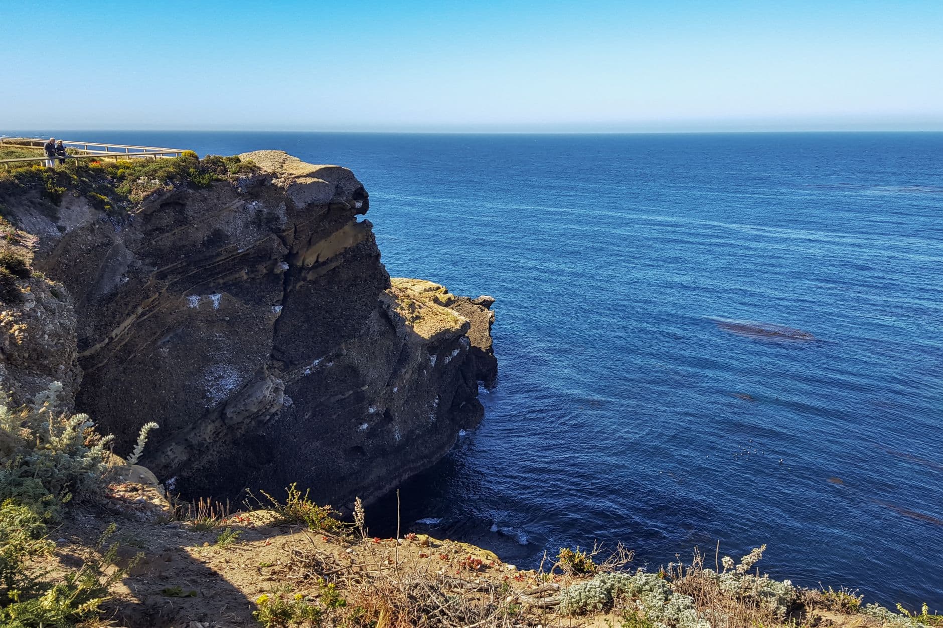
Tomales Point Trail
Photo by dh tang on Pexels
The overlook at mile 1.5 captures the dramatic bay-versus-ocean contrast best in open midday light.
Not recommended for those with mobility concerns — the trail is long, exposed, and unpaved throughout.
Optional detour: Alamere Falls Trail — As an alternative to Tomales Point Trail, not in addition
A dramatically photogenic waterfall cascading directly onto the beach — ideal for photography-focused couples willing to commit to a longer, harder hike. Skip if: Skip if you've already chosen Tomales Point today — doing both trails back-to-back would push well past comfortable pacing and risk overexertion for a couples trip.
If it rains: Both trails become dangerously muddy and slick in heavy rain, with visibility dropping severely at the cliffs. If weather turns, stick to short loops near the Point Reyes Visitor Center and save the longer trails for another day.

Morning opens with cliffside drama at Chimney Rock, wind and wave working together to make the scale of the coastline impossible to ignore.

The afternoon shifts into a longer, wilder walk along Tomales Point, wind-whipped and elk-dotted, demanding more from your legs but rewarding with some of the trip's most expansive views.

With no specific dining data mapped to this remote cluster, plan to eat in Point Reyes Station or save your appetite for tomorrow's coastal dinner — pack snacks and water for the trail itself, since options directly at the trailhead are limited.

Coastal village romance

Day 4: Harbor Light and Farewell Waves — Half Moon Bay

A relaxed final day blending small-town charm, tide pools, and a lighthouse sunset, with a splurge dinner to close the trip; around 2.5 miles of easy walking.

Wear
A warm layer for the harbor breeze in the evening, comfortable shoes for uneven tide-pool rocks, and something a little nicer for the closing dinner.
Budget
$180–260 for the couple, including the splurge dinner
80 min drive — A long coastal drive down CA-1 from Point Reyes — consider splitting it the night before by relocating lodging closer to Half Moon Bay, or enjoy the dramatic cliffside scenery as a worthwhile journey in itself.
9:30 AM - 12:30 PM
Half Moon Bay · morning · 180 min · Half Moon Bay & Coastal Bluffs

Wander Main Street's storefronts in soft morning light, the harbor visible at the street's end with fishing boats bobbing against the fog. This is slow, easy togetherness — coffee in hand, browsing galleries, no itinerary pressure. Arrive before 10am and the sidewalks are still yours.

Half Moon Bay
Elliot, G. F. Scott (George Francis Scott), 1862-1934 / wikimedia (Public domain)
Main Street storefronts glow best in morning light, with the harbor framed at the street's end.
Downtown and harbor paths are flat and wheelchair accessible with frequent benches.
20 min drive — A short coastal drive south on CA-1, farm stands and artichoke fields rolling past.
1:30 PM - 3:30 PM
Pescadero State Beach & Marsh Natural Preserve · afternoon · 120 min · Half Moon Bay & Coastal Bluffs

Sandstone cliffs collide with a wild marsh here, egrets and cormorants wheeling overhead while waves crash below. Explore the tide pools together at low tide — a quieter, more intimate contrast to the morning's village bustle.

Pescadero State Beach & Marsh Natural Preserve
Photo by Edwardo Calles on Pexels
Tide pools and rocky outcrops photograph best at low tide; check tide tables before you go.
Terrain is uneven and not wheelchair accessible; sturdy shoes recommended for the rocks.
15 min drive — A quick hop further down the coast highway, the lighthouse beam already visible from the road.
4:30 PM - 6:00 PM
Pigeon Point Lighthouse · evening · 90 min · Half Moon Bay & Coastal Bluffs

California's tallest lighthouse catches the last gold light of the trip here, cypress trees framing the weathered red-and-white tower as waves pound the rocks below. A fittingly cinematic close before dinner — the kind of view that makes you stop mid-sentence.

Pigeon Point Lighthouse
Photo by Olzheim on Pixabay
The keeper's house glows at golden hour, roughly 5–5:30pm this time of year — plan your arrival accordingly for the best light.
Trails around the lighthouse are uneven; the keeper's house area offers more level ground for easier viewing.
Dinner
The Flying Fish Grill $$
seafood · Near Half Moon Bay town center
Fresh, no-frills seafood with harbor-adjacent character — a solid, unpretentious option if you want casual over formal tonight.
Tortellini Originali $$
italian · Near Half Moon Bay town center
A cozy, romantic Italian spot well-suited to a lingering splurge dinner with a good wine list — reserve ahead for a window table.
Optional detour: Pigeon Point Lighthouse — Already included as the day's evening anchor
n/a Skip if: n/a
If it rains: If heavy rain arrives, trade Pescadero's cliffs for Half Moon Bay's indoor galleries and cafés, and consider skipping the lighthouse trails in favor of the keeper's house museum, which remains sheltered and atmospheric.

The final day opens gently, with unhurried wandering through Half Moon Bay's fog-tinged Main Street before the day's pace quickens.

Afternoon trades village charm for wilder scenery at Pescadero, tide pools and marsh birds offering one last dose of coastal drama before the evening's golden light.

The trip closes at Pigeon Point's lighthouse glow, followed by a lingering, romantic dinner in town — a fitting splurge to toast four days of fog, redwoods, and open coastline together.

Want to tweak this trip?

Our AI planner can customize this itinerary to your exact dates, interests, and travel style.

Customize This Itinerary
Good to Know

Restaurant details (hours, menus, availability) change frequently. Check current hours before visiting, especially in seasonal destinations.

Dietary compatibility tags are general guidance. If you have severe allergies, confirm directly with the restaurant.

Travel tips are general guidance, not professional safety advice. Check government advisories for latest information.

All prices are approximate and may vary seasonally.

We use cookies to improve your experience and analyze site usage. Essential cookies are always active. You can customize your preferences or accept all cookies. Cookie Policy