2 DaysSolo Traveler6 Stops

Cohutta Wilderness, Georgia

2-Day Itinerary for Solo Traveler

Ridgelines and River Song: 2 Days Alone in the Cohutta Wilderness

Ridgelines and River Song: 2 Days Alone in the Cohutta Wilderness

Fog pools in the hollows here before sunrise, and by the time it burns off, you've already got the trail to yourself. This is a two-day solo route through Cohutta's quietest hours — mountain-top ruins at dawn, whitewater roar at midday, and the kind of stillness that only comes from walking alone in old forest.

At a Glance

Climate & Weather
Summer in Cohutta runs warm and humid, with afternoon thunderstorms rolling in most days by early-to-mid afternoon. Mornings are the sweet spot — cool, clear, and quiet. Pack moisture-wicking layers, a lightweight rain shell, sturdy broken-in hiking boots, and more water than you think you'll need.
Getting Around
A rental car is non-negotiable — there's no public transit, and trailheads are spread across gravel forest roads that require careful, unhurried driving. Fill the gas tank and grab groceries in Chatsworth or Ellijay before heading into the wilderness; there's nothing resembling a gas station once you're deep in.
Budget
Expect to spend roughly $40–65/day on food and incidentals for a solo traveler — meals here are hearty and reasonably priced, and there's no entrance fee for the wilderness itself, though Fort Mountain State Park requires a parking pass (around $5).
Safety
Solo hikers should stick to marked trails, tell someone your route and expected return time, and carry a paper map since cell service disappears fast in the backcountry. Black bears, rattlesnakes, and poison ivy are all present but manageable with basic awareness — keep distance, stay alert, and don't hike with headphones in at full volume. River crossings after storms are the single biggest hazard; if water looks high or fast, turn back.
Connectivity
Cell service is unreliable to nonexistent inside the wilderness boundary — download offline maps before you go and let someone know your plans. Basic wifi and signal return once you're back in Chatsworth or Ellijay.
Local Tips
Start every hike by 7:30–8am in summer — you'll beat both the heat and the thunderstorms that build by early afternoon. Restaurants in Chatsworth and Ellijay close early (8–9pm), so plan dinner accordingly rather than rolling in late from a long trail day. If you're craving conversation, gateway-town diners with counter seating are your best bet for striking up a chat with locals.

Highlights

  • Sunrise at the Fort Mountain stone tower before the crowds arrive
  • Tracing the thunder of the Conasauga River through untouched gorge
  • A hemlock-shaded hike to a 30-foot cascade and swimming hole
  • Golden-hour light on 800-year-old mystery stone walls
  • Solo-friendly pacing with built-in rest and photography windows
  • Early starts that beat both the heat and the weekend hikers

Day-by-Day Plan

Orientation & Overlooks

Day 1: Stone Ruins and Mountain Air — Easing In

A gentler first day centered on Fort Mountain State Park's moderate trails and panoramic tower views, covering roughly 3-4 miles at an easy pace to acclimate before tomorrow's deeper wilderness push.

Wear
Breathable moisture-wicking shirt, light hiking pants or shorts, broken-in trail shoes, sun hat, and a packable rain shell for the afternoon storm window.
Budget
$45 (parking pass, trail snacks, lunch, dinner)
7:30 AM - 10:30 AM
Fort Mountain SP · morning · 180 min · Fort Mountain State Park

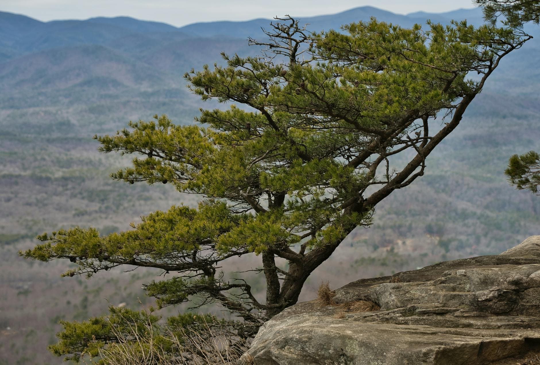
Arrive while the mist still clings to the ridgeline and the ancient stone walls look almost ghostly threading through hemlock and oak. Climb to the observation tower for a 360-degree view over the North Georgia Mountains — by 7:30am you'll likely have the platform to yourself; by 9am, day-trippers start arriving in numbers. Walk the main loop slowly, letting the mystery of the 800-year-old wall (no one knows exactly who built it or why) settle into your thoughts — solo travel suits a place built on unanswered questions.
Fort Mountain SP
Thomas K / pexels (Pexels License)
Shoot the stone wall in dappled early light for texture, then head to the tower around 9am for the clearest valley views before haze builds.
Main loop and tower area have some uneven terrain; the tower platform itself is reachable via a maintained path but not wheelchair accessible.
5 min walkA short stroll down from the tower to the picnic clearing, the crowd noise fading behind you
10:30 AM - 12:00 PM
Fort Mountain SP · midday · 90 min · Fort Mountain State Park

Linger at one of the park's picnic areas for an unhurried lunch break — bring something from town, since dining options thin out fast once you're on park grounds. This is a good window to journal, chat with fellow hikers resting nearby, or simply let your legs recover before the afternoon's lighter walk.

Fort Mountain SP
Thomas K / pexels (Pexels License)
Midday light is flat here — save your camera battery for late afternoon.
Picnic areas have some paved and semi-flat sections near parking.
10 min walkBacktrack along the main loop toward the trailhead junction, the tower now behind you and quieter with the crowd thinned
1:00 PM - 3:00 PM
Fort Mountain SP · afternoon · 120 min · Fort Mountain State Park

Take the northwest trail sections for ridge overlooks with softer, warmer light — a good, low-intensity second lap that lets you notice details missed on the morning climb: lichen patterns on the stones, the particular quiet of a weekday afternoon. Keep an eye on the sky; summer storms often build by mid-afternoon, so treat this as your buffer before retreating if thunder rolls in.

Fort Mountain SP
Thomas K / pexels (Pexels License)
Northwest ridge overlooks catch beautiful side-lighting from around 2-3pm — good for long shadows across the wall sections.
This section has more elevation change and loose rock; sturdy footwear essential.
Optional detour: Fort Mountain SP (extended perimeter walk)After the midday picnic and before the afternoon ridge trail
A flatter, gentler add-on if you want lower-impact mileage before tomorrow's harder day. Skip if: Skip if you're already feeling good and want to preserve energy and daylight for the ridge overlooks instead.
If it rains: If storms roll in, retreat to the tower area and perimeter walk — the maintained, shorter paths hold up better in wet conditions than the looser forest trails. Avoid the full loop in heavy rain.

The day begins in cool, mist-laced air at Fort Mountain State Park, where ancient stone walls emerge from the hemlock like a riddle no one's fully solved. An early arrival — ideally by 7:30am — buys near-total solitude at the observation tower, with valley views stretching out before the haze and crowds arrive. The pace here is unhurried by design: this is a settling-in day, easing the body and mind into wilderness rhythm before tomorrow's deeper push.

After a relaxed lunch at one of the park's picnic clearings, the afternoon shifts to the northwest trail sections, where warmer, angled light picks out details in the stone walls missed during the morning climb. The pace stays gentle — this is recovery mileage, not a push — but keep a weather eye up, since summer thunderstorms tend to build through early-to-mid afternoon in this part of the mountains.

With the ridge walk behind you, head back toward Chatsworth or Ellijay for dinner — plan on eating by 7 or 8pm, since local kitchens close early. Use the evening to rest fully; tomorrow's Conasauga River day asks more of the legs and lungs, and there's real value in getting a full night's sleep after a day spent at altitude in the summer heat.

River & Waterfall Immersion

Day 2: Whitewater and Wildness — Deep in the Conasauga

A more demanding day tracing the Conasauga River corridor and a hemlock-shaded hike to Jacks River Falls, covering an estimated 5-6 miles with sustained moderate-to-high energy output.

Wear
Quick-dry hiking clothes, water shoes or grippy trail shoes for wet rock, a hat, sunscreen, and a dry bag for your phone and camera near the water.
Budget
$55 (trail snacks, hydration, lunch, dinner in town)
45 min driveA winding gravel forest-road drive deeper into the wilderness, windows down and the air noticeably cooling as you climb
7:00 AM - 10:00 AM
Conasauga River · morning · 180 min · Conasauga River Corridor

Arrive early — by 7am the gorge is still cool and the light hits the water at a low, glowing angle, turning the pools nearly luminous. The river thunders through moss-covered boulders here, and the trail hugs the bank closely enough that you'll feel the cool mist on your face at the main cascade. This is prime solo-hiking territory: quiet, wild, and rewarding for anyone comfortable moving at their own pace over uneven, slippery terrain.

Conasauga River
Kelly / pexels (Pexels License)
Morning light hits the main cascade best from the overlook rock around 7:30-8:30am, before the sun climbs directly overhead and flattens the contrast.
Uneven, rocky, and slippery terrain throughout; not suitable for those with mobility concerns.
15 min driveA short forest-road hop uphill, the river sound fading behind you and replaced by birdsong
10:15 AM - 12:15 PM
Lake Conasauga Recreation Area · midday · 120 min · Conasauga River Corridor

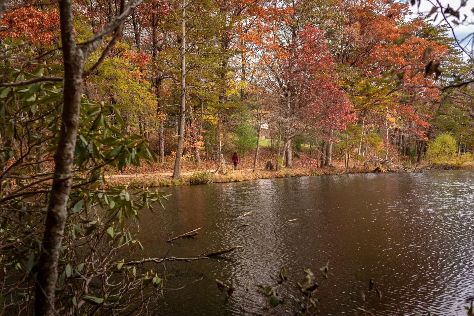
After the intensity of the river gorge, the still, mist-flecked surface of Lake Conasauga offers a genuine pace-down — the quiet here is almost startling after the roar of whitewater. Sit at the lake overlook, eat a packed lunch, and let the near-total absence of engine noise reset your nervous system before the afternoon's waterfall hike.
Lake Conasauga Recreation Area
Photo by Dominik Gryzbon on Pexels
If you can time it, dawn produces the best mist shots, but midday still offers calm, mirror-like reflections along the inlet stream confluence.
Limited accessible infrastructure; lake overlook area is relatively flat but unpaved.
25 min driveBack down the forest road and over to the Jacks River trailhead, gravel dust trailing behind the car
1:00 PM - 3:30 PM
Jacks River Falls · afternoon · 150 min · Jacks River Falls

The hike in is hard-won — trail-worn legs and all — but the payoff is a thundering cascade against dark rock, cool spray drifting across the trail, and a swimming hole that's hard to resist on a hot summer afternoon. Weekday timing works in your favor here; weekends between 10am-2pm draw the heaviest foot traffic, so an early-afternoon weekday arrival should still feel calm and personal.
Jacks River Falls
Bernice Chmarouski / pexels (Pexels License)
Get low near the base of the cascade for dramatic backlight if you arrive earlier; midday sun can wash out detail, so consider a polarizing filter.
Not recommended for those with mobility limitations — trail includes stream crossings and uneven footing.
Optional detour: Panther Creek Falls TrailAfter Jacks River Falls and before heading back to town
A quieter, hemlock-shaded alternative or add-on waterfall hike if you have energy left and want one more solitude-heavy stop with its own 30-foot cascade and swimming hole. Skip if: Skip if legs are tired from Jacks River Falls — back-to-back waterfall hikes on tired legs increase injury risk, and the light will be past its best by late afternoon.
Optional detour: Dally Mountain TrailCould replace the entire day if you want a single full-day intense ridge push instead of the river-and-falls combination
Sweeping panoramic ridge views and true solitude for experienced, fit hikers wanting a more strenuous full-day challenge. Skip if: Skip this on a standard-pace two-day solo trip — the 6-8 hour commitment leaves no room for the waterfall and lake stops, and it demands an early pre-dawn start with full daylight in reserve.
If it rains: If storms threaten, avoid the river and falls entirely — water rises fast and both become genuinely dangerous. Retreat toward Chatsworth or Ellijay for the afternoon and treat it as a town day: grab supplies, rest, and reschedule the river corridor for the next clear weather window.

The day starts before full sunrise with a drive deep into the Conasauga River Corridor, arriving at the river while the gorge is still cool and the light is low and golden across the pools. The trail hugs boulders slick with moss, and the roar of the main cascade fills the whole hollow — this is Cohutta at its wildest, and the early hour means you'll likely have long stretches of trail entirely to yourself.

After a calm, reflective break at Lake Conasauga — still water, mist, and a quiet that feels almost engineered for solo travelers — the afternoon pushes toward Jacks River Falls. The hike in demands effort, but the payoff is immediate: a thundering cascade, cool spray, and a swimming hole that more than earns the trail-worn legs that got you there.

With the falls behind you, the drive back toward Chatsworth or Ellijay offers a chance to decompress, windows down, replaying the day's sounds — river roar, lake silence, falling water. Dinner should happen early given local closing hours; use the evening for a slow wind-down, sore muscles and all, savoring the particular satisfaction of two days spent mostly alone in one of the East Coast's wildest remaining places.

Want to tweak this trip?

Our AI planner can customize this itinerary to your exact dates, interests, and travel style.

Customize This Itinerary
Good to Know

Restaurant details (hours, menus, availability) change frequently, and dining options directly at trailheads are often limited or unmapped — plan meals around gateway towns like Chatsworth or Ellijay rather than expecting on-site options in the wilderness itself.

Dietary compatibility tags are general guidance. If you have severe allergies, confirm directly with the restaurant before dining.

Travel tips are general guidance, not professional safety advice. Check current weather, trail conditions, and government advisories before entering the wilderness, especially regarding river crossings and storm activity.

All prices are approximate and may vary seasonally.

We use cookies to improve your experience and analyze site usage. Essential cookies are always active. You can customize your preferences or accept all cookies. Cookie Policy