Clearwater River Region (Orofino, Kamiah), Idaho
5-Day Itinerary for Solo Traveler
“Winter Silence on the Clearwater: Five Days of Dams, Deep Forest, and Wild Water”
Winter strips the Clearwater River Region down to its essentials: the low growl of the dam spillway, frost on canyon granite, and roads so empty you'll wonder if you've got the whole forest to yourself. This is a trip for travelers who want silence with substance — history, water, and stone, minus the crowds.
At a Glance
Highlights
- Stand alone at the base of Idaho's tallest dam as mist rises in the cold air
- Walk sacred Nez Perce ground with almost no one else on the trail
- Trace the wild, half-frozen Lochsa River along a nearly empty Highway 12
- Warm up over hearty comfort food in small-town cafes built for solo travelers
- Photograph canyon light with none of the summer haze or crowds
- Settle into the unhurried rhythm of a logging-and-river town in deep winter
Day-by-Day Plan
Day 1: Arrival and the Dam's Quiet Roar
A gentle arrival day with one anchor stop and light orientation around Orofino; under 2 miles of walking total.
After the long drive in, let this be your first breath of the region: 717 feet of gray concrete rising out of a frozen-edged reservoir, spillway water thundering even in the cold. Arrive by 1:30 PM and the overlook is likely yours alone — the mist off the spillway catches the low winter light beautifully. Take it slow; this is a settling-in stop, not a checklist item.
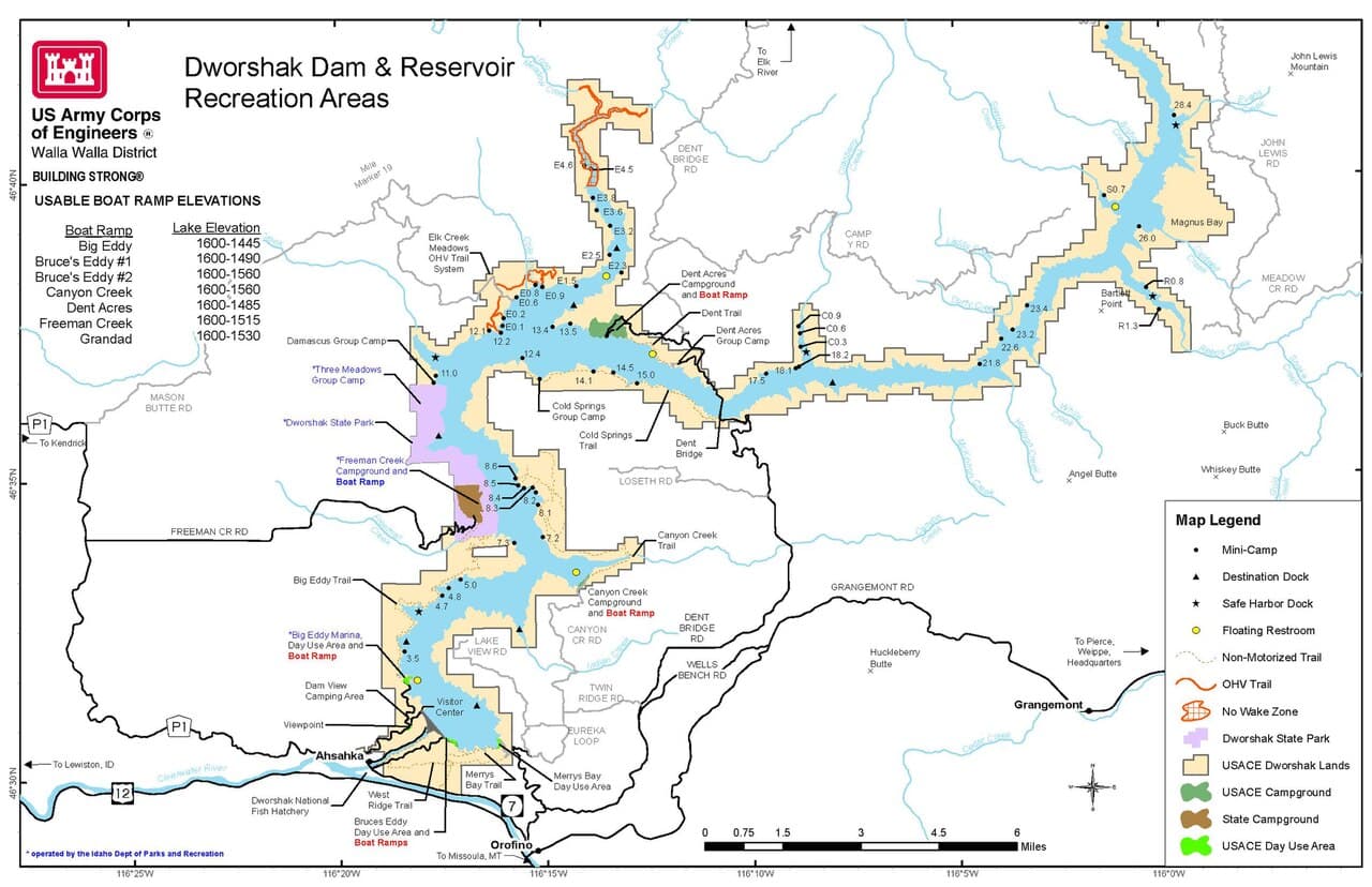
Today is about arrival, not adventure — expect most of the day consumed by the drive in from Spokane or Boise, with US-12 unspooling through increasingly wild, snow-dusted terrain. Take breaks as needed; winter driving through the canyon sections rewards patience over speed.
By early afternoon, ease into the region at Dworshak Dam. The scale of it is almost startling after hours of two-lane highway — a concrete cliff holding back an entire reservoir, spillway roaring even in the cold quiet of winter. Twenty to thirty minutes here is plenty on day one; let the sound and scale sink in without rushing to the next thing.
Head into Orofino as the light fades — days are short this time of year, so expect near-total darkness by 5 PM. Settle into your lodging, unpack warm layers for the days ahead, and aim for an early dinner since most local kitchens close by 6 PM. Bar seating at a local spot is a good way to ease into conversation with other winter travelers or locals passing through.
Day 2: Sacred Ground in Kamiah Basin
A moderate day centered on deep cultural history at Nez Perce National Historical Park, with light walking (under 2 miles) and full indoor comfort as backup.
Arrive by 9 AM for near-total solitude — in winter, this is one of the quietest places in the region, and the weight of the history here settles differently without other visitors around. Wander the museum first, where the air is thick with reverence and the exhibits trace Nez Perce resistance and endurance in vivid, sobering detail. Then step outside, where the cold sharpens the pine scent and the Clearwater River is audible far below the interpretive trail — the stone markers along the path feel especially poignant with fresh snow settling into their carved names.
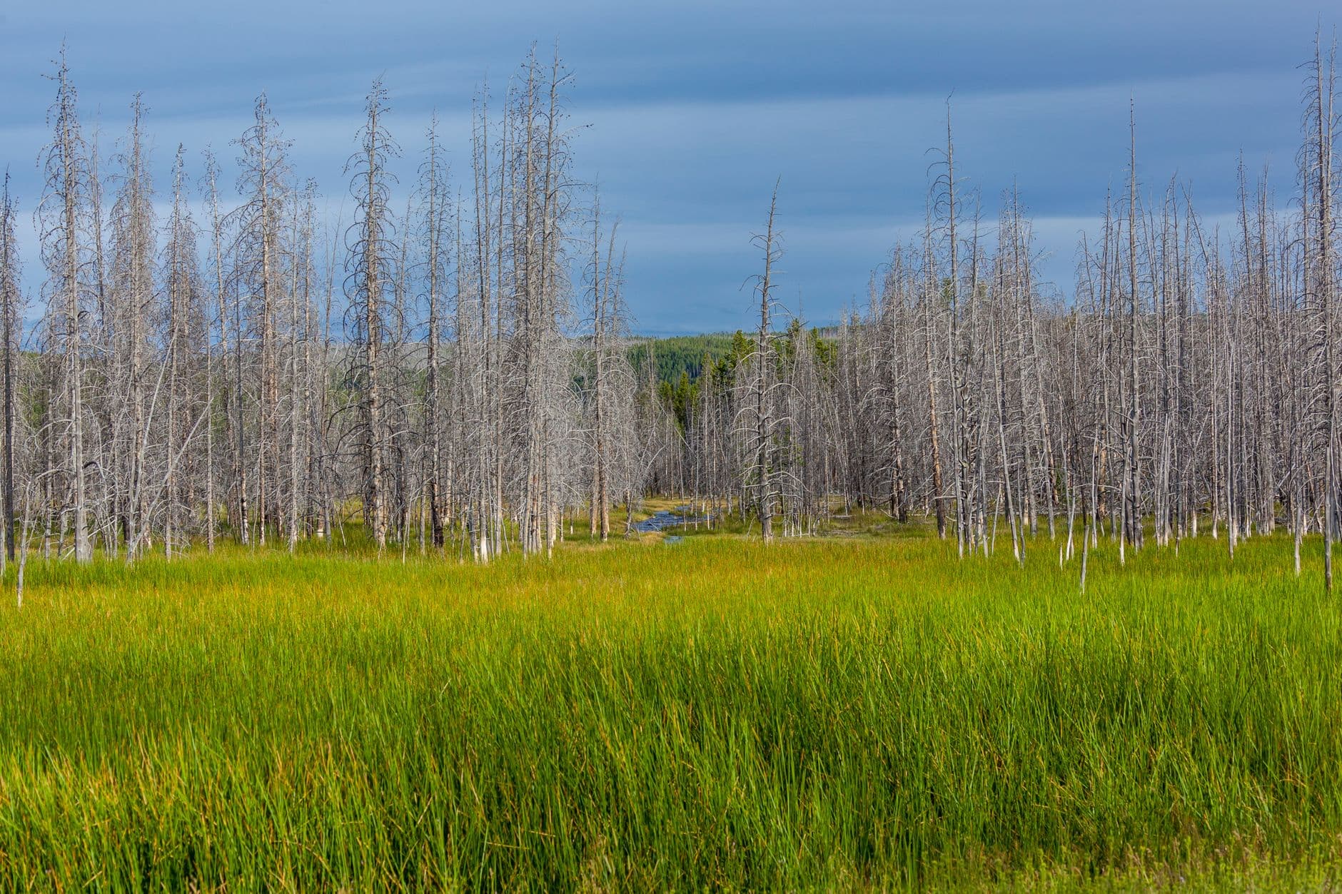
Devote the morning fully to Nez Perce National Historical Park. This isn't a stop to rush — give it the full two hours, moving between the museum's quiet, dense exhibits and the outdoor trail where the river hums below and stone markers stand solemn in the snow. Early arrival means you'll likely have long stretches of the trail entirely to yourself, which changes how the place feels.
With the morning's cognitive weight behind you, spend the afternoon easing into Kamiah itself — a small, quiet village immersed in Nez Perce culture, with little in the way of bustle even outside winter. Use this slower half-day to rest, journal, or simply walk the town at your own pace; there's no need to over-schedule after a morning this substantive.
Dinner options in Kamiah are limited and best approached loosely — plan your evening meal around whatever small local kitchen is open rather than expecting extensive choice, and eat early given the region's 6 PM rhythm. It's a good night for an early bedtime, since tomorrow's drive along the Lochsa corridor deserves full daylight.
Day 3: Wild Water, Frozen Light
A moderate-energy scenic day along the Lochsa River corridor, primarily a driving-and-viewpoint day with short walks totaling under 2 miles.
In winter, the Lochsa is a different creature than its wild summer self — virtually deserted, the water running dark and cold beneath dustings of snow on the granite walls. This is strictly a scenic-drive-and-viewpoint day rather than a rafting one; pull over at the marked overlooks and let the thunder of the current and the primal rhythm of water over rock fill the silence. Arrive early, since winter daylight is short and you'll want good light for photography before early afternoon shadows creep into the canyon.
Give the whole morning to the Lochsa River corridor — this is a slow, contemplative drive punctuated by roadside stops rather than a single fixed destination. The canyon walls press close in places, granite dusted with snow, and the only sound beyond your own footsteps is the river itself, running fast and cold below. Solo travelers should stay near the car in winter conditions and avoid wandering onto unstable riverbank ice.
By early afternoon, begin the drive back toward Kamiah or Orofino before the light fades — winter days end abruptly out here, and driving the canyon curves in the dark is best avoided. Use the return trip to stop at any turnouts you skipped on the way out, since the light angle will have shifted and offer a different mood on the same water.
With an early return, settle into your base town for a quiet, early dinner — today's cold, sensory-heavy outdoor hours warrant a hearty, warming meal. This is a good night to seek out bar seating or a communal table if you're craving conversation after a day spent largely in solitude along the river.
Day 4: Return to the Dam, Deeper This Time
A lighter day returning to the Orofino & Dworshak Corridor for a slower, more photography-focused visit, with minimal walking (under 1.5 miles).
Return to the dam at first light this time — arrive by 7:30 AM and the overlook is entirely empty, the spillway mist catching the first pale sun of the day. This is the photography-focused visit: slower, more deliberate, with time to move between the three main vantage points and watch how the light changes the concrete face from gray to gold. Winter's low sun angle and quiet air make this the best possible version of this stop.
Rise early for a second, quieter visit to Dworshak Dam — this time purely for the light and the solitude, not the orientation. Ninety unhurried minutes here lets you catch the full arc of morning light on the concrete face, with the spillway's roar as a constant, grounding soundtrack. This is one of the best solo-travel mornings of the trip: no schedule pressure, just you, the cold air, and the scale of the structure.
Spend the afternoon gently exploring Orofino itself — the town's rustic, riverside character rewards an unhurried wander, and this is a good day to handle any errands, laundry, or route-planning for the days ahead. Energy levels should stay moderate after an early start; this is intentionally a lower-key day sandwiched between two more demanding ones.
Aim for an early dinner in Orofino, and consider bar seating if you're in the mood for conversation — solo travelers passing through this route often cross paths here, and locals are generally happy to talk once you make the first move. Turn in early; tomorrow involves a longer drive and more walking.
Day 5: Last Light on the Clearwater
A relaxed departure day combining a final short visit to Kamiah Basin with travel logistics, keeping walking light (under 1 mile) ahead of departure.
A shorter, final visit — arrive by 8:30 AM for one last quiet pass through the museum or a brief walk along the interpretive trail, whichever calls to you more after four days in the region. This is less about seeing something new and more about letting the place settle before the drive out; the stillness of a winter morning here is a fitting closing note.
Close out the trip with a brief, unhurried return to Nez Perce National Historical Park — no pressure to see everything again, just a chance to sit with the history and the landscape one more time before the long drive to the airport. The museum's warmth is a welcome contrast to the cold morning air outside.
Begin the drive toward Spokane or Boise, budgeting extra time for winter road conditions along US-12 and beyond. Use any remaining daylight for a final scenic pause if the route allows, but prioritize safe, steady progress over lingering, since mountain roads in winter reward caution over spontaneity.
With flights typically departing in the afternoon or evening, plan for an early arrival at the airport buffer given potential winter driving delays — better to sit at the gate with a coffee than to rush icy canyon roads against the clock.
Want to tweak this trip?
Our AI planner can customize this itinerary to your exact dates, interests, and travel style.
Customize This ItineraryRestaurant details (hours, menus, availability) change frequently, especially in small winter-season towns. Check current hours before visiting.
Dietary compatibility tags are general guidance. If you have severe allergies, confirm directly with the restaurant.
Travel tips are general guidance, not professional safety advice. Check government advisories and local road condition reports for the latest information before traveling.
All prices are approximate and may vary seasonally.