2 DaysSolo Traveler5 Stops

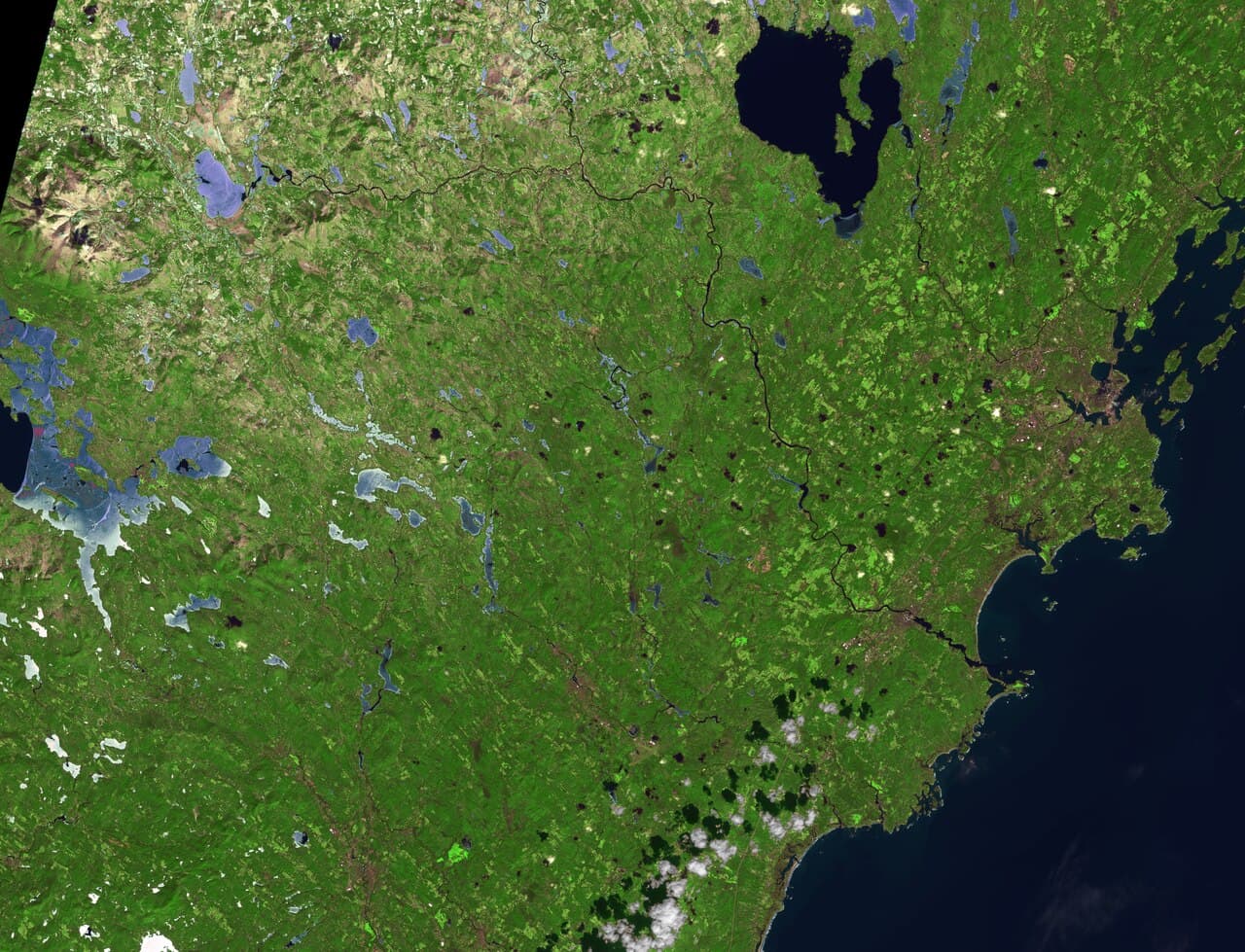
White Mountains (North/South), New Hampshire

2-Day Itinerary for Solo Traveler

โ€œNotches & Ridgelines: Two Days Alone Among New Hampshire's Giantsโ€

Notches & Ridgelines: Two Days Alone Among New Hampshire's Giants

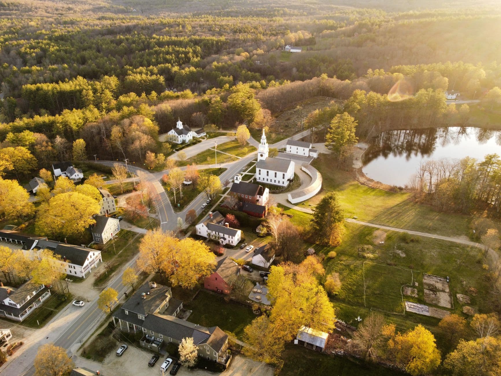
The White Mountains don't ease you in โ€” granite walls rise straight out of the highway and the air smells like balsam and cold river stone before you've even parked the car. This is solo mountain travel at its best: early starts, quiet overlooks, and the kind of trail-side conversations that only happen when you're traveling light and alone.

At a Glance

Climate & Weather
Summer days run mild, around 68ยฐF/20ยฐC, but weather flips fast at elevation โ€” pack a waterproof shell, a warm mid-layer for the summit, and sturdy footwear even for 'easy' overlooks. Afternoon showers are common; mornings tend to be clearer.
Getting Around
A car is essential โ€” distances between clusters are 30โ€“60 minutes on winding notch roads. Fill the gas tank in North Conway or Lincoln before heading into the passes, as services thin out fast.
Budget
Budget roughly $70โ€“110/day for a solo traveler covering meals, park fees, and one major activity (like the Auto Road or Cog Railway) โ€” trail-based days cost less, summit days cost more.
Safety
Traveling solo here is generally low-risk, but treat Mount Washington with real respect โ€” conditions can shift from summer to winter in under an hour. Tell someone your route and expected return time, carry a paper map (cell service is unreliable above treeline), and turn back if weather deteriorates. Black bears are present but rarely a problem if food is stored properly.
Connectivity
Cell coverage is spotty to nonexistent in the notches and above treeline; download offline maps before you leave town. WiFi is reliable in North Conway and Lincoln lodging and cafes.
Local Tips
Start every big-ticket stop before 8am โ€” parking lots at Flume Gorge and the Mount Washington Auto Road base fill by mid-morning in summer. Bring cash or change for self-serve honor-system pullouts, and pack a lunch for high-elevation days since dining options thin out fast above the valleys.

Highlights

  • Sunrise pullouts at Profile Lake before the tour buses arrive
  • A white-knuckle, wide-open drive through Franconia Notch's granite gates
  • Standing atop Mount Washington's summit, wind roaring, whole ranges laid out in purple haze
  • Waterfall-hopping the Kancamagus Highway's forested pullouts
  • Solo-friendly lodge counters and communal picnic tables for easy conversation
  • Golden hour on the Saco River gorge at Crawford Notch
  • Cog Railway as a weather-safe backup to the summit

Day-by-Day Plan

Arrival & alpine orientation

Day 1: Granite Gates: Franconia Notch on Your Own Clock

A moderate day (roughly 3โ€“4 miles of walking) easing into the region with scenic drives and short walks through Franconia Notch's dramatic pass.

Wear
Layered breathable clothing, a light rain shell, broken-in walking shoes โ€” nothing technical needed today.
Budget
$60โ€“85 (parking fees, a trail lunch, casual dinner)
7:30 AM - 9:30 AM
Franconia Notch ยท morning ยท 120 min ยท Franconia Notch & The Flume

Arrive by 7:30am and Profile Lake is nearly silent โ€” just loons calling and mist lifting off the water while the granite walls of the notch catch first light. This is an easy, low-cognitive-load way to start a solo trip: pull off wherever the view grabs you, linger as long as you like, no itinerary pressure. By 9am the parkway pullouts fill with tour traffic, so the early window is yours alone.

Franconia Notch
Paleontological Research Institution (Ithaca, N.Y.) Columbia University / wikimedia (Public domain)
Echo Lake faces east โ€” shoot from the shoreline right at sunrise for a mirror-still reflection of Franconia Ridge.
Roadside pullouts are paved but uneven; full notch views require short unpaved walks.
10 min drive โ€” A short hop deeper into the parkway, granite walls tightening on both sides as the road narrows.
10:00 AM - 12:00 PM
Franconia Notch ยท midday ยท 120 min ยท Franconia Notch & The Flume

Push deeper into the notch through midday, working the Cannon Mountain cliff pullouts where the vertical rock faces loom close enough to feel their cold shadow. Take your time โ€” there's no crowd pressure to move fast, and solo travelers often strike up easy trailside chats with fellow hikers pausing at the same overlooks.

Franconia Notch
Paleontological Research Institution (Ithaca, N.Y.) Columbia University / wikimedia (Public domain)
Afternoon light rakes across the Cannon Mountain cliff faces โ€” worth a return visit near 4pm if you have flexibility.
Some pullouts have benches; terrain beyond the pavement is uneven and unsuitable for wheelchairs.
Optional detour: Kancamagus Highway โ€” After Franconia Notch and before dinner in town
If energy allows, a short detour onto the Kancamagus's eastern pullouts offers a preview of tomorrow's drive and a few easy waterfall photo stops. Skip if: Skip if you'd rather conserve energy for tomorrow's full Kancamagus day โ€” repeating similar scenery back-to-back dilutes the impact.
If it rains: If rain moves in, the Parkway stays open and driveable but views flatten โ€” consider the Cannon Mountain ski lodge visitor center for shelter and mountain history, or push dinner plans earlier in North Conway or Lincoln.

The notch reveals itself slowly in early light โ€” cool air carrying balsam and river mist, granite walls just beginning to catch the sun. Arriving before the crowds means the classic Profile Lake and Echo Lake viewpoints are yours to enjoy at a wandering, unhurried pace, ideal for settling into solo travel rhythm on day one.

By midday, traffic picks up along the parkway, but the pace stays relaxed โ€” this is a light day by design, easing you into the mountains rather than throwing you at a summit right away. Take the Cannon Mountain cliff pullouts slowly, and don't feel obligated to see everything; this is the day to acclimate.

Head back toward North Conway or Lincoln as the light softens, settling into whichever base town suits your plans โ€” both offer easy, casual dining scenes where solo travelers can grab bar seating or a communal table without a second thought, and turn in early to rest up for tomorrow's bigger push toward Mount Washington.

Summit ascent & forest wind-down

Day 2: Above the Clouds: Mount Washington and the Kancamagus Waterfalls

A full, high-energy day (5โ€“6 miles equivalent effort with driving and short trail walks) combining a major summit push with a lighter afternoon along forested waterfall pullouts.

Wear
Serious layering is non-negotiable โ€” start in a light shirt for the valley, but pack a warm fleece, windproof/waterproof shell, hat, and gloves for the summit, which can be 30โ€“40ยฐF colder and gale-force windy even in July.
Budget
$90โ€“140 (Auto Road or Cog Railway ticket, packed lunch, casual dinner)
6:30 AM - 7:15 AM
Crawford Notch ยท morning ยท 45 min ยท Crawford Notch & Mount Washington

Start early and quiet, the Saco River roaring beside the road while morning mist clings to the cliff walls โ€” a brief, grounding stop before the day's main event. This is a good five minutes to breathe and check gear before tackling the mountain ahead.

Crawford Notch
Shipp, John Edgar Dawson, 1858- [from old catalog] / wikimedia (Public domain)
The Crawford Depot overlook offers the classic cliff-and-river composition โ€” best in soft early light before haze sets in.
Roadside pulloffs are accessible by car; walking surfaces are uneven gravel and rock.
25 min drive โ€” Winding south along Route 302, the road tracing the Saco River before climbing toward Pinkham Notch and the mountain's base.
8:00 AM - 4:00 PM
Mount Washington ยท morning ยท 480 min ยท Crawford Notch & Mount Washington

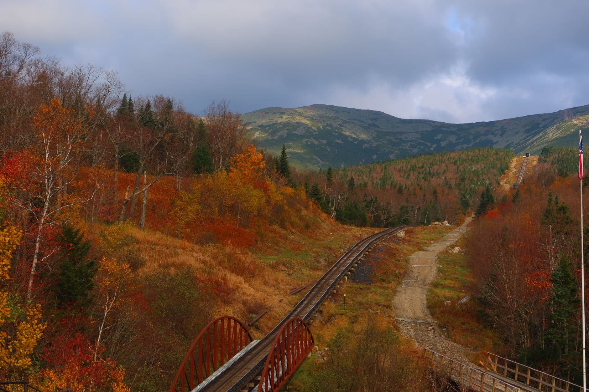
This is the day's centerpiece โ€” whether via the Auto Road or the Cog Railway, reaching 6,288 feet delivers thin air, roaring wind, and views stretching across layered ridgelines in purple haze. Solo travelers often connect easily here โ€” shared shuttle vans, communal viewing platforms at the summit, and fellow hikers comparing notes on conditions make it an unexpectedly social solo day. Check the summit weather forecast before committing, tell someone your plan, and dress for conditions 30โ€“40 degrees colder and far windier than the valley floor.

Mount Washington
Photo by Austin Sullivan on Pexels
Arrive early for a shot at a cloud inversion below the summit cairn โ€” by midday, haze and crowds both increase.
Summit area has some paved platforms; surrounding alpine terrain is rocky, uneven, and unsuitable for limited mobility without assistance.
50 min drive โ€” A descent from alpine terrain back into thick forest, the road curving beside rivers as elevation drops and the air warms.
5:00 PM - 7:00 PM
Kancamagus Highway ยท afternoon ยท 120 min ยท Kancamagus Highway Loop

After the intensity of the summit, the Kancamagus offers a deliberate pace shift โ€” an easy, low-effort drive through cathedral-like forest with pullouts for waterfalls instead of alpine wind. Stretch your legs at Sabbaday Falls or the Lower Falls area, where the scent of pine and dark earth replaces the summit's thin, mineral air.

Kancamagus Highway
United States. Department of Agriculture. Office of Information / wikimedia (Public domain)
Lower Falls catches soft light in early evening โ€” the forest canopy filters harsh sun nicely for texture shots of the water.
Main overlooks are roadside and paved; waterfall viewpoints require short, sometimes uneven walks.
Optional detour: Franconia Notch โ€” After the Kancamagus Highway and before returning to lodging
If daylight and energy remain, a quick return pass through Franconia Notch at dusk offers a completely different mood from yesterday's morning visit โ€” dramatic shadows instead of soft light. Skip if: Skip if the summit day has worn you out โ€” this is an intense day already, and adding a third cluster risks overextension for a solo traveler.
If it rains: If weather sours on the summit, switch immediately to the Cog Railway for a weather-safer ascent, or descend and reroute to the Kancamagus, where mist actually intensifies the waterfalls rather than ruining the experience.

The day opens with a brief, grounding stop in Crawford Notch before the real objective comes into view โ€” Mount Washington itself, its summit often wrapped in cloud even when the valley below sits clear and calm. Starting early here is essential, both to beat the crowds and to give yourself the best weather window before afternoon storms build.

Hours at elevation stretch the day's energy toward its peak โ€” cold wind, thinning air, and sweeping views that make the effort worthwhile, followed by a careful, attentive descent. By late afternoon, the pace deliberately softens as the drive shifts toward the Kancamagus Highway, trading alpine drama for shaded forest and the sound of falling water.

Wind down along the Kancamagus's forest pullouts as the light goes gold and soft, legs tired but spirits high from the day's summit push. Head back into town for a relaxed dinner โ€” bar seating or a communal table works well solo, and after a day like this, easy conversation with fellow travelers over a hearty New England meal feels like the right way to close out the trip.

Want to tweak this trip?

Our AI planner can customize this itinerary to your exact dates, interests, and travel style.

Customize This Itinerary
Good to Know

Restaurant details (hours, menus, availability) change frequently. Check current hours before visiting, especially in seasonal destinations.

Dietary compatibility tags are general guidance. If you have severe allergies, confirm directly with the restaurant.

Travel tips are general guidance, not professional safety advice. Check government advisories and current mountain weather forecasts before summit attempts.

All prices are approximate and may vary seasonally.
We use cookies to improve your experience and analyze site usage. Essential cookies are always active. You can customize your preferences or accept all cookies. Cookie Policy