2 DaysTeen Families5 Stops

White Mountains (North/South), New Hampshire

2-Day Itinerary for Teen Families

โ€œNotch to Notch: A White Mountains Weekend for Teens Who'd Rather Be Outsideโ€

Notch to Notch: A White Mountains Weekend for Teens Who'd Rather Be Outside

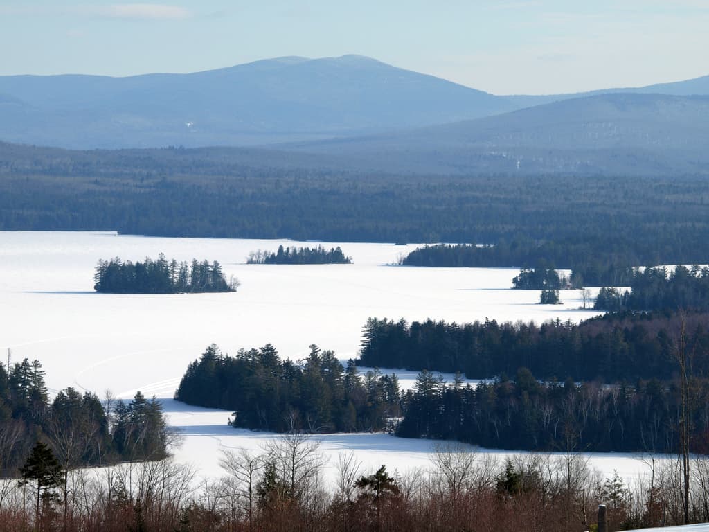
The White Mountains don't do subtle โ€” granite walls lean in over the highway, waterfalls roar loud enough to drown out sibling arguments, and the air smells like balsam and cold river stone. This is a two-day loop built for families with teenagers: enough adrenaline and photo-worthy drama to earn their attention, enough flexibility that nobody's forced into a museum they didn't sign up for.

At a Glance

Climate & Weather
Summer days run mild to warm (upper 60s to low 80sยฐF) with genuine rain risk most afternoons โ€” pack a light rain shell, quick-dry layers, and real hiking shoes, not sandals. Mornings and higher elevations stay cool even in July.
Getting Around
A car is essential โ€” there's no public transit connecting the notches or trailheads. The Kancamagus Highway and Franconia Notch Parkway are the two main arteries; both have frequent pullouts, so resist the urge to rush between stops.
Budget
Plan roughly $80โ€“130/day per family of four for food and activities (Flume Gorge tickets, casual meals, maybe a Cog Railway or Auto Road add-on), not counting lodging.
Safety
Higher summits (especially Mount Washington) can shift from sunny to violent-windy in under an hour โ€” check the summit forecast the morning of, and turn back if weather looks unstable. Black bears are present but rarely aggressive; keep snacks sealed in the car. Notch roads are scenic but narrow and winding, so budget extra driving time.
Connectivity
Cell service is spotty to nonexistent in the notches and on Mount Washington's upper reaches; North Conway and Lincoln have reliable coverage and WiFi. Download offline maps before heading into the mountains.
Local Tips
Arrive at Flume Gorge and major overlooks before 9am โ€” parking lots and boardwalks fill fast by mid-morning in summer. Pack a swimsuit for river pools along the Kancamagus. Let teens pick one stop each day to explore solo within sight โ€” a small taste of independence goes a long way on a family trip.

Highlights

  • Flume Gorge boardwalks squeezed between 70-foot granite walls
  • Profile Lake's mirror-still reflection of Franconia Ridge
  • Sabbaday Falls โ€” a short walk, a serious payoff
  • The Kancamagus Highway's 34 miles of zero-billboard forest
  • Crawford Notch's river-carved drama, easily seen from pullouts
  • Early-morning solitude at overlooks that fill up by 10am

Day-by-Day Plan

Arrival & Alpine Drama

Day 1: Granite Walls and Mirror Lakes: Easing Into Franconia Notch

A gentler first day centered on Franconia Notch's dramatic but low-effort sights โ€” roughly 2 miles of easy walking, moderate energy, built for settling in after travel.

Wear
Layers โ€” a t-shirt under a light fleece or rain shell, sturdy sneakers or light hikers, and a hat for sun at the overlooks.
Budget
$90โ€“120 for the family (Flume Gorge tickets, lunch, snacks)
8:00 AM - 10:00 AM
Franconia Notch ยท morning ยท 120 min ยท Franconia Notch & The Flume

The pass announces itself before you've parked โ€” granite walls rising sheer on both sides, the air suddenly ten degrees cooler and smelling of balsam fir. Pull off at Profile Lake first: on a still morning the water throws back a near-perfect reflection of Franconia Ridge, and by 8am you might have the shoreline to yourselves. This is the easiest possible introduction to the region โ€” no real hiking required, just short walks between pullouts and plenty of places for teens to wander a few steps ahead without losing sight of the group.

Franconia Notch
Paleontological Research Institution (Ithaca, N.Y.) Columbia University / wikimedia (Public domain)
Profile Lake at sunrise or before 9am for glass-still water and the ridge reflection โ€” by mid-morning wind ripples the surface.
Roadside pullouts and short paths are manageable, but paths aren't flat or paved throughout โ€” sturdy shoes recommended.
10 min drive โ€” A short hop south along the Parkway โ€” just enough time to point out Cannon Mountain's cliff face through the windshield.
10:15 AM - 12:00 PM
Franconia Notch ยท midday ยท 105 min ยท Franconia Notch & The Flume

Stay within the same cluster and shift to the Flume Gorge boardwalks โ€” a narrow chasm where granite walls close in overhead and a cold stream churns below wooden walkways. It's dramatic without being strenuous, which makes it a rare stop that satisfies both a teen chasing an adrenaline photo and a parent who wants an easy 1.5-mile loop. Go early; the boardwalks narrow in spots and crowd quickly once tour buses arrive after 11am.

Franconia Notch
Paleontological Research Institution (Ithaca, N.Y.) Columbia University / wikimedia (Public domain)
Midway through the gorge where the walls pinch tightest โ€” soft, indirect light works better than harsh midday sun overhead.
Boardwalks include stairs and uneven sections; not wheelchair accessible.
Optional detour: Parkway pullouts near Cannon Mountain cliffs โ€” After Profile Lake and before Flume Gorge
A five-minute stop for a dramatic straight-up shot of the cliff face โ€” great for a quick teen photo moment. Skip if: Skip if the group is eager to beat the crowds to Flume Gorge; the view is visible from the road anyway.
If it rains: The Parkway stays open in rain and the Flume Gorge boardwalks are covered enough to remain interesting even in a drizzle โ€” the waterfalls actually swell and look more dramatic. If it's a full downpour, consider the Cannon Mountain ski lodge visitor center or duck into Lincoln for shops and a warm meal.

Ease into the mountains rather than sprint โ€” Franconia Notch rewards an early, unhurried start with cool air, quiet overlooks, and the kind of scenery that makes everyone stop scrolling their phones, at least for a minute.

After Flume Gorge, keep the afternoon light โ€” head into Lincoln or North Conway for lunch and a slow wander through shops, letting teens pick a stop or two on their own terms.

Settle in early tonight. Dinner in North Conway or Lincoln, then an early night โ€” tomorrow's day covers more ground and starts earlier.

Mountain Drama & Forest Road

Day 2: The Long Drive Through Everything: Crawford Notch to the Kancamagus

A bigger day covering two clusters โ€” roughly 3 miles of walking across scenic pullouts and a short waterfall trail, moderate-to-high energy with a mountain-scale centerpiece.

Wear
Real hiking shoes, a warm layer for higher elevation (even in summer it's cold up top), rain shell, and swimsuits if the group wants a river dip along the Kancamagus.
Budget
$100โ€“160 for the family (Auto Road or Cog Railway fee if added, lunch, snacks, gas)
45 min drive โ€” An early highway run north from North Conway or Lincoln, coffee in hand, mountains gradually closing in on both sides.
7:30 AM - 8:15 AM
Crawford Notch ยท morning ยท 45 min ยท Crawford Notch & Mount Washington

Start early โ€” Crawford Notch is at its best before the Route 302 traffic builds. The road squeezes between granite walls while the Saco River roars below; stop at the overlook near Crawford Depot for the classic cliff-and-river shot before continuing toward Mount Washington. It's a short stop, but it sets the tone: today is about scale.

Crawford Notch
Shipp, John Edgar Dawson, 1858- [from old catalog] / wikimedia (Public domain)
The overlook near Crawford Depot works best in soft early light, before the sun climbs directly overhead and flattens the cliff faces.
Roadside pulloffs are accessible by car; walking surfaces are uneven gravel.
15 min drive โ€” A short push further along the notch road toward the Mount Washington approach, the peak gradually filling the windshield.
8:45 AM - 11:45 AM
Mount Washington ยท morning ยท 180 min ยท Crawford Notch & Mount Washington

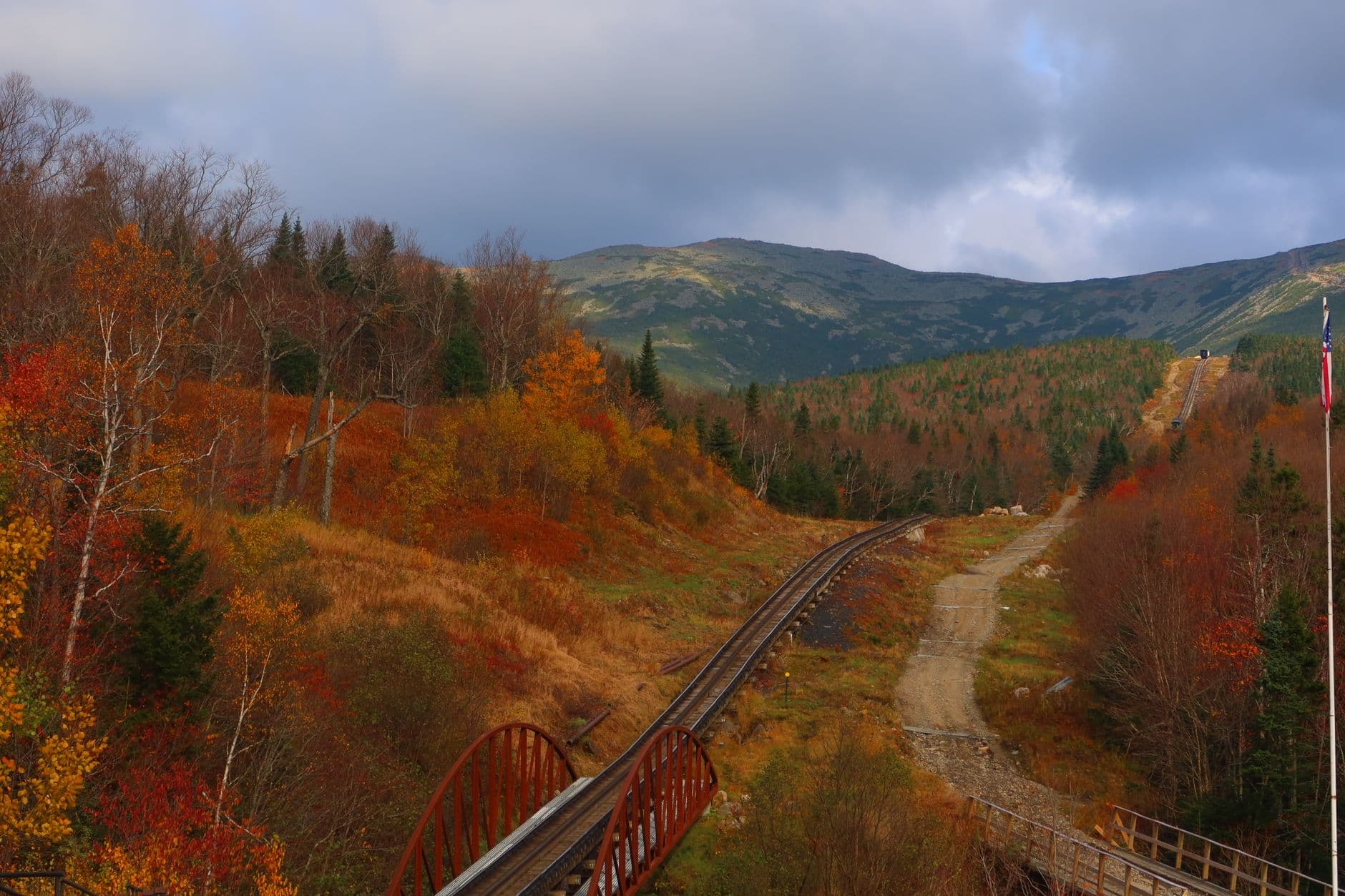
This is the day's centerpiece, and for teen families the sweet spot is 2โ€“3 hours, not a full-day summit slog. Check the summit forecast before committing โ€” winds and cold up top can be startling even on a warm valley day. Whether via the Auto Road or a shorter approach trail toward Tuckerman Ravine, the payoff is real: thin cold air, wind that leans on you, and views stacking ridge after purple ridge to the horizon. Arrive as early as the road/trail allows; by late morning the summit area gets crowded and hazy.

Mount Washington
Photo by Austin Sullivan on Pexels
Cloud inversions are most likely at or just after sunrise; if you're up there mid-morning instead, aim for wide shots along Tuckerman Ravine's headwall for scale.
Summit access is strenuous and weather-dependent on foot; the Auto Road or Cog Railway offers a lower-effort alternative for reaching the top.
50 min drive โ€” A longer transfer south and west, mountains giving way to unbroken forest โ€” a good stretch for snacks and a playlist takeover.
1:30 PM - 3:30 PM
Kancamagus Highway ยท afternoon ยท 120 min ยท Kancamagus Highway Loop

Shift gears entirely โ€” after the intensity of Mount Washington, the Kancamagus is pure low-key payoff: forest canopy, roadside pullouts, and a short walk to Sabbaday Falls that rewards minimal effort with a genuinely striking waterfall. This is a good stretch to let teens set the pace on the short trail, snap their own photos, or wade at a river pullout if the day's warm enough.

Kancamagus Highway
United States. Department of Agriculture. Office of Information / wikimedia (Public domain)
Sabbaday Falls overlook works well any time of day thanks to forest canopy diffusing the light โ€” no harsh midday shadows to fight.
The path to Sabbaday Falls includes some uneven, rooted sections; not stroller or wheelchair friendly.
Optional detour: Lower Falls area โ€” After Sabbaday Falls and before heading back to lodging
A forest-framed swimming hole that's a hit with teens looking to cool off after a warm driving day. Skip if: Skip if the group is tired or short on time โ€” it adds a further stop along an already long day.
If it rains: If storms roll in, descend from Mount Washington immediately regardless of plans โ€” summit weather changes fast and isn't worth the risk. The Cog Railway is a weather-safer way to reach the summit if driving/hiking conditions look poor. Along the Kancamagus, the drive itself remains scenic and safe in light rain, though waterfall trails get slick โ€” stick to overlooks rather than wet, rooted paths.

Today starts earlier and covers more ground โ€” a quick, dramatic pass through Crawford Notch before the day's main event: a few focused hours on Mount Washington, timed to dodge both bad weather and the worst of the midday crowds.

The mood shifts hard after the mountain โ€” the Kancamagus Highway trades alpine intensity for shaded forest road and an easy waterfall walk, giving everyone's legs (and nerves) a break.

Head back toward North Conway or Lincoln as the light softens, with dinner options open in either town โ€” a fitting, low-key close to a trip built around granite, water, and just enough independence to make it memorable.

Want to tweak this trip?

Our AI planner can customize this itinerary to your exact dates, interests, and travel style.

Customize This Itinerary
Good to Know

Restaurant details (hours, menus, availability) change frequently. Check current hours before visiting, especially in seasonal destinations.

Dietary compatibility tags are general guidance. If you have severe allergies, confirm directly with the restaurant.

Travel tips are general guidance, not professional safety advice. Check government advisories for latest information, especially regarding Mount Washington summit conditions.

All prices are approximate and may vary seasonally.
We use cookies to improve your experience and analyze site usage. Essential cookies are always active. You can customize your preferences or accept all cookies. Cookie Policy