3 DaysSolo Traveler6 Stops

White Mountains (North/South), New Hampshire

3-Day Itinerary for Solo Traveler

Notch by Notch: A Solo Winter Traverse of the White Mountains

Notch by Notch: A Solo Winter Traverse of the White Mountains

Winter strips the White Mountains down to essentials: hard light on granite, empty pullouts, the hiss of studded tires on packed snow. This is a solo traveler's season here — the crowds that clog Franconia Notch every October are gone, replaced by silence broken only by wind and the Saco River fighting through ice.

At a Glance

Climate & Weather
Expect daytime highs in the teens to mid-20s°F (-9 to -4°C), colder in wind and at elevation; nights well below zero on clear stretches. Pack true winter layers: insulated waterproof boots, wool base layers, a heavy shell, hand and toe warmers, and microspikes for icy trails. Days are short — full dark by 4:30–5pm — so front-load outdoor plans.
Getting Around
A car is non-negotiable in winter — there is no public transit connecting the notches or the Kancamagus. Roads are plowed but can ice quickly after sunset; drive notch passes in daylight when possible and keep a full tank, since gas stations thin out between towns.
Budget
Budget roughly $70–110/day for a solo traveler — hearty lunches and dinners at taverns and diners, a coffee or two, minor gear rental if needed, and no lift tickets factored in since this itinerary is scenic/hiking-focused rather than alpine skiing.
Safety
Solo winter travel here demands respect for the mountains: tell someone your route and expected return time, especially before any trail beyond a paved pullout. Mount Washington's summit is off-limits for casual solo winter hiking — this itinerary treats it as a valley-view and weather-safe experience only. Keep an emergency kit (blanket, snacks, water, traction devices, charged phone) in the car, and check NH DOT road conditions before crossing any notch.
Connectivity
Cell service is reliable in North Conway, Lincoln, and along Route 302/93 corridors, but drops to spotty-to-none inside the notches and along stretches of the Kancamagus. Download offline maps before setting out each morning.
Local Tips
Winter hours are real — many restaurants and shops close early or take days off entirely November–April, so call ahead rather than assume. Solo diners will find the most natural conversation at bar seating in North Conway's breweries and at counter spots in Lincoln, where locals and other travelers alike tend to linger. Arrive at any scenic pullout within the first hour of daylight; by mid-morning the light flattens and, even in low season, a few other cars will have found the same view.

Highlights

  • Empty-lot sunrise at Profile Lake with Cannon Cliffs glowing pink
  • Flume Gorge boardwalks rimmed in ice under old-growth hemlock
  • Crawford Notch's granite walls narrowing over a frozen Saco River
  • A weather-safe brush with Mount Washington via the valley approach
  • 34 miles of the Kancamagus with almost no one else on the road
  • Sabbaday Falls half-frozen mid-cascade
  • Solo-friendly bar seating and communal tables in North Conway and Lincoln

Day-by-Day Plan

Arrival & orientation

Day 1: Settling Into the Notch — Franconia's Quiet Grandeur

A gentle first day centered entirely in Franconia Notch, with light walking (under 2 miles) and long pauses for photography as you adjust to the cold and the scale of the place.

Wear
Insulated waterproof boots with good tread, heavy base layers, a windproof shell, warm hat and gloves — Flume Gorge's boardwalks can be icy even when groomed.
Budget
$60–80 (lunch, dinner, minor gorge admission if open seasonally)
8:00 AM - 10:00 AM
Franconia Notch · morning · 120 min · Franconia Notch & The Flume

Arrive before 8:30am and Profile Lake is yours alone — no tour buses, no idling engines, just the granite walls of Cannon Mountain catching first light while your breath fogs in the cold. The notch in winter feels almost held in suspension: ice rimming the lake's edges, the highway's hum muffled by snowbanks, ridgelines sharp against a pale sky. Take it slow here; this is your adjustment day, and there's no rush to move on.

Franconia Notch
Paleontological Research Institution (Ithaca, N.Y.) Columbia University / wikimedia (Public domain)
Profile Lake shoreline just after sunrise — the water often stays unfrozen enough near the center to catch a faint reflection of the ridge before wind picks up.
Roadside pullouts are paved but can ice over; use caution and consider microspikes even for short walks to the shoreline.
8 min driveA short crawl north on the Parkway, heater blasting, cliffs growing taller through the windshield with each mile.
10:15 AM - 11:30 AM
Franconia Notch · midday · 75 min · Franconia Notch & The Flume

A short drive up the Parkway brings you to the pullouts beneath Cannon's cliffs, where the vertical rock faces loom directly over the road — genuinely humbling at this scale, especially with snow etching every ledge and crack. This is a good stretch for unhurried photography; nothing about winter here rewards rushing.

Franconia Notch
Paleontological Research Institution (Ithaca, N.Y.) Columbia University / wikimedia (Public domain)
Midday sun rakes low across the cliff faces in winter — look for shadow lines carving texture into the granite.
Pullouts are roadside and level, but snow accumulation varies; check for plowed shoulder space before stepping out.
Optional detour: Echo Lake scenic overlookAfter the Cannon Mountain pullouts and before heading to lodging
A quieter, east-facing vantage that catches Franconia Ridge reflected when the lake isn't fully iced over. Skip if: Skip if the light has already flattened by early afternoon or if you're ready to warm up indoors after two cold stops.
If it rains: If weather turns to rain or heavy snow, the Parkway itself remains drivable and still scenic through the windshield — consider the Cannon Mountain ski lodge visitor center for a warm indoor pause, or wait out the worst of it in Lincoln before resuming.

The day opens slow and cold at Profile Lake, where the absence of crowds lets you actually feel the scale of Franconia Notch rather than photograph it in a hurry. Frost clings to trailside grasses, the lake holds a thin skin of ice at its edges, and Cannon Mountain's cliffs seem to lean into the sky above you. This is deliberately unhurried — a day built for recalibrating to mountain time.

After lingering at the water, a short drive up the Parkway puts you directly beneath Cannon's granite walls, close enough that the scale becomes almost uncomfortable in the best way. There's little walking required here — mostly standing, looking up, and letting the cold sharpen your attention. By early afternoon the light has flattened somewhat, a natural cue to start winding toward town.

With no restaurant data mapped directly to this cluster, plan your evening meal once you've settled into your base town (Lincoln/Woodstock or North Conway) — both offer cozy taverns well-suited to solo dining, with bar seating that makes striking up conversation easy after a quiet day in the notch.

Rugged drama, respected distance

Day 2: Between Granite Walls — Crawford Notch and the Valley View of Washington

A moderate day of scenic driving and short cold-weather stops through Crawford Notch, with Mount Washington approached only as a valley-level, weather-safe viewing experience — roughly 2 miles of walking total.

Wear
Full winter layering system, waterproof boots, hand warmers, and a hat that covers your ears — wind exposure increases noticeably in the notch and near the base of Washington.
Budget
$50–70 (lunch, dinner, coffee)
50 min driveA winding southeast crossing on Route 3 and then 302, mountains shifting from one notch's silhouette to the next; consider a brief pullover at a scenic midpoint if road conditions allow.
8:00 AM - 8:45 AM
Crawford Notch · morning · 45 min · Crawford Notch & Mount Washington

Arrive early and the Saco River's roar over ice-crusted boulders is the only sound for miles — steep granite walls press in on both sides of Route 302, dusted white, with the road itself often the only sign of human presence. This compressed, dramatic passage feels entirely different from Franconia's broader sweep; it's tighter, darker in the shadows, more intimate.

Crawford Notch
Shipp, John Edgar Dawson, 1858- [from old catalog] / wikimedia (Public domain)
The overlook near Crawford Depot offers the classic cliff-and-river composition — best in the first hour of light when shadows still carve depth into the rock.
Roadside pulloffs only; footing near the river can be icy, so stay on cleared shoulder areas.
25 min driveFollowing 302 and then Route 16 north, the peak gradually reveals itself through gaps in the trees, often wreathed in its own private weather system.
9:30 AM - 12:00 PM
Mount Washington · midday · 150 min · Crawford Notch & Mount Washington

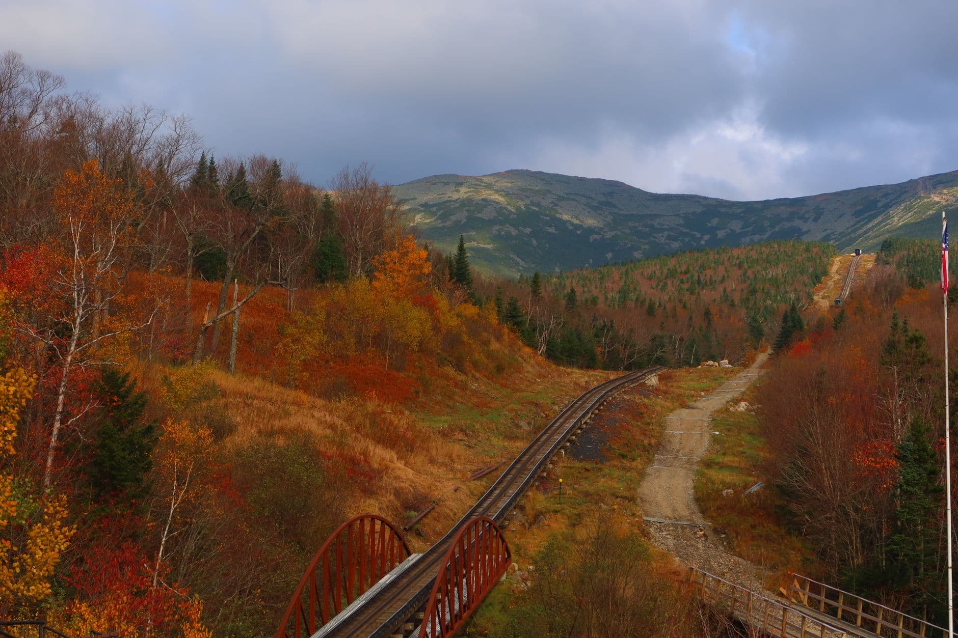
This is not a summit attempt — in winter, that's an expert-only pursuit even for experienced solo hikers. Instead, take in Mount Washington from valley vantage points and interpretive stops near its base, where the scale of the peak is still humbling: distant ridgelines wrapped in cloud, wind visibly tearing snow off the upper slopes even when the valley floor is calm. It's a reminder of why this mountain has its reputation, observed at a respectful, safe distance.

Mount Washington
Photo by Austin Sullivan on Pexels
Look for moments when cloud breaks briefly around the summit — even a partial view against the valley's stillness makes for a striking, moody shot.
Viewing areas are roadside and mostly level, but wind chill can be severe; limit exposed time and warm up in the car between stops.
Optional detour: Saco Lake viewpointAfter Crawford Notch and before heading toward Mount Washington
On a clear morning, Mount Washington can appear reflected faintly in the lake's calmer stretches — a rare double payoff. Skip if: Skip if the lake is fully frozen and snow-covered, which erases the reflection effect entirely in deep winter.
If it rains: If weather deteriorates — rain, heavy snow, or high wind advisories — the notch drive remains passable at reduced speed with headlights on; consider the Cog Railway (weather-permitting alternative) for a safer way to experience Washington's elevation, or retreat to indoor dining in North Conway or Lincoln until conditions clear.

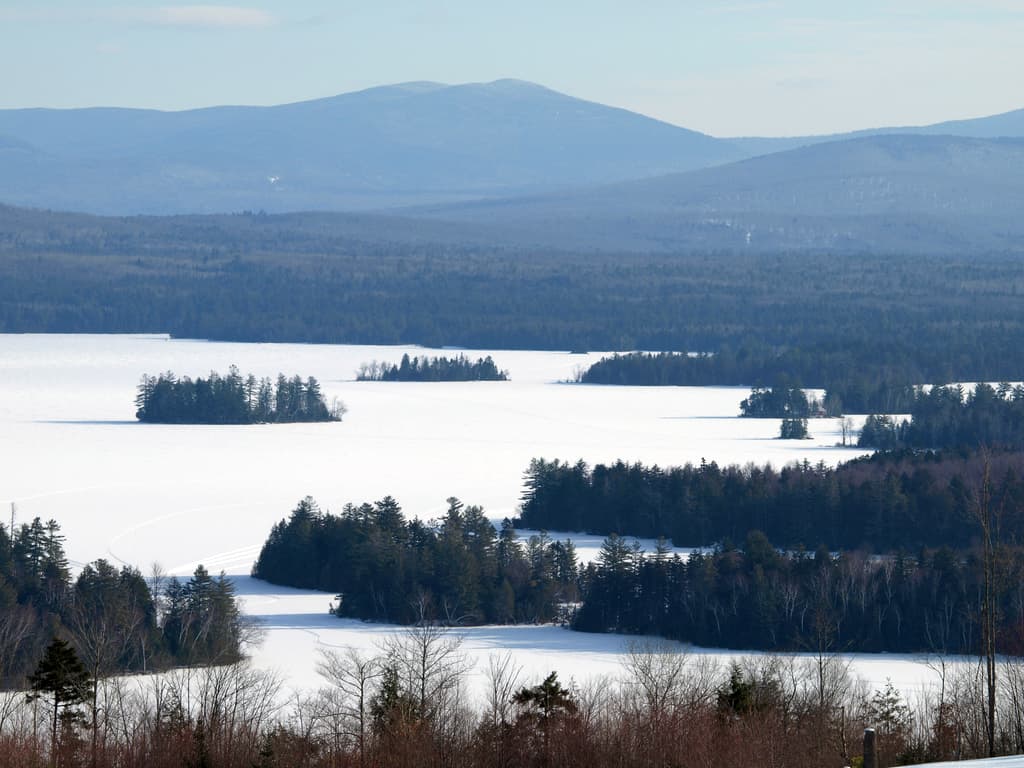
Crawford Notch greets you tight and dramatic, granite walls narrowing overhead while the Saco River fights its way through ice below. It's a shorter, more compressed experience than Franconia — less time needed, but no less striking, especially with the added texture of snow-draped cliffs and low winter sun cutting sideways through the gap.

From there, the drive toward Mount Washington shifts the mood entirely — this is about respecting scale rather than conquering it. Valley-level viewpoints let you watch the mountain's infamous weather in action from safety, wind visibly scouring the upper elevations while you stand comfortably below. It's humbling in a completely different register than yesterday's quiet lake.

As with Crawford Notch itself, dining options directly in this cluster aren't mapped — plan to return to your base town for dinner, where warm taverns and diners offer the kind of hearty, unfussy comfort food that suits a cold day well spent outdoors.

Forest solitude

Day 3: The Empty Kancamagus — Forest, Ice, and the Long Way Home

A lighter final day driving the quiet winter Kancamagus Highway, with short stops for half-frozen waterfalls and forest views, totaling roughly 1.5 miles of walking.

Wear
Warm layers with good traction boots for short icy walks to overlooks; bring a thermos, since amenities along this stretch are minimal in winter.
Budget
$40–60 (lunch, coffee, light dinner)
45 min driveA scenic run south and east from your base, mountains slowly giving way to dense, hushed forest as you enter the Kancamagus corridor.
9:00 AM - 11:00 AM
Kancamagus Highway · morning · 120 min · Kancamagus Highway Loop

Arrive by mid-morning and you'll likely have long stretches of this 34-mile route entirely to yourself — no summer traffic, no foliage crowds, just clean pavement cutting through spruce and birch heavy with snow. Pull off wherever the mountains open up; in winter's low light, the ridgelines take on a soft blue cast that's hard to find any other season.

Kancamagus Highway
United States. Department of Agriculture. Office of Information / wikimedia (Public domain)
Overlooks between mile 20–25 offer wide valley vistas — aim for late morning when the sun has cleared the ridgeline but hasn't yet flattened the snow's texture.
Pullouts are unpaved shoulder in places and may have packed snow or ice; step carefully and keep to cleared sections.
10 min driveA short hop further along the highway, the road narrowing slightly as forest presses closer on both sides.
11:15 AM - 12:15 PM
Kancamagus Highway · midday · 60 min · Kancamagus Highway Loop

Continue to the Sabbaday Falls pullout, where the cascade half-freezes into sculptural ice formations by midwinter — a strange, beautiful contrast to its rushing summer self. The short walk in from the road is quiet enough that you'll likely hear only your own footsteps in the snow and the muffled trickle of water still finding its way beneath the ice.

Kancamagus Highway
United States. Department of Agriculture. Office of Information / wikimedia (Public domain)
Sabbaday Falls overlook pullout captures the ice formations well in flat midday light — no harsh shadows to fight with here.
The path to the falls overlook is short but can be icy and uneven; microspikes are recommended for solo travelers to move confidently and safely.
Optional detour: Lower Falls areaAfter the Sabbaday Falls pullout and before exiting the Kancamagus toward Conway
A forest-canopy-framed waterfall view that rounds out the day's water-and-ice theme without much extra driving. Skip if: Skip if daylight is running short — winter's early sunset means prioritizing the drive back before roads ice over after dark.
If it rains: If rain or fresh snowfall reduces visibility, the Kancamagus remains driveable but views will be limited — treat it as a slower, more contemplative forest drive rather than a scenic-vista day, and consider cutting the route short to return to town before conditions worsen.

The final day trades drama for quiet, the Kancamagus unfolding in near-total solitude under a soft winter sky. Forest presses close on both sides, snow-laden branches arching overhead, and the handful of pullouts you stop at feel like private overlooks rather than tourist stops.

By midday, the short walk to Sabbaday Falls offers one last sensory shift — the sound of water still moving beneath a shell of ice, a strange stillness broken only by your own breath. It's a fitting, low-key close to a trip built around respecting winter's pace rather than fighting it.

With the Kancamagus itself sparse on mapped dining, plan a final meal back in North Conway or Lincoln, where bar seating and communal tables make it easy to end the trip in conversation with fellow travelers or locals, warming up after three days spent largely in quiet, cold air.

Want to tweak this trip?

Our AI planner can customize this itinerary to your exact dates, interests, and travel style.

Customize This Itinerary
Good to Know

Restaurant details (hours, menus, availability) change frequently, especially in winter when many establishments reduce hours or close entirely. Check current hours before visiting.

Dietary compatibility tags are general guidance. If you have severe allergies, confirm directly with the restaurant.

Travel tips are general guidance, not professional safety advice, especially regarding winter mountain conditions. Check government advisories, NH DOT road conditions, and Mount Washington Observatory forecasts before any outdoor activity.

All prices are approximate and may vary seasonally.
We use cookies to improve your experience and analyze site usage. Essential cookies are always active. You can customize your preferences or accept all cookies. Cookie Policy