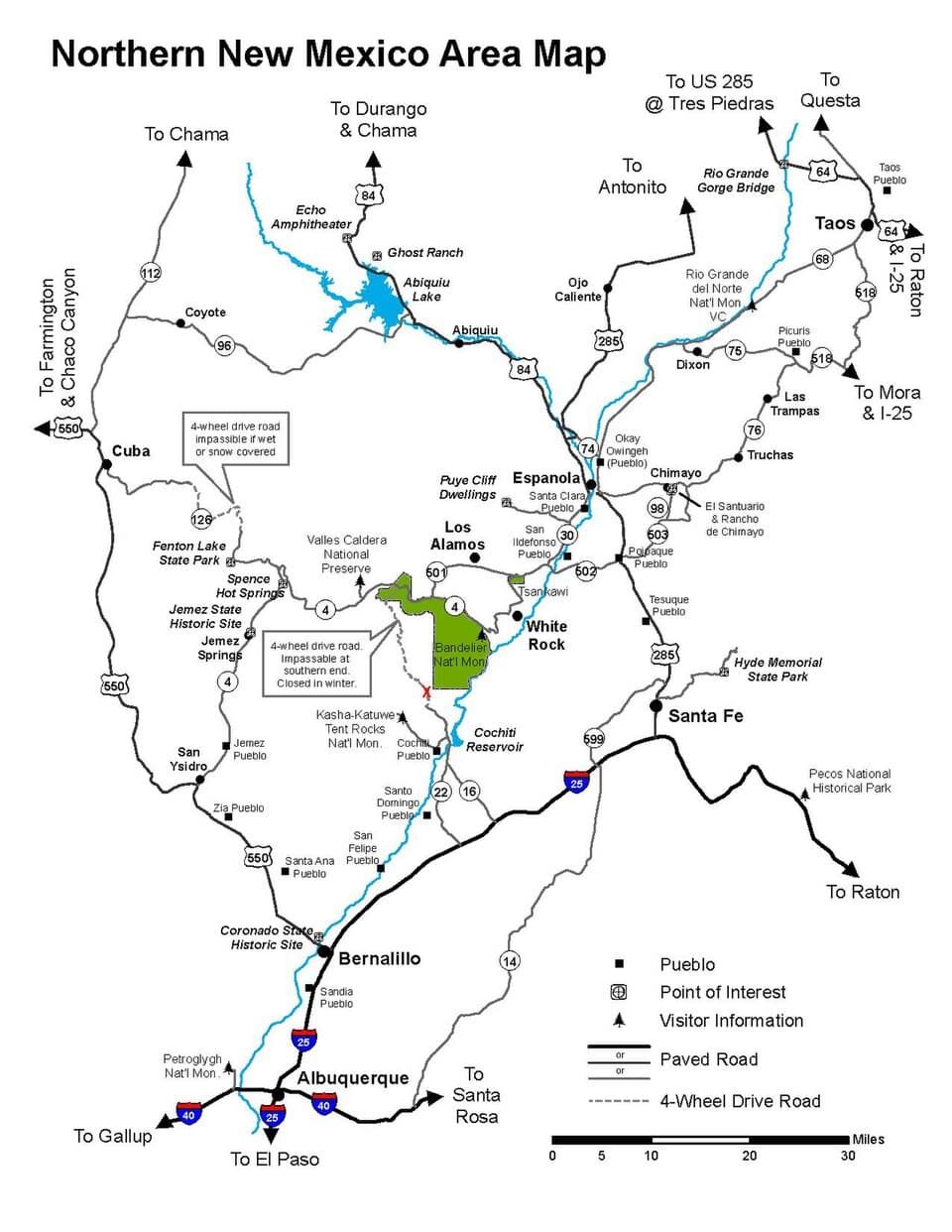
Jemez Mountains (Los Alamos, Jemez Springs), New Mexico
3-Day Itinerary for Solo Traveler
“Volcanic Silence: 3 Days Alone in the Jemez Mountains”

Steam rises off travertine terraces while elk bugle across an eleven-mile-wide caldera—this corner of New Mexico rewards those willing to drive slow, hike early, and sit with silence. Three days alone here move from canyon-bottom hot springs to alpine grassland, with nothing but wind, pine resin, and the occasional distant thunderhead for company.
At a Glance
Highlights
- Soda Dam's mineral-streaked travertine cascade at first light
- A cool, misty scramble to Jemez Falls before the weekend crowds arrive
- Standing atop Battleship Rock with the whole volcanic range unfurled below
- A full day inside one of the world's largest calderas, alone with elk and wind
- Golden-hour photography across meadows ringed by 11,000-foot peaks
- Slow mornings built around solo-friendly pacing and flexible timing
Day-by-Day Plan
Day 1: Settling Into the Canyon's Quiet
A gentle, low-mileage day easing into the region's rhythm with two short, sensory-rich stops in the Jemez Springs Corridor—under 2 miles of walking total.
Arrive by 8am and the travertine terraces are nearly silent save for birdsong bouncing off canyon walls—by mid-morning, weekend visitors start trickling in. Warm, mineral-scented air drifts up from the milky turquoise water as you trace calcified ridges of cream and rust stone, still warm from the night before. It's an easy, contemplative start—no exertion required, just texture and light.

The short approach trail is quiet on a weekday morning, and the payoff is immediate: a roaring cascade dropping through narrow canyon walls, cool mist settling on your skin, the scent of wet earth and Douglas fir thick in the air. Moss-covered rocks edge a clear plunge pool—tempting on a warm day, though footing is slick. This is a good spot to slow down and simply watch water move.
The day begins gently, with Soda Dam's travertine terraces offering a low-effort, high-reward introduction to the Jemez landscape—steam, mineral color, and canyon quiet setting the tone before the sun climbs higher.
By late morning, the short hike to Jemez Falls adds a bit more movement without overwhelming a still-adjusting body—cool mist and moving water make a natural contrast to the dam's stillness, and by early afternoon there's time to rest, eat, and let the altitude settle in before tomorrow's bigger day.
With no fixed plans for dinner in this stretch of canyon, treat the evening as open and easy—wander the village at your own pace, settle in early, and let the sound of the river outside be the evening's entertainment. Most options here are limited, so it's worth checking in with your lodging host for current local recommendations before dinner.
Day 2: Rock, Range, and Rising Ground
A moderate-energy day climbing from canyon to overlook, covering roughly 3–4 miles on foot with one sustained ascent at Battleship Rock.
Arrive by 8am and the trail is yours—quiet, cool, with high-altitude pine and sage scenting the air as wind rushes across exposed volcanic stone. The climb earns a reward: from the saddle, the Valles Caldera begins to reveal itself to the north, rust-colored columnar rock framing an impossibly blue sky. By mid-morning the parking area fills with weekend hikers, so this early window is the one worth protecting.

The morning is built around a single sustained effort—the climb to Battleship Rock—timed deliberately early to beat both heat and the weekend hiking crowd, with panoramic payoff at the top.
Afternoon shifts to a slower gear: descending the trail, driving the scenic byway at an unhurried pace, and allowing the body to recover from the morning's exertion while storm clouds (if any) build over the caldera rim in the distance.
With dining options in this stretch best sourced from lodging in Jemez Springs or Los Alamos, plan to return to town for an early dinner—most kitchens here close by 8pm, so don't wait too long after sunset to look for a seat.
Day 3: Into the Caldera's Vast Quiet
A full, immersive day inside Valles Caldera National Preserve, combining a scenic drive with multiple short walks—roughly 3 miles total at a relaxed, photography-friendly pace.
Enter by 8am and the caldera floor is hushed—mist still clinging to the grass, elk sometimes visible at the meadow's edge before retreating into treeline. Alpine air carries pine resin and the occasional distant bugle call; vistas stretch uninterrupted toward 11,000-foot ridgelines. This is the day's centerpiece: a scenic drive paired with stops at the main overlook, La Cueva picnic area, and the Restless Geysers Trail, each offering a different angle on the volcanic bowl. By midday, visitation picks up noticeably, so claim the quiet now.
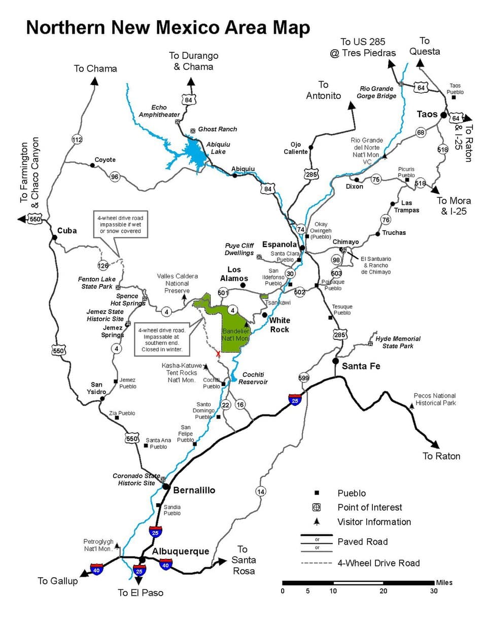
The morning stretches long and unhurried across the caldera floor, moving between overlook, picnic area, and geothermal trail as the light shifts from misty gray to full alpine clarity—this is the trip's quietest, most expansive stretch.
As midday visitation builds, the pace naturally slows—this is the time to linger at whichever overlook offered the best light, watch for wildlife at a respectful distance, and let the scale of the place sink in before the drive back down.
With the caldera's remoteness meaning dining options are best planned back in Los Alamos or Jemez Springs, aim to return to town while there's still daylight and settle into an early dinner—a fitting, unhurried close to a trip built around open sky and quiet ground.
Want to tweak this trip?
Our AI planner can customize this itinerary to your exact dates, interests, and travel style.
Customize This ItineraryRestaurant details (hours, menus, availability) change frequently. Check current hours before visiting, especially in seasonal destinations.
Dietary compatibility tags are general guidance. If you have severe allergies, confirm directly with the restaurant.
Travel tips are general guidance, not professional safety advice. Check government advisories for latest information.
All prices are approximate and may vary seasonally.