3 DaysSolo Traveler10 Stops

San Francisco Bay Area (day trips), California

3-Day Itinerary for Solo Traveler

Fog, Redwoods, and Wind: Three Days Solo in the North Bay

Fog, Redwoods, and Wind: Three Days Solo in the North Bay

The fog here doesn't just roll in — it arrives like a living thing, swallowing ridgelines and softening the roar of the Pacific into a hush. This is a trip built for solitude: redwood groves quiet enough to hear your own footsteps, cliff-top trails where the only company is a tule elk herd, and small-town counters where a solo diner is the most normal thing in the room.

At a Glance

Climate & Weather
Fall brings cooling temperatures (55–65°F), thinning summer fog, and some of the year's clearest inland views, though coastal fog can still roll in fast — pack breathable layers, a waterproof shell, and a warm hat for exposed ridgelines. Days shorten quickly this time of year, so plan sunset activities for 5:30–6pm rather than pushing later.
Getting Around
A rental car is essential — these are car-dependent day trips with no meaningful public transit between clusters. Roads are winding two-lane coastal highways (CA-1, CA-92, US-101); allow extra time and expect slow, scenic driving rather than highway speed.
Budget
Budget roughly $60–90/day for a solo traveler covering meals, coffee, park entrance/parking fees, and incidental costs like the Muir Woods reservation fee — activities here are mostly free (trails, overlooks) so spend concentrates on food.
Safety
This region is very safe for solo travelers, but coastal trails have real hazards — sudden cliff drop-offs, slick rocks, and fog that can erase visibility in minutes. Stick to marked trails, tell someone your rough plan for remote hikes like Tomales Point or Alamere Falls, and carry a downloaded offline map since cell service disappears in several of these clusters.
Connectivity
Cell service is unreliable to nonexistent at Point Reyes, much of Mount Tamalpais, and parts of the Highway 1 corridor near Pescadero. Download offline maps and any trail apps before leaving San Francisco each morning.
Local Tips
Muir Woods requires a timed-entry parking or shuttle reservation booked in advance — do this before you leave home. Arrive at any marquee trailhead by 7:30–8am on weekends to beat both crowds and parking scarcity. Solo travelers will find counter seating and communal picnic tables at harbor-side spots in Half Moon Bay genuinely conducive to conversation with fellow travelers and locals alike.

Highlights

  • Sunrise silence atop Mount Tamalpais before the parking lot fills
  • Fog-hushed cathedral groves in Muir Woods before the tour buses arrive
  • Windswept ridgeline walking on Tomales Point with wild elk for company
  • Pillar Point Harbor at golden hour, fishing boats swaying against fall light
  • Pigeon Point Lighthouse — California's tallest, nearly empty on weekday afternoons
  • Farm-stand pumpkins and fresh seafood in Half Moon Bay's low-key downtown

Day-by-Day Plan

orientation, alpine air

Day 1: Ridgelines and Redwood Hush: Marin's High and Low Country

A gentler first day mixing an easy alpine viewpoint with a beach wind-down, roughly 3 miles of walking at a relaxed pace.

Wear
Layers — a t-shirt base, fleece or light sweater, and a packable waterproof shell; sturdy sneakers or light hikers; a warm hat for the summit wind.
Budget
$45–65 (parking, coffee, lunch, dinner)
8:00 AM - 11:00 AM
Mount Tamalpais · morning · 180 min · Marin Headlands & Mount Tamalpais

Arrive by 8am and the East Peak parking area is nearly empty — just you, the wind combing through Douglas firs, and a view that on a clear fall morning stretches from the Sierra foothills to the flat silver line of the Pacific. This is an easy first-day stop: an easy paved short walk from parking gets you sweeping panoramas without demanding hiking legs, and solo travelers often find the summit benches a natural spot to strike up conversation with fellow early risers. By 9:30am, weekend crowds start filtering in.

Mount Tamalpais
Banks, Charles Eugene, 1852-1932 Read, Opie Percival, 1852-1939 / wikimedia (Public domain)
Shoot from the East Peak summit parking area right at sunrise for the clearest light and fewest people in frame; the Pantoll Ranger Station overlook is a strong second option mid-morning.
Paved overlooks and accessible parking exist near the summit, but most trail sections are uneven and unpaved.
25 min driveA winding descent on Panoramic Highway with the tree canopy suddenly opening to ocean glimpses around each switchback
12:30 PM - 3:30 PM
Stinson Beach · afternoon · 180 min · Marin Headlands & Mount Tamalpais

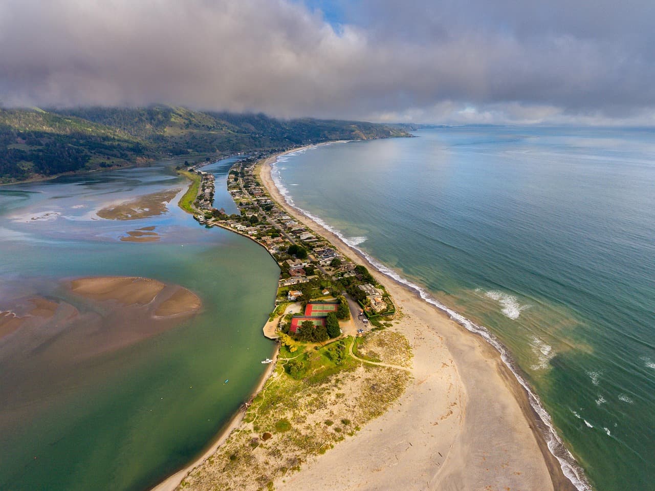
The descent from mountain to shoreline is its own kind of therapy — cool forest air gives way to salt spray and the steady percussion of Pacific swells. Stinson's wide, flat sand is easy solo-hiking territory; walk the shoreline toward the rocky outcrop north of the lifeguard tower for tide pools and a natural turnaround point. Early afternoon light is strong and clean here, good for photos, though the beach fills in on clear fall weekends by early afternoon.
Stinson Beach
Photo by derwiki on Pixabay
The southern end of the beach looking north toward the bluffs is best around 4–5pm as the light turns gold, but a midday visit still rewards the rocky tide-pool area near the lifeguard tower.
Flat, wheelchair-accessible sand access near the main parking lot.
If it rains: If rain moves in, skip Stinson Beach's exposed shoreline and instead spend the afternoon in Mill Valley's covered shopping streets, or push the beach visit to Day 2 and substitute an easier walk near the Pantoll Ranger Station.

The day opens gently and high — Mount Tamalpais at first light, cool air and quiet trails easing you into the trip's rhythm without demanding much of jet-lagged legs. The summit rewards patience: arrive early, and the whole bay seems to belong to you alone.

From alpine hush to ocean roar, the drive down to Stinson Beach flips the day's register entirely. Sand replaces trail dust, and the pace slows further — this is a wander-and-sit kind of afternoon, good for reading a book with your feet in cold water or just watching surfers time the swells.

With no specific dining data mapped to this cluster, plan your evening meal back in whichever town you're staying — Sausalito's waterfront or Mill Valley's small downtown both offer casual, solo-friendly counters and bar seating within a short drive of Stinson Beach.

redwoods, wild coastline

Day 2: Cathedral Light and Coastal Wind: Muir Woods to Point Reyes

A full outdoor day moving from shaded redwood groves to open, windswept peninsula trails — roughly 5-6 miles total, moderate-to-high energy.

Wear
Moisture-wicking layers, a windproof/waterproof shell (Point Reyes wind is relentless), sturdy trail shoes with grip, and a hat that won't blow off.
Budget
$55–75 (parking/reservation fee, lunch, dinner, coffee)
45 min driveA scenic haul back down from Stinson toward Highway 1 then inland on Panoramic Highway, redwood shadows deepening as you approach the valley
8:00 AM - 10:00 AM
Muir Woods (early reservation) · morning · 120 min · Muir Woods & Mill Valley

Book the earliest available reservation — by 8am the fog is often still threading through the canopy, and the grove feels genuinely sacred rather than crowded. The scent of damp redwood and earth is immediate; the silence is the kind that makes you lower your voice without meaning to. Solo travelers get an easy, meditative pace here — no one to hurry for, no rushing past the twin redwoods near the entrance.

Muir Woods (early reservation)
Ontario. Royal Commission on Forest Reservation and National Park / wikimedia (Public domain)
The Main Trail's twin redwoods near the entrance photograph best in the soft, even light of early morning before direct sun breaks through the canopy.
Main boardwalk sections are accessible, but full loop trails involve uneven terrain and roots.
5 min walkA short walk deeper into the preserve, the crowd noise from the entrance fading behind you
10:15 AM - 11:15 AM
Redwood Creek Trail Loop (Muir Woods Extension) · midday · 60 min · Muir Woods & Mill Valley

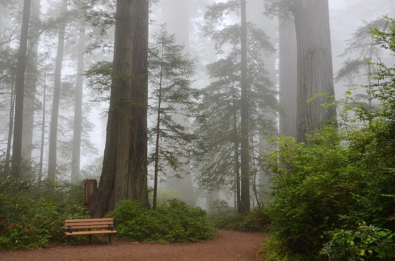
An easy, flat extension of the morning's grove-walking — Redwood Creek murmurs alongside you, and benches every couple hundred meters make this one of the most accessible stretches of ancient forest anywhere in the region. Cathedral Grove, partway along, is worth lingering in; the trees here are the tallest and most photogenic concentration in the whole preserve.
Redwood Creek Trail Loop (Muir Woods Extension)
Photo by USA-Reiseblogger on Pixabay
The main bridge over Redwood Creek gives a classic reflected-tree shot; try late morning once the fog has lifted slightly for definition in the upper canopy.
This loop is flat and wheelchair-accessible with frequent benches — the most accessible stretch of the whole cluster.
50 min driveHighway 1 hugging the coastline, then inland roads through ranch country before the peninsula opens up — a genuinely beautiful drive worth taking slowly
1:00 PM - 3:00 PM
Point Reyes (Chimney Rock, Tomales Point) · afternoon · 120 min · Point Reyes National Seashore

The landscape changes entirely here — golden grasslands drop straight into sea cliffs, and the wind is a constant physical presence. Chimney Rock overlook delivers one of the coast's most dramatic views: white sand, sea stacks, and often a distant elk or two grazing the bluffs. This is prime solo-hiking territory; the openness of the trail makes it easy to relax into your own rhythm.

Point Reyes (Chimney Rock, Tomales Point)
Golden Gate Audubon Society.; Audubon Association of the Pacific.; Audubon Society of the Pacific. / wikimedia (Public domain)
Chimney Rock overlook is best in early-to-mid afternoon when the sun is high enough to light the sea stacks without harsh shadow.
Trails here are uneven and unpaved with real drop-offs — stay on marked paths, especially in wind.
10 min driveA short hop further up the peninsula road to the trailhead, ranch fences giving way to open range
3:15 PM - 5:15 PM
Tomales Point Trail · afternoon · 120 min · Point Reyes National Seashore

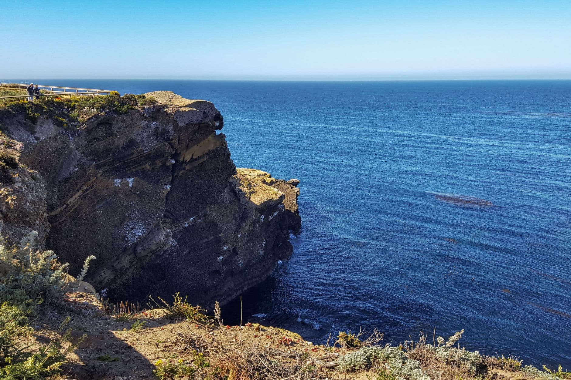
For a solo traveler, this ridge walk is the day's highlight — wild, open, and rated a perfect fit for those wanting real trail immersion. Tule elk often appear along the northern bluffs, grazing unbothered by the wind that never quite stops here. Two oceans of water — bay on one side, Pacific on the other — frame nearly the entire walk. Turn back with enough daylight margin given fall's earlier sunsets.
Tomales Point Trail
Photo by dh tang on Pexels
The overlook around mile 1.5 captures the striking split between bay and ocean — aim for a 4pm start on this stretch to catch softening afternoon light without losing the trail to dusk.
Not accessible — uneven grassland terrain, no paved sections, not recommended for those with mobility limitations.
Optional detour: Alamere Falls TrailBetween Point Reyes (Chimney Rock) and end of day
A dramatic waterfall-onto-beach payoff that's one of the most photogenic spots on the entire coast. Skip if: At 4 hours minimum and rated intense energy, it doesn't fit alongside Tomales Point in the same afternoon without over-extending a solo hiker's day — save it for a dedicated visit.
If it rains: Heavy rain makes both Point Reyes trails muddy and hazardous — if weather turns, shorten the Point Reyes portion to a quick stop at Chimney Rock's main overlook only, or redirect the afternoon to Muir Woods' visitor center and gift shop for shelter.

Redwoods first, while the fog still clings to the canopy and the grove is at its quietest — an early reservation here rewards you with something close to silence, footsteps and birdsong the only sounds.

The scenery flips dramatically as the drive carries you from shaded forest into the wide-open drama of Point Reyes — wind, grassland, and cliffs replacing the hush of the redwoods. This is the day's most physically active stretch, so pace the two trail segments with a water and snack break in between.

No specific restaurants are mapped to either the Muir Woods or Point Reyes clusters, so plan to eat back toward Point Reyes Station or your home base — small, unmapped roadside options and general stores are common in this area even though they're not listed here, so keep an open mind and ask locally.

seaside village, maritime calm

Day 3: Harbor Light and Lighthouse Wind: Half Moon Bay's Coastal Bluffs

A lower-intensity closing day mixing an easy village walk with two cliff-top natural sites, roughly 4 miles of walking at a relaxed pace.

Wear
Layers again — mornings are cool and foggy, afternoons can turn sunny; bring a windbreaker for the lighthouse and marsh overlooks.
Budget
$50–70 (lunch, dinner, coffee, minor parking fees)
9:00 AM - 12:00 PM
Half Moon Bay · morning · 180 min · Half Moon Bay & Coastal Bluffs

Start in town while the fog still clings to Pillar Point Harbor — fishing boats bob quietly, and Main Street's shops are just opening. This is an easy, low-effort morning: wander the harbor, grab coffee, browse the fall pumpkin displays if you're here in season. Solo travelers will find the coffee shops and casual counters here genuinely comfortable for lingering alone with a book or journal.

Half Moon Bay
Elliot, G. F. Scott (George Francis Scott), 1862-1934 / wikimedia (Public domain)
Main Street storefronts photograph best in soft morning light with the harbor visible at the street's end; save the harbor-at-sunset shot for later if your schedule allows a return.
Flat, wheelchair-accessible throughout downtown and the harbor overlook.
20 min driveA quiet stretch of Highway 1 south, farm stands and pumpkin fields flashing by on the inland side
12:45 PM - 2:45 PM
Pescadero State Beach & Marsh Natural Preserve · midday · 120 min · Half Moon Bay & Coastal Bluffs

The shift from cheerful downtown to wild marsh and sandstone cliff is immediate and welcome — this stretch feels far emptier than Half Moon Bay itself, and rated a top fit for solo travelers precisely because of that solitude. Watch for cormorants and, in fall, early migrating shorebirds working the marsh. The cliffside overlook is dramatic but exposed — stay well back from the edge.

Pescadero State Beach & Marsh Natural Preserve
Photo by Edwardo Calles on Pexels
The marsh viewing platforms are best around golden hour, but a midday visit still delivers strong shots at the main beach overlook where cliffs frame the ocean.
Limited accessible terrain — the main overlook is reachable but most trails are uneven and unpaved.
15 min driveA short coastal hop further south, the lighthouse visible from the road well before you arrive
3:15 PM - 4:45 PM
Pigeon Point Lighthouse · afternoon · 90 min · Half Moon Bay & Coastal Bluffs

California's tallest lighthouse rises stark red-and-white against the sky here, and on a weekday afternoon in fall you'll likely have the coastal trail nearly to yourself. The keeper's house and surrounding trail are compact enough for an easy solo wander, with whales sometimes visible offshore during fall migration. This is a fitting, quiet close to an outdoor-heavy three days.

Pigeon Point Lighthouse
Photo by Olzheim on Pixabay
The keeper's house catches a strong reflection of the red tower at golden hour — worth timing your visit's end around 4:30–5pm for this light.
Trails around the lighthouse are uneven; the immediate viewing area near parking is more accessible.
Lunch
The Flying Fish Grill $$
seafood · Near Half Moon Bay
Casual counter-service seafood that locals actually eat at — a solid, unfussy lunch stop near the harbor.
Sushi Main Street $$
japanese · Near Half Moon Bay
A compact, friendly spot on Main Street good for solo counter seating and easy conversation with the chef.
Dinner
Main Street Grill $$
american · Near Half Moon Bay
A relaxed, classic American joint with counter seating — the kind of place where solo diners blend right in.
Tortellini Originali $$
italian · Near Half Moon Bay
Comfort-food Italian in a low-key setting, good for winding down after a long day of coastal walking.
Optional detour: Peet's CoffeeBefore Half Moon Bay walk or after Pigeon Point Lighthouse
A reliable, cozy coffee stop for warming up after the foggy morning or windy lighthouse visit. Skip if: Skip if you're short on time — Starbucks nearby offers the same basic function if Peet's has a line.
If it rains: If rain sets in, skip the exposed Pescadero cliffs and lighthouse trails and instead spend the day in Half Moon Bay's covered downtown galleries and cafés, or drive to Pescadero village itself for indoor browsing.

The day eases in at human scale — a small coastal town waking up, harbor fog lifting slowly, coffee in hand with nowhere urgent to be. It's the gentlest morning of the trip, deliberately so, after two days of trail miles.

From village calm to wild marsh and cliff, the afternoon regains some of the trip's wilder energy without demanding much physical effort — these are shorter, more contemplative stops built for lingering and photography rather than covering ground.

Close the trip with dinner back in Half Moon Bay's compact downtown — Main Street Grill or Tortellini Originali both suit a solo diner well, with casual counter or bar seating that makes eating alone feel unremarkable. It's an easy, unhurried way to let three days of fog, redwoods, and coastal wind settle before heading back.

Want to tweak this trip?

Our AI planner can customize this itinerary to your exact dates, interests, and travel style.

Customize This Itinerary
Good to Know

Restaurant details (hours, menus, availability) change frequently. Check current hours before visiting, especially in seasonal destinations.

Dietary compatibility tags are general guidance. If you have severe allergies, confirm directly with the restaurant.

Travel tips are general guidance, not professional safety advice. Check government advisories for latest information.

All prices are approximate and may vary seasonally.

We use cookies to improve your experience and analyze site usage. Essential cookies are always active. You can customize your preferences or accept all cookies. Cookie Policy