3 DaysSolo Traveler10 Stops

San Francisco Bay Area (day trips), California

3-Day Itinerary for Solo Traveler

Fog, Ferns & Far Horizons: Three Days Solo in the Bay Area's Wild Edges

Fog, Ferns & Far Horizons: Three Days Solo in the Bay Area's Wild Edges

Fog moves through these hills like it owns them, curling around redwood crowns and pouring over ridgelines before the sun burns it back. This is a trip for the solo traveler who wants long silences broken by birdsong, salt wind, and the occasional friendly nod from a fellow early riser on the trail.

At a Glance

Climate & Weather
Spring brings mild days (55–65°F), morning fog that burns off by midday, and the real possibility of rain — pack a waterproof shell, warm layers, and sturdy waterproof boots. Wildflowers peak this season along coastal bluffs, a nice reward for damp mornings.
Getting Around
A rental car is essential — these day trips radiate out from San Francisco via winding coastal and mountain roads, and public transit doesn't reach most trailheads. Download offline maps before you go, as cell service drops out in canyons and along remote coastline.
Budget
Budget roughly $70–110/day for a solo traveler: $10–20 park/reservation fees, $35–55 on meals (mix of casual counters and one nicer dinner), and $10–20 on coffee, snacks, or small souvenirs.
Safety
Solo travelers are generally very safe here, but coastal trails have real hazards: sudden cliff drop-offs, slick rocks, and fog that can erase visibility in minutes. Tell someone your trail plan, carry a charged phone, stick to marked paths, and avoid turning your back on the ocean at tide pools or bluffs — sneaker waves are real.
Connectivity
Spotty to nonexistent in Muir Woods, along Highway 1, and throughout Point Reyes — download maps, playlists, and any reservations in advance. Coverage returns reliably in towns like Mill Valley, Point Reyes Station, and Half Moon Bay.
Local Tips
Book your Muir Woods parking/shuttle reservation days ahead — it sells out, especially on spring weekends. Arrive at trailheads by 7:30–8am to beat both crowds and fog-burn-off delays. Solo diners will find easy camaraderie at counter seating and casual harbor-side spots — locals are chatty about trail conditions and fishing reports.

Highlights

  • Sunrise light filtering through 1,000-year-old redwoods at Muir Woods before the crowds arrive
  • Wind-scoured summit views from Mount Tamalpais stretching to the Sierra on a clear day
  • Tule elk grazing along the wild spine of Tomales Point
  • Waves crashing below Pigeon Point Lighthouse, California's tallest
  • Pillar Point Harbor's fishing boats glowing at golden hour in Half Moon Bay
  • Solo-friendly counter seats and casual bistros where conversation comes easy
  • Wildflowers blooming along coastal bluffs — spring's fleeting gift

Day-by-Day Plan

Arrival & Gentle Immersion

Day 1: Redwood Hush: Settling Into the Fog

A low-key first day among ancient redwoods and a wide, wild beach — about 2.5 miles of easy walking, gentle pace to ease into the trip.

Wear
Layers under a waterproof shell, closed-toe walking shoes with good grip, a hat for sun or drizzle.
Budget
$65–85 (parking/reservation fees, casual lunch, coffee, light dinner)
8:00 AM - 10:00 AM
Muir Woods (early reservation) · morning · 120 min · Muir Woods & Mill Valley

Book the earliest reservation slot you can — arriving by 8am means the grove is nearly silent, mist still clinging to the ferns, and you might have entire stretches of the Main Trail to yourself. The redwoods here are 600–800 years old, some pushing past 250 feet, and the hush under their canopy feels almost sacred. Solo travelers often find this an easy place to strike up quiet conversation with fellow early birds pausing at the same viewpoint.

Muir Woods (early reservation)
Ontario. Royal Commission on Forest Reservation and National Park / wikimedia (Public domain)
Head to the Main Trail twin redwoods near the entrance in the first hour — soft, even light filters through without harsh shadows.
Main boardwalk sections are accessible, but full loop has uneven, unpaved terrain.
5 min walkA short walk connects the two trailheads — barely enough time to shake the moss dust off your boots.
10:15 AM - 11:15 AM
Redwood Creek Trail Loop (Muir Woods Extension) · midday · 60 min · Muir Woods & Mill Valley

Extend your morning with this gentle loop along the creek — the trail is flat, well-benched, and gives you Cathedral Grove's densest concentration of ancient trees without backtracking. Listen for the creek's murmur underneath birdsong; it's a meditative close to your redwood immersion before the crowds thicken.
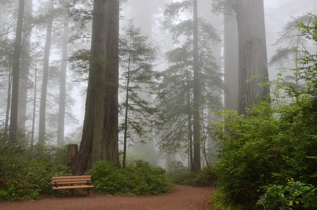
Redwood Creek Trail Loop (Muir Woods Extension)
Photo by USA-Reiseblogger on Pixabay
The main bridge over Redwood Creek offers a classic reflected-tree shot — best in the soft, diffused late-morning light.
Flat sections of the main loop are wheelchair accessible with benches every 200 meters.
25 min driveA winding descent on Highway 1 with the ocean suddenly appearing between cypress trees — pull over at a scenic turnout if you can.
12:30 PM - 3:00 PM
Stinson Beach · afternoon · 150 min · Marin Headlands & Mount Tamalpais

After the forest's hush, Stinson Beach opens everything up — wide sand, thundering Pacific swells, and enough space to stretch your legs after the morning's shaded walk. Solo travelers often bring a book or journal here; the village cafés nearby make it easy to linger over lunch and watch the surf. Early afternoon light is soft enough for good photos without the midday glare.
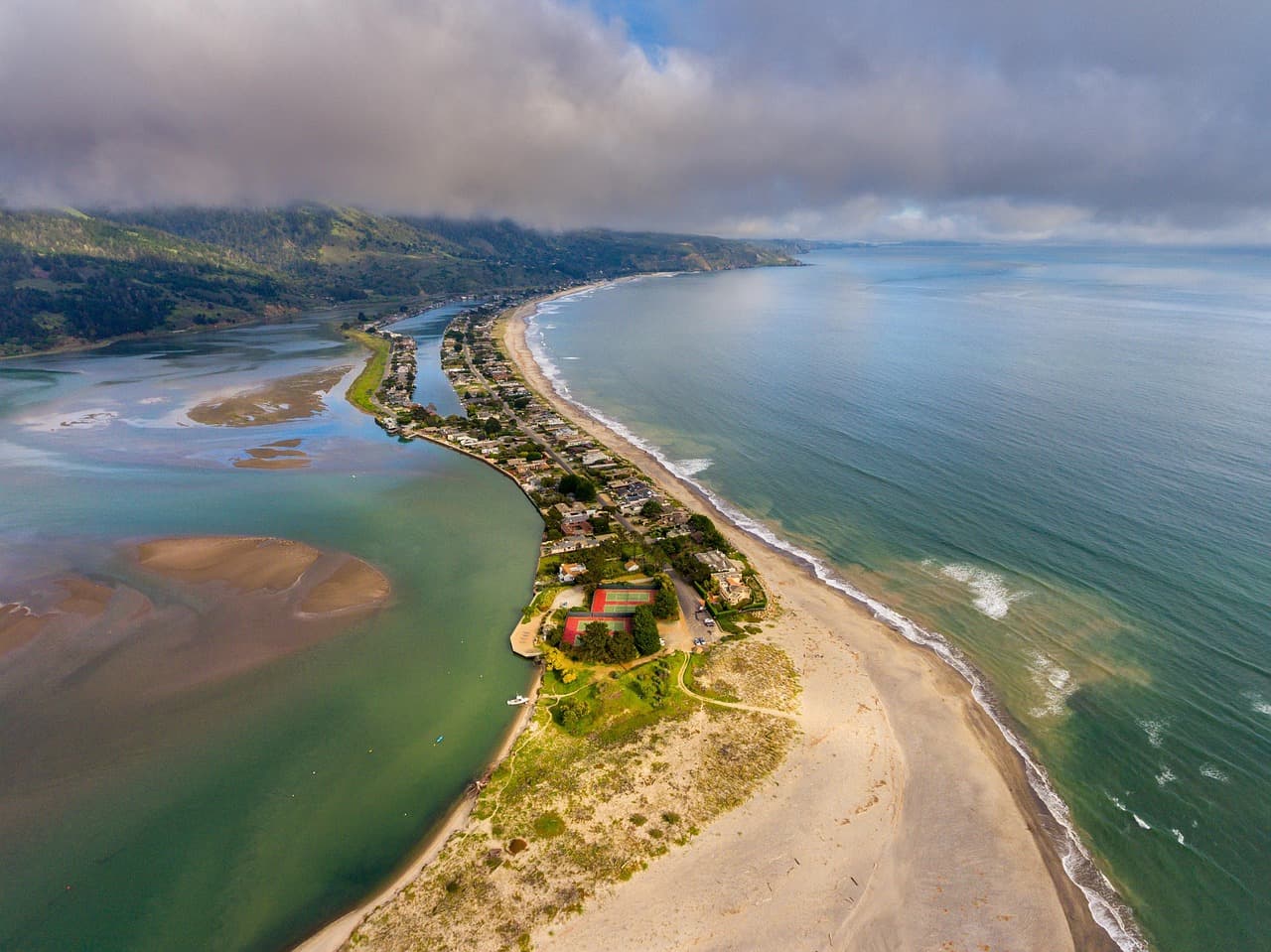
Stinson Beach
Photo by derwiki on Pixabay
Walk to the rocky outcrop north of the lifeguard tower for tide pools and sea stacks, especially striking with afternoon backlight.
Flat, accessible paths along most of the beach; sand itself is loose underfoot.
If it rains: If rain moves in, both Muir Woods trails remain atmospheric and passable in light rain — the fog actually deepens the mood. For Stinson Beach, shift to a covered café in the village or drive north to explore Mill Valley's indoor shops instead.

You'll want to be groggy-eyed and caffeinated by 7:30am, because the real reward here is beating the crowd into Muir Woods. The grove at that hour is close to silent — just filtered light, damp earth smell, and the occasional creak of an ancient trunk settling into the day. It's a gentle, grounding way to start a solo trip: no rush, no itinerary pressure, just scale and quiet.

By midday you'll trade cathedral shade for open sky at Stinson Beach, a total sensory reset. The sound shifts from birdsong to crashing surf, the air turns salty, and the pace naturally slows — a good spot to sit with a coffee, watch dogs chase waves, and let jet lag or travel fatigue settle out of your shoulders.

Head back toward your lodging as the fog starts creeping back over the ridgelines — a signature Bay Area evening effect. Keep dinner simple and unhurried tonight; you've covered enough ground for a first day, and tomorrow asks more of your legs.

Mountain & Ridge Adventure

Day 2: Ridge to Reef: Tamalpais Heights and Coastal Wind

A moderately strenuous day combining mountain views and coastal hiking — approximately 5 miles total, higher energy output than Day 1.

Wear
Sturdy hiking boots, wind-resistant layers, sun protection, and a packable rain shell — Tam's weather can shift fast.
Budget
$70–100 (parking, trail snacks, one sit-down lunch, dinner)
7:30 AM - 10:30 AM
Mount Tamalpais · morning · 180 min · Marin Headlands & Mount Tamalpais

Arrive by 7:30am and the East Peak parking area is nearly empty — a rare gift on a mountain this popular. The summit trail rewards you with a 360-degree panorama: San Francisco's skyline across the bay on one side, the Pacific stretching to the horizon on the other, and on the clearest mornings, the Sierra Nevada's faint outline. The Douglas fir scent and cool mountain air make this a deeply restorative solo hike — many trail regulars are happy to chat about conditions if you strike up conversation at an overlook.

Mount Tamalpais
Banks, Charles Eugene, 1852-1932 Read, Opie Percival, 1852-1939 / wikimedia (Public domain)
The East Peak summit at sunrise offers the clearest light and thinnest crowds — come before 8am for near-empty vantage points.
Trails are unpaved with elevation gain; accessible parking and paved overlooks exist for shorter visits.
20 min driveA twisting downhill drive through eucalyptus groves — roll the windows down as the air turns salty.
11:00 AM - 1:00 PM
Stinson Beach · midday · 120 min · Marin Headlands & Mount Tamalpais

Descend from the ridge to sea level for a contrasting midday stop — after the wind and exertion of the summit, the beach's flat sand and steady surf feel like a reward. This is a good window for a relaxed lunch at one of the village spots before your afternoon drive north.

Stinson Beach
Photo by derwiki on Pixabay
Midday light is flat here, but the southern end of the beach looking toward the bluffs photographs beautifully even without golden hour.
Flat, wheelchair-accessible paths along most of the shoreline.
Optional detour: Pantoll Ranger Station overlookAfter Mount Tamalpais summit and before descending to Stinson Beach
A quick, easy pull-off with sweeping views if you want one more photo stop without extending your hike. Skip if: Skip if you're short on time or already got your summit photos — the view is a slightly lower-elevation echo of what you saw at the top.
If it rains: If heavy rain rolls in, skip the summit trails (they're unpaved and can get slick) and pivot to Muir Woods instead — the redwood canopy handles rain gracefully and the trails remain passable.

The mountain asks for an early start, but it pays you back generously: cool air, empty overlooks, and views that seem to fold the entire Bay Area into a single frame. This is solo hiking at its best — solitude that doesn't feel lonely, just spacious.

By midday you're back at sea level, trading granite and fir for sand and salt spray. The shift in scenery mirrors a shift in energy — slower, looser, good for lunch and people-watching before the day winds toward its next chapter.

Drive back toward town as fog begins rolling over the ridge behind you — a nightly performance worth watching from a pullout if you have five extra minutes. Keep the evening low-key; tomorrow's coastal exploration covers real distance.

Coastal Wilderness & Maritime Charm

Day 3: Wild Edges: Point Reyes Elk and Half Moon Bay Light

A full day split between two dramatic coastal clusters — roughly 4 miles of walking with a scenic drive between, moderate energy throughout.

Wear
Windbreaker or rain shell (Point Reyes wind is relentless), layers, waterproof hiking shoes, sunglasses.
Budget
$75–110 (park fees, lunch, dinner, coffee stops)
7:30 AM - 10:30 AM
Tomales Point Trail · morning · 180 min · Point Reyes National Seashore

This is the trail solo travelers rave about — a 5/5 fit for exactly this kind of trip. Arrive early and the ridge is yours: tule elk grazing in the morning mist, the Pacific crashing on one side and calm Tomales Bay on the other, wind constant in your ears. It's physically engaging without being technical, and the scale of the landscape makes solitude feel expansive rather than isolating.
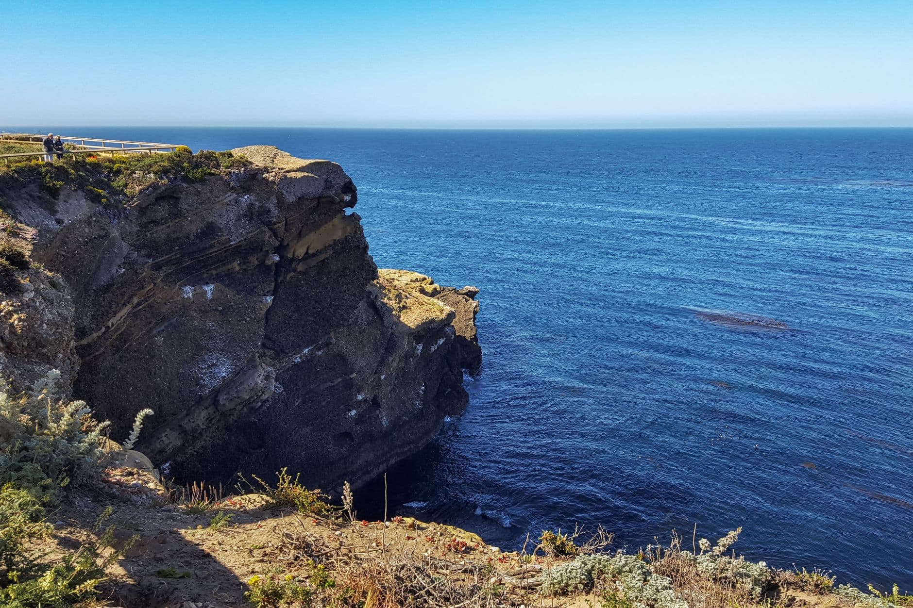
Tomales Point Trail
Photo by dh tang on Pexels
The overlook at mile 1.5 captures the dramatic split between bay and ocean — best in the low-angle morning light before 9am.
Not wheelchair accessible; uneven grassland terrain throughout.
15 min driveA short hop along the peninsula road, sheep and cattle grazing roadside the whole way.
11:00 AM - 1:00 PM
Point Reyes (Chimney Rock, Tomales Point) · midday · 120 min · Point Reyes National Seashore

After the ridge hike, Chimney Rock offers a shorter, equally dramatic payoff — white-sand beaches framed by sea cliffs and, in spring, wildflowers threading through the grass. It's an easy way to extend your Point Reyes time without more serious elevation gain, and a good lunch-break landscape if you packed a picnic.

Point Reyes (Chimney Rock, Tomales Point)
Golden Gate Audubon Society.; Audubon Association of the Pacific.; Audubon Society of the Pacific. / wikimedia (Public domain)
The Chimney Rock overlook is best photographed midday when the white sand and sea stacks catch full sun.
Unpaved, uneven trails; limited accessibility.
55 min driveA long but scenic haul down Highway 1 — consider a quick stop at a coastal pullout partway to stretch your legs and check the ocean's mood.
2:30 PM - 4:00 PM
Pigeon Point Lighthouse · afternoon · 90 min · Half Moon Bay & Coastal Bluffs

California's tallest lighthouse rises 115 feet above a wild, rocky point — a striking contrast to the morning's open grasslands. Solo travelers tend to linger here longer than planned; the coastal trail views and tide pools reward slow wandering, and it's a natural place to swap trail stories with other travelers pausing at the overlook.

Pigeon Point Lighthouse
Photo by Olzheim on Pixabay
Golden hour (around 5–6pm in spring) turns the red-and-white tower into a striking silhouette — but 2:30–4pm still offers good light with fewer crowds.
Trails are uneven; keeper's house museum offers a more accessible indoor alternative.
10 min driveA quick coastal hop — the harbor comes into view as the road curves inland slightly.
4:30 PM - 7:30 PM
Half Moon Bay · evening · 180 min · Half Moon Bay & Coastal Bluffs

End your trip in Half Moon Bay's easy, low-key charm — Pillar Point Harbor glows gold as fishing boats bob at anchor, and Main Street's shops and cafés make for a relaxed final wander. This is a comfortable place to eat solo: counter seating and casual joints mean no awkwardness dining alone, and locals are generally chatty about the day's catch or surf conditions at Mavericks.

Half Moon Bay
Elliot, G. F. Scott (George Francis Scott), 1862-1934 / wikimedia (Public domain)
Pillar Point Harbor at sunset is the classic shot — boats silhouetted against the darkening Pacific.
Flat, wheelchair-accessible paths throughout downtown and harbor areas.
Dinner
The Flying Fish Grill $$
seafood · Near Half Moon Bay
Casual counter-service seafood with harbor-fresh catch — easy and unpretentious for solo diners.
Sushi Main Street $$
japanese · Near Half Moon Bay
A relaxed sushi counter where solo seating feels completely natural — good for winding down after a long day.
Main Street Grill $$
american · Near Half Moon Bay
Classic comfort food in a low-key setting, popular with locals — a solid final-night option.
Optional detour: Pescadero State Beach & Marsh Natural PreserveAfter Pigeon Point Lighthouse and before Half Moon Bay
A wild, quieter stop with sandstone cliffs and marsh birdlife, especially rewarding at golden hour for photography. Skip if: Skip if you're running low on daylight or energy — the terrain is uneven and better suited to a day with more time to spare.
If it rains: If rain sets in, skip Tomales Point (it becomes dangerously slick) and instead stick to short loops near the Point Reyes Visitor Center; in Half Moon Bay, shift to indoor galleries and cafés along Main Street until weather clears.

The wind on Tomales Point hits you almost immediately — bracing, constant, and strangely energizing. Elk graze unbothered as you walk the ridge between two very different bodies of water, and the emptiness of the trail this early makes the whole morning feel like a private preview of the park.

The drive south trades wild grassland for lighthouse drama and eventually the gentler, more domesticated charm of Half Moon Bay. Energy shifts from physical exertion to unhurried wandering — cliffside views give way to harbor light and Main Street's easy pace.

Your last evening calls for a relaxed, solo-friendly dinner — counter seating at a harbor-side spot, the day's hiking replaced by tired satisfaction. Watch the fishing boats settle into the harbor as fog begins its nightly crawl back over the coast, a fitting, quiet close to three days spent at the edges of the Bay Area's wild side.

Want to tweak this trip?

Our AI planner can customize this itinerary to your exact dates, interests, and travel style.

Customize This Itinerary
Good to Know

Restaurant details (hours, menus, availability) change frequently. Check current hours before visiting, especially in seasonal destinations.

Dietary compatibility tags are general guidance. If you have severe allergies, confirm directly with the restaurant.

Travel tips are general guidance, not professional safety advice. Check government advisories for latest information.

All prices are approximate and may vary seasonally.
We use cookies to improve your experience and analyze site usage. Essential cookies are always active. You can customize your preferences or accept all cookies. Cookie Policy