2 DaysTeen Families5 Stops

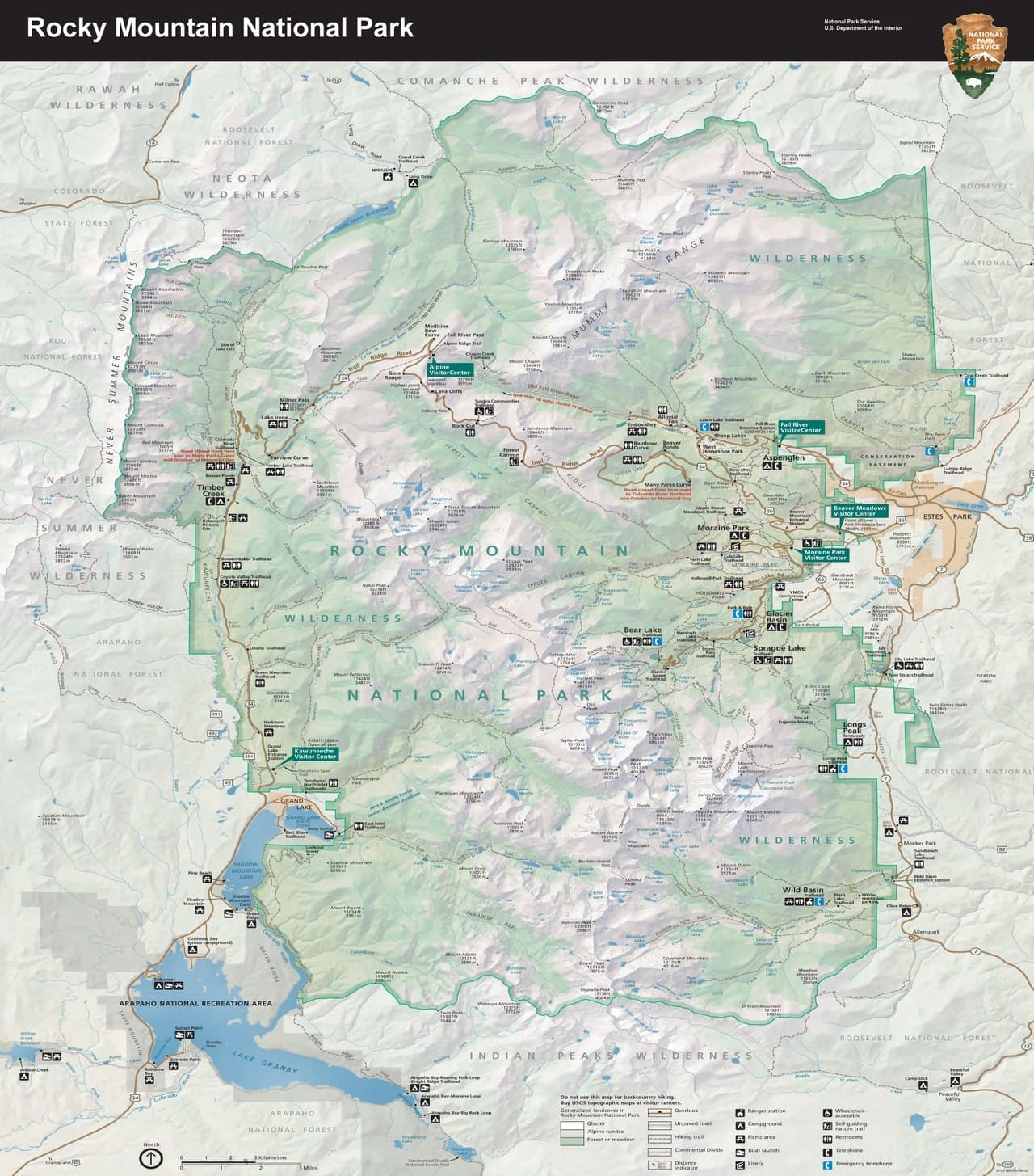
Rocky Mountain NP (Trail Ridge Road), Colorado

2-Day Itinerary for Teen Families

Tundra Skies & Alpine Waters: 2 Days on Trail Ridge Road

Tundra Skies & Alpine Waters: 2 Days on Trail Ridge Road

Above 11,000 feet, the world thins out to rock, wind, and impossible horizons — this is Trail Ridge Road in spring, when snowmelt feeds waterfalls, wildflowers push through tundra soil, and the crowds haven't yet arrived. Two days here move from sky-high overlooks to mirror-still alpine lakes, paced for families with teens who want both awe and a little room to roam.

At a Glance

Climate & Weather
Spring on Trail Ridge Road is unpredictable — expect mild valley temperatures but near-freezing conditions and possible snow flurries at elevation, even in May and June. Pack waterproof layers, a warm hat and gloves, and sun protection; the road's upper sections may have restricted hours or late-season closures depending on snowpack, so check NPS alerts before driving up.
Getting Around
A personal vehicle is essential — there's no public transit on Trail Ridge Road itself, and the route connects Estes Park to Grand Lake via the 48-mile scenic byway. Parking lots at popular stops like Bear Lake fill by mid-morning in shoulder season, so early starts matter as much for parking as for crowds.
Budget
Budget roughly $80–130 per day per family for food and minor activity costs (park entrance fees, cafe meals, snacks) — lodging and gear rental run separately.
Safety
At 12,000+ feet, oxygen levels drop roughly 30%, so altitude sickness (headache, nausea, fatigue) is a real risk for teens and adults alike — ascend gradually, hydrate constantly, and descend immediately if symptoms appear. Afternoon thunderstorms build fast in the high country, so plan alpine activities for morning hours and treat any distant thunder as your cue to head to lower elevation.
Connectivity
Cell service is spotty to nonexistent above 9,000 feet and inside most of the park's interior; Estes Park and Grand Lake have reliable coverage and WiFi at most lodging and restaurants. Download offline maps and let someone know your route before heading up to the tundra.
Local Tips
Arrive at Trail Ridge Road's high-elevation stops before 9am; by late morning, both parking and light quality decline. Spring's shoulder-season crowds are lighter than summer, but variable weather means building in flexibility — have a lower-elevation backup plan for every alpine outing.

Highlights

  • Stand at 11,796 feet where tundra meets sky at the Alpine Visitor Center
  • Photograph the hairpin drama of Many Parks Curve overlooking the Continental Divide
  • Walk the boardwalk at Rock Cut through wind-sculpted alpine tundra
  • Circle Bear Lake at sunrise with Hallett Peak reflected in still water
  • Stroll the fully accessible boardwalk loop at Sprague Lake
  • Spot marmots, pikas, and maybe elk along high-altitude trails
  • Spring wildflowers blooming against snow-dusted peaks

Day-by-Day Plan

Alpine Arrival

Day 1: First Light on the Roof of the Rockies

A gentle but awe-filled introduction to high-altitude Colorado, covering roughly 2 miles of easy walking along Trail Ridge Road's signature overlooks.

Wear
Layered clothing is non-negotiable — a moisture-wicking base, warm mid-layer, and waterproof/windproof outer shell, plus sturdy shoes, sunglasses, and sunscreen for intense high-altitude UV.
Budget
$70–100 for the day (park entrance, cafe lunch, snacks)
8:00 AM - 8:30 AM
Many Parks Curve · morning · 20 min · Trail Ridge Road Scenic Corridor

The road bends sharply here and the whole Continental Divide seems to unfold at once — a hairpin curve that feels like the mountain caught its breath. Arrive by 8am and it's just you, the wind, and the vast tundra scrub; by mid-morning, tour buses crowd the small pullouts. It's a quick stop, but the scale of it lands hard, especially for teens who've only seen mountains in photos.

Many Parks Curve
inkknife_2000 (7.5 million views +) / wikimedia (CC BY-SA 2.0)
Shoot north across Forest Canyon toward the Divide in morning light, when shadows carve out the ridgelines.
No paved path and no benches — involves uneven ground near the overlook, so supervise younger walkers closely.
15 min driveA short climb higher along the byway, ears popping as the road curls past more overlooks and the trees finally give way to open tundra.
9:00 AM - 9:45 AM
Rock Cut · morning · 45 min · Trail Ridge Road Scenic Corridor

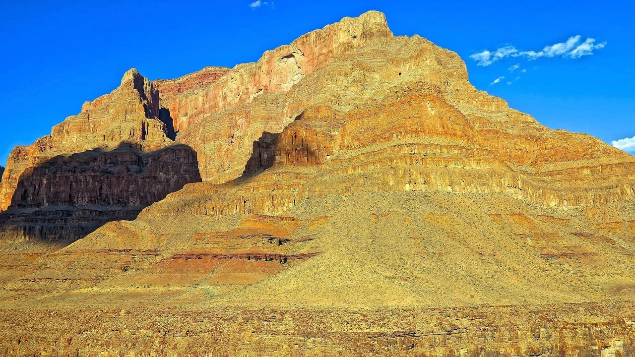
A flat boardwalk threads through genuine alpine tundra at 12,000 feet — brush past low, tough little plants that take decades to grow an inch, and keep ears open for the sharp whistle of a marmot. This is one of the most rewarding stops for families: accessible, safe, and dramatic, with 360-degree views of granite peaks that make the whole trip feel real. Arrive before 10am to beat both crowds and the buildup of afternoon cloud.
Rock Cut
Photo by nextvoyage on Pixabay
The main boardwalk overlook facing the Continental Divide is best photographed mid-morning, before haze builds.
Fully wheelchair accessible with a flat boardwalk and frequent benches — one of the best high-altitude stops for mixed-mobility groups.
10 min driveA short, curving climb further up — watch for sudden temperature drops as the elevation ticks past 11,500 feet.
10:15 AM - 11:00 AM
Alpine Visitor Center · midday · 45 min · Trail Ridge Road Scenic Corridor

At 11,796 feet, this is as close as most visitors get to standing on the roof of the Rockies — step outside and the wind carries the mineral scent of lichen and stone, with views stretching to impossible distances. Inside, exhibits explain the tundra ecosystem in ways that land well with teens curious about how anything survives up here, and the gift shop is a good spot for a low-stakes souvenir stop. It gets busy by midday, so this timing threads the needle between morning cold and afternoon crowds.

Alpine Visitor Center
inkknife_2000 (7.5 million views +) / wikimedia (CC BY-SA 2.0)
The west-facing overlook is stunning even at midday, but for the best light, this spot truly shines closer to sunset if you're staying nearby.
Wheelchair accessible with flat paths and frequent benches, plus mostly indoor exhibits for a rest from wind and altitude.
Lunch
Trail Ridge Cafe $
Cafe/Coffee · At the Alpine Visitor Center
A simple, no-frills spot to warm up with coffee and a quick bite right at elevation — practical rather than fancy, but exactly what's needed after a morning in thin air.
If it rains: If thunderstorms or fog roll in, head straight into the Alpine Visitor Center for its indoor exhibits, or descend to lower elevation entirely — Trail Ridge Road's exposed overlooks are not safe during lightning.

The day opens with a slow climb up Trail Ridge Road, windows cracked to let in the sharp scent of pine giving way to thin alpine air. Many Parks Curve delivers an early gut-punch of scale — the Continental Divide laid out ahead — before the drive continues up to Rock Cut, where a flat boardwalk lets the whole family wander through genuine tundra without breaking a sweat.

By late morning, the group arrives at the Alpine Visitor Center, the literal high point of the day both geographically and experientially. A light lunch at Trail Ridge Cafe offers a chance to warm up and recover from the altitude before easing back down toward Estes Park, giving everyone's lungs and legs a break from the thin air.

Evening settles in back at lower elevation, where oxygen feels thicker and the mountain chill softens. This is a good night to keep things low-key — an early dinner in town and a good night's sleep will make tomorrow's lake hikes feel effortless by comparison.

Alpine Lakes

Day 2: Mirror Lakes and Mountain Light

A moderately active day covering about 3–4 miles of walking across two lake ecosystems, balancing scenic reflection with a bit of teen-friendly adventure.

Wear
Sturdy hiking shoes, moisture-wicking layers, a packable rain shell, and a hat — mornings at the lakes are cold enough for gloves even in late spring.
Budget
$60–90 for the day (park entrance already covered, casual lunch, snacks)
25 min driveAn early, quiet drive along the shuttle road before the day's traffic builds, mountains slowly emerging from shadow.
7:30 AM - 9:30 AM
Bear Lake · morning · 120 min · Bear Lake & Emerald Lake Corridor

Arrive by 7:30am and the lake is glass-still, Hallett Peak doubled perfectly in the water with barely another soul in sight — by 9am the small parking lot fills and the mirror effect gets broken by breeze and boots. The loop trail is easy enough for the whole family, but teens looking for a bit more can push on toward Nymph Lake for a taste of steeper trail and a reward view. Watch for early light catching the granite faces above — this is the postcard moment of the whole trip.

Bear Lake
inkknife_2000 (7.5 million views +) / wikimedia (CC BY-SA 2.0)
Shoot the shoreline reflection of Hallett Peak in the first hour after sunrise, when the water is stillest.
The main Bear Lake Loop is mostly flat but unpaved and uneven in sections — manageable for most fitness levels but not fully wheelchair accessible.
15 min driveA short descent to lower elevation, trees thickening back into forest as the road drops toward the lake.
11:00 AM - 12:00 PM
Sprague Lake · midday · 60 min · Sprague Lake Loop

After the morning's climb, Sprague Lake offers a deliberate pace-down — a fully accessible half-mile boardwalk loop where the whole family can stretch their legs without strain, mountain peaks still looming but the terrain gentle underfoot. Clark's nutcrackers call from the lodgepole pines, and the lake's calm surface makes for another round of reflection shots without the early wake-up call. It's an easy, unhurried midday stop that resets energy before the afternoon.

Sprague Lake
U.S. National Park Service, restoration/cleanup by National Park Maps (https://npmaps.com) / wikimedia (Public domain)
The boardwalk midpoint facing Flattop and Hallett Peak is the classic shot — best around midday when the sun is high enough to avoid harsh shadow on the water.
Fully wheelchair accessible boardwalk with frequent benches — ideal for a lower-energy stop for any member of the group.
Optional detour: Sky Pond TrailAfter Bear Lake and before Sprague Lake
For families with older, adventure-hungry teens (12+) and strong fitness, this full-day trek to a turquoise glacial lake ringed by permanent snow is the single most dramatic hike in the park. Skip if: At 8–10 hours round-trip with serious elevation gain and real lightning risk, it's not feasible to combine with anything else that day and isn't recommended for younger kids or anyone short on time.
If it rains: If storms move in, retreat immediately from Bear Lake's exposed shoreline and head to Sprague Lake's lower-elevation boardwalk, which stays safer and more sheltered in light rain — or shorten the day and head into Estes Park for indoor options.

The day begins early and quietly, with the family arriving at Bear Lake while the water is still glassy and the parking lot nearly empty. The loop trail offers an easy, family-paced walk with the option for teens to push a little further toward Nymph Lake, granite peaks rising sharply overhead the whole way.

By late morning, the pace shifts to something gentler at Sprague Lake, where the fully accessible boardwalk lets tired legs recover while still delivering mountain views and quiet moments by the water. This lower-key stop makes a natural bridge between the morning's early adventure and the wind-down that follows.

With the major hiking behind them, the evening is left open for a relaxed return to town — sore legs, camera rolls full of reflection shots, and the kind of quiet satisfaction that comes from two days spent above the clouds.

Want to tweak this trip?

Our AI planner can customize this itinerary to your exact dates, interests, and travel style.

Customize This Itinerary
Good to Know

Restaurant details (hours, menus, availability) change frequently, especially in seasonal mountain destinations — check current hours before visiting.

Dietary compatibility tags are general guidance. If you have severe allergies, confirm directly with the restaurant or cafe.

Travel tips are general guidance, not professional safety advice. Check NPS alerts and government advisories for the latest road and weather conditions before your trip.

All prices are approximate and may vary seasonally, particularly around shoulder-season openings and closures.

We use cookies to improve your experience and analyze site usage. Essential cookies are always active. You can customize your preferences or accept all cookies. Cookie Policy