3 DaysCouples5 Stops

Rocky Mountain NP (Trail Ridge Road), Colorado

3-Day Itinerary for Couples

โ€œTundra Light: 3 Days Along Trail Ridge Roadโ€

Tundra Light: 3 Days Along Trail Ridge Road

The road climbs until the trees give up and the sky takes over โ€” tundra rolling in every direction, granite peaks catching the first gold light while the valley below still sleeps. This is a trip built for two people willing to rise early, breathe thin air, and let a mountain silence do most of the talking.

At a Glance

Climate & Weather
Summer along Trail Ridge Road means mild days near 45โ€“65ยฐF at elevation with intense sun, sudden afternoon thunderstorms, and the possibility of snow flurries above 11,000 feet even in July. Pack layered clothing โ€” a warm fleece and waterproof shell are non-negotiable, along with sunglasses, sunscreen, and a hat for the high-UV alpine sun.
Getting Around
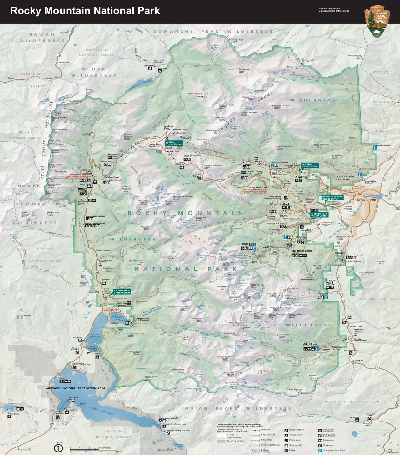
A personal vehicle is essential โ€” there's no public transit on Trail Ridge Road itself. The 48-mile route between Estes Park and Grand Lake takes 2โ€“3 hours without stops, longer in summer traffic, so budget generously and start early.
Budget
Expect roughly $120โ€“200 per day per couple for meals, coffee, and incidentals, plus park entrance fees (around $30 per vehicle for a day pass, more for multi-day passes) โ€” lodging is separate and varies by gateway town.
Safety
The thin air at 12,000 feet (roughly 30% less oxygen than sea level) can cause lightheadedness or headache โ€” move slowly, hydrate constantly, and descend if symptoms worsen. Afternoon lightning is the park's most serious hazard in summer, so plan high-elevation stops for morning and be off exposed tundra by early afternoon. Keep a respectful distance from elk and marmots, and never approach wildlife for a photo.
Connectivity
Cell service is spotty to nonexistent along most of Trail Ridge Road and inside the park's higher elevations; download offline maps beforehand. Estes Park and Grand Lake have reliable WiFi and cell coverage in town.
Local Tips
Arrive at high-elevation stops by 7:30โ€“8am; by 10am parking lots at Bear Lake and the Alpine Visitor Center fill completely and rangers may close access. Reserve a timed-entry permit for Bear Lake Road in advance during summer โ€” it's required and sells out. Bring a thermos of coffee, since dining options thin out dramatically once you're above treeline.

Highlights

  • Sunrise at 12,183 feet with the Rockies laid out below you
  • A boardwalk stroll through tundra where marmots outnumber people
  • Still-water reflections of Hallett Peak at Bear Lake before the crowds arrive
  • Easy, romantic lakeside wandering at Sprague Lake
  • Golden-hour photography at Rock Cut's Continental Divide overlook
  • Afternoon thunderstorm-dodging built into every day's rhythm
  • A pace designed for lingering, not rushing

Day-by-Day Plan

Arrival & Alpine Orientation

Day 1: First Light on the Roof of the Rockies

A gentle, awe-forward introduction to Trail Ridge Road with under 2 miles of easy walking and plenty of pauses to adjust to altitude.

Wear
Layers are essential โ€” a t-shirt under a fleece and waterproof shell, closed-toe walking shoes, sunglasses, and a warm hat for the summit stops.
Budget
$90โ€“140 for the couple (coffee, lunch, light dinner, park entrance)
7:30 AM - 7:50 AM
Many Parks Curve ยท morning ยท 20 min ยท Trail Ridge Road Scenic Corridor

This hairpin turn is where the drive first reveals its scale โ€” the Continental Divide unfurling across the horizon while your breath fogs faintly even in July. Arrive before 8am and you'll likely have the pullover to yourselves, just wind and the tundra scrub at your feet. It's a short stop, but a perfect place to slow down and let the altitude โ€” and the view โ€” settle in together.

Many Parks Curve
inkknife_2000 (7.5 million views +) / wikimedia (CC BY-SA 2.0)
Shoot north across Forest Canyon toward the Divide in early morning light, when haze hasn't yet built up.
No paved path and no benches โ€” sturdy shoes recommended, and the pullover itself is small and unpaved.
15 min drive โ€” A short, curling climb along the byway โ€” windows down, the air noticeably thinner and cooler with every switchback.
8:10 AM - 8:50 AM
Rock Cut ยท morning ยท 40 min ยท Trail Ridge Road Scenic Corridor

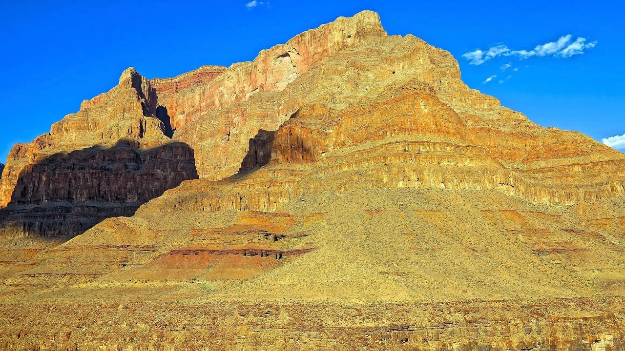
A flat boardwalk winds through genuine alpine tundra at 12,000 feet, past lichen-crusted rock and low, tenacious wildflowers that survive brutal winters. Walk slowly here โ€” not just for the altitude, but because a marmot whistle or a sudden view of the Never Summer Range rewards patience. This is an easy, romantic stretch of walking with 360-degree mountain drama on every side.
Rock Cut
Photo by nextvoyage on Pixabay
The eastern spur boardwalk offers a clean shot of the Never Summer Range as backdrop โ€” best before 10am while light is soft and clouds haven't built.
Fully wheelchair-accessible boardwalk with frequent benches โ€” one of the easiest high-alpine walks in the park.
10 min drive โ€” A brief final climb to the highest point of the drive โ€” ears popping, views widening with every hundred feet.
9:10 AM - 9:55 AM
Alpine Visitor Center ยท midday ยท 45 min ยท Trail Ridge Road Scenic Corridor

At 11,796 feet, this is literally the roof of the Rockies โ€” step outside and the tundra stretches in every direction, broken only by distant granite summits. Warm up over coffee inside if the wind bites, browse the small exhibits on alpine ecology, then step back out to the overlook for one more long look before the midday crowds arrive. By 10am this lot is full; you're arriving right at the edge of the sweet spot.

Alpine Visitor Center
inkknife_2000 (7.5 million views +) / wikimedia (CC BY-SA 2.0)
Face west from the overlook โ€” best light is late afternoon, but morning offers the clearest, haze-free air for distant peaks.
Wheelchair-accessible with flat paths and frequent benches; most exhibits are indoors and step-free.
Lunch
Trail Ridge Cafe $
Cafe/Coffee ยท At Alpine Visitor Center
A simple, warm respite at 11,796 feet โ€” hot coffee, light sandwiches, and a place to thaw out after the tundra wind, right at the Alpine Visitor Center.
If it rains: If afternoon thunderstorms roll in, retreat immediately into the Alpine Visitor Center for indoor exhibits and coffee, and plan to descend to lower elevation rather than linger at exposed overlooks like Many Parks Curve or Rock Cut.

The day begins deliberately early, climbing Trail Ridge Road while the light is still low and gold and the pullovers are empty. Many Parks Curve offers the first wide-open view of the Divide, a quiet moment to catch your breath โ€” literally, at this altitude โ€” before continuing upward.

By midday, you've reached the highest point of the drive at the Alpine Visitor Center, where a warm drink and short rest counter the thin air. This is a good moment to pace yourselves; altitude fatigue is real, and the day's rhythm rewards patience over ambition.

With the alpine stops behind you, the descent back toward your gateway town in Estes Park feels almost gentle by comparison โ€” thicker air, warmer light, and a chance to settle into dinner and rest before tomorrow's lake-focused day.

Lakes & Reflection

Day 2: Still Water and Mirrored Peaks

A moderately active day centered on Bear Lake's reflective waters, with roughly 2.5โ€“3 miles of easy-to-moderate walking.

Wear
Sturdy hiking shoes, moisture-wicking layers, a light rain shell for afternoon storms, and a sunhat โ€” mornings are cold, midday warms quickly.
Budget
$100โ€“160 for the couple (breakfast supplies, lunch, dinner splurge)
25 min drive โ€” A winding descent from the alpine corridor into denser forest, the air thickening and warming as elevation drops โ€” note that a timed-entry permit is required for this road in summer.
7:00 AM - 9:00 AM
Bear Lake ยท morning ยท 120 min ยท Bear Lake & Emerald Lake Corridor

Arrive at first light and Hallett Peak's reflection lies almost perfectly still on the lake's surface โ€” a scene that draws photographers and hikers alike, but at 7am it's often just the two of you and the sound of water lapping the shore. Walk the full lake loop slowly, then continue a short distance up toward Nymph Lake for a framed peak view before the trail traffic builds. By 9am, parking is full and the trail crowds; you'll have already had the best of it.

Bear Lake
inkknife_2000 (7.5 million views +) / wikimedia (CC BY-SA 2.0)
Shoot the shoreline reflection of Hallett Peak in the first hour after sunrise, before wind ripples the water.
The main lake loop is unpaved but relatively flat; the Nymph Lake extension involves moderate uphill grade.
Optional detour: Sky Pond Trail โ€” After Bear Lake, as an alternative to the afternoon rest
For couples craving a serious, all-day adventure, this strenuous trail rewards with turquoise glacial water and dramatic granite basins few visitors ever reach. Skip if: At 8+ hours round-trip with intense elevation gain, it overwhelms the day's pacing for a standard couples itinerary and carries real lightning risk in the afternoon โ€” most couples will prefer the shorter Bear Lake loop and an unhurried rest of the day.
If it rains: If storms build, retreat from the exposed lake trail immediately โ€” lightning risk increases sharply above treeline โ€” and shift the remainder of the day toward lower-elevation, sheltered activities in Estes Park or Grand Lake.

Bear Lake at dawn is the day's centerpiece: still water, sharp granite reflections, and a quiet that summer afternoons never offer. The short extension toward Nymph Lake adds variety without adding real strain, keeping the pace gentle and romantic.

With the lake loop finished before the crowds peak, the afternoon opens up for rest โ€” a slow lunch, a nap, or simply sitting somewhere shaded while the sun climbs high and thunderclouds begin building over the peaks, right on schedule for a Rocky Mountain summer.

As the storm clouds clear and light softens, dinner in the gateway town offers a chance to unwind together, comparing photos from the morning's reflection shots and letting tired legs rest before tomorrow's easier final day.

Easy Wandering & Farewell

Day 3: Slow Mornings and Soft Water

A relaxed, low-impact final day with under 1 mile of walking, designed to close the trip gently.

Wear
Comfortable layers, light jacket for morning chill, and easy walking shoes โ€” no technical gear needed today.
Budget
$70โ€“120 for the couple (breakfast, lunch, any souvenirs)
10 min drive โ€” A short, easy drive along lower forest roads โ€” the elevation gain of the past two days finally behind you.
8:00 AM - 9:00 AM
Sprague Lake ยท morning ยท 60 min ยท Sprague Lake Loop

After two days of altitude and early alarms, Sprague Lake is a deliberate exhale โ€” a flat, half-mile boardwalk loop where Hallett Peak rises in full reflection and the only real sound is Clark's nutcrackers calling from the lodgepole pines. This is the most accessible, unhurried stop of the trip, ideal for lingering hand-in-hand rather than checking off a hike. Arrive by 8am for soft light and near-empty boardwalks before the day-trippers arrive.

Sprague Lake
U.S. National Park Service, restoration/cleanup by National Park Maps (https://npmaps.com) / wikimedia (Public domain)
The boardwalk midpoint facing Flattop and Hallett Peak is the classic shot โ€” best in the first hour after sunrise when the water is glassy.
Fully wheelchair-accessible boardwalk loop with frequent benches โ€” the easiest lake experience in the park.
If it rains: If it rains, shorten the walk to just the main overlook section of the boardwalk, or shift the visit to nearby Hollowell Park for a quieter, sheltered alternative.

The final morning trades ambition for ease โ€” a slow, flat walk around Sprague Lake with coffee in hand, watching Hallett Peak mirror itself in still water while the trip's earlier alarms and altitude finally catch up in a good, tired way.

With no further stops planned, the afternoon is left open deliberately โ€” a last coffee in town, a lingering lunch, or simply sitting somewhere with a mountain view before starting the drive back toward Denver.

As the trip closes, there's no rush โ€” just the quiet satisfaction of having seen the range from its highest paved point to its calmest reflected water, and time enough for one last unhurried dinner together in the gateway town.

Want to tweak this trip?

Our AI planner can customize this itinerary to your exact dates, interests, and travel style.

Customize This Itinerary
Good to Know

Restaurant details (hours, menus, availability) change frequently. Check current hours before visiting, especially in seasonal destinations.

Dietary compatibility tags are general guidance. If you have severe allergies, confirm directly with the restaurant.

Travel tips are general guidance, not professional safety advice. Check government advisories for latest information.

All prices are approximate and may vary seasonally.
We use cookies to improve your experience and analyze site usage. Essential cookies are always active. You can customize your preferences or accept all cookies. Cookie Policy