3 DaysSolo Traveler8 Stops

Rocky Mountain NP (Trail Ridge Road), Colorado

3-Day Itinerary for Solo Traveler

β€œThin Air, Wide Sky: 3 Solo Days on Trail Ridge Road”
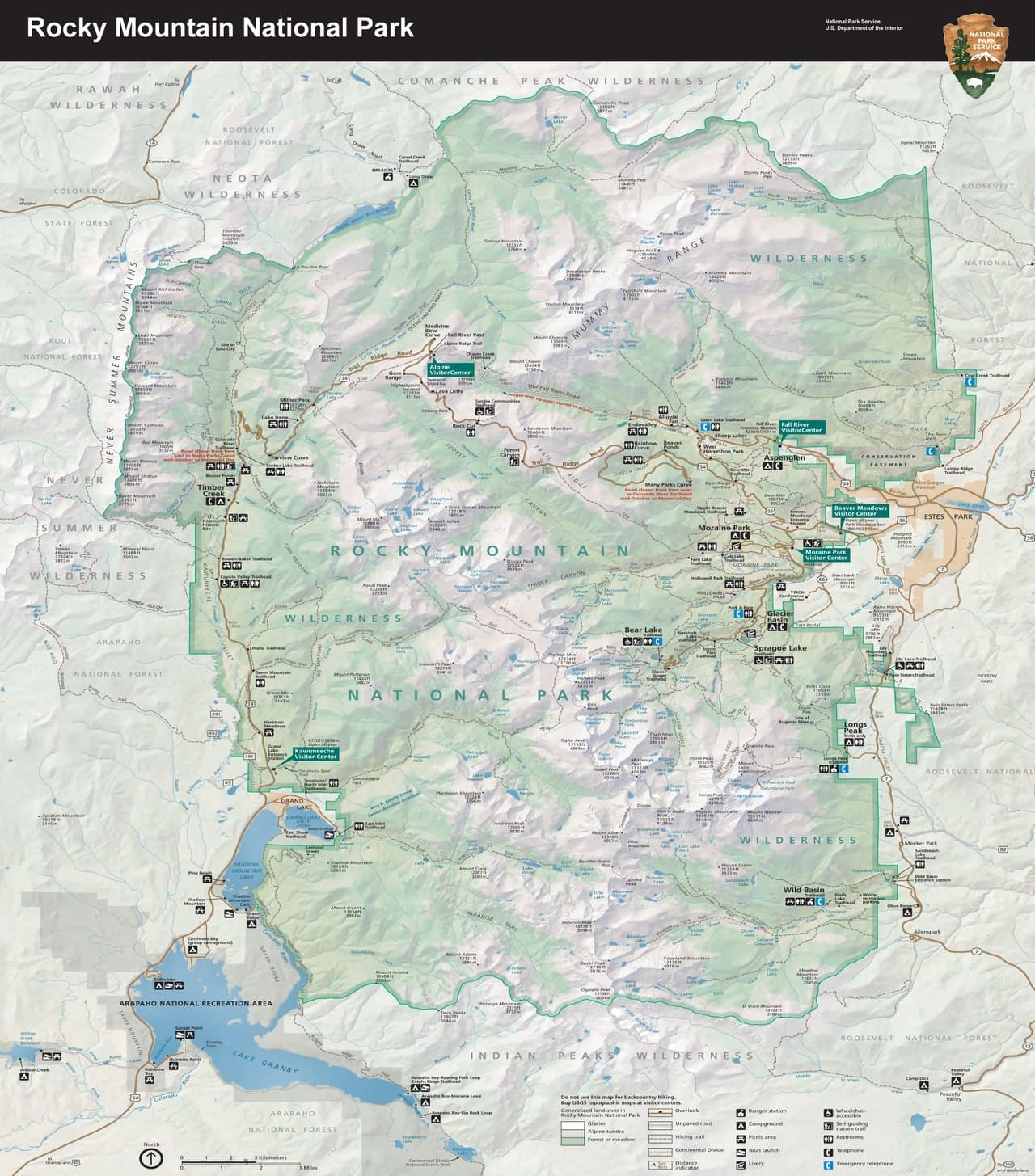
Thin Air, Wide Sky: 3 Solo Days on Trail Ridge Road

Above 11,000 feet the trees give up and the tundra takes over, a rumpled carpet of lichen and wind-bent grass stretching toward peaks that still wear snow in July. This is a landscape built for early risers and unhurried wandering β€” three days threading the highest paved road in North America down into mirror-still lakes, with plenty of room to stop, breathe, and let the scale of it sink in.

At a Glance

Climate & Weather
Summer (July–September) brings mild days near 45–65Β°F at elevation with clear morning skies, but afternoon thunderstorms roll in almost daily above 11,000 feet β€” pack a waterproof shell, insulating layers, gloves, and sun protection even in July. Snow is possible any month at the highest points, so check road status before each drive up.
Getting Around
A personal vehicle is essential β€” there's no public transit on Trail Ridge Road itself, and the park's shuttle system serves the Bear Lake corridor but not the high alpine sections. Base yourself in Estes Park for easy access to both Trail Ridge Road and Bear Lake, and expect parking lots at popular trailheads to fill by 8–9am in summer.
Budget
Budget roughly $60–90 per day for a solo traveler covering meals, coffee, and incidentals, plus the park entrance fee (around $30 for a single-vehicle weekly pass, or free with an annual pass). Gear rental or a bear canister isn't necessary for day trips, which keeps costs modest beyond food and park access.
Safety
Solo travelers should tell someone their plan for the day, especially before longer hikes like Sky Pond, and carry a paper map since cell service vanishes above treeline. Altitude affects everyone differently β€” go slow, hydrate constantly, and descend immediately if you feel dizzy, nauseated, or short of breath beyond normal exertion. Afternoon lightning at elevation is genuinely dangerous; plan to be off exposed tundra and ridgelines by early afternoon, and give elk and marmots a wide, respectful berth.
Connectivity
Cell coverage is unreliable to nonexistent above treeline and patchy even in Estes Park proper β€” download offline maps and let someone know your itinerary before you lose signal. Most lodges and cafes in Estes Park offer WiFi, but don't count on connectivity once you're on the road itself.
Local Tips
Arrive at trailheads and viewpoints by 7–7:30am β€” by 9am, Bear Lake's lot is often full and Trail Ridge Road pullouts are shoulder-to-shoulder with cars. Solo travelers will find easy conversation at communal picnic areas and popular overlooks like Rock Cut, where fellow early risers tend to be chatty about the view; timed-entry permits are required for the park in peak summer months, so reserve online well ahead.

Highlights

  • Watch sunrise turn the tundra gold from Rock Cut's boardwalk, alone but for marmots
  • Stand at 11,796 feet inside the Alpine Visitor Center's thin, crystalline air
  • Trace Hallett Peak's reflection across Bear Lake before the crowds arrive
  • Feel your pulse in your ears on the long climb toward Sky Pond's turquoise water
  • Coast the easy half-mile boardwalk loop at Sprague Lake, peaks doubled in still water
  • Catch afternoon thunderheads building over the Never Summer Range from Many Parks Curve
  • Descend from alpine tundra to lodgepole forest in the span of a single scenic drive

Day-by-Day Plan

Orientation & Alpine Wonder

Day 1: First Light on the Roof of the Rockies

A gentler introduction to altitude with three iconic Trail Ridge Road stops, roughly 1.5 miles of easy walking total, timed to beat both crowds and afternoon storms.

Wear
Layered clothing (t-shirt to insulated jacket), waterproof shell, sturdy walking shoes, sunglasses, and sunscreen β€” temperatures can swing 30 degrees between morning and midday at elevation.
Budget
$45–65 (park entry, coffee, packed lunch, casual dinner in Estes Park)
7:00 AM - 7:30 AM
Many Parks Curve Β· morning Β· 25 min Β· Trail Ridge Road Scenic Corridor

This hairpin turn is where the road first reveals its full ambition β€” the Continental Divide unfurling in the near distance, tundra scrub silvered with morning dew, and your breath visibly clouding even in July's thin air. Arrive at 7am and the pullout is nearly empty; by mid-morning it fills with tour buses and idling cars.

Many Parks Curve
inkknife_2000 (7.5 million views +) / wikimedia (CC BY-SA 2.0)
Shoot north across Forest Canyon toward the Divide in the low, slanted early light β€” the shadows carve the ridgelines into sharp relief.
No paved path and no benches here β€” footing is uneven gravel, so this stop favors those comfortable standing on natural terrain.
10 min drive β€” A short climb along the ridge road, windows cracked despite the chill, the tundra opening wider with every switchback.
7:45 AM - 8:45 AM
Rock Cut Β· morning Β· 60 min Β· Trail Ridge Road Scenic Corridor

At 12,000 feet, the boardwalk at Rock Cut winds through genuine alpine tundra β€” low, tenacious plants that take decades to recover from a single footstep, which is exactly why the boardwalk exists. Wind is constant and cool here even in summer; listen for the sharp whistle of marmots among the granite before the trail fills with mid-morning visitors. This is a good spot to strike up conversation with fellow early risers who share the same wide-eyed reaction to the exposed 360-degree views.
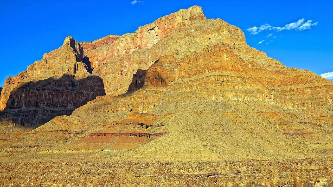
Rock Cut
Photo by nextvoyage on Pixabay
The main boardwalk overlook faces the Continental Divide β€” come between 7:30 and 9am for crisp light with minimal haze and thinner crowds in your frame.
Flat, wheelchair-accessible boardwalk with frequent benches β€” one of the most accessible high-alpine experiences in the park.
10 min drive β€” A brief, winding climb to the park's highest visitor facility, tundra pressing close on both sides of the road.
9:00 AM - 10:15 AM
Alpine Visitor Center Β· midday Β· 75 min Β· Trail Ridge Road Scenic Corridor

Stepping inside at 11,796 feet feels almost absurd β€” a gift shop bell chiming while outside the world drops away into endless tundra and jagged granite. The exhibits explain the ecology you just walked through at Rock Cut, useful context before the crowds arrive in full by mid-morning. Grab something warm at the on-site cafe and sit outside if the wind allows; it's an easy, low-effort spot for a solo traveler to linger and people-watch.

Alpine Visitor Center
inkknife_2000 (7.5 million views +) / wikimedia (CC BY-SA 2.0)
The west-facing overlook is best saved for a return trip near sunset, but midday still offers dramatic cloud-shadow patterns across the tundra.
Fully wheelchair accessible with flat paths and frequent benches β€” the most accommodating stop of the day for any mobility level.
Lunch
Trail Ridge Cafe $
Cafe/Coffee Β· At the Alpine Visitor Center
Simple sandwiches and hot coffee at 11,796 feet β€” not fine dining, but a genuinely welcome warm-up after a windy morning on the tundra.
If it rains: If thunderstorms build early, retreat into the Alpine Visitor Center for its indoor exhibits and gift shop, then descend below treeline entirely rather than lingering on exposed tundra.

The day begins in near-darkness, driving up through switchbacks as the sky lightens from charcoal to rose. Many Parks Curve offers the first big reveal β€” the Continental Divide catching first light β€” before the short climb to Rock Cut, where a flat boardwalk lets you wander deep into genuine alpine tundra with almost no one else around.

By late morning, the Alpine Visitor Center provides a warm, low-effort pivot β€” indoor exhibits, a hot drink, and a chance to rest at altitude before the afternoon's inevitable cloud-build begins. This is the natural point to start descending, both to beat the storms and to let your body acclimatize before tomorrow's longer day.

Head back down into Estes Park by mid-afternoon, giving your body time to adjust to lower elevation before dinner. Keep the evening easy β€” an early meal, a short stroll along the town's main street, and rest ahead of a bigger day at Bear Lake tomorrow.

Alpine Lakes & Reflection

Day 2: Mirror Lakes and Mountain Shadows

A moderate-to-strenuous day centered on the Bear Lake corridor, covering roughly 3-5 miles depending on how far up the trail you choose to go, with an early start essential for parking and solitude.

Wear
Sturdy hiking boots, moisture-wicking layers, a warm mid-layer, waterproof shell, hat, and plenty of sun protection β€” high-altitude sun is intense even on cool mornings.
Budget
$50–70 (trail snacks, packed lunch, evening meal, possible shuttle parking fee)
7:00 AM - 8:30 AM
Bear Lake Β· morning Β· 90 min Β· Bear Lake & Emerald Lake Corridor

Arrive by 7am and Bear Lake is glassy and still, Hallett Peak's granite face doubled perfectly in the water before wind or crowds disturb the surface. The full loop is gentle enough for a relaxed morning walk, and the quiet at this hour makes it easy to actually hear the place β€” water lapping, a distant woodpecker, the occasional creak of settling rock. This is the calm before the day's bigger physical effort.

Bear Lake
inkknife_2000 (7.5 million views +) / wikimedia (CC BY-SA 2.0)
Shoot the shoreline reflection in the first hour after sunrise, when the water is stillest and the light hits Hallett Peak directly.
The main loop is unpaved and uneven in places, not fully wheelchair accessible, but manageable for most walkers at a relaxed pace.
5 min walk β€” The trailhead branches off near Bear Lake itself β€” a short walk past the lake's edge before the real climbing begins.
8:45 AM - 4:45 PM
Sky Pond Trail Β· midday Β· 480 min Β· Bear Lake & Emerald Lake Corridor

This is the day's centerpiece and its biggest physical ask β€” a long, lung-testing ascent past waterfalls and alpine meadows to a glacial pond so turquoise it looks artificially colored. Starting before 9am means tackling the exposed upper basin before early-afternoon thunderstorms typically arrive, and gives solo hikers the best chance to fall in with other trekkers on the trail for casual company. Budget the full day, check weather obsessively before committing to the final push above treeline, and turn back without hesitation if clouds build early.

The Sky Pond shoreline looking west toward the Divide is the reward shot β€” but the switchback traverse around mile 3.5 offers wide-angle vistas worth stopping for even if you don't summit fully.
Not feasible for mobility-impaired travelers β€” steep, rocky, and exposed terrain with significant elevation gain throughout.
Optional detour: Sprague Lake β€” After Sky Pond Trail and before returning to Estes Park
If Sky Pond leaves you craving one more flat, easy mountain view, Sprague Lake's boardwalk offers a gentle half-mile loop with classic peak reflections and almost no elevation gain. Skip if: After a full day on Sky Pond Trail, most solo travelers will be ready to rest rather than add another stop β€” save it fresh for tomorrow instead.
If it rains: If storms build early or the sky looks unstable above treeline, turn back from Sky Pond Trail well before the exposed upper basin β€” there's no indoor alternative on this trail, so erring toward descent is the only safe choice.

The day opens at Bear Lake in near-solitude, the water perfectly still and Hallett Peak mirrored across its surface before the first wave of day-hikers arrives. It's a short, easy loop β€” a calm warm-up before the trail steepens.

From Bear Lake, the Sky Pond Trail climbs steadily through forest, past cascading waterfalls, and finally breaks into open alpine basin where the air thins noticeably and conversation with fellow hikers comes easily on the switchbacks. The turquoise water at the top is a genuine payoff for the effort, but the real discipline is watching the sky the entire way and turning back at the first hint of thunder.

Descend in the mid-to-late afternoon, legs tired and grateful for pavement again. Keep dinner simple back in Estes Park and prioritize an early night β€” tomorrow's pace is intentionally lighter.

Gentle Farewell

Day 3: Easy Miles and a Last Alpine Look

A lighter closing day combining an easy lakeside stroll with a final scenic drive stop, totaling under 2 miles of walking and designed to ease the body after yesterday's exertion.

Wear
Comfortable layers, light waterproof jacket for possible afternoon showers, walking shoes suited to flat boardwalks and short paved paths.
Budget
$35–50 (breakfast, snacks, casual lunch, minimal activity costs)
7:30 AM - 8:30 AM
Sprague Lake Β· morning Β· 60 min Β· Sprague Lake Loop

After two demanding days, Sprague Lake's half-mile boardwalk loop feels like a gift β€” flat, quiet, and utterly scenic, with Hallett and Flattop peaks doubling in the still morning water. Clark's nutcrackers call from the lodgepole pines and the only real decision is which bench to sit on longest. Arrive early and you'll likely have long stretches of boardwalk to yourself.

Sprague Lake
U.S. National Park Service, restoration/cleanup by National Park Maps (https://npmaps.com) / wikimedia (Public domain)
The boardwalk midpoint facing Flattop and Hallett Peak is the classic shot β€” best in the first hour after sunrise when the water is glassiest.
Fully wheelchair accessible boardwalk loop with frequent benches β€” the easiest, most universally accommodating stop of the entire trip.
25 min drive β€” A climb back up onto Trail Ridge Road, the forest thinning into tundra one more time before the final descent.
10:00 AM - 10:30 AM
Many Parks Curve Β· midday Β· 30 min Β· Trail Ridge Road Scenic Corridor

One last stop at elevation before heading down for good β€” the same hairpin curve from Day 1, but the light and clouds are entirely different now, often with dramatic afternoon buildup already forming over the Never Summer Range. It's a fitting bookend: the same view, but you'll notice far more after three days of learning to read this landscape.

Many Parks Curve
inkknife_2000 (7.5 million views +) / wikimedia (CC BY-SA 2.0)
Late-morning light works well here for a westward shot toward the Never Summer Range, especially if clouds are just beginning to build.
Uneven, unpaved footing with no benches β€” a brief stop best suited to those comfortable standing on natural terrain for a short while.
Optional detour: Rock Cut β€” After Many Parks Curve, if time and weather allow before departure
A return visit offers a chance to revisit the tundra boardwalk in different light and say a proper goodbye to the high alpine zone. Skip if: If storms are building or you're pressed for a departure time, it's reasonable to skip a repeat visit and head down while skies are clear.
If it rains: If weather turns at Many Parks Curve, skip lingering and descend directly β€” Sprague Lake's boardwalk remains passable in light rain and can absorb extra time if the morning stop needs to be extended instead.

The morning starts gently at Sprague Lake, an easy boardwalk loop that asks nothing of tired legs while still delivering the same reflective peak views that make this park famous. It's the right note to end on β€” quiet, accessible, unhurried.

A final climb up to Many Parks Curve offers one last wide-open look at the Divide before the long descent out of the park. With three days of altitude acclimatization behind you, the view lands differently now β€” more familiar, more legible.

Plan the drive out with enough daylight buffer to enjoy the descent without rushing, watching the tundra give way to forest one last time. A final relaxed meal in Estes Park is a fitting close before departure.

Want to tweak this trip?

Our AI planner can customize this itinerary to your exact dates, interests, and travel style.

Customize This Itinerary
Good to Know

Restaurant details (hours, menus, availability) change frequently. Check current hours before visiting, especially in seasonal destinations.

Dietary compatibility tags are general guidance. If you have severe allergies, confirm directly with the restaurant.

Travel tips are general guidance, not professional safety advice. Check government advisories and current NPS road/weather conditions before heading out.

All prices are approximate and may vary seasonally.
We use cookies to improve your experience and analyze site usage. Essential cookies are always active. You can customize your preferences or accept all cookies. Cookie Policy