3 DaysTeen Families8 Stops

Rocky Mountain NP (Trail Ridge Road), Colorado

3-Day Itinerary for Teen Families

β€œTundra High and Lake Light: 3 Days on Trail Ridge Road”
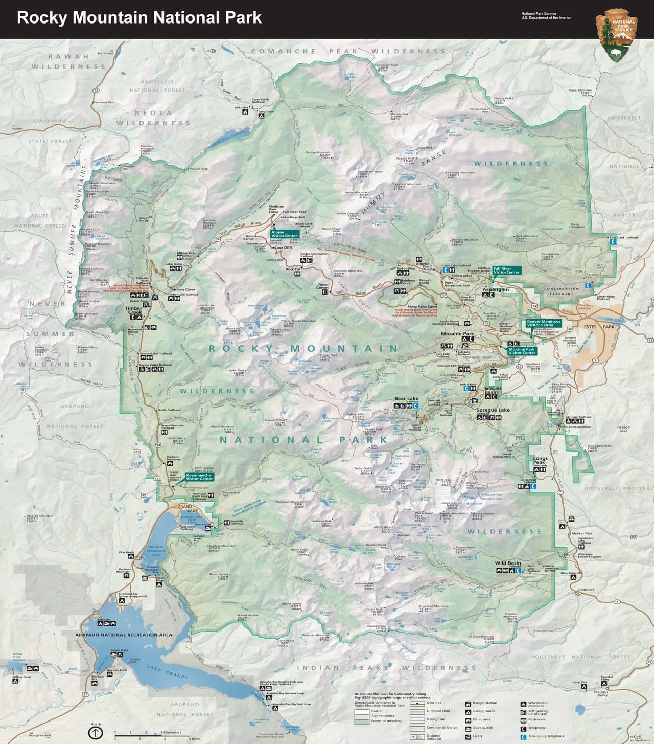
Tundra High and Lake Light: 3 Days on Trail Ridge Road

The road climbs until the trees give up and the sky takes over β€” 12,183 feet of tundra, wind, and impossibly blue distance. This is a trip built for teens who want a little adventure and parents who want everyone home by dinner, with alpine lakes, hairpin overlooks, and just enough elevation to make your ears pop.

At a Glance

Climate & Weather
Summer days on Trail Ridge Road hover around 45–60Β°F at elevation even when Estes Park bakes in the 80s below β€” pack real layers: a warm fleece, waterproof shell, hat, and gloves for the summit stretch, plus sunscreen and sunglasses for the relentless high-altitude UV. Afternoon thunderstorms build almost daily July–September, so plan to be off the ridge by early afternoon.
Getting Around
A personal vehicle is essential β€” there's no public transit on Trail Ridge Road itself. Base in Estes Park for the easiest access to the eastern half of the drive and the Bear Lake corridor; expect to do all your driving yourselves along the 55-mile byway connecting to Grand Lake.
Budget
Plan roughly $70–100 per day per family member for meals and incidentals (park entrance and lodging are separate) β€” casual lodge dinners and cafe lunches in Estes Park run $12–25 per plate, and the Alpine Visitor Center snack bar is pricier for what you get.
Safety
The air at 12,000 feet has roughly 30% less oxygen than sea level, so expect teens and adults alike to feel winded or lightheaded β€” move slowly, hydrate constantly, and descend immediately if anyone shows signs of altitude sickness (headache, nausea, dizziness). Lightning is the real danger up top; if thunder rumbles, get back in the car and drop elevation fast. Keep a respectful distance from elk and marmots β€” they're wild, not photo props.
Connectivity
Cell service is spotty to nonexistent above treeline and inside most of the park β€” download offline maps and let everyone in the group know the plan before you lose signal. Estes Park and Grand Lake have reliable WiFi and cell coverage at lodges and cafes.
Local Tips
Arrive at Rock Cut or Many Parks Curve before 8am in summer β€” by 10am the pullouts fill and the light goes flat and harsh. Bring a picnic lunch to eat lakeside at Bear Lake or Sprague Lake instead of hunting for food at elevation, since dining options thin out dramatically above the gateway towns. Let teens carry their own small pack and choose one photo stop to direct themselves β€” a little autonomy goes a long way on a family trip.

Highlights

  • Sunrise arrival at Rock Cut before the tour buses show up
  • Standing at 11,796 feet at the Alpine Visitor Center, thin air and all
  • Hallett Peak's reflection doubling itself in Bear Lake's still water
  • A hairpin curve view of the Continental Divide that stops conversations mid-sentence
  • Easy boardwalk miles that let tired legs still feel like they earned the view
  • Marmots, pikas, and wind-sculpted rock at 12,000 feet
  • A gentle, accessible lake loop to close out the trip without anyone melting down

Day-by-Day Plan

Arrival & Orientation

Day 1: First Light on the Roof of the Rockies

A gentle first day easing into altitude with a scenic drive and two low-effort, high-reward stops along the Trail Ridge Road corridor, totaling under 2 miles of walking.

Wear
Layers are non-negotiable β€” short sleeves for the drive up, but pack a warm fleece, waterproof shell, hat, and gloves for the summit stops; sturdy sneakers are fine, no technical boots needed today.
Budget
$60-90 for the family (lunch, snacks, gift shop incidentals)
8:00 AM - 8:25 AM
Many Parks Curve Β· morning Β· 20 min Β· Trail Ridge Road Scenic Corridor

Your first taste of the alpine world arrives fast β€” a hairpin curve where the trees fall away and the Continental Divide suddenly fills the windshield. It's a quick stop, perfect for still-adjusting lungs and legs, and the view rewards you disproportionately to the effort. Kids and teens alike gasp audibly the first time; it's a good gauge of how everyone's handling the altitude before you go higher.

Many Parks Curve
inkknife_2000 (7.5 million views +) / wikimedia (CC BY-SA 2.0)
Shoot north across Forest Canyon toward the Divide in the soft early light β€” by mid-morning the haze flattens the contrast.
No paved path and no benches; fine for most but not ideal for anyone needing flat, stable ground.
15 min drive β€” A short climb higher on Trail Ridge Road, windows cracked to feel the temperature drop degree by degree
8:45 AM - 9:35 AM
Rock Cut Β· midday Β· 50 min Β· Trail Ridge Road Scenic Corridor

At 12,000 feet, the boardwalk here loops through genuine tundra β€” low, tough little plants clinging to rock and wind. Arrive by 9am and you'll likely have long stretches of boardwalk to yourselves; by 10am the pullout crowds thicken fast. Let the teens hunt for marmots and pikas while the adults catch their breath β€” literally, the air is noticeably thin here, so keep the pace slow and easy.
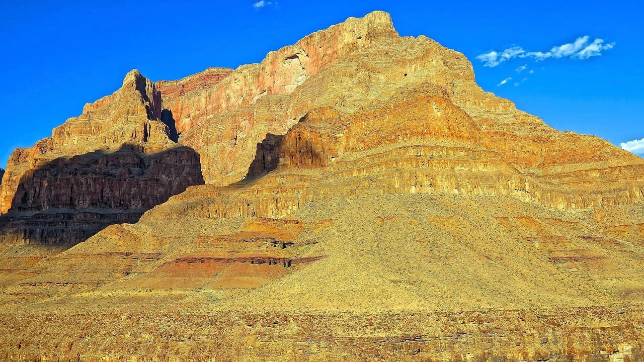
Rock Cut
Photo by nextvoyage on Pixabay
The main boardwalk overlook facing the Divide is best in morning light before clouds build; try the eastern spur for a quieter angle with the Never Summer Range behind you.
Flat boardwalk with frequent benches β€” one of the most accessible high-alpine experiences in the park.
10 min drive β€” A short hop south along the ridge, peaks stacking up on both sides of the road
10:00 AM - 10:50 AM
Alpine Visitor Center Β· afternoon Β· 50 min Β· Trail Ridge Road Scenic Corridor

The roof of the Rockies, literally β€” this is the highest point most visitors reach by car, and the visitor center gives everyone a chance to warm up, browse the gift shop, and read up on the tundra ecosystem you just walked through. It's a good soft landing after two outdoor stops, with indoor exhibits that keep teens engaged without another physical push.

Alpine Visitor Center
inkknife_2000 (7.5 million views +) / wikimedia (CC BY-SA 2.0)
The west-facing overlook is spectacular at golden hour, but midday still delivers β€” just watch for building afternoon clouds signaling it's time to descend.
Fully wheelchair accessible with flat paths and frequent benches β€” the most accessible high-altitude stop in the park.
Lunch
Trail Ridge Cafe $$
Cafe/Coffee Β· At the Alpine Visitor Center
Basic hot food and snacks at 11,796 feet β€” not gourmet, but a genuinely rare chance to eat lunch above treeline.
If it rains: Afternoon thunderstorms build fast at this elevation in summer β€” if clouds darken or thunder rumbles, head straight into the Alpine Visitor Center for indoor exhibits and the gift shop, then descend to lower elevation immediately rather than lingering at Rock Cut or Many Parks Curve.

You'll feel the altitude before you see the views β€” ears popping, air thinning, trees thinning right along with it. Many Parks Curve is your first jaw-drop, a quick hairpin stop that opens onto the Continental Divide like a curtain pulled back. It's brief by design, easing everyone into the day before the bigger stop ahead.

Rock Cut is where the trip really announces itself β€” genuine alpine tundra, a flat boardwalk winding through wind-sculpted rock, and (if you're lucky and quiet) a marmot or two. From there it's a short hop to the Alpine Visitor Center, the literal high point of the drive, where everyone can warm up, grab a snack, and let the achievement sink in without more uphill walking.

Descend back toward Estes Park as the afternoon clouds start stacking up over the peaks β€” a good reminder of why mornings up here are sacred. Settle into town for an easy dinner, let the teens explore the main street a little on their own, and get to bed early; day two asks more of everyone's legs.

Hiking & Alpine Lakes

Day 2: Lakes, Reflections, and Earned Views

A more active day centered on Bear Lake's moderate trails with roughly 3-4 miles of walking and a moderate energy level, balanced by a shorter, easier stop later.

Wear
Real hiking shoes with grip, moisture-wicking layers, a warm layer for the lake breeze, sun hat, and a light rain shell β€” weather here turns fast even on a clear morning.
Budget
$70-110 for the family (packed lunch supplies, snacks, possible gear rental)
25 min drive β€” Down and around from Trail Ridge Road into the Bear Lake corridor, the road narrowing as the forest thickens
7:30 AM - 9:30 AM
Bear Lake Β· morning Β· 120 min Β· Bear Lake & Emerald Lake Corridor

Arrive by 7:30am and the lake is glass-still, Hallett Peak's reflection doubling the mountain in the water before the wind and the crowds arrive. The main loop is easy enough for tired legs, but there's enough trail branching off toward Nymph Lake to satisfy teens craving a bit more distance and a bit more solitude. This is the kind of place that quiets a car full of teenagers β€” the scale of it does the work for you.

Bear Lake
inkknife_2000 (7.5 million views +) / wikimedia (CC BY-SA 2.0)
Shoot the shoreline reflection of Hallett Peak in the first hour of light, before wind ripples the water β€” by mid-morning the mirror effect is gone.
The main lake loop is unpaved but relatively flat; side trails toward Nymph Lake are rougher and not accessible for mobility devices.
15 min drive β€” A short descent to a lower, quieter pocket of the park, pines thickening around the road
1:00 PM - 2:00 PM
Sprague Lake Β· afternoon Β· 60 min Β· Sprague Lake Loop

After the morning's exertion, Sprague Lake is the perfect counterweight β€” a half-mile boardwalk loop so easy it barely counts as a hike, but the views of Flattop and Hallett Peak rival anything you worked harder for at Bear Lake. It's a good spot to let legs recover while still checking the box on a classic mountain-lake photo.

Sprague Lake
U.S. National Park Service, restoration/cleanup by National Park Maps (https://npmaps.com) / wikimedia (Public domain)
The boardwalk midpoint facing Flattop and Hallett Peak is the classic postcard shot β€” best in early afternoon light before shadows lengthen.
Fully wheelchair accessible boardwalk loop with frequent benches β€” the easiest full lake experience in the park.
Optional detour: Sky Pond Trail β€” Could replace Bear Lake for older, fitter teens (12+) wanting a full-day adventure
The turquoise glacial lake at trail's end is genuinely one of the most spectacular sights in the park and a serious bragging-rights hike for capable teens. Skip if: At 8-10 hours round trip with real elevation and lightning exposure, it blows past the demographic's pacing needs and isn't recommended for younger kids or anyone not already acclimatized.
If it rains: If storms roll in over the Bear Lake basin, head back to the trailhead immediately β€” exposed lake shorelines and ridgelines are dangerous in lightning; there's no indoor alternative in this cluster, so plan the earliest possible start to beat afternoon weather entirely.

The alarm is early today, but Bear Lake at dawn is worth every yawn β€” mirror-still water, Hallett Peak looming, and almost nobody else around. Give the family time to wander the full loop and maybe push a little further toward Nymph Lake if legs and enthusiasm hold out; this is the day's centerpiece and deserves the unhurried morning light.

After lunch and a short drive, Sprague Lake offers a deliberate change of pace β€” flat, easy, and forgiving on tired legs, but no less scenic. It's a smart way to close out the physical part of the day without anyone hitting a wall, and the boardwalk makes for an easy, low-stress family stroll.

Head back into Estes Park with sore legs and good photos, and let the evening be low-key β€” a casual dinner, maybe a short stroll through town, and an early night. Tomorrow eases back down in intensity, so tonight is about recovery, not more adventure.

Wind-Down & Departure

Day 3: Last Light on the Ridge

A lighter final day revisiting the Trail Ridge Road corridor for photography and a farewell overlook, with under 2 miles of easy walking.

Wear
Same layering strategy as day one β€” warm layer and waterproof shell for elevation, comfortable shoes, sun protection for the exposed overlooks.
Budget
$50-80 for the family (lunch, snacks, any last souvenirs)
7:45 AM - 8:35 AM
Alpine Visitor Center Β· morning Β· 50 min Β· Trail Ridge Road Scenic Corridor

One more pass through the highest point on the drive, but this time in the hush of early morning β€” arrive by 7:45am and you'll likely have the overlook nearly to yourselves, a stark contrast to the midday crowds from day one. It's a good chance to finish any gift shopping and take in the tundra view one last time before descending for good.

Alpine Visitor Center
inkknife_2000 (7.5 million views +) / wikimedia (CC BY-SA 2.0)
Morning light here is softer and less contrasty than midday β€” a good final chance for wide tundra shots without haze.
Fully wheelchair accessible with flat paths and frequent benches.
15 min drive β€” Descending gradually, the tundra giving way slowly back to trees
9:00 AM - 9:20 AM
Many Parks Curve Β· midday Β· 20 min Β· Trail Ridge Road Scenic Corridor

A short farewell stop on the way back down β€” the same hairpin view from day one, but now familiar, almost like an old friend. It's a nice bookend: the first alpine view and the last, framing the whole trip.

Many Parks Curve
inkknife_2000 (7.5 million views +) / wikimedia (CC BY-SA 2.0)
Late morning light works well here for a final group photo with the Divide in the background.
No paved path or benches; a brief, easy stop for most.
Lunch
Trail Ridge Cafe $$
Cafe/Coffee Β· At the Alpine Visitor Center
A last hot drink or snack at elevation before the long drive down β€” convenient rather than exceptional, but the setting makes up for it.
If it rains: If weather closes in early, skip Many Parks Curve and head straight into the Alpine Visitor Center for a longer indoor visit, then descend to Estes Park ahead of schedule rather than waiting out a storm on the exposed ridge.

The final morning is deliberately gentle β€” one more early visit to the Alpine Visitor Center while the light is soft and the crowds haven't arrived, giving everyone a last unhurried look at the tundra from 11,796 feet.

A brief stop at Many Parks Curve on the way down closes the loop nicely, echoing the first big view of the trip before the road winds back down through the trees toward Estes Park.

With the drive down complete, the rest of the day is open for a relaxed departure β€” grab a final casual meal in Estes Park, let the teens do a last bit of independent wandering through town, and head out with sunburned noses and a phone full of tundra photos.

Want to tweak this trip?

Our AI planner can customize this itinerary to your exact dates, interests, and travel style.

Customize This Itinerary
Good to Know

Restaurant details (hours, menus, availability) change frequently. Check current hours before visiting, especially in seasonal destinations.

Dietary compatibility tags are general guidance. If you have severe allergies, confirm directly with the restaurant.

Travel tips are general guidance, not professional safety advice. Check government advisories and current road/weather conditions before visiting.

All prices are approximate and may vary seasonally.
We use cookies to improve your experience and analyze site usage. Essential cookies are always active. You can customize your preferences or accept all cookies. Cookie Policy