3 DaysTeen Families6 Stops

Twin Falls area, Idaho

3-Day Itinerary for Teen Families

β€œCanyon Thunder: Three Days Above the Snake River”
Canyon Thunder: Three Days Above the Snake River

Here, the earth just opens up β€” a 500-foot gash in the high desert where the Snake River thunders over basalt cliffs and wingsuit flyers step off bridges into open air. For families with teens, Twin Falls delivers the rare combination of jaw-dropping scenery and genuine adrenaline, all within a compact, walkable canyon rim that never demands more than a short drive between wonders.

At a Glance

Climate & Weather
Summer in Twin Falls means warm to hot days (often 85–95Β°F) with intense high-desert sun and low humidity; mornings are cool and pleasant, so plan outdoor time before 11am. Pack sunscreen, hats, sunglasses, a light windbreaker for canyon-rim gusts, and reusable water bottles β€” hydration matters more than people expect at this elevation and dryness.
Getting Around
A car is essential β€” clusters are a short drive apart (5–15 minutes) but not walkable between each other. Canyon Rim Area attractions cluster tightly enough for easy family day-hopping, and parking is generally free and plentiful.
Budget
Budget roughly $60–100/day per person for food and activities β€” Twin Falls attractions are largely free or low-cost (canyon overlooks, bridge viewing), so spend concentrates on meals and optional extras like river activities.
Safety
This is a low-risk destination overall, but canyon rims are unguarded in several spots β€” keep teens back from edges near Perrine Bridge and Snake River Canyon overlooks, especially in wind. Watch footing on loose rock, and be alert for rattlesnakes on warm trailside terrain. Sun exposure is the biggest real risk in summer β€” reapply sunscreen and take shade breaks.
Connectivity
Cell coverage is solid in town and at major overlooks like Perrine Bridge and Shoshone Falls; expect occasional dead zones in canyon-bottom areas near Milner Dam. Most hotels offer free WiFi.
Local Tips
Arrive at Shoshone Falls and Perrine Bridge before 8:30am in summer β€” both the light and the crowd levels reward early risers. BASE jumpers favor calm early-morning and late-afternoon thermals, so those windows are best for teens hoping to see a jump. Locals eat dinner early (by 7–8pm), so don't wait too late to find a table.

Highlights

  • Watch BASE jumpers leap from Perrine Bridge into the gorge below
  • Feel the mist off Shoshone Falls, the 'Niagara of the West'
  • Walk canyon rim trails with 500-foot drops and endless sky
  • Explore Milner Dam's century-old hydroelectric engineering
  • Chase golden-hour light on basalt cliffs streaked red and orange
  • Early-morning canyon visits before the summer heat and crowds arrive
  • Teen-friendly autonomy at overlooks with built-in photo ops

Day-by-Day Plan

Arrival & Orientation

Day 1: First Light on the Rim

A gentle first day easing into the canyon's scale, with light walking (under 2 miles) and two iconic, high-impact stops.

Wear
Comfortable walking shoes, breathable layers, sun hat, sunglasses, and a light jacket for canyon breeze.
Budget
$70–90 for the day (meals plus incidentals; attractions are free)
8:00 AM - 8:45 AM
Perrine Bridge (BASE jumping viewing) Β· morning Β· 45 min Β· Canyon Rim & Gorge Viewpoints

Start here while the morning thermals are calm and the jumpers are most active β€” there's a genuine thrill in watching someone step off a 486-foot bridge into open sky, parachute snapping open against the orange-streaked canyon wall. The wind carries the mineral smell of sun-warmed rock, and teens will appreciate the low-key adrenaline of watching without doing.

Perrine Bridge (BASE jumping viewing)
United States. Bureau of Land Management / wikimedia (Public domain)
North parking area overlook gives an unobstructed view of both the canyon and any jumpers in the air; shoot into the canyon, not toward the rising sun.
Uneven, unpaved sections near the bridge edge; sturdy shoes recommended, and the walkway itself is not fully wheelchair-accessible.
10 min drive β€” A short hop along the canyon rim road, with glimpses of the gorge flashing between trees.
9:15 AM - 11:00 AM
Shoshone Falls (Niagara of the West) Β· midday Β· 105 min Β· Canyon Rim & Gorge Viewpoints

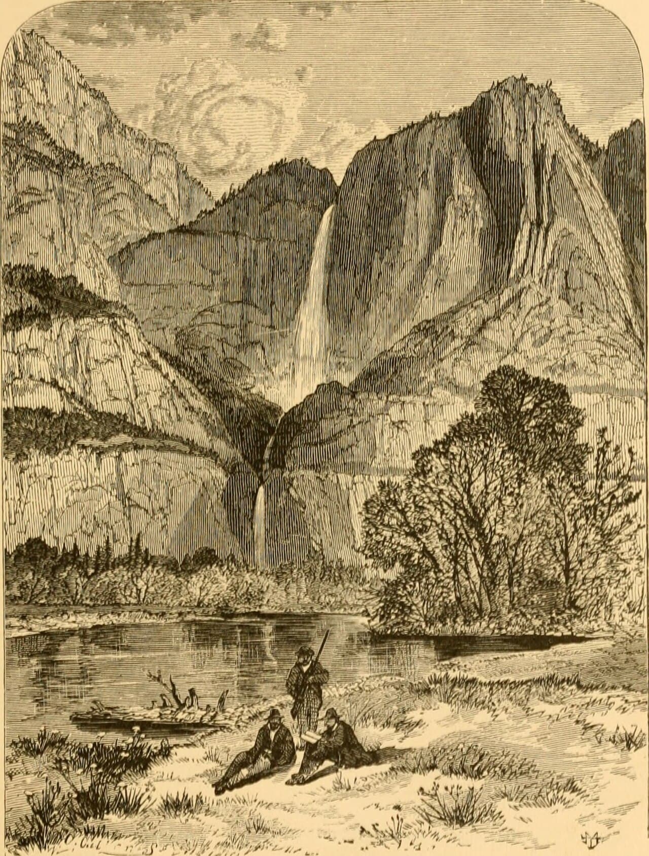
By mid-morning the falls are roaring at full volume β€” 212 feet of whitewater crashing into a canyon that swallows sound and throws it back as mist. This is the trip's postcard moment: cool spray on your face, sagebrush air mixing with the electric charge of moving water, and sightlines that make every phone camera look professional. Arriving before 11am beats the thickest crowds and the harshest sun.

Shoshone Falls (Niagara of the West)
Internet Archive Book Images / wikimedia (No restrictions)
The main canyon-rim overlook offers the classic full-face shot of the falls; come in early morning or late afternoon for softer light and fewer people in frame.
Wheelchair accessible with flat paths and frequent benches β€” one of the most accessible major stops in the region.
Optional detour: Snake River Canyon β€” After Perrine Bridge and before Shoshone Falls
A quieter canyon-rim stretch for families wanting a longer, less crowded walk with sweeping gorge views. Skip if: Skip if the day already feels full β€” the views overlap significantly with Perrine Bridge's canyon panorama.
If it rains: Rain doesn't close Shoshone Falls and can actually enhance the mist and drama of the scene, though paths get muddy β€” wear grippy shoes. If visibility drops badly, downtown Twin Falls' museums and galleries make a solid indoor alternative for the afternoon.

Ease into the trip with Perrine Bridge at its liveliest hour β€” cool air, active jumpers, and a manageable dose of scale before the day's main event. It's a gentle, low-walking start that still delivers a jolt of genuine wonder.

After Shoshone Falls, keep the afternoon unstructured β€” settle into lodging, rest from the sun, and let teens decompress with phones and photo-editing time. No further scheduled stops today; this is intentional after a big sensory morning.

Dinner options in town open early and stay casual β€” plan for something relaxed within a short drive of downtown Twin Falls, and turn in at a reasonable hour to be ready for an earlier start tomorrow.

Canyon Adventure

Day 2: Deep Into the Gorge

A fuller, moderately active day (around 3 miles of walking) exploring canyon rim trails and engineering history.

Wear
Sturdy hiking shoes, moisture-wicking clothing, sun protection, and a refillable water bottle β€” this is the day's most physically demanding stretch.
Budget
$80–110 for the day
7:30 AM - 9:00 AM
Snake River Canyon Β· morning Β· 90 min Β· Canyon Rim & Gorge Viewpoints

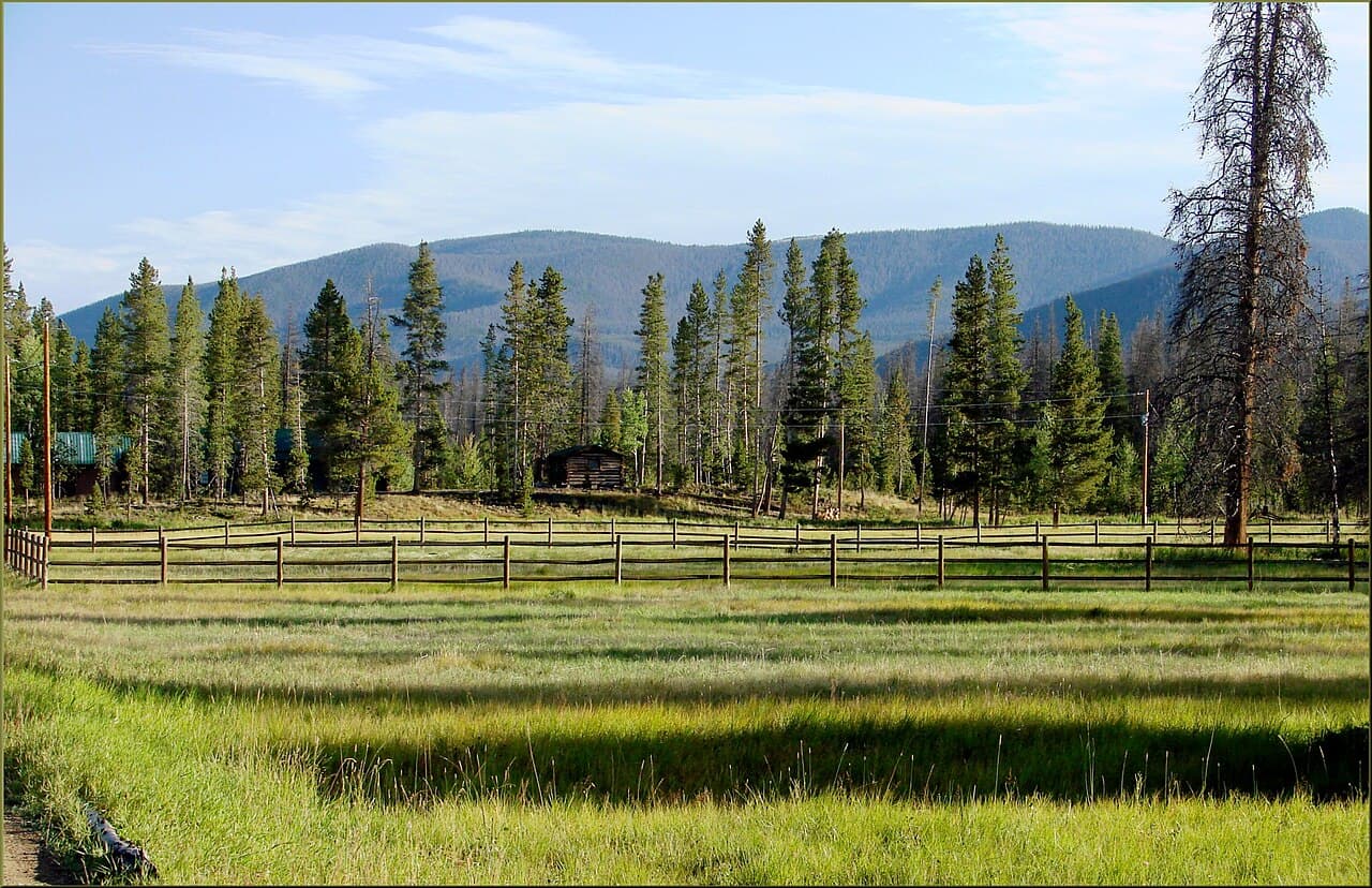
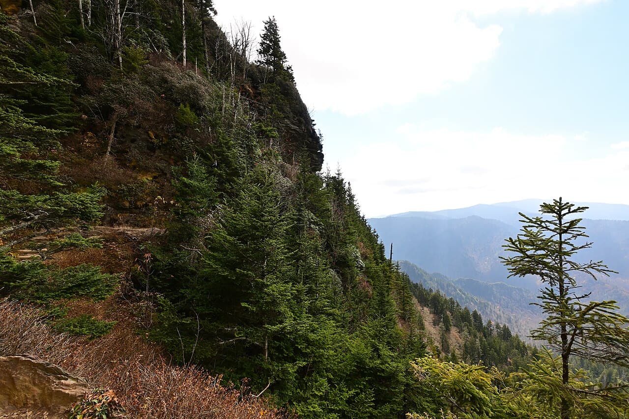
Arrive by 7:30am and the rim trail is nearly empty β€” just wide-open sky, sage on the wind, and that stomach-drop moment when the gorge suddenly appears beneath your boots. This is prime territory for teens craving a little autonomy: paved and dirt pullouts along the rim let the group spread out for photos and quiet moments without losing sight of each other.

Snake River Canyon
Bureau of Land Management / wikimedia (Public domain)
Hansen Bridge vista point offers a dramatic downstream shot; visit before 9am for long shadows and cooler light.
Uneven terrain and sparse benches β€” not ideal for those with mobility limitations; sturdy footwear is a must.
25 min drive β€” A scenic stretch along the canyon rim road with wide-open farmland views opening up beyond the gorge.
10:00 AM - 11:15 AM
Milner Dam & Historic Hydroelectric Site Β· midday Β· 75 min Β· Canyon Rim & Gorge Viewpoints

A change of pace from raw nature to raw engineering β€” the dam hums with the vibration of hydroelectric power, water roaring through century-old penstocks. Teens who like mechanics or history will find genuine intrigue here, and the canyon backdrop keeps it visually striking rather than dry.

Milner Dam & Historic Hydroelectric Site
Photo by Brett Sayles on Pexels
Shoot from the dam crest looking downstream in late-morning light for the best contrast between stone, water, and canyon shadow.
Uneven ground around the powerhouse; benches are sparse, so plan rest breaks accordingly.
Optional detour: Perrine Bridge (BASE jumping viewing) β€” After Milner Dam and before dinner
A late-afternoon return catches optimal jumping thermals and backlit parachutes for dramatic photos. Skip if: Skip if the group is fatigued from the morning's walking β€” the bridge was already covered on Day 1.
If it rains: Canyon views stay dramatic even in rain β€” bring waterproof layers and use extra caution on wet overlook surfaces at Snake River Canyon. If conditions turn heavy, shift the day's focus indoors toward downtown Twin Falls' shops and casual dining instead of the dam site.

Beat the heat with an early canyon rim walk β€” the light is gentler, the trail nearly yours alone, and the scale of the gorge feels almost private before the day's crowds arrive.

The pace shifts from hiking to history at Milner Dam, trading wide-open vistas for the tactile hum of engineering β€” a good midday cooldown activity that still keeps everyone engaged.

Head back toward town for an early, relaxed dinner β€” locals eat by 7 or 8pm, so aim to be seated well before then, and let the evening wind down gently after an active day.

Reflection & Light

Day 3: Golden Hour Farewell

A lighter final day (under 2 miles walking) revisiting favorite viewpoints in their best light before departure.

Wear
Comfortable travel-friendly clothing, layers for cooler morning air, and a hat for sun protection during the return visits.
Budget
$50–80 for the day
7:30 AM - 9:00 AM
Shoshone Falls (Niagara of the West) Β· morning Β· 90 min Β· Canyon Rim & Gorge Viewpoints

One more look at the falls in the day's softest light β€” fewer people, cooler air, and the roar of water feels almost meditative before the crowds return. This is a good moment for teens to grab that final, uncrowded photo they didn't quite get on Day 1.

Shoshone Falls (Niagara of the West)
Internet Archive Book Images / wikimedia (No restrictions)
East-side trail perspective offers a more intimate angle with canyon walls framing the falls β€” best light is right after sunrise.
Flat, wheelchair-accessible paths with frequent benches make this an easy final-day stop.
10 min drive β€” A quick, familiar drive along the canyon rim, windows down for one last breath of sage-scented air.
9:30 AM - 10:15 AM
Perrine Bridge (BASE jumping viewing) Β· midday Β· 45 min Β· Canyon Rim & Gorge Viewpoints

A final stop at the bridge to catch any late-morning jumpers and take in the canyon one more time before heading out β€” it's a fitting bookend, echoing the trip's first stop but with the ease of familiarity now built in.

Perrine Bridge (BASE jumping viewing)
United States. Bureau of Land Management / wikimedia (Public domain)
East approach captures backlit parachute silhouettes if jumpers are active β€” otherwise, the canyon view alone is worth the frame.
Unpaved sections near the edge; supervise teens closely near the rim.
Optional detour: Snake River Canyon β€” After Perrine Bridge and before departure
One last expansive canyon view for the road, especially if there's time before travel. Skip if: Skip if departure timing is tight β€” the views closely echo what's already been seen at Perrine Bridge and Shoshone Falls.
If it rains: If rain rolls in on the final morning, the falls remain dramatic and the mist even more atmospheric β€” just allow extra time for slower, careful walking on wet paths before heading to the airport or next destination.

Return to Shoshone Falls one last time while the light is soft and the crowds are thin β€” a quiet, reflective bookend to the trip's most iconic stop.

A short final visit to Perrine Bridge rounds out the canyon experience, leaving room for an unhurried departure without cramming in new territory.

With travel typically filling the evening, keep plans simple β€” grab something easy near the highway corridor on the way out of town and let the canyon views linger in the rearview mirror.

Want to tweak this trip?

Our AI planner can customize this itinerary to your exact dates, interests, and travel style.

Customize This Itinerary
Good to Know

Restaurant details (hours, menus, availability) change frequently. Check current hours before visiting, especially in seasonal destinations.

Dietary compatibility tags are general guidance. If you have severe allergies, confirm directly with the restaurant.

Travel tips are general guidance, not professional safety advice. Check government advisories for latest information.

All prices are approximate and may vary seasonally.

We use cookies to improve your experience and analyze site usage. Essential cookies are always active. You can customize your preferences or accept all cookies. Cookie Policy