Blue Ridge Parkway (NC sections), North Carolina
2-Day Itinerary for Solo Traveler
“Ridgeline Solitude: Two Days Alone on the Blue Ridge Parkway”
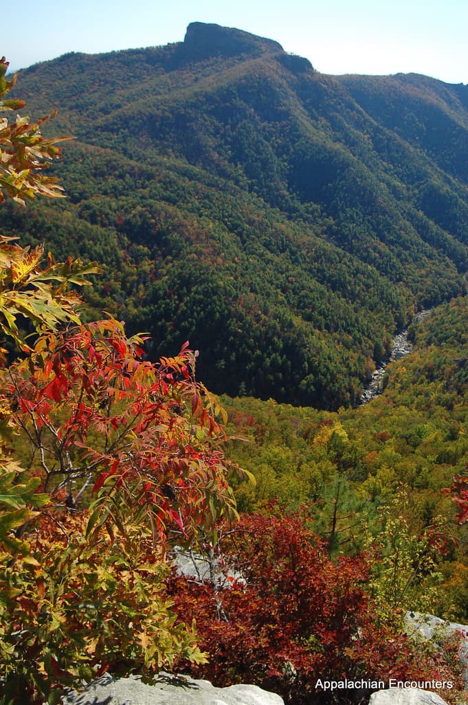
Fog lifts slow off the Black Mountains here, and for a few spring mornings before the tour buses arrive, the ridgeline belongs entirely to whoever got up early enough to claim it. This two-day loop through the Parkway's high country trades crowds for quiet — wildflower balds, a summit walk to the highest point east of the Mississippi, and long stretches of road where the only company is wind moving through balsam fir.
At a Glance
Highlights
- Sunrise solitude at Craggy Pinnacle before the crowds arrive
- Wildflower-studded ridge walk on Rough Ridge Trail
- Standing atop Mount Mitchell, the highest peak east of the Mississippi
- Gilded Age craft traditions at Moses H. Cone Memorial Park
- Spring rhododendron and wildflower blooms across alpine meadows
- Quiet, contemplative pace ideal for solo reflection
Day-by-Day Plan
Day 1: Alpine Meadows & Craft Traditions
A lighter first day easing into Parkway rhythm with a wildflower ridge walk, a misty garden overlook, and a slow afternoon among Gilded Age craft traditions — roughly 3 miles of walking, moderate energy.
Arrive by 7:30am and the exposed ridge is yours alone — just wind moving through sage-scented grasses and the sight of rare purple coneflowers swaying against an impossibly wide sky. The one-mile loop gains little elevation but rewards fully, with views plunging into Linville Gorge and out toward Grandfather Mountain. By mid-morning this fills with weekend hikers, so the early light and empty trail are the whole point.

Cool mountain air carries the faint green smell of high-altitude vegetation as you climb toward the Pinnacle Overlook, where twisted trees frame ridge after ridge fading into blue haze. Spring means the rhododendrons aren't yet in full purple bloom, but the meadows are alive with early wildflowers and the solitude is real — this stretch stays quiet until afternoon tour arrivals. Take your time on the short overlook trail; there's no rush here, and the bench at the top is a good spot to just sit.

The pace shifts entirely here — from ridge wind to the soft clack of wooden looms inside a 3,600-acre Gilded Age estate. Wander the flat, accessible grounds toward the Manor House, then step into the craft center where artisans work heritage looms under cathedral-high ceilings; it's an easy, contemplative afternoon and a good chance to strike up conversation with the craftspeople or fellow solo travelers browsing the exhibits. Weekday midday hours here are calm, well before the 11am-3pm demonstration crowds peak on weekends.

The day starts early and quiet, with the Rough Ridge Trail's exposed one-mile loop offering wide-open views and rare wildflowers before anyone else arrives. From there, the drive climbs higher into balsam country toward Craggy Gardens, where cool air and misty overlooks reward a slow, unhurried pace.
The rhythm softens considerably at Moses H. Cone Memorial Park, trading ridge-top wind for the calm of a historic estate — flat paths, craft demonstrations, and a Manor House that feels like stepping into another century. It's the gentlest stretch of the trip, ideal for easing into the Parkway's contemplative mood.
With no dining data mapped directly to today's stops, plan your evening meal in whichever gateway town you're based from — Asheville, Blowing Rock, or Boone all offer casual, solo-friendly spots with bar seating where striking up conversation comes easy. Settle in early; tomorrow's summit push to Mount Mitchell starts before dawn.
Day 2: Summit Day: Mount Mitchell and the Long Road Down
A more demanding day combining a high-elevation summit hike with a wilderness waterfall descent — roughly 4-5 miles of walking, higher energy output.
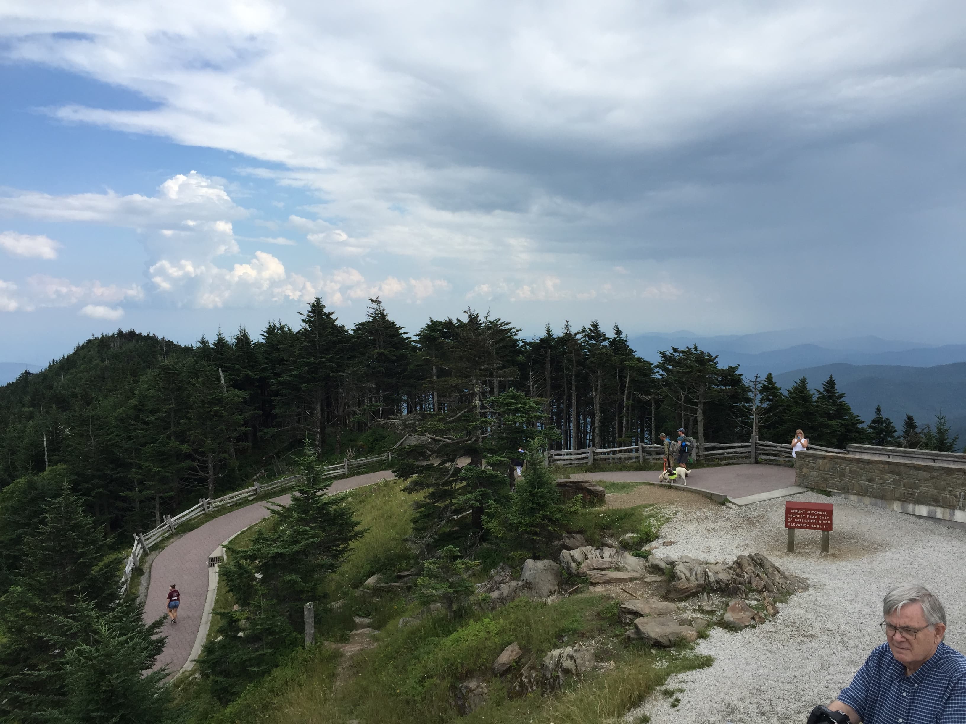
Arrive before 8am and the observation tower at 6,684 feet is nearly silent — just thin, crisp air filling your lungs and wind buffeting your jacket as endless ridgelines fade to blue horizon. This is the highest point east of the Mississippi, and the solitude of an early summit is worth the cold start; by 9am, mid-morning crowds arrive in waves. Budget real time here — the trail overlooks on approach and the small park museum both reward lingering, and there's no need to rush a morning this good.
The transition from summit stillness to gorge roar is dramatic — root-worn paths descend toward a 2,000-foot plunge, cool spray hitting your face as white water explodes against dark granite. Midday brings heavier crowds here, so keep expectations realistic on the main trail, but the sound and scale of the falls make it worth sharing the path with a few others. This is a good spot for a trailside break and conversation with fellow hikers heading the same direction.
A short, easy stop to close out the gorge cluster — cool stone underfoot, the distant rush of river far below, and the visual surprise of Victorian-era engineering anchored into forested slopes. It's a calm, flat-path counterpoint to the falls' intensity, and a good final photo stop before the drive back. Late afternoon light works well here, though tour buses sometimes arrive in this window, so don't expect total solitude.

The day opens with the trip's biggest physical commitment: a pre-dawn drive and an early summit push to Mount Mitchell, where thin air and total silence reward those who beat the crowds. It's worth treating this as the day's centerpiece and giving it unhurried time before the mid-morning rush arrives.
The descent into Linville Gorge shifts the mood entirely, trading wide-open summit views for the tight, roaring intimacy of a 2,000-foot waterfall plunge. A short stop at the Viaduct at High Bridge closes the afternoon on a gentler note — flat paths, historic engineering, and easy photography without the physical demand of the falls trail.
No mapped dining sits directly at today's stops, so plan an evening meal back in Linville, Banner Elk, or another Parkway gateway town, where casual local joints tend to have bar seating well suited to solo diners. With the summit and falls both behind you, this is the night for an early, well-earned rest.
Want to tweak this trip?
Our AI planner can customize this itinerary to your exact dates, interests, and travel style.
Customize This ItineraryRestaurant details (hours, menus, availability) change frequently. Check current hours before visiting, especially in seasonal destinations.
Dietary compatibility tags are general guidance. If you have severe allergies, confirm directly with the restaurant.
Travel tips are general guidance, not professional safety advice. Check government advisories for latest information.
All prices are approximate and may vary seasonally.
Attractions in This Itinerary
More Itineraries for Blue Ridge Parkway (NC sections)
Explore North Carolina