Blue Ridge Parkway (NC sections), North Carolina
3-Day Itinerary for Solo Traveler
“Ridgeline Solitude: Three Days on the Blue Ridge Parkway”
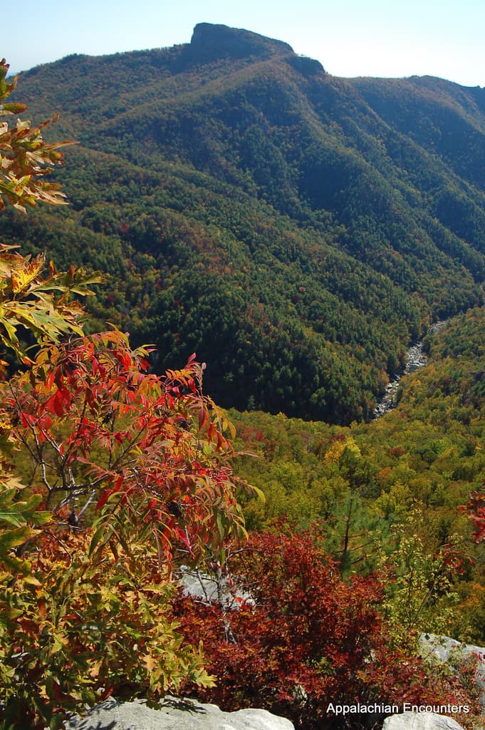
Fog lifts off the ridgelines like a slow exhale, revealing wave after wave of blue-green mountains stretching to the horizon. This is a trip measured in overlooks and quiet trailheads, best taken alone — where the only schedule that matters is the light.
At a Glance
Highlights
- Sunrise solitude at Craggy Gardens before the bloom-season crowds arrive
- Standing atop the highest point east of the Mississippi at Mount Mitchell
- The thunder and spray of Linville Falls up close on root-worn trails
- Wandering the working looms of the Moses Cone Craft Center
- Golden hour on the Linn Cove Viaduct, stone against sky
- Wildflower meadows on Rough Ridge Trail with views into the gorge
Day-by-Day Plan
Day 1: Into the High Meadows
A gentle first day easing into elevation with two moderate walks and generous photography time — about 2.5 miles of walking total, light-to-moderate energy.
Arrive while the parking area is still nearly empty and the rhododendron ridge is wrapped in cool mist that burns off slowly as the sun climbs. The air smells faintly green and mineral, and the silence up here — broken only by wind moving through twisted trees — is the kind of quiet solo travelers come to the mountains for. By 9am the first tour groups start arriving; you'll have had the stone overlook wall to yourself.

A short, breezy mile along an exposed ridge where early-blooming wildflowers sway against an impossibly wide sky and the land drops away into the folds of Linville Gorge. It's an easy, sociable trail — you'll likely trade trail-etiquette nods and a few words with other early hikers, a nice low-key social touchpoint for a solo day.

The pace shifts from wind-scoured ridge to a hushed Gilded Age estate, where the soft clack of looms drifts from the craft center and light pours through tall windows onto quilts and period furniture. It's an easy, low-impact afternoon — flat paths, frequent benches, and artisans happy to talk about their craft, which makes it an easy place to strike up a conversation if you're craving company after a solitary morning.

The day begins in cool, mist-veiled quiet at Craggy Gardens, where purple rhododendron ridges pierce low clouds and the only sound is wind moving through stunted trees. Arriving before 8am rewards you with total solitude at the stone overlook — a rare gift before the tour buses arrive.
After a short, breezy walk along Rough Ridge's wildflower meadows, the day softens considerably with a scenic drive down to the Moses Cone estate, where 3,600 acres of Gilded Age grounds and a working craft center offer flat paths, frequent benches, and gentle conversation with resident artisans.
With no dining data mapped directly to these high-country stops, plan your evening meal around your overnight base — Asheville, Blowing Rock, or Boone all offer easy options within a short drive, and settling into a gateway town for the night lets the day's quiet mountain pace ease into a proper dinner and rest.
Day 2: The Summit Pilgrimage
The most physically demanding day, centered on the climb to Mount Mitchell's summit — roughly 2 miles of walking at higher exertion due to elevation and thinner air.
Arrive before 8am and the summit trail feels like your private ascent — thin, crisp air fills your lungs as you climb toward the observation tower, and the 360-degree view from the top, ridge after blue ridge fading to the horizon, is the payoff for the whole trip. By 9-11am, the parking lot fills and the tower gets crowded; the early climb is worth the wake-up call, especially since this is the kind of solitary, meditative summit experience solo travelers often come here specifically for.
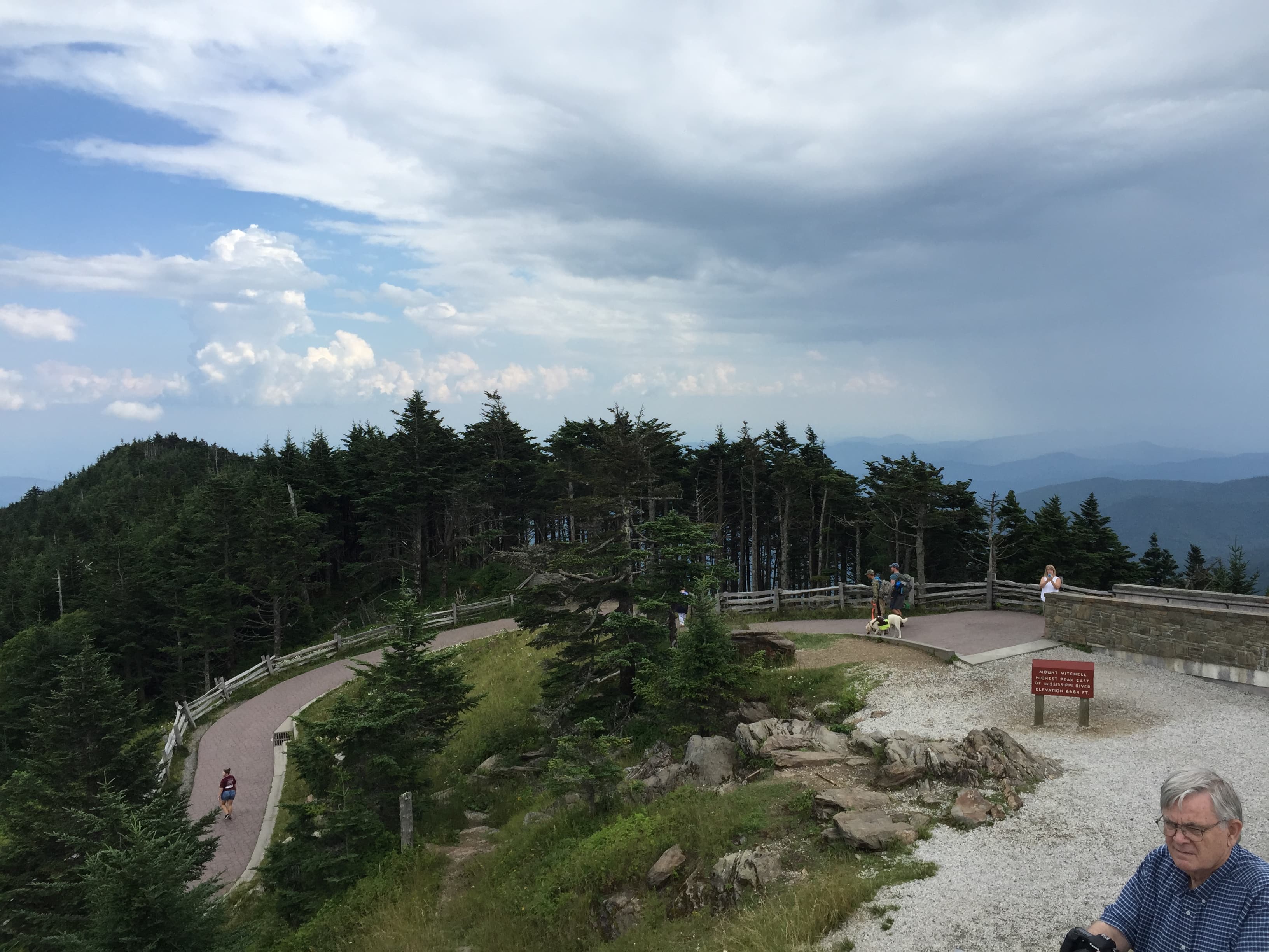
The day is built entirely around one goal: reaching the highest point east of the Mississippi while the morning light is still soft and the crowds haven't arrived. The climb to Mount Mitchell's summit tower rewards patience and warm layers with a view that stretches impossibly far in every direction — ridge lines fading to blue haze, silence broken only by wind and your own breath.
With no dining infrastructure mapped directly at the summit, the smart move is to descend by early afternoon and refuel in a gateway town rather than counting on trailside options — pack snacks for the climb itself, and treat the descent as a chance to decompress after the exertion and thin air of the ascent.
Let the evening be unhurried — the physical toll of a high-elevation morning is real, even for a well-conditioned solo hiker, so an early dinner and quiet night in your base town (Asheville, Blowing Rock, or Linville/Banner Elk depending on your route) sets you up well for tomorrow's gorge exploration.
Day 3: Waterfall Thunder & Stone Bridges
A moderate final day split between a dramatic waterfall descent and an easy, accessible engineering landmark — about 3 miles of walking with mixed terrain.
Arrive early and the roar of water echoing off stone walls feels almost private — cool spray on your face, the mineral smell of wet rock, and white water exploding against dark granite below a 2,000-foot gorge. By mid-morning the trail fills with weekend hikers and families; the early light and quiet make this the best window for a solo, contemplative descent to the falls.
After the physical exertion of the falls trail, this stop is a deliberate change of pace — flat, paved overlooks with frequent benches let you rest while taking in Victorian-era stone engineering anchored dramatically to forested slopes, the distant river just a whisper far below. It's an easy, social spot too, with other travelers pausing at the same railings to swap trail notes from the morning.

The final day begins with the thunder of Linville Falls, water exploding against dark granite two thousand feet down in one of the wildest gorges east of the Rockies — an early start means the trail and overlooks are yours before the weekend crowds arrive.
The pace deliberately eases at the Viaduct, a flat, accessible stretch of Victorian stonework where you can rest tired legs on frequent benches while taking in the engineering against the mountain backdrop — a gentle, contemplative close to three days of ridge-walking and summit-climbing.
With no dining data mapped directly to the gorge cluster, plan a proper farewell meal in whichever gateway town anchors your route home — Asheville's food scene or the college-town energy of Boone both offer easy, solo-friendly dining to mark the end of a trip built on quiet mountain solitude.
Want to tweak this trip?
Our AI planner can customize this itinerary to your exact dates, interests, and travel style.
Customize This ItineraryRestaurant details (hours, menus, availability) change frequently, especially in seasonal mountain towns. Check current hours before visiting.
Dietary compatibility tags are general guidance. If you have severe allergies, confirm directly with the restaurant.
Travel tips are general guidance, not professional safety advice. Check government advisories and current road/weather conditions before driving Parkway sections.
All prices are approximate and may vary seasonally.
Attractions in This Itinerary
More Itineraries for Blue Ridge Parkway (NC sections)
Explore North Carolina