Blue Ridge Parkway (NC sections), North Carolina
3-Day Itinerary for Couples
“Ridge Light & Quiet Roads: 3 Days Along the Blue Ridge Parkway”
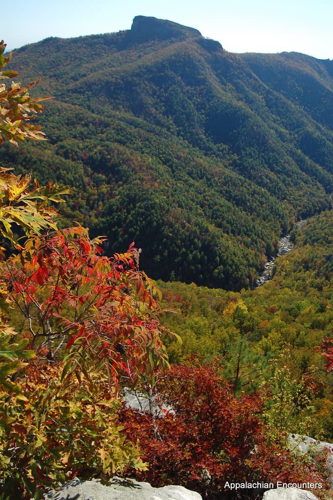
The Parkway unspools like a slow-motion film reel of ridgelines and mist, each overlook a held breath before the next reveal. This three-day arc moves at the pace of two people with nowhere urgent to be — early light on rhododendron balds, thin summit air, and the roar of a waterfall carved into ancient stone.
At a Glance
Highlights
- Sunrise solitude on Craggy Gardens' rhododendron-studded ridge
- Standing atop Mount Mitchell, the highest point east of the Mississippi
- The thunder and spray of Linville Falls plunging into its gorge
- Golden hour at the Moses H. Cone Manor House and craft looms
- Sunset silhouettes at the Linn Cove Viaduct
- Wildflower meadows and 360° views along Rough Ridge Trail
Day-by-Day Plan
Day 1: Settling Into the High Country
A gentle first day easing into elevation with two moderate stops in the Craggy Gardens area, totaling under 3 miles of walking.
Arrive while the parking area still has open spaces and the light is soft and low — by 7:30-8:00 AM you'll likely have the ridge nearly to yourselves, mist still clinging to the lower valleys. In mid-June, the rhododendrons ignite the ridge in purple, but any summer morning here delivers cool air, twisted high-altitude trees, and views that fade into blue haze at the horizon. This is a slow-walk kind of place — no rush, no crowds yet, just the two of you and the wind.

The pace shifts from wild ridge to Gilded Age serenity — wide lawns, a white Colonial Revival manor, and the soft clack of looms inside the craft center as artisans work heritage textiles by hand. Wander the flat, easy paths around the estate grounds hand in hand, then step inside to browse handwoven goods and watch demonstrations that run steadily from late morning into early afternoon. It's an easy, romantic midday pause — cool indoor spaces if the sun gets strong, and genuinely lovely light on the Manor House facade.

The day begins slowly and deliberately — the kind of first morning meant to ease into elevation rather than conquer it. Craggy Gardens greets you with cool, thin air and a ridge that seems to float above the clouds, the rhododendron blooms (if timing allows) adding a wash of purple against gray stone and green slope. Early arrival means quiet, uncrowded contemplation before the day's first tour groups arrive.
By midday, the mood shifts from windswept wilderness to cultivated calm at Moses H. Cone Memorial Park. The 3,600-acre estate offers flat, easy walking paths perfect for a slower amble, while the craft center's working looms and quiet galleries provide a cool, unhurried indoor counterpoint to the morning's alpine air. This is a day built for lingering, not checking boxes.
With no dinner venues mapped directly along this stretch of Parkway, plan to head into a nearby town — Blowing Rock or Boone if staying north, Asheville if based south — for the evening meal, treating the drive itself as part of the wind-down. Pack a light dinner or reserve ahead in town, and let the first day's slower rhythm carry into a quiet porch-sitting evening.
Day 2: Above the Clouds: Mount Mitchell
A more physically demanding day centered on the highest peak east of the Mississippi, with roughly 2-3 miles of walking at elevation.
Arrive before 8:30 AM and the summit parking lot is half empty, the observation tower yours to share only with wind and distant birdsong. At 6,684 feet, the air feels thin and bright, and the 360-degree view from the tower platform stretches in every direction — ridge after ridge fading into blue distance. This is the trip's splurge moment, not in cost but in scale: take the full morning, walk the approach trail slowly, and let the silence do the talking. By 10-11 AM, tour groups and families fill the lot; the early window is worth protecting.
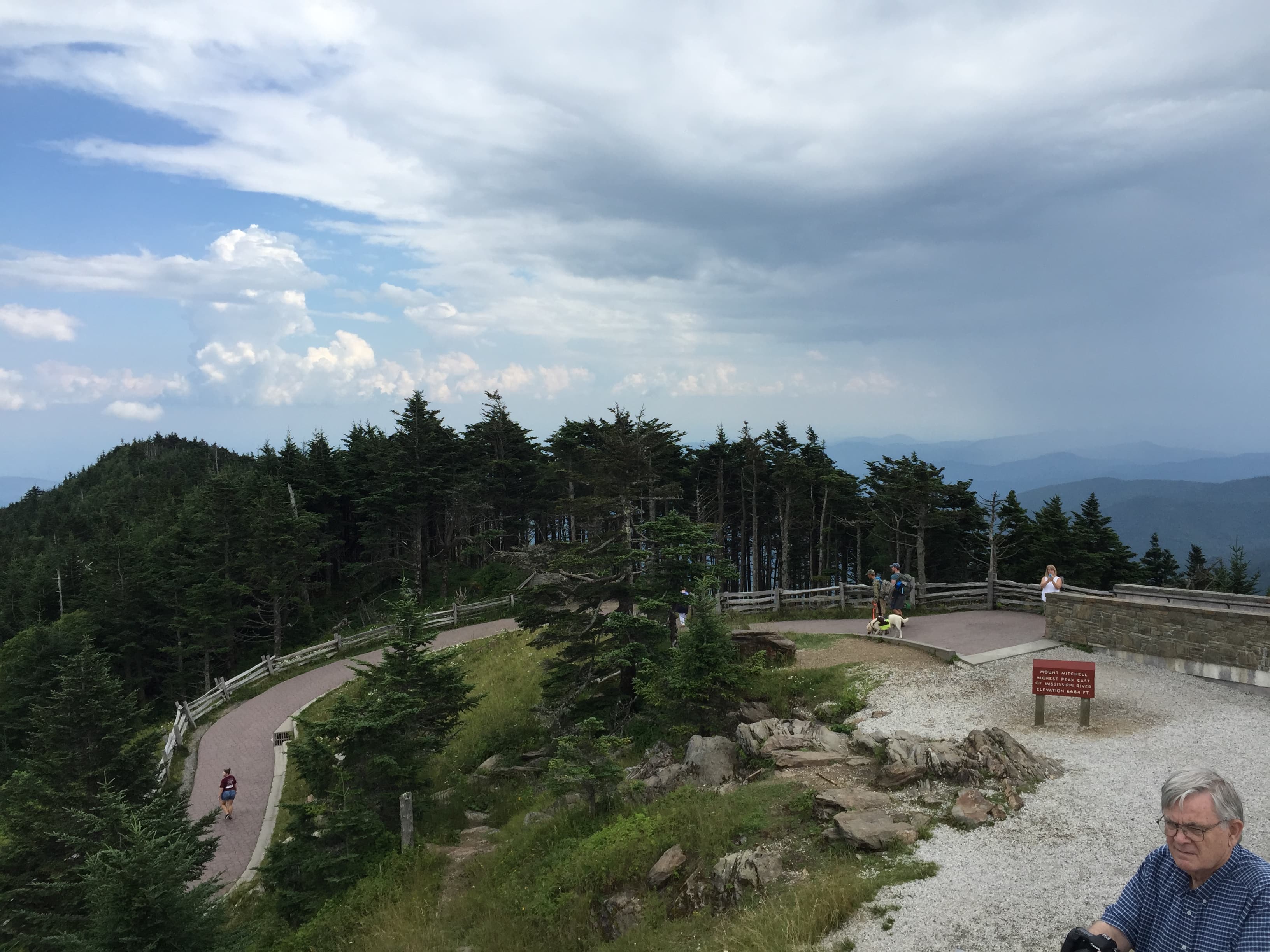
Today asks for an earlier alarm and warmer socks. The climb up toward Mount Mitchell reveals the air thinning and cooling with every switchback, and by the time the observation tower comes into view, the valley below has vanished into a haze of layered blue ridges. This is the trip's most physically demanding stretch, but also its most awe-filled — few places convey scale quite like standing atop the highest point east of the Mississippi with someone you love.
With the morning's summit conquered, the afternoon slows deliberately. Since no dining options are mapped directly at Mount Mitchell, pack a proper picnic before setting out for the day and enjoy it at one of the trailside overlooks on the descent, watching the ridgelines shift color as clouds drift through the gaps. There's no need to rush the return — this stretch of Parkway rewards unhurried driving with pull-offs at nearly every bend.
Head toward your base town for the evening — Blowing Rock, Boone, or Asheville, depending on lodging — and let dinner be a proper sit-down affair after a physically full day. This is a good night to book the trip's one upscale dinner reservation if it hasn't happened yet, pairing a hearty Appalachian-inspired meal with an early bedtime ahead of Day 3's gorge trails.
Day 3: Into the Gorge: Falls and the Viaduct
A moderately active final day exploring Linville Gorge's waterfall and the iconic viaduct, with roughly 2 miles of walking on root-worn trails.
Get there by 8 AM and the trail down to the falls is quiet, root-worn paths glistening with morning dew, the roar of water building steadily as you descend. Linville Falls plunges 2,000 feet into one of the wildest gorges east of the Rockies, the spray cooling the air and the mineral smell of wet granite rising off the rock walls. By 10 AM the upper overlook fills with day-trippers — this early window is when the falls feel like a private discovery rather than a tourist stop.
Time this one for late afternoon, when the light rakes low across the stone span and the viaduct seems to hover against the forested slopes below. The engineering itself is quietly astonishing — a Victorian-era ribbon of stone anchored improbably into the mountainside — but for couples, it's really about the mood: mountain laurel scent in the air, the river's distant rush far below, and one last shared overlook before the trip winds down.

The final day opens with the trip's most dramatic sound: the roar of Linville Falls rising up through the gorge as you descend the trail in the day's first cool light. Spray mists your skin, the trail's roots and stones underfoot, and the reward is a wall of white water exploding against dark granite — a fittingly wild note before the trip's gentler closing act.
Midday eases back into contemplation. Since dining options directly along this stretch of the gorge aren't mapped, plan a picnic lunch from supplies gathered in town before setting out, or hold off and treat lunch as a stop once back near Blowing Rock, Boone, or Asheville. The afternoon stays unhurried, leaving room to simply sit at an overlook and watch the gorge's light shift.
Save the day's final hours for the Linn Cove Viaduct at golden hour, when the stone span glows and the whole trip feels like it's exhaling into its last quiet frame. Afterward, head into your base town for a relaxed final dinner — this is the moment to use that one reserved upscale table if it's still on the books, closing three days of ridge light and quiet roads with a proper toast.
Want to tweak this trip?
Our AI planner can customize this itinerary to your exact dates, interests, and travel style.
Customize This ItineraryRestaurant details (hours, menus, availability) change frequently, and dining options directly along the Parkway are limited — always confirm current hours before visiting, especially in seasonal mountain communities.
Dietary compatibility tags are general guidance. If you have severe allergies, confirm directly with the restaurant before ordering.
Travel tips are general guidance, not professional safety advice. Check current road conditions, weather forecasts, and government advisories before setting out, especially at higher elevations.
All prices are approximate and may vary seasonally, particularly during peak summer travel.
Attractions in This Itinerary
More Itineraries for Blue Ridge Parkway (NC sections)
Explore North Carolina