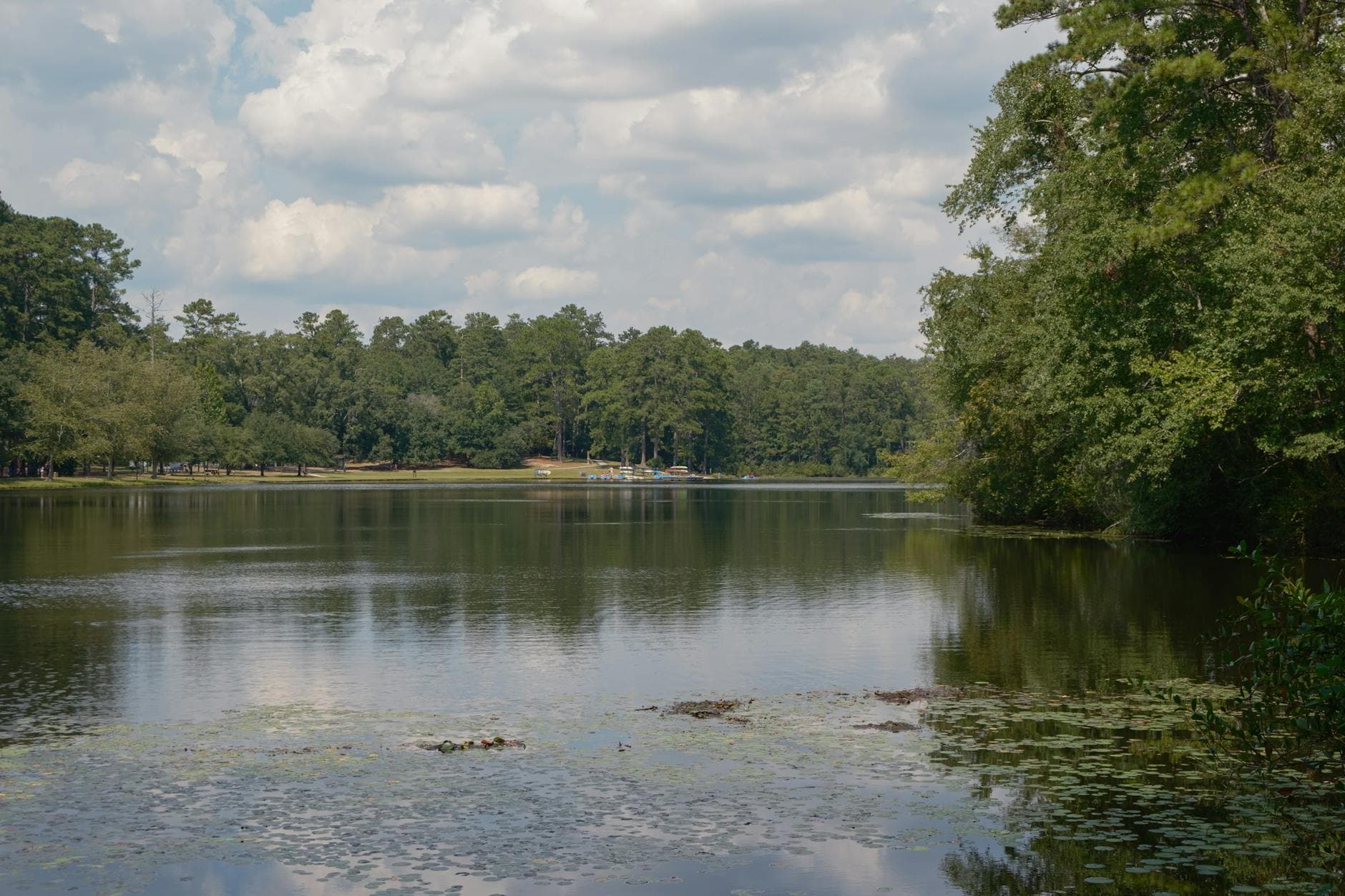
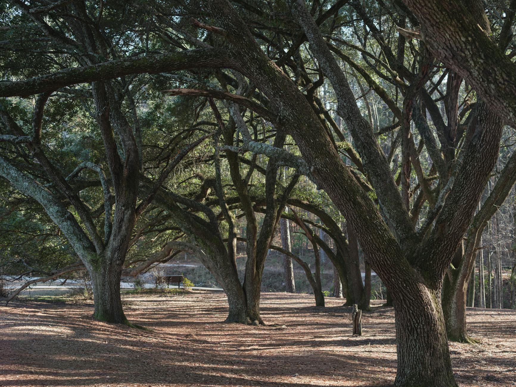
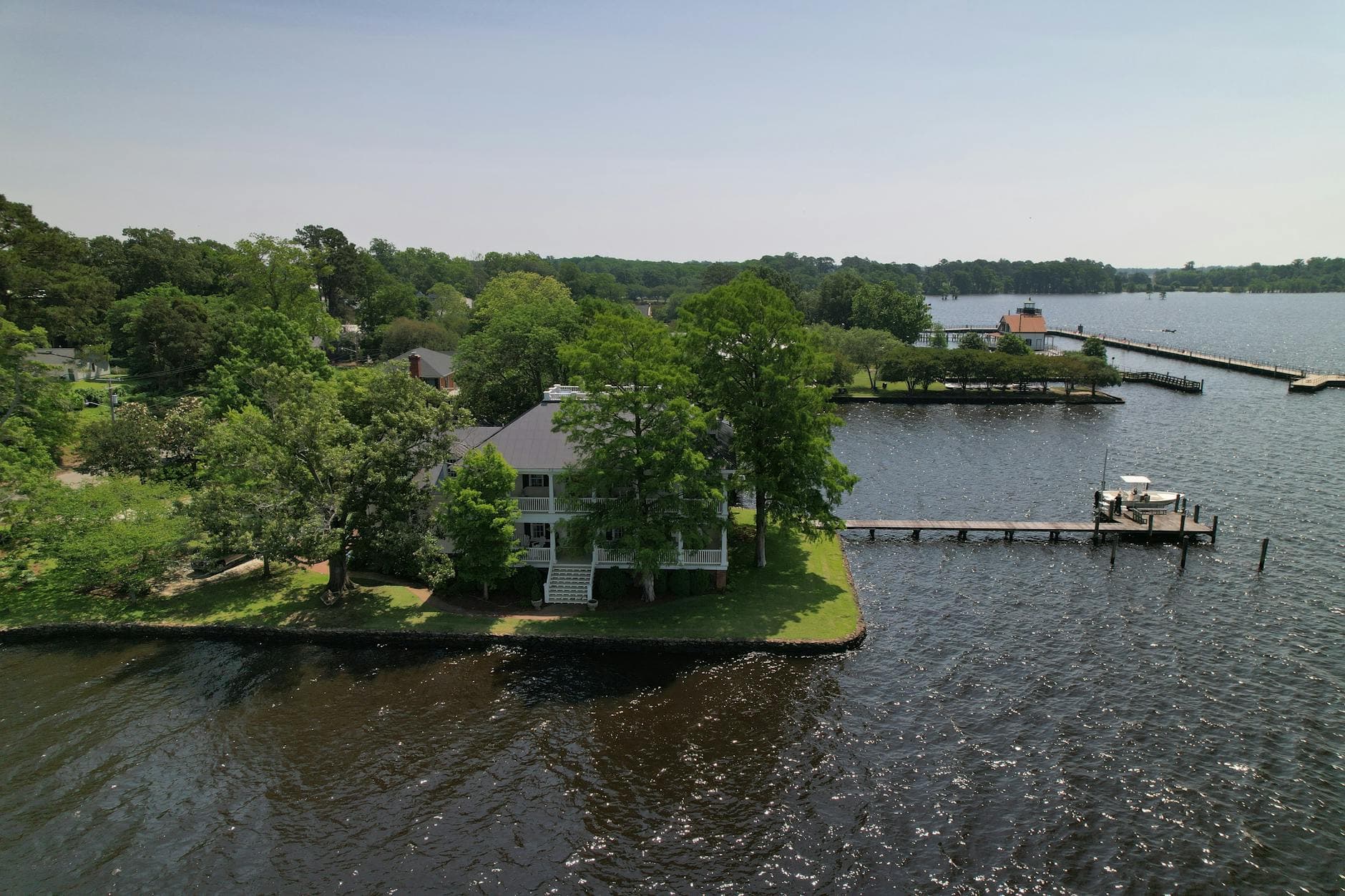
3 DaysSolo Traveler8 Stops

Blue Ridge Parkway (NC sections), North Carolina

3-Day Itinerary for Solo Traveler

โ€œRidgeline Solitude: 3 Days Alone on the Blue Ridge Parkwayโ€

Ridgeline Solitude: 3 Days Alone on the Blue Ridge Parkway

The Parkway unspools like a slow exhale โ€” rhododendron balds fading into blue-on-blue ridgelines, the roar of falling water echoing off granite, and long stretches where the only company is wind moving through spruce. This is a trip built for one set of eyes and no schedule but your own.

At a Glance

Climate & Weather
Summer on the Parkway runs warm to hot in the valleys (75โ€“85ยฐF) but noticeably cooler at elevation โ€” Craggy Gardens and Mount Mitchell can sit 20 degrees cooler than Asheville, with sudden fog and afternoon thunderstorms common. Pack layers: a light fleece or windbreaker for exposed ridges, plus quick-dry hiking clothes and a rain shell for pop-up storms.
Getting Around
A car is essential โ€” the Parkway itself is the route, a two-lane road with a 45 mph speed limit and frequent overlooks. Distances between clusters can take 45โ€“75 minutes even though they look close on a map, so fuel up in gateway towns since gas stations are sparse along the route itself.
Budget
Budget roughly $50โ€“80/day for a solo traveler covering meals, picnic supplies, and minor park fees โ€” dining is casual and inexpensive, though fine dining options are limited along the route itself.
Safety
Solo travelers should tell someone their daily route and expected return time, since cell service drops out completely in gorge and ridge sections. Watch for black bears near overlooks and trailheads (secure food in the car, never in a tent or pack left unattended), and get off exposed summits like Mount Mitchell and Craggy Pinnacle before afternoon thunderstorms roll in โ€” lightning risk at elevation is real and fast-moving.
Connectivity
Cell coverage is unreliable to nonexistent along most of the Parkway โ€” download offline maps before you go and expect dead zones for hours at a stretch, especially in gorge sections. Wifi is available at lodges and gateway-town cafes but not at trailheads or overlooks.
Local Tips
Start every big stop before 8am in summer โ€” parking lots at Craggy Gardens, Mount Mitchell, and Linville Falls fill by mid-morning and overflow parking means a longer walk in. Pack a picnic lunch from a gateway town, since eating at scenic overlooks is one of the Parkway's quiet pleasures and dining options directly on-route are sparse. Craft demonstrations at Moses Cone draw a crowd between 11amโ€“3pm โ€” a good place to strike up conversation with fellow solo travelers if you're craving company.

Highlights

  • Sunrise solitude at Craggy Pinnacle before the tour buses arrive
  • Standing atop the highest point east of the Mississippi at Mount Mitchell
  • Watching Linville Falls plunge 2,000 feet into wild gorge
  • Wandering a Gilded Age craft center where looms still clack
  • A one-mile ridge walk through rare alpine wildflowers on Rough Ridge
  • Golden-hour photography on a Victorian-era stone viaduct
  • Evening porch-sitting pace โ€” no itinerary rushing, ever

Day-by-Day Plan

Arrival & Alpine Orientation

Day 1: First Light in the Craggy High Country

A gentle first day easing into elevation and pace, with roughly 2.5 miles of walking across moderate terrain and a low-key afternoon at a historic craft estate.

Wear
Layered clothing โ€” a t-shirt with a packable fleece or windbreaker for exposed ridges, sturdy trail shoes with good grip, and a hat for sun at lower elevations.
Budget
$45โ€“60 (picnic lunch, coffee, minor park donations)
7:30 AM - 9:00 AM
Craggy Gardens ยท morning ยท 90 min ยท Craggy Gardens & High Peaks

Arrive while the parking lot still has open spaces and the ridge is wrapped in cool, green-smelling air โ€” by 9am, tour buses start arriving and the quiet evaporates. In mid-June the rhododendrons surge purple across the rocky outcrops; even outside bloom season, the 360-degree views from the stone-walled overlook are reason enough to come early and have the ridge nearly to yourself.

Craggy Gardens
Santhosh Adiga / pexels (Pexels License)
Shoot the Craggy Pinnacle Overlook stone wall just after sunrise, when mist is still lifting off the lower valleys and light is soft.
Trails here are uneven with no paved path โ€” sturdy footwear is essential, and benches are sparse.
35 min drive โ€” A scenic Parkway stretch south with pull-off overlooks tempting you to stop every few miles โ€” resist most, but the Linville Gorge preview overlook near mile marker 316 is worth 5 minutes.
10:00 AM - 10:45 AM
Rough Ridge Trail ยท midday ยท 45 min ยท Craggy Gardens & High Peaks

A short, breezy one-mile loop that feels bigger than its distance โ€” wind pushes against you on the exposed ridge while rare purple coneflowers and blazing star wildflowers sway against an impossibly wide sky. The highest point looks straight into Linville Gorge, a preview of day three's destination.

Rough Ridge Trail
Photo by andres Nino on Pexels
The wildflower meadow mid-trail, shot low with layered mountain ridges as backdrop, works best late morning when light is even.
Uneven, rocky, exposed terrain โ€” not wheelchair accessible; avoid in active storms due to lightning exposure.
15 min drive โ€” A short hop further along the Parkway, ridge views trading for denser forest as the road drops slightly.
12:30 PM - 3:30 PM
Moses H. Cone Memorial Park & Craft Center ยท afternoon ยท 180 min ยท Craggy Gardens & High Peaks

A slower, shaded afternoon after two exposed morning stops โ€” wander the 3,600-acre estate grounds, then step into the craft center where looms still clack and artisans work heritage crafts under cathedral-high ceilings. This is one of the better places on the Parkway to strike up a conversation with a fellow traveler, since demonstrations between 11am and 3pm naturally draw a small, chatty crowd.

Moses H. Cone Memorial Park & Craft Center
Photo by Jared Brotman on Pexels
The Manor House front facade glows best at golden hour, but midday north light is ideal for photographing artisans at the looms inside.
Fully wheelchair accessible with flat paths and frequent benches โ€” the most accessible stop of the day.
If it rains: If storms roll in, skip the exposed Craggy Gardens overlook and Rough Ridge entirely and head straight to Moses Cone โ€” the Manor House and craft center are fully operational indoors, and misty views from covered porches can be atmospheric rather than dangerous.

The day begins in cool, green-scented air at Craggy Gardens, arriving early enough that the ridge belongs to you alone before the tour buses find it. From there, the short walk out to Rough Ridge trades garden calm for wind-in-your-face drama, a one-mile loop that punches well above its distance with wildflowers and a straight shot into Linville Gorge.

The pace shifts deliberately after two exposed, high-energy stops โ€” Moses Cone's shaded estate grounds and craft center offer a slower, indoor-adjacent afternoon where wandering replaces hiking. Craft demonstrations between late morning and mid-afternoon offer a rare social touchpoint on an otherwise solitary day, worth lingering for if conversation is welcome.

With no dining data mapped directly to today's stops, plan the evening meal back in whichever gateway town serves as home base โ€” pack a light dinner or seek out a local joint in town, and let the evening settle into porch-sitting pace, the Parkway's natural rhythm after a day spent gaining elevation.

Summit & Solitude

Day 2: Ascent to the Roof of the East

The most physically demanding day, with roughly 3 miles of walking at elevation and a high-energy summit push best started before the heat and crowds arrive.

Wear
Warm layers even in summer โ€” temperatures at 6,684 feet can run 20+ degrees cooler than the valley floor, so bring a proper jacket, plus broken-in hiking boots for uneven summit trails.
Budget
$40โ€“55 (picnic supplies, museum donation, snacks)
7:00 AM - 10:00 AM
Mount Mitchell ยท morning ยท 180 min ยท Mount Mitchell & Black Mountains

Arrive before 8am and the summit observation tower is nearly yours โ€” by mid-morning, crowds thicken and the parking lot fills. The air up here is thin and crisp, wind buffets your jacket, and the 360-degree view from the tower stretches across endless blue ridgelines fading to the horizon โ€” a genuinely rare kind of quiet, broken only by your own breathing.
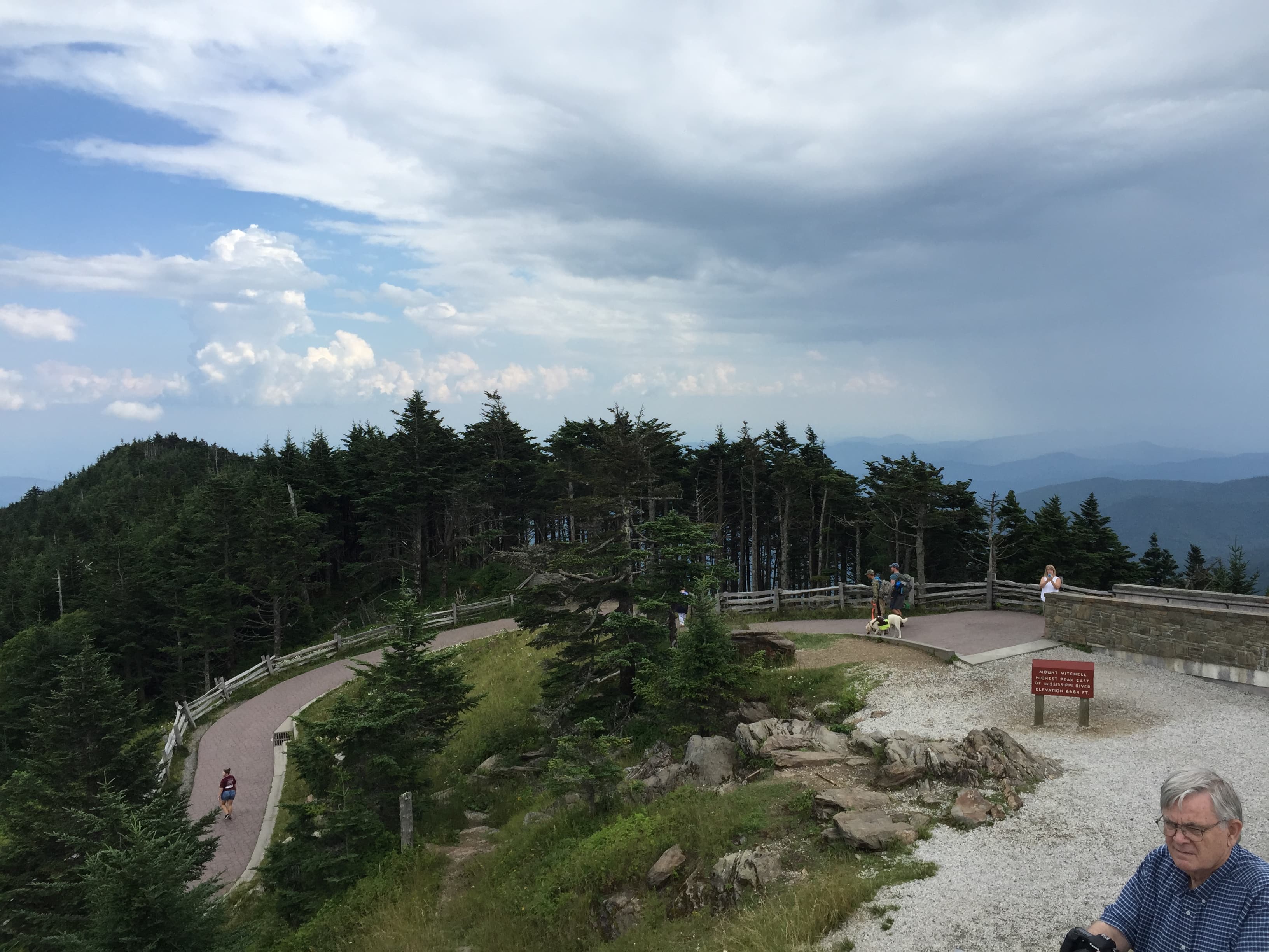
Mount Mitchell
Famartin / openverse (by-sa)
Shoot from the observation tower platform right at opening โ€” early light rakes across the layered ridges before haze builds later in the day.
The summit trail is uneven with real elevation gain; not wheelchair accessible, and benches are sparse along the approach.
10 min walk โ€” A short descent from the tower back toward the museum area, legs already feeling the elevation.
10:00 AM - 11:00 AM
Mount Mitchell ยท midday ยท 60 min ยท Mount Mitchell & Black Mountains

After the summit push, ease into the Mount Mitchell State Park Museum area for a lower-energy hour โ€” a good spot for a slow picnic lunch with framed peak views, letting legs recover before the afternoon's return drive. This is also prime time to watch the crowd shift from quiet morning solitude to the midday rush.

Mount Mitchell
Famartin / openverse (by-sa)
The museum area's framed peak views work well at midday when the sun is high and shadows are minimal.
More accessible than the summit trail itself, though still uneven in places.
Optional detour: Viaduct at High Bridge โ€” After Mount Mitchell and before returning to lodging
A dramatically different mood after a strenuous summit day โ€” flat, accessible, and visually striking Victorian-era engineering against forested slopes. Skip if: It's a detour south toward tomorrow's cluster; if energy is low after the Mitchell hike, save it for day three when you're already in that area.
If it rains: Do not ascend Mount Mitchell if thunderstorms are forecast โ€” lightning risk at this elevation is extreme. If weather turns, retreat to lower elevations and explore shops in nearby Burnsville, or reschedule the summit for early the next clear morning.

Today opens with the day's biggest physical ask โ€” an early, cool-air push to the Mount Mitchell summit, timed to beat both the heat and the mid-morning crowd surge. Thin air, buffeting wind, and a view that runs unbroken to the horizon make the effort worth the early alarm.

After the exertion of the summit, the pace deliberately drops โ€” the museum area near the summit offers a slower hour to recover, eat, and let the legs settle before facing the drive back down. No stop today calls for another strenuous hike; the body gets a break even as the eyes keep working.

With no on-site dining mapped to today's stops, plan dinner back in town โ€” a hearty, unfussy meal is earned after a summit day. Let the evening wind down early; tomorrow's gorge exploration deserves fresh legs and an early start.

Waterfall & Wilderness

Day 3: Into the Wild Gorge

A moderate final day with roughly 2 miles of walking, balancing the drama of a plunging waterfall with the calm structure of a historic viaduct.

Wear
Quick-dry clothing and shoes with good grip โ€” trails near the falls are root-worn and can be slick with spray; bring a light rain layer since afternoon thunderstorms are common in summer.
Budget
$35โ€“50 (picnic lunch, snacks, minor fees)
7:30 AM - 9:00 AM
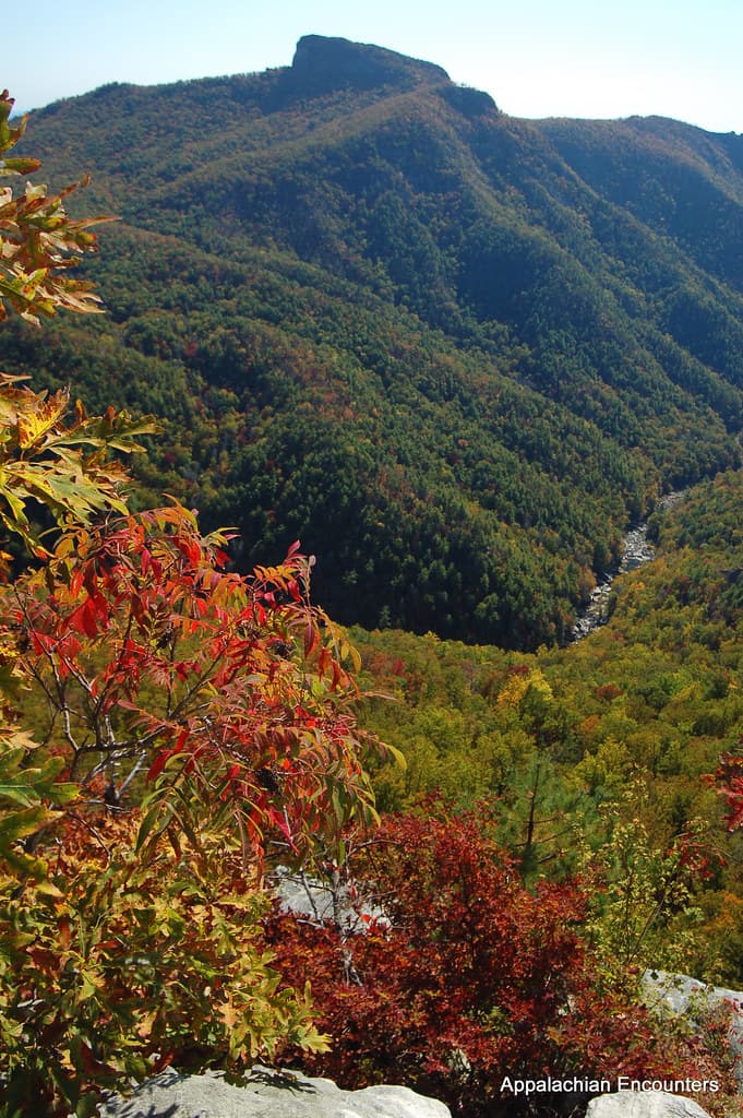
Linville Gorge (Linville Falls) ยท morning ยท 90 min ยท Linville Gorge & Falls

Get there early and the trail down to the falls is quiet enough to hear your own footsteps on root-worn paths, before the roar of water grows into full crescendo. The mineral smell of wet rock and cool spray on your face announce the falls before you see them โ€” white water exploding against dark granite, a 2,000-foot plunge into one of the wildest gorges east of the Rockies. By 10am the upper overlook fills with weekend crowds; solitude belongs to the early riser.

Linville Gorge (Linville Falls)
Appalachian Encounters / openverse (by)
The upper falls overlook gives the full cascade view โ€” come early for soft light and empty frames; the gorge rim at sunset (if staying nearby) offers dramatic silhouettes.
Trails are root-worn and uneven; only the lower observation deck offers limited accessible viewing.
20 min drive โ€” A short Parkway drive with the gorge's forested walls receding in the rearview mirror.
10:00 AM - 10:45 AM
Viaduct at High Bridge ยท midday ยท 45 min ยท Linville Gorge & Falls

A complete change of texture after the falls โ€” cool stone underfoot, the distant rush of the river far below, and the visual shock of pristine Victorian-era engineering anchored to forested slopes. It's a gentler, flatter stop, ideal for slowing the pulse after the gorge trail's uneven footing.

Viaduct at High Bridge
Photo by K on Pexels
The main overlook platform captures the full viaduct span โ€” midday light works, but late afternoon backlights the stone beautifully from the eastern viewing platform.
Fully wheelchair accessible with flat paths and frequent benches โ€” the easiest stop of the trip.
Optional detour: Mount Mitchell โ€” Not applicable today โ€” already visited day 2
N/A Skip if: Already covered; no repeat needed.
If it rains: The falls are often more dramatic during light rain, but trails become slick and technical scrambles should be avoided โ€” stick to the lower viewing area only. Heavy fog at the viaduct erases photography value, so if visibility is poor, linger longer at the falls' lower deck instead and reschedule the viaduct for clearer skies.

The final day opens with the trip's most dramatic sound โ€” water thundering into Linville Gorge, reached early enough that the trail is still quiet and the light still soft. It's a fitting way to close a solo journey: standing alone at the edge of something vast and loud after days of ridge-top silence.

The mood shifts deliberately toward calm at the Viaduct at High Bridge โ€” flat paths, frequent benches, and long views of engineering set against the same forested slopes that framed the whole trip. It's an easy, contemplative note to end on, legs finally getting a full rest.

With no dining data mapped to today's stops, plan a final meal in a gateway town โ€” a quiet, unhurried dinner feels right after three days of early mornings and long views. Let the last evening stretch out slow, porch-sitting pace, the Parkway's rhythm fully absorbed by now.

Want to tweak this trip?

Our AI planner can customize this itinerary to your exact dates, interests, and travel style.

Customize This Itinerary
Good to Know

Restaurant details (hours, menus, availability) change frequently. Check current hours before visiting, especially in seasonal destinations.

Dietary compatibility tags are general guidance. If you have severe allergies, confirm directly with the restaurant.

Travel tips are general guidance, not professional safety advice. Check government advisories for latest information.

All prices are approximate and may vary seasonally.

We use cookies to improve your experience and analyze site usage. Essential cookies are always active. You can customize your preferences or accept all cookies. Cookie Policy