Blue Ridge Parkway (NC sections), North Carolina
3-Day Itinerary for Teen Families
“Ridgeline & Rhododendron: 3 Days on the Blue Ridge Parkway”
Spring on the Parkway means wildflowers pushing through last winter's frost, fog curling off the ridgelines at dawn, and just enough shoulder-season quiet to make every overlook feel like it belongs to your family alone. Pack layers — the same afternoon can swing from misty 45°F summit winds to sun-warmed 65°F valley air.
At a Glance
Highlights
- Sunrise solitude at Craggy Gardens before the rhododendrons draw a crowd
- A one-mile ridge walk on Rough Ridge with views that plunge into Linville Gorge
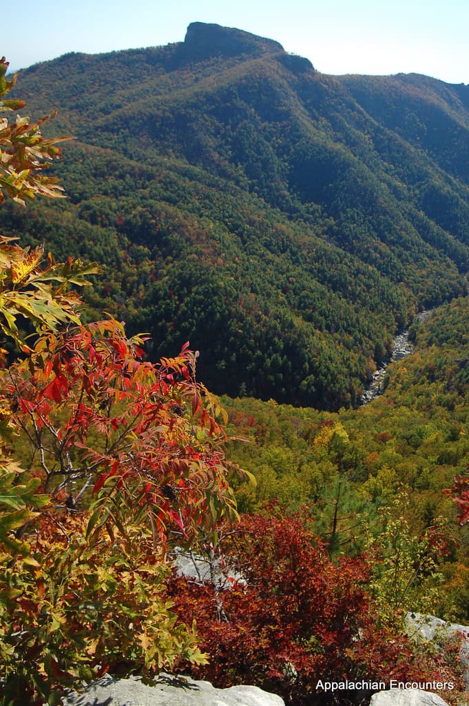
- Standing at 6,684 feet atop Mount Mitchell, the highest point east of the Mississippi
- Weaving looms and Gilded Age architecture at the Moses H. Cone estate
- The thunder and spray of Linville Falls after spring rain swells the river
- A Victorian-era stone viaduct that teens will want for their camera roll
Day-by-Day Plan
Day 1: First Light on the High Meadows
A gentle first day easing into mountain rhythm with under 3 miles of walking across Craggy Gardens' meadows and the Cone estate's flat carriage trails.
Arrive by 8am and the ridge is nearly silent, mist still clinging to the rhododendron thickets before the first tour groups climb the path. The cool air smells faintly of wet stone and high-altitude greenery, and even without full bloom, the twisted trees and rolling balds give teens plenty to photograph against the blue-hazed ridgelines. This is an easy entry point — short trail, big payoff, no serious elevation demands on day one.

The transition from wild meadow to manicured Gilded Age estate is a welcome change of pace — flat carriage trails let legs recover while the craft center's looms and quilts give teens something tactile and unexpected to explore. Weekday mornings here stay quiet until around 11am, when craft demonstrations start pulling in visitors, so arriving right at opening means near-private access to the Manor House grounds.

The Parkway wakes up slowly, fog still pooled in the valleys below as you climb toward Craggy Gardens in the cool blue light of early morning. Wildflowers are just beginning their spring push through the meadow grasses, and the whole ridge feels like it's holding its breath before the day's first crowds arrive.
By midday, the pace shifts from wild mountain air to the hushed elegance of the Cone estate — flat paths wind past a grand white Manor House while the craft center hums with the quiet clack of looms. It's an easy, low-impact stretch that lets everyone recalibrate after the morning's exposed ridge walking.
With no mapped dining options directly at these first stops, plan to head into a nearby gateway town for dinner — Asheville or Blowing Rock both offer casual, family-friendly spots with diverse menus perfect for weary first-day appetites. Settle in early; tomorrow's summit push starts before sunrise.
Day 2: To the Roof of the East
The most physically demanding day, combining a moderate ridge-top hike with the pilgrimage to Mount Mitchell's summit — roughly 3-4 miles of walking total at a standard pace.
Arrive by 7:30am and the ridge is yours — no crowds, just wind hissing through sage-scented grasses and the electric sight of purple coneflowers swaying against an impossibly wide sky. This one-mile loop packs in more visual payoff per step than almost anywhere else on the Parkway, and the exposed viewpoint over Linville Gorge is the kind of moment that makes teens put their phones down and just stare. Give kids a moment of autonomy here — let them range ahead to the ridge point while parents catch up at their own pace.

The drive up feels like ascending into a different season — trees thin, air sharpens, and by the time you reach the observation tower, the whole Appalachian chain unfurls in every direction. This is the highest point east of the Mississippi, and standing on that platform with wind buffeting your jacket is a genuinely thrilling, bragging-rights moment for teens. Arrive before 9am if possible to beat the mid-morning rush; by 11am the summit lot and tower can feel crowded.
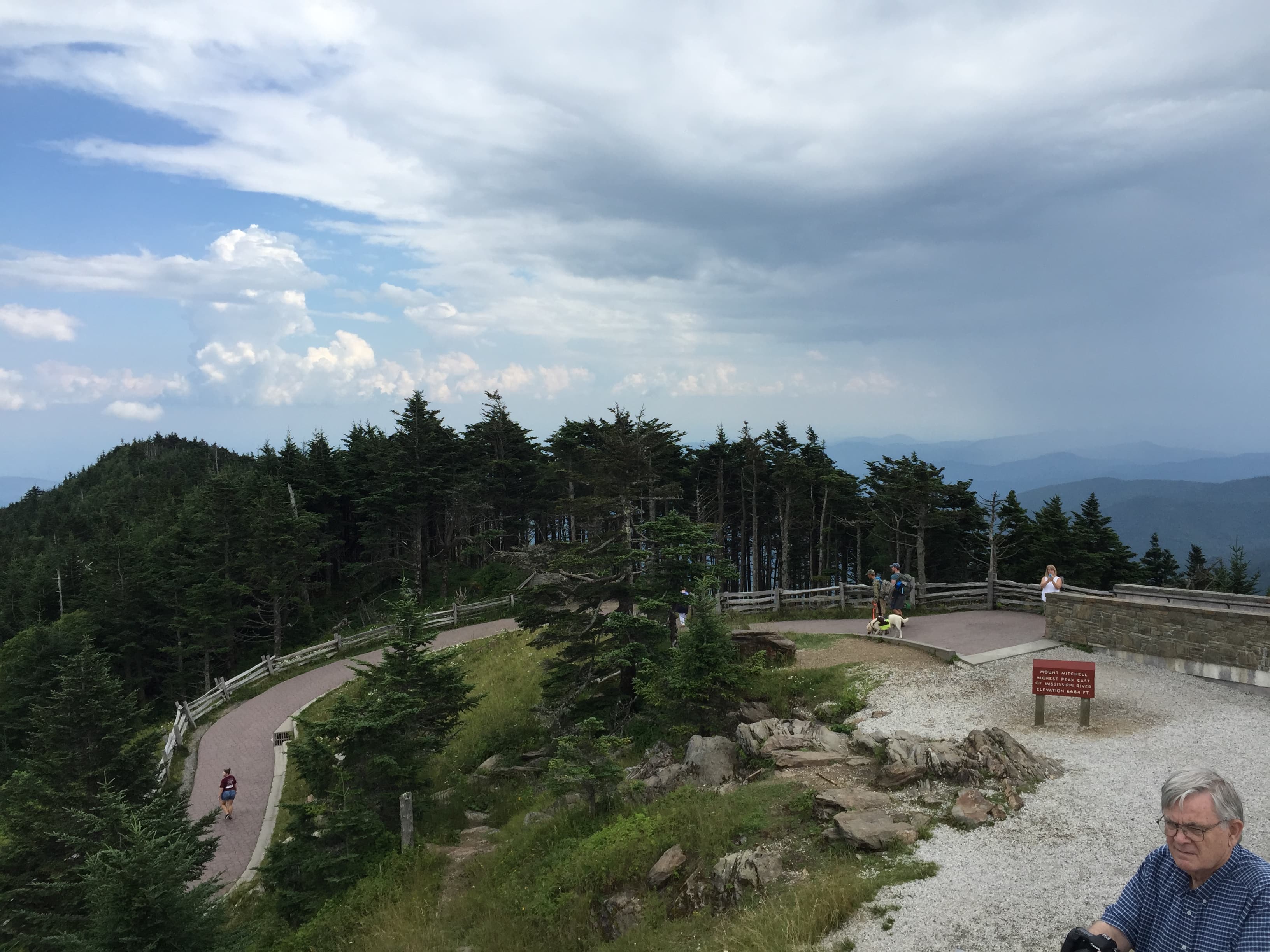
The ridge greets you with cold, clean wind and a wide-open sky just brightening past dawn — Rough Ridge Trail's short climb rewards quickly, dropping you into wildflower meadows with views that seem to fall away into Linville Gorge itself. It's the kind of early-morning solitude that disappears fast once the trailhead lot fills.
From ridge-top wildflowers to true summit, the drive to Mount Mitchell climbs through changing forest until the observation tower appears, windswept and dramatic against the sky. Standing atop the highest point east of the Mississippi is the day's headline moment — pack a picnic lunch to eat at one of the overlook benches since dining options up here are limited.
With no restaurant data mapped directly to these high-elevation stops, plan dinner in a nearby town like Burnsville or back toward Blowing Rock — casual, hearty Appalachian fare awaits after a day of thin air and long views. Legs will be tired; an early night sets up tomorrow's gorge adventure.
Day 3: Into the Gorge
A dramatic final day descending into Linville Gorge to chase waterfall spray and cross a Victorian-era viaduct, covering roughly 2-3 miles of trail.
Arrive by 8am and the trail down to the falls is blissfully uncrowded, the roar of water building with every switchback until it fills your ears completely. Spring rains often swell the river, meaning this may be the most dramatic version of the falls you'll ever see — cool spray on your face, the mineral smell of wet granite, and white water exploding against dark rock below. Give teens the lead on the trail; the root-worn path and multiple viewpoints make for a naturally paced adventure with built-in photo stops.
After the wet drama of the falls, the viaduct offers a completely different mood — cool stone, sweeping engineering, and a view that stretches the river valley out below in quiet, photogenic calm. It's a favorite stop for teens chasing the perfect shot, and the flat, accessible overlook platform makes it an easy, low-effort finale to the hiking portion of the trip.

The trail into Linville Gorge builds anticipation with every switchback, water sound growing louder until the falls finally reveal themselves in a spray-soaked crescendo of white water against dark stone. Spring runoff often makes this the most powerful version of the falls all year, and the relatively early start means the trail belongs mostly to your family.
From roaring water to quiet stone, the short drive to the viaduct offers a gentler close to the hiking day — flat, accessible paths and sweeping valley views make it an easy stop even on tired legs. It's a fitting finale shot for the trip, one that captures both the engineering history and natural drama of the Parkway.
With dining options not mapped directly to the gorge stops, plan a final dinner in Linville, Banner Elk, or back toward Asheville depending on departure plans — a relaxed, casual meal to talk through three days of overlooks, ridges, and one unforgettable summit before heading home.
Want to tweak this trip?
Our AI planner can customize this itinerary to your exact dates, interests, and travel style.
Customize This ItineraryRestaurant details (hours, menus, availability) change frequently. Check current hours before visiting, especially in seasonal destinations.
Dietary compatibility tags are general guidance. If you have severe allergies, confirm directly with the restaurant.
Travel tips are general guidance, not professional safety advice. Check government advisories for latest information.
All prices are approximate and may vary seasonally.
Attractions in This Itinerary
More Itineraries for Blue Ridge Parkway (NC sections)
Explore North Carolina