Blue Ridge Parkway (NC sections), North Carolina
3-Day Itinerary for Teen Families
“Ridgeline & Rhododendron: 3 Days on the Blue Ridge Parkway”
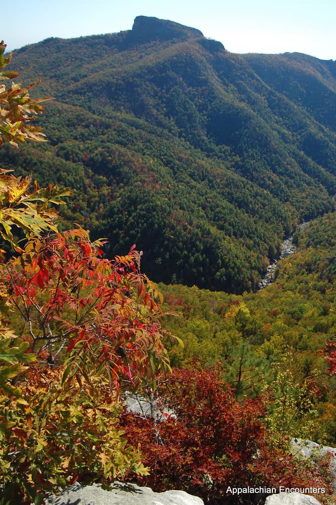
The Parkway doesn't rush anyone — it unspools in long green curves, mile markers ticking past like a slow heartbeat, until the trees fall away and the whole Appalachian spine opens up beneath you. This is a trip built for families with teens who want real air in their lungs: a ridge walk with a view worth the climb, a summit that makes everyone a little breathless, a waterfall roaring loud enough to drown out any complaints about the drive.
At a Glance
Highlights
- Sunrise at Craggy Gardens before the tour buses arrive
- A one-mile ridge walk at Rough Ridge with 360° views teens will actually want to photograph
- Standing atop Mount Mitchell — the highest point east of the Mississippi
- The thunder and spray of Linville Falls plunging into its 2,000-foot gorge
- Watching Gilded Age craft traditions come alive at Moses Cone's working looms
- A Victorian-era viaduct that feels like a secret engineering marvel
Day-by-Day Plan
Day 1: Meadows in the Clouds
A gentle first day easing into Parkway rhythm with a short garden walk, a breezy ridge-top hike, and a slower afternoon exploring a historic estate — roughly 2.5 miles of walking total, light-to-moderate energy.
Arrive while the mist is still peeling off the lower valleys and the rhododendrons look like they're glowing from within. This high ridge is an easy introduction to Parkway hiking — short paths, huge payoff — and by 9am the parking area starts filling with tour groups, so the early window is yours alone. Teens tend to light up at the Craggy Pinnacle Overlook, where the stone wall frames a 360° view that looks almost too good to be real.

A one-mile ridge loop that punches well above its weight — wildflowers sway against an impossibly wide sky, and the exposed high point looks straight down into Linville Gorge. This is the stop where teens usually forget they're on a 'family trip' at all; hand over trail-finding duties for a stretch and let them lead. Wind can be brisk even on hot days, so a light jacket earns its keep here.

After two hikes, this 3,600-acre Gilded Age estate is a welcome change of pace — flat carriage roads, shaded porches, and a working craft center where the soft clack of looms fills the air. Teens who groaned at 'historic site' tend to come around once they see artisans actually weaving in real time; it's tactile and unhurried, a good counterbalance to the morning's exertion. The Manor House grounds offer sweeping ridge views without another step of serious climbing.

The day begins gently, with the Parkway still quiet and cool. Craggy Gardens greets you with rolling meadows and a purple haze of rhododendron blooms clinging to rocky ridgelines — arrive by 7:30am and the overlook is nearly empty, just wind and distant blue ridges fading into haze. It's an easy, low-stakes introduction to high-country hiking that eases everyone into Parkway rhythm without overwhelming first-day legs.
Energy shifts up a notch at Rough Ridge, where a short but exposed ridge walk delivers one of the trip's best views for surprisingly little effort — this is the stop most likely to get phones out for genuine, unprompted photos. From there, the pace downshifts again at Moses Cone, trading trail dust for shaded carriage roads and the quiet clatter of working looms, giving legs a rest while curiosity stays engaged.
With no dining data mapped directly to today's stops, plan to eat in a nearby gateway town rather than expecting options at the trailheads themselves — pack a picnic for lunch on the estate grounds, then settle into your lodging for an early mountain evening. Porch-sitting and an early bedtime aren't a compromise here; they're the whole point of the Parkway's rhythm.
Day 2: To the Roof of the East
The most demanding day of the trip, centered on a pilgrimage to Mount Mitchell's summit — roughly 2 miles of walking with sustained elevation exposure, moderate-to-high energy.
This is the headline stop of the whole trip — the highest peak east of the Mississippi, and the air at the top feels thin and electric in a way that makes everyone go quiet for a second. Arrive by 8am to beat both the crowds and the afternoon cloud buildup that can swallow the view whole; the observation tower delivers a 360-degree payoff that's hard to overstate. For teens, the novelty of standing at 6,684 feet is a built-in bragging right — let them lead the ascent to the tower.
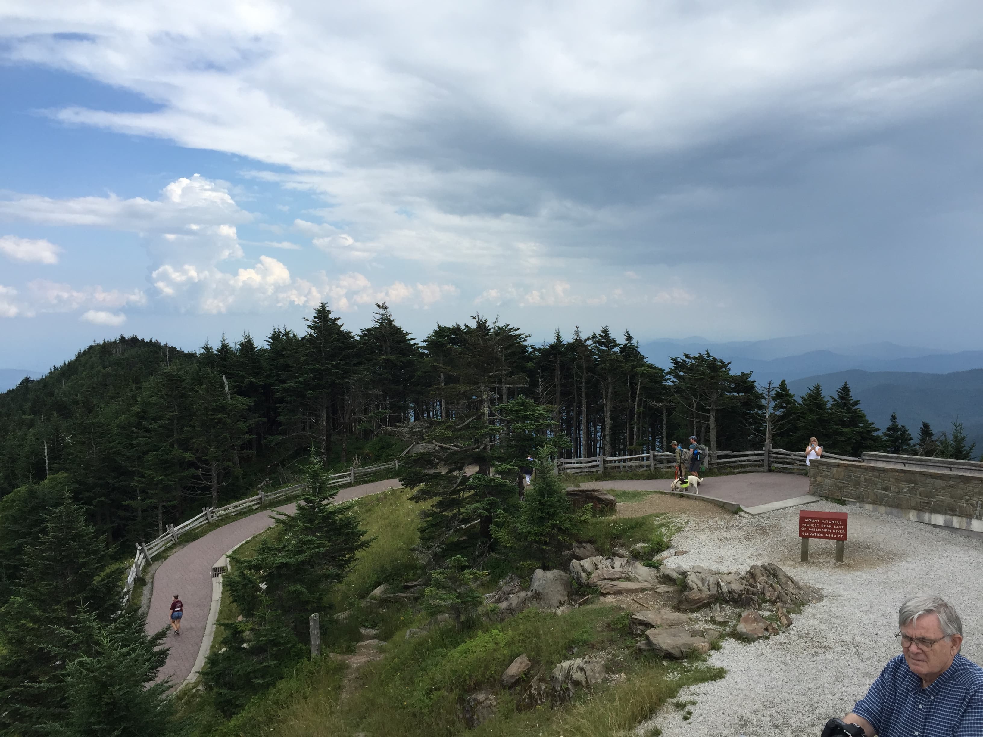
Today asks for an earlier start than yesterday — the goal is the summit before clouds build. The drive up climbs steadily, ears popping, trees changing from broadleaf to spruce-fir as the air gets thinner and cooler. Reaching the tower at Mount Mitchell and stepping out onto that 360-degree platform is the kind of moment that quiets even distracted teenagers — layered ridgelines stretch to the horizon in every direction, and the silence up there has its own texture.
With the summit conquered, the afternoon opens up for a slower pace — this is an intentionally lighter half-day to offset the morning's exertion and elevation. Museum exhibits near the summit area offer an easy, low-energy way to extend the visit without more climbing, ideal for family members who've had enough incline for one day.
As with today's other stops, no dining venues are mapped directly to Mount Mitchell, so plan to eat in Burnsville or another nearby town rather than expecting food options at the summit itself — pack sandwiches for a picnic at one of the lower overlooks on the way down. Settle in early tonight; tomorrow's gorge hike deserves fresh legs.
Day 3: Thunder in the Gorge
A dramatic final day descending into Linville Gorge to a plunging waterfall, capped by a quieter stop at a Victorian-era viaduct — roughly 3 miles of walking, moderate energy with some elevation on the falls trail.
A 2,000-foot plunge into one of the wildest gorges east of the Rockies — the roar builds as you descend the root-worn trail, cool spray hitting your face before the falls even come into view. Arriving by 8am means the upper overlook is quiet and the light is soft, ideal for photos before the 10am crowd surge. This is a favorite for teens who want a bit of adventure without technical climbing — the trail has enough texture to feel like a real hike.
After the falls' roar and scramble, this Victorian-era stone viaduct is a calmer, almost cinematic close to the trip — cool stone underfoot, the river a distant murmur far below, mountain laurel scenting the air. It's an easy, flat walk that everyone can enjoy regardless of how tired legs are from the gorge, and the engineering itself tends to genuinely impress teens once they see the scale of the span against the forested slopes.

The final day starts with sound before sight — the low rumble of Linville Falls reaching you before the trail even opens up to a view. Descending the root-worn path in early morning cool, spray misting exposed arms, feels like the trip's most physically alive moment; by the time the full cascade comes into view, crashing white against dark granite, it's clear why this is one of the wildest gorges east of the Rockies. Getting there by 8am means having much of the trail to yourselves before the mid-morning crowds arrive.
The pace deliberately eases after the falls — the Viaduct at High Bridge offers flat, accessible walking and a completely different kind of beauty, all cool stone and quiet engineering rather than roaring water. It's a gentle, reflective close to three days of ridge walks, summit air, and gorge spray, giving tired legs a break while still delivering one more genuinely photogenic stop.
No dining venues are mapped to today's stops, so build the final evening around a meal in a nearby town like Linville or Blowing Rock rather than expecting options at the gorge or viaduct itself. Let the trip wind down slowly — a last mountain sunset, a porch, and the particular quiet that settles over these ridges once the day-trippers have gone home.
Want to tweak this trip?
Our AI planner can customize this itinerary to your exact dates, interests, and travel style.
Customize This ItineraryRestaurant and dining details change frequently, especially in seasonal mountain destinations; check current hours and availability before visiting. Where no dining data is listed, absence reflects gaps in our sources, not a confirmed lack of options — check nearby gateway towns.
Dietary compatibility tags are general guidance only. If you have severe allergies, confirm directly with any restaurant before dining.
Travel and safety tips provided here are general guidance, not professional advice. Always check current weather, road conditions, and any park advisories before heading out, especially at high elevation.
All prices and spend estimates are approximate and may vary seasonally or with personal spending habits.
Attractions in This Itinerary
More Itineraries for Blue Ridge Parkway (NC sections)
Explore North Carolina