2 DaysSolo Traveler7 Stops

Great Smoky Mountains (NC side), North Carolina

2-Day Itinerary for Solo Traveler

Elk, Fog, and the Rooftop of the Smokies: A Solo Two-Day Wander

Elk, Fog, and the Rooftop of the Smokies: A Solo Two-Day Wander

Mist rolls through Cataloochee Valley like breath from the mountain itself, wild elk grazing where settlers once broke ground a century ago. Two days on the North Carolina side trade crowds for solitude — a solo traveler's pace suits this place perfectly, where quiet trails and slow overlooks reward those willing to rise early and linger long.

At a Glance

Climate & Weather
Spring on the NC side means layers are non-negotiable — mornings can dip into the 40s°F while afternoons climb into the 60s. Rain arrives quickly and often; pack a proper rain jacket, waterproof footwear, and a warm midlayer for elevation gain at Clingmans Dome, where temperatures run 10-20 degrees cooler than the valley floor.
Getting Around
A personal vehicle is essential — no public transit serves the park. Cataloochee Valley requires a slow, winding gravel approach via Cove Creek Road (20 minutes from the entrance), while Newfound Gap Road and Clingmans Dome Road are paved but curvy; budget extra time for both.
Budget
Budget roughly $50-75/day for a solo traveler covering meals, a coffee or two, minor gear needs, and no park entrance fee (Smokies remains free), though a parking tag is now required for extended stays.
Safety
This is a solo-friendly destination — trails are well-marked and rangers are present at major hubs, but always tell someone your planned route, especially for Cataloochee's remote gravel roads. Keep at least 50 yards from elk (they're wild and unpredictable during spring calving season), carry a paper map since cell service vanishes in the valleys, and start hikes early enough to finish before dusk.
Connectivity
Cell coverage is sparse to nonexistent inside the park, particularly in Cataloochee and along ridge roads. Download offline maps before you go, and treat this as a true digital-detox stretch — most lodges in Waynesville, Cherokee, or Bryson City offer reliable WiFi to reconnect each evening.
Local Tips
Arrive at Cataloochee by dawn or Clingmans Dome before 9am — both fill with visitors by midday even in shoulder season. Many restaurants in surrounding towns close by 8pm and some shut entirely on Mondays, so plan dinner timing accordingly, and consider communal-table spots in Cherokee or Waynesville where solo diners can strike up conversation with fellow travelers.

Highlights

  • Wild elk grazing in mist-soaked Cataloochee Valley at dawn
  • Standing above the clouds atop Clingmans Dome, the highest point on the Appalachian Trail
  • 31 miles of ridge-line drama along Newfound Gap Road
  • The hypnotic turn of a 140-year-old water wheel at Mingus Mill
  • A moss-softened pilgrimage to Laurel Falls through old-growth hemlock
  • Spring wildflowers threading through valley floors and trailside slopes
  • Solo-friendly pacing with flexible timing and built-in safety margins

Day-by-Day Plan

Wildlife & Arrival

Day 1: Into the Mist: Elk and Ancient Valleys

A gentle first day centered on Cataloochee Valley's wild elk and pastoral quiet, with light walking (under 2 miles) and generous unstructured time to acclimate.

Wear
Layered clothing with a warm midlayer, waterproof hiking shoes, and a packable rain jacket — mornings in the valley run cold and damp regardless of forecast.
Budget
$40-55 (breakfast, gas for the gravel drive, snacks, no entrance fee)
7:00 AM - 9:30 AM
Cataloochee Valley (elk) · morning · 150 min · Cataloochee Valley

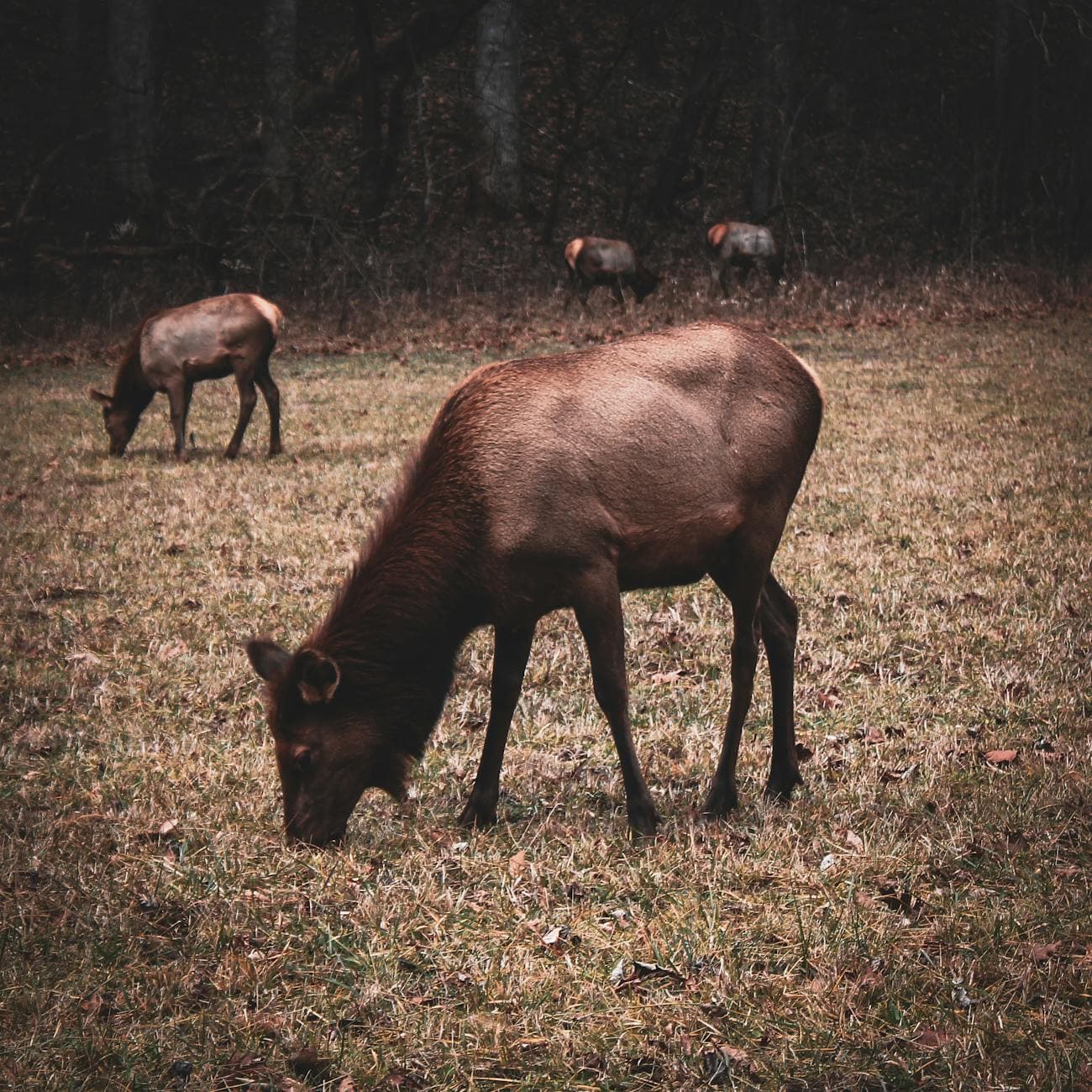
Arrive before 7:30am and the valley belongs to you and the elk — by mid-morning, cars line the pull-offs and the herd retreats to treeline. Cool air carries the low bugle of a bull elk somewhere in the mist, and the valley floor, dotted with weathered homesteads, feels frozen in another century. Walk the Caton Cove Road stretch slowly; this is where the herd congregates in open meadow, close enough to photograph but wild enough to demand respect and distance.

Cataloochee Valley (elk)
Niki Clark / pexels (Pexels License)
Shoot from Caton Cove Road just after sunrise — low golden light through valley mist makes the elk glow against dark treeline.
Uneven grass and gravel paths; no paved walkways, so sturdy footwear is essential.
10 min walkA short stroll along the valley loop road, boots crunching gravel, elk still visible grazing in the distance.
9:30 AM - 10:30 AM
Cataloochee Valley (elk) · midday · 60 min · Cataloochee Valley

Linger near Palmer Chapel and the historic homesteads as the crowds thin the wildlife but thicken the human traffic — a good window to explore Appalachian history at a slower, contemplative pace. The weathered wood of the old structures holds a century of mountain stories, and the quiet here is different from the elk-watching hush: more reflective, less charged.

Cataloochee Valley (elk)
Niki Clark / pexels (Pexels License)
Palmer Chapel's white clapboard against green valley backdrop photographs best in soft, overcast light — spring's frequent cloud cover works in your favor here.
Some uneven terrain around homestead sites; benches are sparse.
Breakfast
Peter's Pancakes & Waffles $
Breakfast/Brunch · Near Oconaluftee, en route to Cataloochee
A hearty, unpretentious stack-and-syrup start before the long gravel drive into Cataloochee — fuel up here since options thin out fast once you're in the valley.
Optional detour: Cataloochee Valley (elk)After the morning elk-watching and before departing the valley
A second, quieter pass through the valley in late morning light offers a different mood — mist often lifts, revealing the full sweep of the pastoral landscape. Skip if: If you've already captured strong photos and want to beat afternoon traffic on the drive out, this second loop is skippable.
If it rains: If heavy rain rolls in, elk viewing becomes difficult and the gravel roads slicken — retreat to Palmer Chapel and the historic Abrams House for a covered, low-key alternative that still honors the valley's Appalachian history.

The valley wakes slowly under a blanket of low fog, and arriving before the sun fully clears the ridgeline means having Cataloochee's wild elk herd almost entirely to yourself. Their tawny shapes drift through knee-high grass, hooves crunching softly on damp earth, while the occasional low bugle echoes across the pastoral bowl. This is solo travel at its most rewarding — no rush, no crowd, just quiet witness to a scene unchanged for a century.

As the morning chill burns off, the pace shifts toward reflection: wandering past Palmer Chapel and the scattered homesteads that tell Cataloochee's human story, the isolation that once defined mountain life still palpable in the weathered wood and quiet clearings. It's a gentler contrast to the wildlife-watching high of dawn, ideal for settling into the trip's rhythm without overexertion on day one.

With no dinner options mapped directly in the valley, plan the evening meal back in town — Waynesville or Cherokee offer relaxed, solo-friendly spots to unwind, though specific venues near Cataloochee itself remain limited, so consider packing a light dinner or snacks for the drive back if timing runs late.

Summit & Heritage

Day 2: Above the Clouds, Beside the River

A moderately active day combining the high-altitude drama of Clingmans Dome with the cultural and historic textures of the Oconaluftee Gateway, totaling roughly 4-5 miles of walking.

Wear
Warm layers for the summit (temperatures can be 15-20 degrees cooler than the valley), a windproof shell, sturdy hiking shoes with good tread for Laurel Falls' sometimes-slick trail, and a rain jacket just in case.
Budget
$45-65 (lunch, coffee, minor trail snacks, no entrance fee)
75 min driveA winding, scenic climb up Clingmans Dome Road — windows fogging slightly as elevation and temperature both climb.
7:30 AM - 9:00 AM
Clingmans Dome · morning · 90 min · Clingmans Dome High Country

Arrive by 7:30am and the observation tower is nearly empty, mist often still clinging below the summit as sunlight breaks through fraser fir. The climb up the paved-but-steep path leaves your lungs burning pleasantly, and stepping onto the tower's platform above the cloud layer feels like breaching into another atmosphere entirely — the highest point on the Appalachian Trail, and it shows in the sweep of blue-ridged horizon in every direction.

Clingmans Dome
Famartin / openverse (by-sa)
Shoot from the tower's exterior platform right at sunrise for silhouetted forest layers below; by 9am, haze and crowds both thicken.
The summit trail is paved but steep with real elevation gain; not wheelchair accessible despite the tower's accessible design.
15 min driveA short, winding drop from the Clingmans Dome parking area onto the main ridge road, sunlight now fully breaking through.
9:30 AM - 11:30 AM
Newfound Gap Road · midday · 120 min · Clingmans Dome High Country

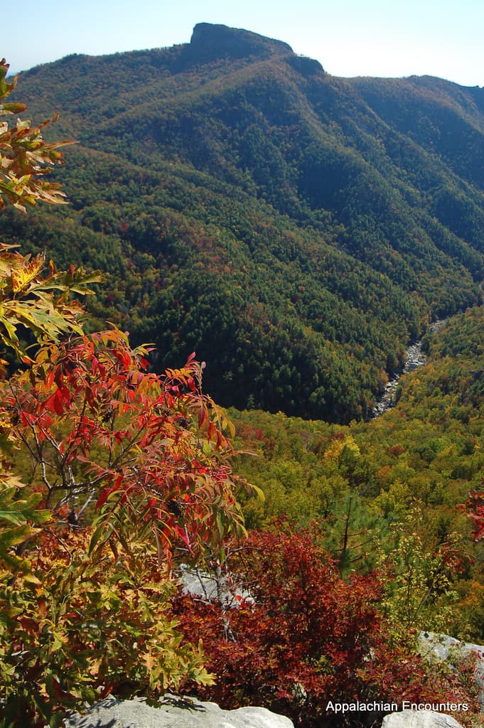
The descent along Newfound Gap Road becomes its own destination — 31 miles of ridge-hugging curves where each overlook reveals a new blue-hazed vista. Stop at the Newfound Gap overlook itself, straddling the Tennessee-North Carolina state line, where cool air and the scent of fir and damp leaves make an easy case for lingering longer than planned.

Newfound Gap Road
Photo by Esteban Carriazo on Pexels
The Newfound Gap overlook works best late morning once fog has burned off — layered ridgelines stack toward the horizon in soft blue gradients.
Overlooks along the road are paved and accessible; short walks to some viewpoints involve uneven ground.
25 min driveA gentle descent from ridge country back toward the river valley, the road straightening as elevation drops and forest thickens.
12:15 PM - 1:00 PM
Mingus Mill · afternoon · 45 min · Oconaluftee Gateway

The rumble of the water wheel greets you before the mill itself comes into view — a 140-year-old rhythm of grinding stone and rushing millrace that feels almost meditative after the morning's elevation gain. Weathered wood beneath your fingers and the acrid dust of fresh-ground corn connect this stop to the mountain culture that shaped the valley below, a satisfying low-energy contrast to the summit's drama.

Mingus Mill
Photo by Jteder on Pixabay
Interior shots of the grinding stones work best with the mill's natural window light, ideally early afternoon before shadows deepen.
Flat, paved paths and frequent benches make this one of the most accessible stops in the park.
10 min driveA brief hop along the park road, gearing up mentally for the trail's moderate climb.
1:30 PM - 3:00 PM
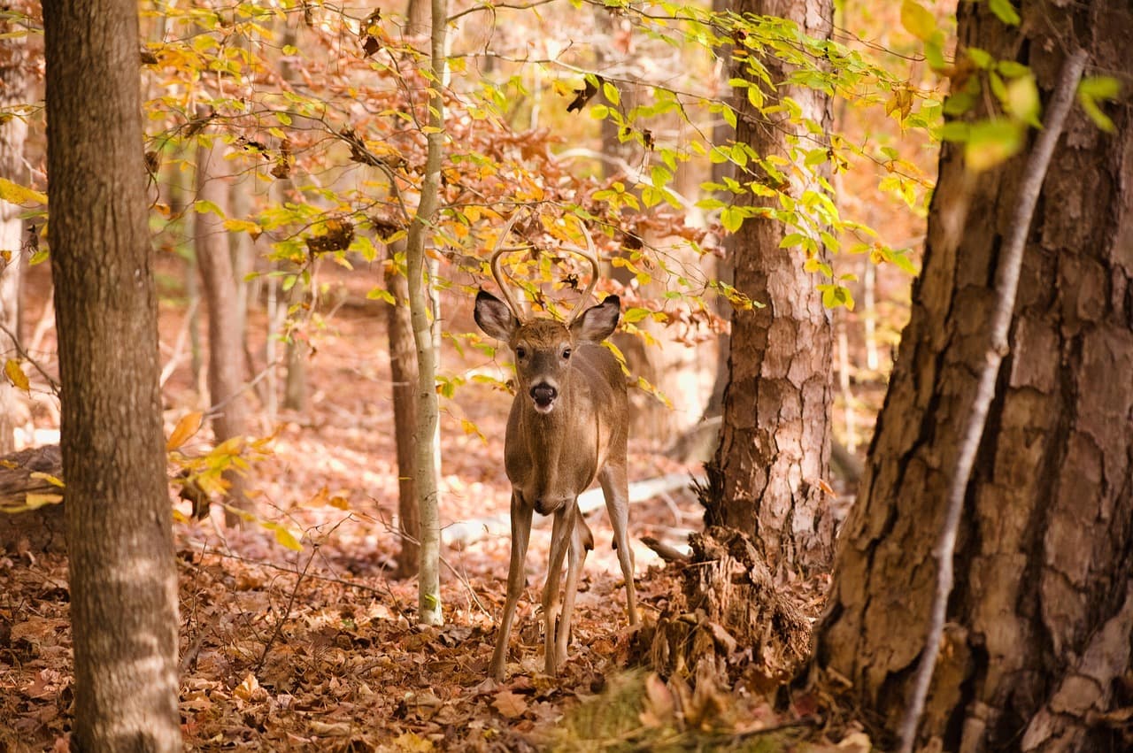
Laurel Falls Trail · afternoon · 90 min · Oconaluftee Gateway

The trail's roar grows steadily louder with each switchback, damp earth and ancient hemlock scenting the air until the falls reveal themselves in a sudden cascade of white water. It's an ideal solo hike — well-trafficked enough to feel safe, contemplative enough to feel like your own discovery, especially if you've timed it for early-to-mid afternoon once the trail's morning crowds have thinned slightly.
Laurel Falls Trail
Photo by jothamsutharson on Pixabay
Frame the falls' base with hemlock branches for scale and depth — midday light filters best through the canopy for even exposure.
Trail is unpaved and uneven with real elevation change; not recommended for those needing flat, accessible terrain.
Lunch
Happy Garden Restaurant $
Chinese · Near Oconaluftee
A quick, satisfying midday reset near Oconaluftee before tackling Mingus Mill and Laurel Falls — casual counter seating works well solo.
El Cajelito $
Mexican · Near Oconaluftee
Lively, informal spot where solo diners can grab a seat at the counter — good energy without pressure to linger past your afternoon plans.
Dinner
Hunt Brothers Pizza $
Pizza · Near Oconaluftee
Simple, no-fuss option near Oconaluftee for an easy end to a physically full day — grab a slice and recap the day's miles.
Optional detour: OconalufteeAfter Laurel Falls Trail and before dinner
A short, easy stroll along the river valley overlook offers a calm bookend to the day's more strenuous stops, with mist rising off the Oconaluftee River in late-afternoon light. Skip if: If energy is low after the Laurel Falls climb, this stop is easily skipped in favor of heading straight to dinner and rest.
If it rains: If rain rolls in at elevation, descend promptly from Clingmans Dome to the lower Newfound Gap area, which often retains better visibility; Mingus Mill remains fully operable in light rain and offers covered viewing, making it a solid rainy-day anchor for the afternoon.

The climb to Clingmans Dome rewards early risers most of all — thin, biting air and the scent of fraser fir accompany the steep push up to the tower, where breaking above the cloud layer feels like stepping into a different world entirely. From the summit, the Appalachian Trail's highest point offers a 360-degree sweep of ridgelines fading into blue haze, best appreciated in the hush of pre-9am quiet before the parking lot fills.

The descent along Newfound Gap Road slows the pace deliberately, trading summit adrenaline for long, curving overlooks and roadside pull-offs where the mountains unfold in layers. By early afternoon, the rhythm shifts again at Mingus Mill's grinding stones and Laurel Falls' mossy switchbacks — a contrast of stillness and motion that suits a solo traveler's flexible timing, neither stop demanding rush.

With the day's elevation gain and mileage behind you, dinner calls for something easy and unfussy — a casual pizza near Oconaluftee closes the loop on a day that carried you from cloud-piercing summit to river-valley quiet, leaving just enough energy for a slow evening back in town.

Want to tweak this trip?

Our AI planner can customize this itinerary to your exact dates, interests, and travel style.

Customize This Itinerary
Good to Know

Restaurant details (hours, menus, availability) change frequently. Check current hours before visiting, especially in seasonal destinations.

Dietary compatibility tags are general guidance. If you have severe allergies, confirm directly with the restaurant.

Travel tips are general guidance, not professional safety advice. Check government advisories for latest information.

All prices are approximate and may vary seasonally.

We use cookies to improve your experience and analyze site usage. Essential cookies are always active. You can customize your preferences or accept all cookies. Cookie Policy