2 DaysSolo Traveler7 Stops

Great Smoky Mountains (NC side), North Carolina

2-Day Itinerary for Solo Traveler

Mist, Elk, and Ridgelines: Two Days on the Smokies' Quiet Side

Mist, Elk, and Ridgelines: Two Days on the Smokies' Quiet Side

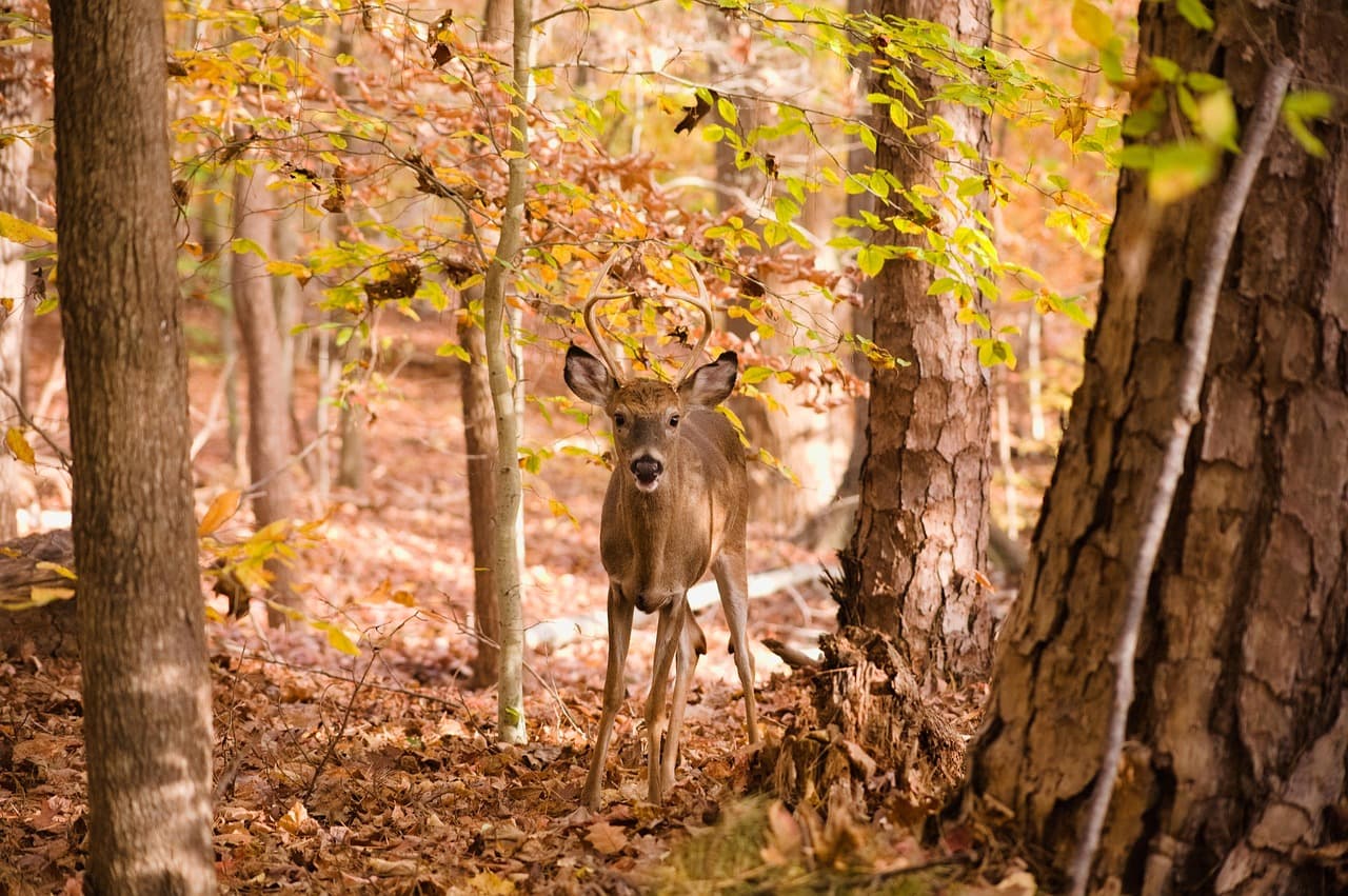
Mist pools in the hollows of Cataloochee Valley before the sun ever clears the ridge, and somewhere in that gray hush a bull elk bugles like it's calling across centuries. This corner of the Smokies rewards the traveler who rises early, moves slowly, and doesn't mind eating dinner alone at a counter that feels more like a kitchen table.

At a Glance

Climate & Weather
Summer on the NC side runs warm to hot in the valleys (upper 70s–80s°F) but noticeably cooler and breezier at elevation—Clingmans Dome can be 15-20 degrees cooler than Cherokee. Pack light layers, a rain shell for sudden afternoon storms, and sturdy shoes; humidity is high and hiking gear should wick moisture.
Getting Around
A personal vehicle is essential—there's no park transit. Distances between clusters (Cataloochee to Oconaluftee, Oconaluftee to Clingmans Dome) run 45-75 minutes on winding mountain roads, so budget driving time generously and fuel up before entering remote areas like Cataloochee.
Budget
Expect to spend roughly $60-90/day on food and modest gear or trail snacks for a solo traveler—park entry itself is free, but factor in gas for the mountain driving and a few sit-down meals in Cherokee or Waynesville.
Safety
Very safe for solo travelers, but this is bear and elk country—keep 50+ yards from elk (especially during any agitation) and never approach bears. Tell someone your trailhead and expected return time, carry a paper map since cell service vanishes in the valleys, and stick to marked trails, particularly at Laurel Falls where wet rock gets slick.
Connectivity
Cell coverage is patchy to nonexistent inside the park, especially in Cataloochee Valley and along Clingmans Dome Road. Download offline maps beforehand and let your accommodation know your daily plans.
Local Tips
Arrive at trailheads and overlooks before 8am in summer to beat both heat and crowds—by 10am, parking at Clingmans Dome and Laurel Falls fills fast. Restaurants in surrounding towns often close by 8pm, so plan dinner earlier than you might elsewhere, and don't expect much open on Mondays.

Highlights

  • Wild elk grazing in dawn mist at Cataloochee Valley
  • Standing above the clouds at Clingmans Dome, the highest point on the Appalachian Trail
  • 31 miles of ridge-line drama along Newfound Gap Road
  • Cherokee heritage and mountain ecology meeting at Oconaluftee
  • A working 1880s water-powered mill still grinding corn at Mingus Mill
  • A hemlock-shaded pilgrimage to Laurel Falls, one of the Smokies' most rewarding easy hikes

Day-by-Day Plan

Wildlife & Heritage

Day 1: Elk at Dawn, Water Wheels at Dusk

A gentle orientation day covering roughly 3-4 miles of easy walking, split between misty elk-watching in Cataloochee Valley and a slower cultural wind-down at Oconaluftee.

Wear
Layered clothing for cool dawn air warming into humid midday heat—a light long-sleeve, moisture-wicking layer, closed-toe walking shoes, and a light rain shell in your bag.
Budget
$45-65 (breakfast, lunch, minor trail snacks)
7:00 AM - 9:00 AM
Cataloochee Valley (elk) · morning · 120 min · Cataloochee Valley

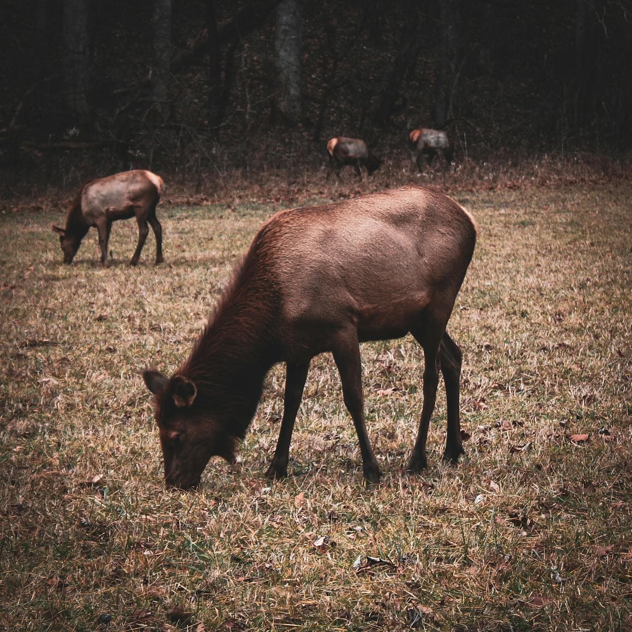
Arrive while the valley is still holding its breath—mist clings low over the grass and the only sound is hooves and distant bugling. This is peak elk activity time, and by 9am the meadows near Caton Cove Road often fill with a handful of other early risers, but rarely crowds. Solo travelers find this an easy place to strike up quiet conversation with fellow wildlife-watchers, all speaking in the same hushed, reverent tone.

Cataloochee Valley (elk)
Niki Clark / pexels (Pexels License)
Shoot from Elk Pen Gap overlook just after sunrise, when low golden light rims the fog and the elk are most active.
Roadside viewing areas are accessible, but most vantage points involve uneven, unpaved ground—benches are sparse.
75 min driveA winding descent out of Cataloochee onto backroads, then a scenic stretch along US-441 South with ridge views opening up through the windshield.
11:15 AM - 12:00 PM
Oconaluftee · midday · 45 min · Oconaluftee Gateway

The valley opens up here, river mist rising against a backdrop of layered ridgelines—a quieter, more contemplative stop after the charged energy of elk-watching. It's an easy, flat walk to the main overlook, a good spot to breathe and reset before the afternoon's cultural stop.

Oconaluftee
James St. John / openverse (by)
Midday sun is harsh here—if you have flexibility, this stop shines more at golden hour, but the river-and-ridge composition still works well any time.
Fully wheelchair accessible with flat paved paths.
10 min walkA short, flat path connects Oconaluftee to Mingus Mill, following the sound of rushing water the whole way.
1:00 PM - 1:45 PM
Mingus Mill · afternoon · 45 min · Oconaluftee Gateway

The mill's water wheel groans and thunders as it has for 140 years, grinding corn into flour while dust hangs gold in the slanted light. It's a low-energy, easy stop—ideal after a morning of hiking-adjacent activity—and the interpretive setting gives solo travelers plenty to read and absorb without needing a companion.

Mingus Mill
Photo by Jteder on Pixabay
Interior shots work best with the soft window light in early-to-mid afternoon, when the demonstration mill is typically running.
Wheelchair accessible with frequent benches and flat paths throughout.
20 min driveA short hop along Newfound Gap Road, ridge silhouettes deepening as the afternoon light lowers.
4:00 PM - 5:30 PM
Laurel Falls Trail · evening · 90 min · Oconaluftee Gateway

By late afternoon the crowds thin and the light through the hemlocks turns amber-green, making this a rewarding time for the moderate 2.6-mile round-trip trek to the falls. The trail's paved-but-uneven surface and steady incline make it a satisfying solo workout, and the payoff—a curtain of white water framed by old-growth trees—feels earned rather than crowded.
Laurel Falls Trail
Photo by jothamsutharson on Pixabay
Capture the base of the falls with hemlock framing in the lower-angle late-afternoon light for the most dramatic contrast.
Not wheelchair accessible—uneven terrain and elevation gain throughout.
Breakfast
Peter's Pancakes & Waffles $
Breakfast/Brunch · Near Oconaluftee
A hearty, unpretentious stack-and-syrup spot near Oconaluftee—good communal counter seating for solo travelers to chat with locals before a day outdoors.
Lunch
Hunt Brothers Pizza $
Pizza · Near Oconaluftee
Quick, casual, and easy for a solo traveler refueling between stops—no frills, just a filling slice.
Dinner
Happy Garden Restaurant $$
Chinese · Near Oconaluftee
A comfortable, low-key sit-down option near Oconaluftee, good for unwinding solo after a long trail day with a full plate and no pressure to rush.
Optional detour: El CajelitoBetween Mingus Mill and Laurel Falls Trail
A flavorful, casual Mexican option if you want a heavier lunch before the Laurel Falls hike. Skip if: Skip if you'd rather hike on a lighter stomach, since the trail involves steady elevation gain.
If it rains: If rain moves in, shift focus to Mingus Mill's covered viewing areas and the Oconaluftee overlook—both remain atmospheric and accessible in light rain, with mist enhancing rather than ruining the mood. Save Laurel Falls for a drier window, since the trail turns slick and hazardous in heavy rain.

Dawn breaks cool and gray over Cataloochee Valley, mist pooling in the hollows as wild elk emerge from the treeline to graze in silence broken only by the occasional distant bugle. This is the valley at its most cinematic—arrive by 7am and the meadows near Elk Pen Gap and Caton Cove Road are often yours to share with just a handful of other quiet observers, all trading hushed nods rather than words.

The pace shifts from wildlife-watching to cultural wandering as you head south to Oconaluftee, where river mist and layered ridgelines frame an easy, flat overlook walk. A short stroll away, Mingus Mill's water wheel thunders through its 140-year-old routine, grinding corn in a scene that feels suspended in time—a gentle, low-energy contrast to the morning's charged wildlife encounter.

As the afternoon light softens toward gold, the moderate trek to Laurel Falls offers the day's most physically engaging stretch, rewarding the climb with hemlock-framed cascades and thinning crowds. Dinner afterward at a quiet, unhurried spot near Oconaluftee closes the day gently—no rush, no pressure, just a full plate and the low hum of a small mountain town settling into evening.

Summit & Scenic Drive

Day 2: Above the Clouds on the Ridge Line

A more physically demanding day with roughly 3 miles of moderate walking at elevation, centered on Clingmans Dome's summit views and the long scenic sweep of Newfound Gap Road.

Wear
Warm layers for the summit (temperatures can be 15-20°F cooler and windy), a light jacket, sturdy hiking shoes, and sun protection for the exposed overlooks.
Budget
$40-60 (breakfast, lunch, minor snacks)
7:30 AM - 9:00 AM
Clingmans Dome · morning · 90 min · Clingmans Dome High Country

Arrive by 7:30am and the observation tower is nearly empty, the alpine wind biting and the fraser fir scent sharp in your lungs as you climb above the cloud layer into blinding early light. By 9am the parking lot and trail fill quickly with summer crowds, so this early window is the one true solo, contemplative experience at the park's highest point—and a good spot to chat briefly with fellow early risers who made the same call.

Clingmans Dome
Famartin / openverse (by-sa)
Shoot from the tower's exterior platform at sunrise, when the forest below is silhouetted and the light rakes across the ridgelines dramatically.
The tower itself is wheelchair accessible, though the paved approach trail has a steady, moderate incline.
15 min driveA short descent from the summit parking area onto Newfound Gap Road itself, engine humming through tight switchbacks.
10:00 AM - 12:00 PM
Newfound Gap Road · midday · 120 min · Clingmans Dome High Country

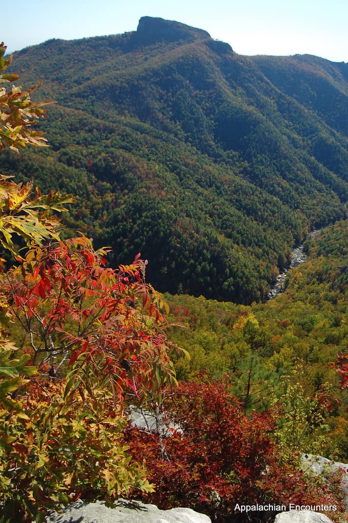
The drive back down unfolds in long, sweeping curves, each one revealing another blue-hazed ridge stretching to the horizon—stop at 2-3 overlooks along the way rather than rushing straight through. Traffic builds through midday, so treat this as a slow, meditative scenic drive rather than a race, pulling off wherever the view calls for it.

Newfound Gap Road
Photo by Esteban Carriazo on Pexels
The Newfound Gap overlook at the state line offers the clearest layered-ridge shot, best in the softer light of late morning before midday haze thickens.
Overlooks are wheelchair accessible with minimal walking required from parking areas.
30 min driveContinuing south on Newfound Gap Road as it descends out of the high country, the air warming noticeably with every mile.
1:00 PM - 1:45 PM
Oconaluftee · afternoon · 45 min · Oconaluftee Gateway

Returning to Oconaluftee after the ridge-line drama feels like exhaling—the river valley is calmer, greener, and closer to eye level, a fitting bookend to a morning spent above the clouds. It's a light, easy stop to stretch your legs before deciding on lunch in Cherokee.

Oconaluftee
James St. John / openverse (by)
Late afternoon light along the river valley here is softer and more forgiving than the harsh midday sun from Day 1's visit.
Fully wheelchair accessible with flat paved paths.
Breakfast
Peter's Pancakes & Waffles $
Breakfast/Brunch · Near Oconaluftee
A reliable, filling start before the early Clingmans Dome climb—counter seating makes it easy to eat quickly and solo.
Lunch
Happy Garden Restaurant $$
Chinese · Near Oconaluftee
A satisfying, low-pressure sit-down lunch near Oconaluftee after a morning of elevation and driving—good portions to refuel.
Dinner
El Cajelito $$
Mexican · Near Oconaluftee
Flavorful, communal-feeling spot near Oconaluftee to close out the trip—good energy for a solo traveler wanting some buzz on the last night.
Optional detour: Mingus MillBetween Newfound Gap Road and Oconaluftee
If you didn't linger at the mill on Day 1, it's a peaceful, low-energy add-on to close the loop on Oconaluftee Gateway's cultural sites. Skip if: Skip if you already visited on Day 1, since the experience won't change significantly on a repeat viewing.
If it rains: If clouds descend on Clingmans Dome, visibility can drop to near zero at the summit—retreat to lower-elevation Newfound Gap for alternative scenic views, which often stay clearer even when the peak is socked in. Morning fog frequently lifts by late morning, so a short weather delay before driving up can pay off.

The pre-dawn drive up to Clingmans Dome climbs through darkness into first light, the air growing thinner and colder with every switchback until you emerge, ears popping, above a sea of cloud. Arriving by 7:30am means the tower and summit trail are yours almost alone—a rare, hushed communion with the highest point on the Appalachian Trail before the crowds arrive by mid-morning.

The pace slows into a long, contemplative drive down Newfound Gap Road, each overlook offering another version of the same blue-ridged infinity, best absorbed slowly rather than rushed. By early afternoon the descent back to Oconaluftee brings warmer air and a gentler, river-level perspective—a soft landing after the morning's high-altitude drama.

The trip closes with a livelier dinner in Cherokee, communal energy and good flavor offering a fitting final note after two days spent largely in quiet, misty solitude. It's an easy night to wind down early, replaying the morning's cloud-top silence and the valley's wild elk against the day's ridge-line sweep.

Want to tweak this trip?

Our AI planner can customize this itinerary to your exact dates, interests, and travel style.

Customize This Itinerary
Good to Know

Restaurant details (hours, menus, availability) change frequently. Check current hours before visiting, especially in seasonal destinations.

Dietary compatibility tags are general guidance. If you have severe allergies, confirm directly with the restaurant.

Travel tips are general guidance, not professional safety advice. Check government advisories for latest information.

All prices are approximate and may vary seasonally.

We use cookies to improve your experience and analyze site usage. Essential cookies are always active. You can customize your preferences or accept all cookies. Cookie Policy