4 DaysSolo Traveler9 Stops

El Paso area, Texas

4-Day Itinerary for Solo Traveler

โ€œDesert Light & Ancient Stone: 4 Days Solo in El Pasoโ€

Desert Light & Ancient Stone: 4 Days Solo in El Paso

Here, the desert doesn't whisper โ€” it holds still and waits for you to notice the details: the scrape of boot on volcanic rock, the smell of creosote after a rare spring rain, 800-year-old handprints pressed into sun-warmed stone. El Paso in spring is wildflower dust and borderland flavor, a city that rewards the traveler willing to go slow and look twice.

At a Glance

Climate & Weather
Spring in El Paso runs mild and sunny, generally 60โ€“75ยฐF by day with cooler mornings and occasional evening rain showers. Wildflowers are blooming and the desert air is crisp โ€” pack layers, a light rain jacket, sunscreen, and sturdy footwear for uneven rocky trails.
Getting Around
A rental car is essential โ€” distances between clusters span 20-40 minutes and public transit doesn't reach the state parks. Downtown and East Side neighborhoods are walkable once you're parked; everything else requires driving.
Budget
Budget roughly $60-90/day for a solo traveler covering meals, state park entrance fees ($5-7 per vehicle), and incidental gear or coffee stops โ€” lodging not included.
Safety
El Paso is one of the safer mid-size US cities for solo travelers; tourist zones and state parks are well-patrolled. Hueco Tanks requires a reservation and orientation due to its protected petroglyph sites โ€” solo hikers should stick to marked trails, carry extra water, and tell someone their return time since cell coverage is spotty in the backcountry. Flash flood risk exists in canyons during sudden spring storms โ€” never linger in a wash if rain starts.
Connectivity
Cell coverage is solid in downtown and urban El Paso but drops to spotty or nonexistent inside Franklin Mountains State Park's interior trails and much of Hueco Tanks. Download offline maps before heading out each morning.
Local Tips
Reserve your Hueco Tanks entry slot online days in advance โ€” self-guided access is capped daily and fills fast in spring. Arrive at Franklin Mountains trailheads before 8am to beat both heat and weekend crowds. Many restaurants close between 2-5pm, so plan your main meal around lunch, borderland-style.

Highlights

  • Sunrise switchbacks in Franklin Mountains State Park with the whole city laid out below
  • Scenic drives through red-rock canyons where the only sound is wind and the occasional raven
  • Ancient petroglyphs at Hueco Tanks โ€” hand-etched stories 800 years old
  • Golden-hour overlooks framing the Franklin Range from Tom Mays Park
  • A full day given to solitude and desert silence, 32 miles from anywhere
  • Spring wildflowers scattered through high-desert scrub
  • Borderland pace โ€” early breakfasts, long lunches, slow evenings

Day-by-Day Plan

Arrival & Orientation

Day 1: Settling Into the High Desert

A gentle first day easing into El Paso's rhythm with light scenic driving and short walks, roughly 2 miles of easy walking, low-to-moderate energy.

Wear
Comfortable layers โ€” a light jacket for cool morning air, sunscreen, closed-toe shoes for uneven overlooks, and a hat for midday sun.
Budget
$55-70 (meals, park entrance fee, incidentals)
9:00 AM - 10:30 AM
Tom Mays Park & Scenic Drive ยท morning ยท 90 min ยท Franklin Mountains โ€” Desert peaks and adventure

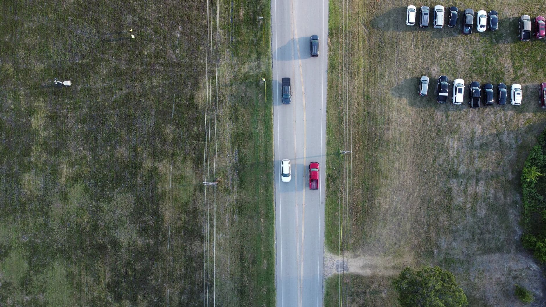
Ease into the desert here rather than diving straight into a strenuous hike โ€” this is scenic drive and short-walk territory, ideal for a travel-weary first morning. The main overlook delivers the El Paso skyline fading into haze, with creosote and acacia scenting the breeze. Arrive by 9am and the drive is nearly empty; by late morning weekend traffic picks up.
Tom Mays Park & Scenic Drive
Photo by Viktoria B. on Pexels
The main scenic overlook faces the El Paso skyline โ€” morning light keeps the haze soft and the mountains crisp behind you.
Scenic drive is accessible by car with short walks to overlooks; paths are uneven and not wheelchair-friendly.
15 min drive โ€” A short hop along mountain-base roads, windows down, the city shrinking in the rearview mirror.
11:00 AM - 12:15 PM
McKelligon Canyon Road / Scenic Drive ยท midday ยท 75 min ยท Franklin Mountains โ€” Desert peaks and adventure

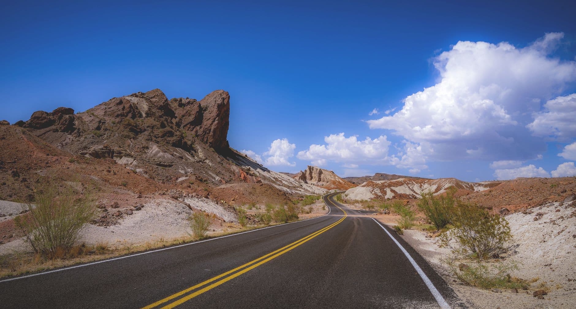
A short, easy drive deeper into red-rock canyon country, perfect for someone still adjusting to time zones or travel fatigue. Rust-colored cliffs rise close enough to feel their mineral chill, and the occasional raven call is the loudest thing around. Pull over at the upper overlook for a quiet, unhurried look at striated canyon walls.
McKelligon Canyon Road / Scenic Drive
Photo by Genevieve Ma'yet on Pexels
Upper canyon overlook works best late morning when light rakes across the striated rock faces.
Scenic drive only recommended for this demographic today โ€” most pullouts require short uneven walks.
Optional detour: Franklin Mountains SP โ€” After McKelligon Canyon Road and before settling in for the evening
If energy allows, a short low-intensity loop here eases you into the park's terrain ahead of tomorrow's bigger hike. Skip if: Skip if travel fatigue is real โ€” save full energy for tomorrow's sunrise hike instead of splitting focus today.
If it rains: If storms roll in, skip the canyon drive and spend the afternoon at an indoor downtown museum or gallery instead โ€” the scenic roads become slick and canyon washes carry flash flood risk.

The first morning calls for slowness, not ambition. A gentle loop through Tom Mays Park's scenic drive gets you acclimated to the high-desert air and the long, flat light that makes the Franklin Range glow gold at the edges. There's no rush here โ€” just overlooks, breeze, and the quiet reintroduction to altitude and sun.

Midday shifts into McKelligon Canyon's scenic drive, a short, easy outing that trades Tom Mays' open vistas for close, towering red-rock walls. It's a good low-key stretch for a solo traveler still finding their bearings โ€” minimal crowds, maximum scenery, and plenty of pullouts to simply sit with the silence.

Wind down early tonight. Settle into wherever you're staying, rehydrate after the dry desert air, and let the day's light fatigue do its work โ€” tomorrow starts early with a real hike, and the Franklin Mountains reward those who show up rested.

Summit & Solitude

Day 2: Sunrise on the Franklin Range

The trip's most physically demanding day, centered on Franklin Mountains State Park's trails with roughly 4-5 miles of hiking at moderate-to-high energy.

Wear
Sturdy hiking boots, moisture-wicking layers, a packable rain jacket, sun hat, and plenty of sunscreen โ€” desert sun is deceptive even in mild spring temps.
Budget
$50-65 (park fee, trail snacks, lunch, dinner)
10 min drive โ€” A quick pre-dawn drive with the mountains silhouetted ahead, still dark enough to see a few fading stars.
7:00 AM - 9:30 AM
Franklin Mountains SP ยท morning ยท 150 min ยท Franklin Mountains โ€” Desert peaks and adventure

Arrive by 7:30am and the Tom Mays summit overlook is yours alone โ€” just the scrape of boots on rocky switchbacks and the profound silence of high desert before the day warms up. Jagged desert peaks unfold in every direction, creosote and juniper scenting the cool morning air. By 9am, hikers start filtering in, so claim this window for solitude and unobstructed photography.

Franklin Mountains SP
Dull, Charles W Klein, Linda, editor United States. State and Private Forestry. Southeastern Area / wikimedia (Public domain)
The upper switchbacks at sunrise catch alpenglow on the Franklin Range โ€” arrive before 7:45am for the best light.
Trails are uneven with loose rock and switchbacks; not wheelchair accessible, benches sparse.
8 min drive โ€” A short descent back down the park road, dust settling behind the car.
10:00 AM - 11:00 AM
Tom Mays Park & Scenic Drive ยท midday ยท 60 min ยท Franklin Mountains โ€” Desert peaks and adventure

After the morning's exertion, this stop offers a lighter pace โ€” a scenic drive and short walk to the main overlook rather than another climb. It's a deliberate contrast: legs recover while eyes still get the payoff of sweeping mesa views fading into haze.

Tom Mays Park & Scenic Drive
Photo by Viktoria B. on Pexels
Midday light flattens shadows here, so focus shots on the broad skyline panorama rather than texture.
Short paved sections near the overlook are easier going than morning's trail.
Optional detour: McKelligon Canyon Road / Scenic Drive โ€” After Tom Mays Park and before evening downtime
A relaxed late-afternoon drive through the canyon offers golden-hour light on the red-rock walls if energy remains. Skip if: Skip if legs are tired from the morning hike โ€” two scenic drives back-to-back can feel repetitive after a big climb.
If it rains: If rain threatens, avoid the canyons and switchbacks entirely due to flash flood risk โ€” redirect to downtown El Paso's indoor museums or galleries for the day instead.

Today begins before the sun fully clears the ridgeline. The hike into Franklin Mountains State Park rewards early risers with empty trails, crisp air, and panoramic silence โ€” just you, the rock, and the slow reveal of El Paso spreading out below as light grows. It's the kind of solitude that solo travelers come to the desert for.

After the climb, the pace deliberately softens. A return to Tom Mays Park's scenic drive offers recovery time โ€” legs resting while the eyes keep working, taking in wide mesa views without demanding another scramble. This is a day built around contrast: exertion, then ease.

With muscles worked and the day's big views collected, evening calls for rest and refueling. Find a quiet spot to decompress, rehydrate well after a day in dry desert air, and let the adrenaline of sunrise summit views settle into satisfied tiredness.

Ancient Stone & Solitude

Day 3: Into the Silence of Hueco Tanks

A full-day excursion to Hueco Tanks State Park, roughly 3-4 miles of moderate hiking among rock formations and petroglyphs, at a moderate energy level.

Wear
Hiking shoes with good grip for boulder scrambling, layers for temperature swings, a hat, and a reservation confirmation printed or saved offline.
Budget
$45-60 (park fee/reservation, snacks, meals)
45 min drive โ€” A straight desert highway drive with mesas rising on the horizon โ€” a good stretch for podcasts or simply watching the land change.
8:00 AM - 11:00 AM
Hueco Tanks SP ยท morning ยท 180 min ยท Hueco Tanks โ€” Ancient desert, off the beaten path

The 32-mile drive northeast feels like leaving the city behind entirely โ€” strip malls give way to open desert and distant mesas. Arrive early for the West Tank petroglyphs at sunrise light, when 800-year-old handprints and animal figures etched into rust-colored boulders seem to glow faintly in low-angle sun. Reservations are required here, and self-guided slots fill fast in spring, so lock this in days ahead. Solo travelers should stick to marked routes โ€” cell service is unreliable and the terrain is deceptively remote-feeling despite its proximity to the city.

Hueco Tanks SP
Karabo Mahlangu / pexels (Pexels License)
Tank 1 (West Tank) petroglyphs are best photographed at sunrise, when raking light reveals the carved details without harsh glare.
Very limited accessible routes โ€” most trails involve rock scrambling and uneven terrain; allow about 1 hour if mobility is a concern.
15 min walk โ€” A short walk between tank areas along marked paths, boulders rising on either side like old sentinels.
11:15 AM - 12:45 PM
Hueco Tanks SP ยท midday ยท 90 min ยท Hueco Tanks โ€” Ancient desert, off the beaten path

Continue deeper into the park toward the North Tank vista, where desert valleys open up in every direction. This stretch is quieter even than the morning crowd at West Tank, since most visitors cluster near the entrance. The acrid, clean smell of creosote after any overnight moisture lingers here, and the stillness is almost total.

Hueco Tanks SP
Karabo Mahlangu / pexels (Pexels License)
North Tank vista works well late morning when the valley haze starts to lift, sharpening the distant mesas.
Uneven, rocky terrain throughout; not suitable for wheelchairs.
If it rains: Hidden water crossings become dangerous and trails slippery in rain โ€” if storms are forecast, reschedule Hueco Tanks entirely and spend the day exploring downtown El Paso's indoor cultural sites instead.

The drive out to Hueco Tanks sets the tone for the day โ€” a deliberate departure from the city into something older and quieter. By the time the West Tank petroglyphs come into view, bathed in low morning light, the desert has fully taken over: no traffic noise, no skyline, just stone that's held these markings for 800 years.

The pace stays unhurried as the day continues toward the North Tank vista, a vantage point that trades petroglyph detail for sweeping valley views. Few visitors make it this far into the park, so the solitude deepens rather than fades โ€” ideal for a solo traveler who came for exactly this kind of quiet.

The 45-minute drive back into El Paso feels like a slow re-entry into civilization. After a day spent in deep desert stillness, keep the evening simple โ€” a relaxed meal and early rest let the day's impressions settle before tomorrow's final explorations.

Farewell & Reflection

Day 4: Last Light on the Range

A lighter closing day revisiting favorite textures of the Franklin Mountains cluster with flexible timing, roughly 2-3 miles of easy-to-moderate walking.

Wear
Comfortable layered clothing, light jacket for variable spring weather, and footwear suited to both driving stops and short walks.
Budget
$40-55 (meals, incidentals, no major park fees if revisiting free overlooks)
8:30 AM - 10:00 AM
McKelligon Canyon Road / Scenic Drive ยท morning ยท 90 min ยท Franklin Mountains โ€” Desert peaks and adventure

A final unhurried pass through the canyon, this time with the benefit of knowing the road's rhythms from day one. Morning light at 8:30am keeps crowds light and the switchback curves cast long shadows across the striations โ€” a good last chance for considered, unrushed photography before departure logistics take over.

McKelligon Canyon Road / Scenic Drive
Photo by Genevieve Ma'yet on Pexels
Switchback curves catch dramatic shadow play on the rock faces in morning light โ€” slow down at each pullout.
Scenic drive accessible by car; pullouts require short uneven walks.
10 min drive โ€” A short final drive between trailheads, the mountains now feeling like old acquaintances rather than strangers.
10:30 AM - 12:00 PM
Franklin Mountains SP ยท midday ยท 90 min ยท Franklin Mountains โ€” Desert peaks and adventure

One last shorter loop here, lighter than day two's sunrise summit push โ€” a chance to notice spring wildflowers scattered through the scrub that might've been missed the first time around. It's a gentle, reflective close to the outdoor portion of the trip, with the city view feeling familiar now rather than overwhelming.

Franklin Mountains SP
Dull, Charles W Klein, Linda, editor United States. State and Private Forestry. Southeastern Area / wikimedia (Public domain)
Wyler Canyon's narrow sections offer dramatic ridge-framed views without requiring the full summit effort.
Choose shorter, flatter sections for an easier final outing; trails remain uneven overall.
Optional detour: Tom Mays Park & Scenic Drive โ€” After Franklin Mountains SP and before departure
A final easy stop for one more skyline overlook if time allows before heading to the airport. Skip if: Skip if flight timing is tight โ€” the other two stops already deliver the key views without the extra drive.
If it rains: If rain moves in on this final day, skip the canyon drive and spend remaining time at an indoor downtown gallery or museum before departure.

The last full morning returns to McKelligon Canyon, but with a different quality of attention โ€” less discovery, more appreciation. The light at this hour is gentler than midday, and the canyon walls feel almost familiar after days of borderland desert immersion.

A final, easier loop through Franklin Mountains State Park closes the outdoor chapter of the trip. Spring wildflowers add unexpected color to the rocky scrub, and the pace stays deliberately gentle โ€” this is about closure, not conquest.

With bags likely needing to be packed and travel logistics looming, keep the final evening simple and restorative โ€” a quiet meal, a last look at the mountains from wherever you're staying, and an early night ahead of departure.

Want to tweak this trip?

Our AI planner can customize this itinerary to your exact dates, interests, and travel style.

Customize This Itinerary
Good to Know

Restaurant details (hours, menus, availability) change frequently. Check current hours before visiting, especially in seasonal destinations.

Dietary compatibility tags are general guidance. If you have severe allergies, confirm directly with the restaurant.

Travel tips are general guidance, not professional safety advice. Check government advisories for latest information.

All prices are approximate and may vary seasonally.

We use cookies to improve your experience and analyze site usage. Essential cookies are always active. You can customize your preferences or accept all cookies. Cookie Policy