Mark Twain National Forest (North section), Missouri
2-Day Itinerary for Active Retirees
“Springs, Stone, and Slow Water: Two Days in Mark Twain National Forest”

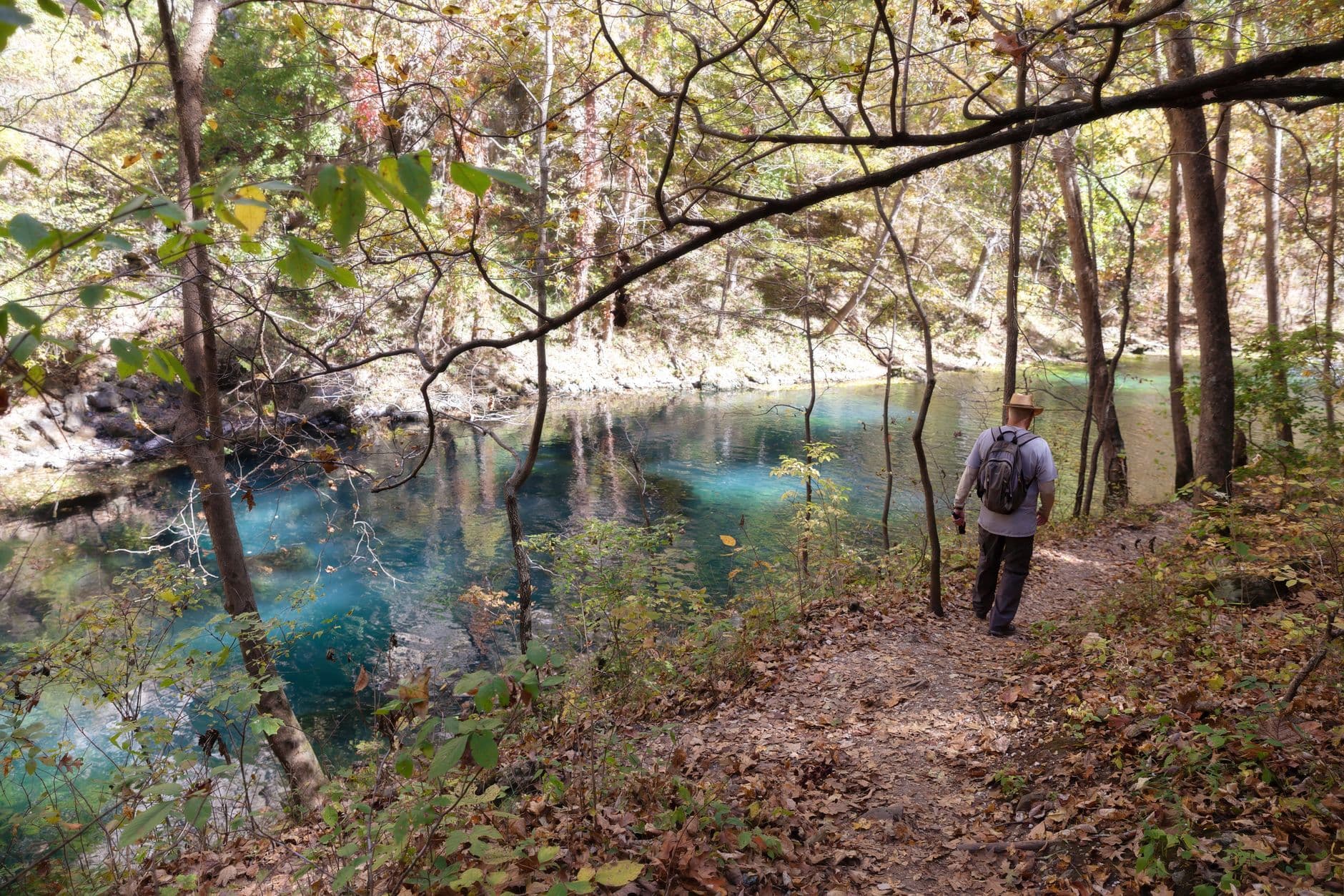
Turquoise water rises silently from limestone here, cool enough to fog your glasses even in May sunshine. This corner of the Ozarks moves at the pace of its springs—unhurried, clear, and best met in the soft hours before the day's first paddlers arrive.
At a Glance
Highlights
- Standing at the overlook above Blue Spring's impossible turquoise pool at first light
- Tracing limestone-fed water along the gentle grades of Lost Valley
- A slow afternoon beside the Eleven Point River's jade current
- Sunset mist rising off Greer Spring's 360-cubic-feet-per-second discharge
- Ozark comfort food—catfish, pie, and unhurried porch dinners
- Wildflowers threading the forest floor along every trailhead
Day-by-Day Plan
Day 1: First Light at Blue Spring
A quiet, low-mileage day (under 2 miles total) centered entirely in the Blue Spring Valley cluster, easing into the forest's rhythm.
Arrive by 8am and the overlook is likely yours alone—just the sound of water trickling from limestone fissures and mist curling off a pool so clear you can trace the bottom thirty feet down. The color is almost unbelievable in early light, a turquoise that seems lit from within. Benches near the overlook are sparse, so take your time finding a comfortable perch rather than rushing the view.

Rather than the full loop, take a gentle out-and-back along the lower, flatter stretch of Lost Valley Trail, where the creek runs smooth over limestone and the scent of spring water mixes with oak and hickory. This is a scaled-back visit—skip the swimming-hole scramble further upstream and simply enjoy the cascade sounds and valley walls at a comfortable pace, turning back well before the trail narrows and grows uneven.

The day opens gently at Blue Spring, where early arrival rewards you with silence and a pool of water so clear and blue it feels almost staged by nature. There's no rush here—just the quiet click of the forest waking up and the steady murmur of spring water finding its way through limestone.
After the spring, a short walk brings you to the lower stretch of Lost Valley Trail, chosen deliberately for its gentler grade. The pace slows further here: dappled light, the smell of damp earth and wildflowers, and just enough movement to feel like you've explored without overextending. This is a day for settling into the forest's slower clock, not for covering ground.
With no mapped dining directly in this immediate area, plan to return toward Van Buren or your lodging base for an easy dinner—porch seating and a simple, hearty meal suit the tone of the day. Let the evening wind down early; the quiet of an Ozark night, with no city light to compete, is its own kind of reward.
Day 2: River Light and Limestone Springs
A moderate-energy day within the Eleven Point River Corridor and adjoining Greer Spring & Ozark Plateau cluster, with total walking kept under 2.5 miles.
Arrive by 8:30am for the river at its most solitary—jade-green water sliding almost silently past sycamore and cypress, birdsong the only competing sound. Rather than paddling, this visit favors the scenic overlooks and short streamside walks near the Highway 160 access point, ideal for taking in the current's clarity without committing to a full float. The morning light catches the water at a low angle, making the famous clarity even more striking.

By early afternoon, the crowds—if any—have thinned, and Greer Spring's steady rush of 360 cubic feet per second feels almost theatrical after the river's calm. Cool mist drifts off the pool where water emerges straight from the rock face, and the mineral scent deepens the sense of being somewhere ancient and untouched. Take the walk slowly; benches are sparse, so pause wherever a rock ledge or clearing offers a natural seat.

The morning belongs to the Eleven Point River, best met early when the light is low and the water nearly silent. There's no need to paddle to appreciate it—an unhurried walk to the overlook near Highway 160 delivers the same sense of quiet immersion, jade water sliding past limestone bluffs and sycamore roots.
The afternoon shifts to Greer Spring, where the mood turns more dramatic—water doesn't just flow here, it emerges, cold and forceful, from the rock itself. The pace remains gentle, with plenty of pauses along the uneven path, and the mineral-rich air feels like a fitting final immersion in the forest's watery heart.
As with the previous evening, no mapped dining sits directly within this cluster, so plan to head back toward Van Buren or Salem for dinner—aim for an earlier seating, as most local kitchens wind down by 8 or 9pm. Let the day close as it began: unrushed, with the sound of water still somewhere in the background of memory.
Want to tweak this trip?
Our AI planner can customize this itinerary to your exact dates, interests, and travel style.
Customize This ItineraryRestaurant details (hours, menus, availability) change frequently, and no specific dining venues were mapped directly within these forest clusters—plan meals around nearby towns like Van Buren or Salem and check current hours before visiting.
Dietary compatibility tags are general guidance. If you have severe allergies, confirm directly with the restaurant.
Travel tips are general guidance, not professional safety advice. Check government advisories and current water/weather conditions before visiting springs or rivers.
All prices are approximate and may vary seasonally.